|
We parked in the small lot and started off on the trail around 10:30am. It
was warmer than yesterday, and there weren't the nice cool breezes, either.
Fortunately, the trail was shorter than yesterday, so it wouldn't be a problem.
I thought it would be a walk in the park, but it provided a little bit of
unexpected adventure.
The sign at the trailhead says that Lake Margaret is 2.5 miles away. It may
have been that way once, but perhaps not anymore. The trail descends immediately,
perhaps 100-150 feet. We then a marsh on the left and continued straight along
the trail until we ran into...water. The trail just went straight into the water,
with no relief in sight. There was nowhere to turn, so we backtracked a few feet
and took a side trail toward the east. There's no trail sign here, but I think that's
the only way.
We saw fresh horse manure on the trail, which encouraged us into thinking we were
still on the right trail. Shortly, there's another trail fork into a meadow. We
took the fork to the right, which I think now is simply longer. As long as the
water levels are not high, the left fork is probably better. In any case, the
right fork skirts the edge of the meadow and goes along the edge of a small granite
wall. It then turns left and enters the forest.
The trail meanders through the forest before reaching Caples Creek. We walked
around a bit, trying to find the best way to cross. We asked some other hikers,
but no one seemed to know the best way. We eventually found a small log upstream
to cross. Well, everyone else crossed it but I decided it was too narrow for me.
Instead, I went downstream a few yards and jumped over to a gravel bar, then got
a running start and jumped from there to the opposite shore. I got a small splash,
but was none the worse for wear. I can't imagine doing that in July, but as you'll
see, we found a better way for the return trip.
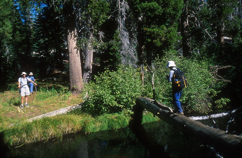
Crossing the creek
We now had the task of finding the trail again. We quickly found it, but it wasn't
immediately apparent whether to turn left or right. We suspected it was left, but
we decided to turn right and explore the trail going upstream. The trail becomes
faint but does reach a small plateau near a tiny waterfall. Aspens of varying
colors clustered on the rocks above the plateau. I noticed the remains of a
camp fire, perhaps a horsepacker's camp from the looks of it.
Satisfied that the trail was simply there to go to the camp site, we turned around
and headed back down the trail, which heads west. We soon ran into a trail
intersection. One side of the trail headed left, back to the marsh; it looked
like the main trail, but there's no telling if the creek crossing there was
better. We took the right fork, which continues on toward Lake Margaret.
At some point we crossed a dry river bed, and a dried up pond as well. We then
came across a group of boy scouts who were returning from a backpacking trip to
the lake. They said we were about halfway there (it was about 11:10am now), and
that the lake was well worth the trip.
We scrambled down the granite and continued along the trail. About 10 minutes
later we came across a large pond. Soon after that we went through a forest of
aspen trees. Many of the trees had initials carved into them. It was like a
disease -- it looked like people saw the carvings and decided to carve their
own initials in there, adding to the forest vandalism.
We crossed another dry creek bed. The two books I have which discuss Lake
Margaret make no mention of interesting creek crossings or dry creek beds. In
fact, they mention crossing the creek on a wooden bridge. There was no such bridge
in sight. I suspect that very recently, in the past year or two, something changed
the course of the water. Perhaps a storm downed some trees or there was a mudslide.
In any event, the water now flows where the trail used to be, and where there used
to be water, there's now a dry creek bed. Be forewarned -- allocate yourself
enough time on this hike to account for the unexpected.
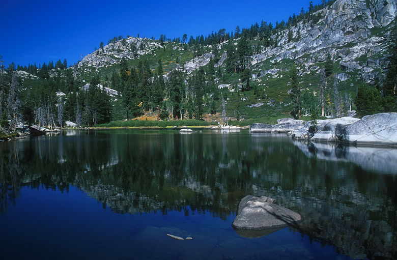
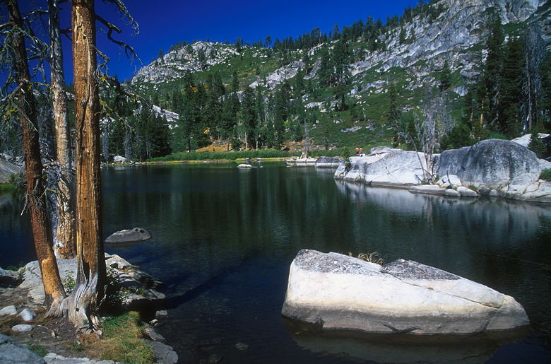
Lake Margaret
Soon after crossing the dry creek bed, we turned right and followed the cairns
steeply up and over granite rocks. Once we got over the top, we finally saw the
beautiful sight of Lake Margaret. It is, in fact, one of the prettier lakes
you will see. It's much smaller than Fourth of July Lake, but perhaps just as
pretty. Large granite rocks line the northern shore. We picked an isolated set
of rocks near the trail for our resting spot.
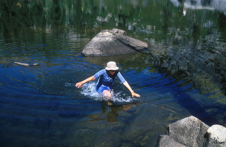
Cammy splashing through the lake
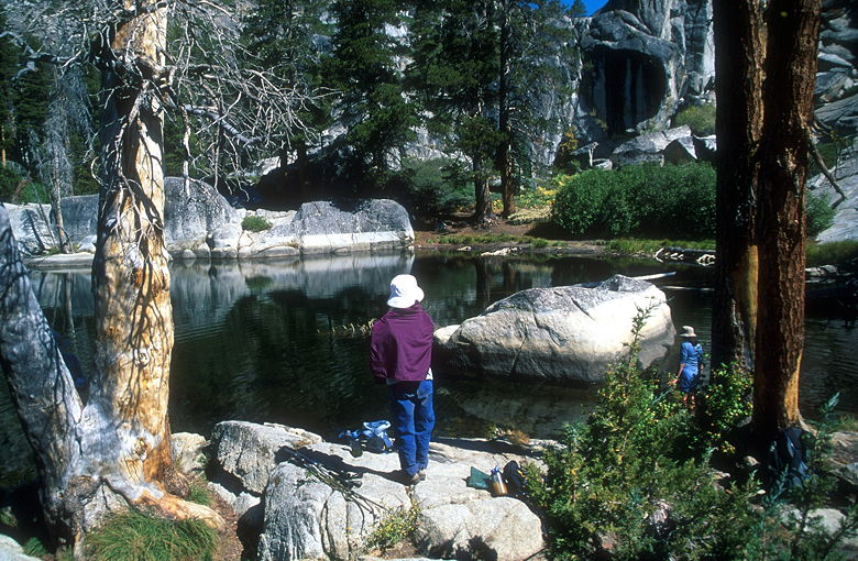
Jean resting by the lake
There was a pair of hikers on the opposite shore. We'd seen them earlier when
we'd crossed the creek. I looked up at the mid-day sun and decided to eat first
before taking pictures, since the light wouldn't change. Unfortunately I didn't
think about the effect of more hikers coming.
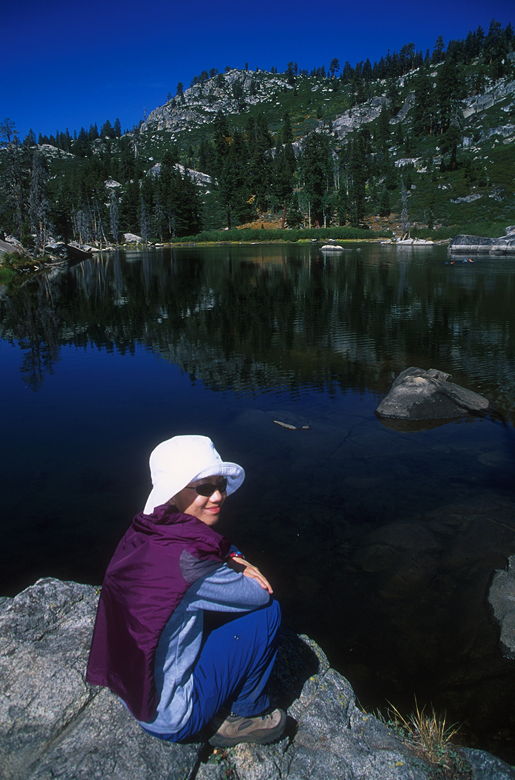
Jean resting by the lake
We enjoyed leftovers from dinner the night before. I then got up and perched my
tripod on the granite near the water's edge. While I was taking pictures, Cammy
decided to walk through the water (she had her Tevas) to a rock a few feet from
shore. The lake bottom is quite soft and you'll sink a good foot or two in it,
so be forewarned if you're planning to repeat her feat.
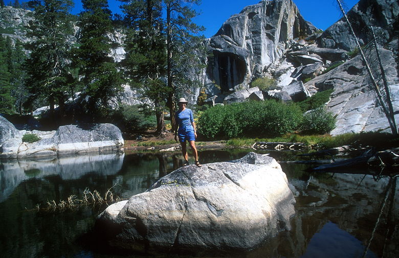
Cammy on a rock in the lake
While I was taking my photographs, a large group of hikers came upon the lake. They
went to the northern shore where the granite rocks were and decided to jump into
the lake. They jumped and hollered and swam. It would have been nice to stay
longer, but we wanted to get back to the Bay Area, so we packed up and started
on the trail back the way we came.
Lake Margaret
We retraced our steps, going back on the trail uneventfully. We ran into a pair
of hikers who asked us about the creek crossing. They were a bit confused, as
well. Further evidence that this is a relatively new phenomenon.
We resisted the temptation to try the untested right fork, continued on the left
fork to return the way we'd come. Once at the creek shore, we went our separate
ways to find the best crossing. Since Cammy had her Tevas, she decided to just
wade through it. I was getting myself psyched up to jump across to the gravel bar
again, but it wouldn't be nearly as easy as the way in. I was jumping toward
smaller targets now, and it wouldn't be easy. So I was relieved when I saw Jason
and Jean on the other side, telling me there was a really big log crossing just
downstream.
I went downstream about 100 feet or so and found the huge log crossing. A tree
had simply fallen in the right place, and it provided a very safe crossing
of the creek. I rejoined the others and we continued on the trail through the forest,
past the meadow, and finally, up the 100 or so feet back up to the trailhead.
| 

