|
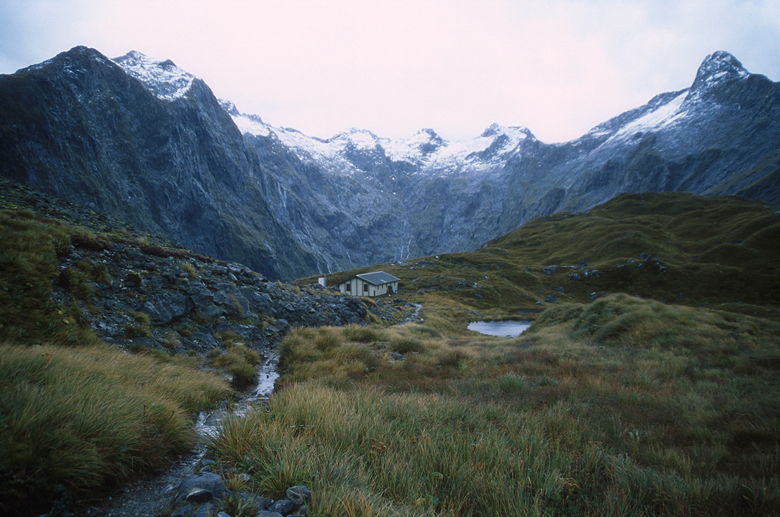
Mintaro Hut has three bunkrooms -- two on the lower level (the same as the kitchen), with 8 bunks
in each room, and one on the upper level. We were in the lower left bunk room. At 5am
it was pouring rain outside. It was 6:30am when I was thinking about how comfortable I was and how I would stay
in my sleeping bag for a while. Then I heard an awful noise. It was water dripping from the ceiling and onto
my sleeping bag. It wasn't a big leak in the roof, but it was enough to get me up. I didn't enjoy the
thought of having a wet down sleeping bag.
I got up and started breakfast. Tom and Rhonda were already up, marveling at all the waterfalls we could now
see that weren't there the day before. It continued to rain, though not hard, and it didn't look like it would
get any better throughout the day.
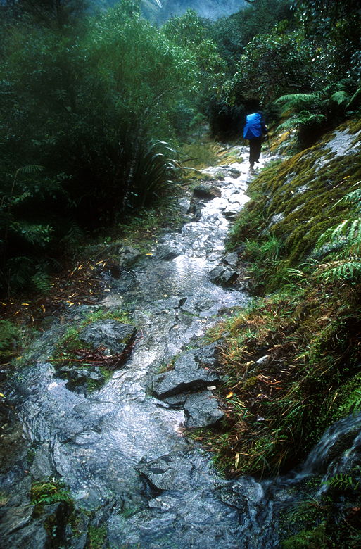
Jean and I left the hut around 9:15am. It was still raining as we started the long climb up to Mackinnon Pass.
I was only wearing the Icebreaker shirt and my rain jacket. Even though it was raining, it wasn't that cold,
and I would build up a lot of heat on the the climb. Jean started overheating from wearing too much, and also
started to get stomach cramps, so that slowed us down a bit.
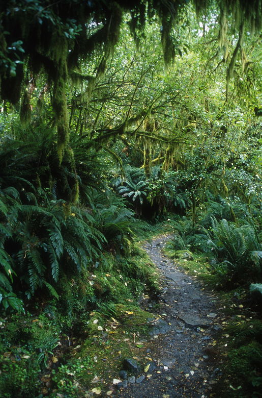
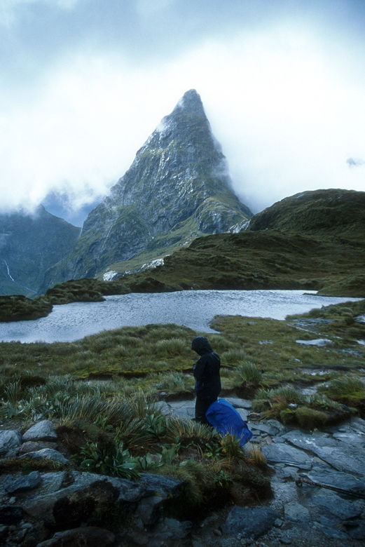
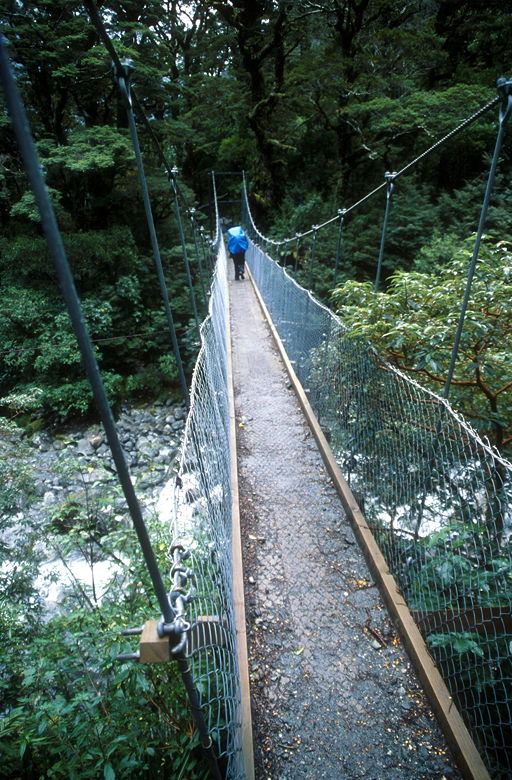
Trees, ferns, and trail
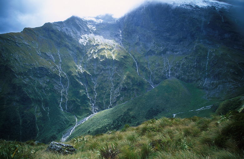
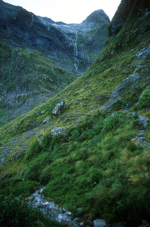
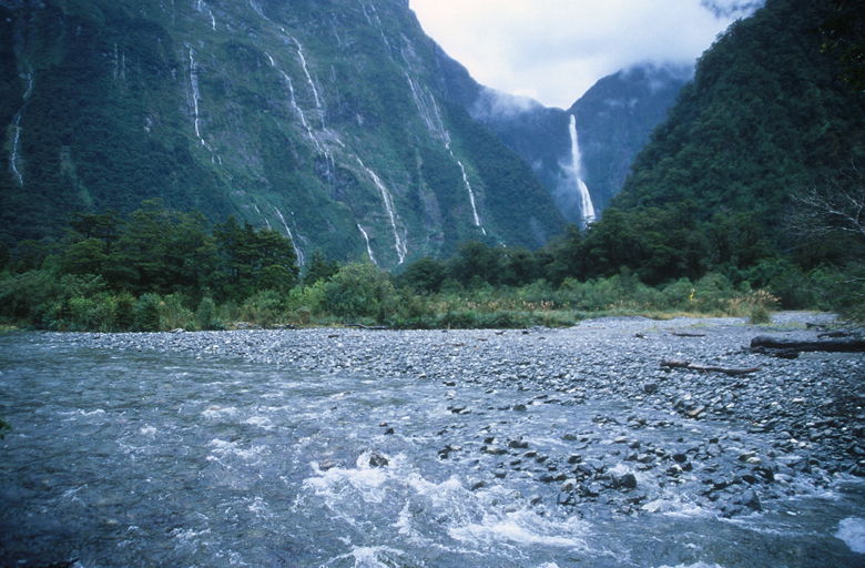
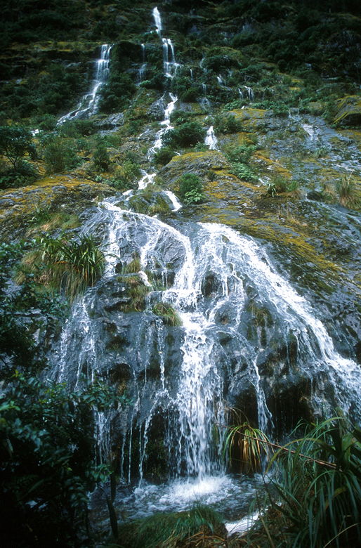
We passed through more forest before starting to climb above the bush line. The views started opening up and
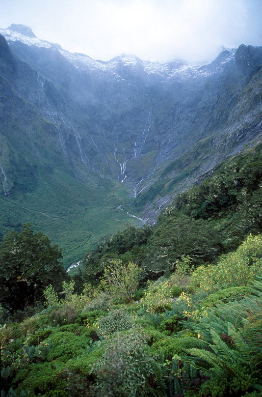
we could see the waterfalls flowing down the mountain sides, like veins. We could see Lake Mintaro and the Clinton
Valley behind us. A range of snow-covered mountains dominated the view to our left.
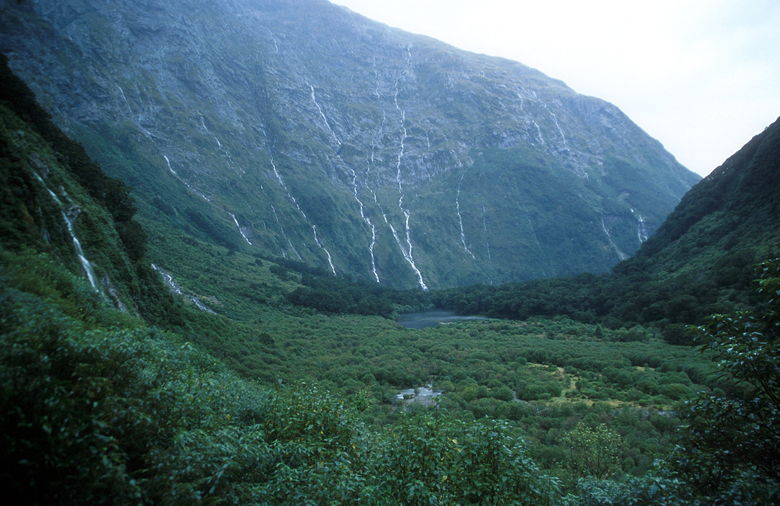
Falls above Lake Mintaro
Snow-covered mountains
Ernest Hemingway passed by us on the switchbacks. Eran and Melissa and another woman whose name I don't know
passed us as we neared the top. It started to hail off and on. After about 1800 feet of climbing, we reached the Mackinnon Memorial. Conditions
were horrible. Amazingly, a group of a 6 or 7 trampers was out by the edge, taking pictures and hanging out.
The winds were strong and the rain kept coming. I went up next to the memorial to get out of the wind so I could
take a couple pictures.
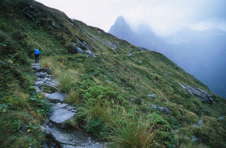
Jean heading up into the mist
Jean near the Mackinnon Memorial
A sign told us we still had about 20 minutes to go to reach the shelter. The sign also says to stick together
in adverse conditions. I would say this qualified as adverse conditions. We put on our gloves, gritted our
teeth, and started the trek to the shelter, which lay over and around a small hill. We made the short climb
and then started traversing around the hill. As we did so, the winds picked up and threatened to knock us
to the ground. To make things worse, the hail picked up, but much worse than before. You could hear the tap,
tap, tap of pea-sized hail, and then it would grow stronger and stronger until it was if a hundred people were
shooting a BB gun at you simultaneously. The legs were the worst, since they were the least protected -- it hurt!
I'm glad we had our gloves on, too -- even if they were soaked through.
There was nothing to do but keep trudging along as best we could. At one point the wind knocked me off balance
so much that I think I nearly broke my trekking pole. The path is short, though, and we soon rounded the corner
and descended to the shelter, quickly huddling inside. It was crowded when we arrived in the small shelter,
about 12 x 12 feet. A separate room in the shelter was for guided walkers only. They made sure to keep us
segregated. I assume they were served warm drinks in there.
Outhouse with a view
Steam rose from everyone as they removed their packs and wet clothes. I read a posting in the shelter which
stated that we were actually in the fifth pass shelter -- the previous 4 had been blown off the mountain.
I can believe it; we were here in late summer -- a winter storm must wreak havoc on the pass. Slowly, trampers
began to leave the hut. We ate lunch and rested, and we were glad we stayed as long as we did. The rain stopped
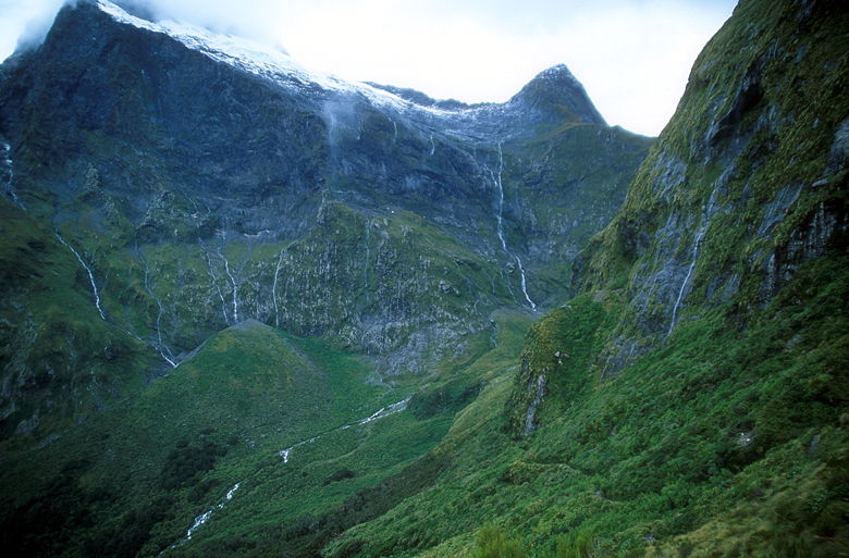
and the clouds began to dissipate a little, providing us with tremendous views of the Clinton Valley, the
snow-covered mountains to the west, and the steep mountain directly above us to the east (Mount Balloon).
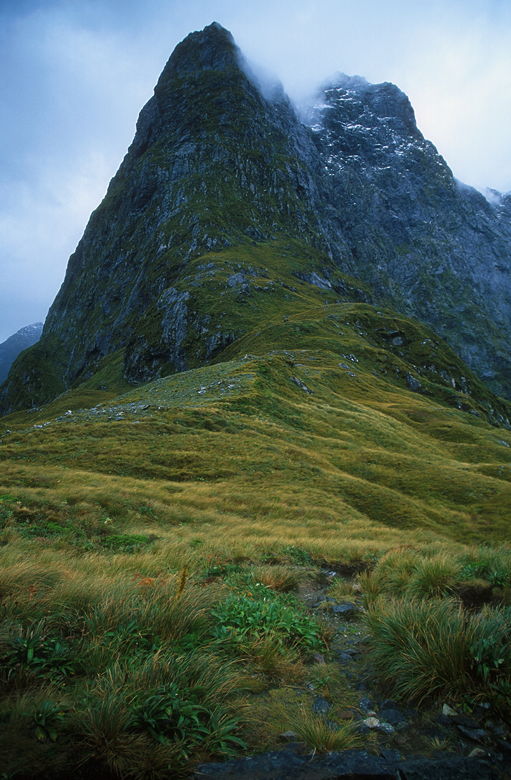
Mount Balloon
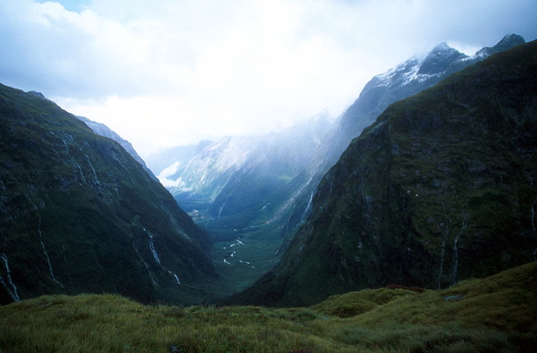
Clinton Valley
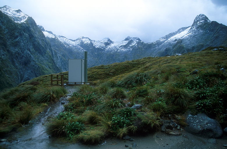
There's a pit toilet, a separate structure from the hut. While inside I was thinking two things -- first, the
pit was nearly full and second, I was thinking of all those previous huts which had been blown off the mountain and
wondered if the toilets had blown off, as well.
Mackinnon Pass Shelter
We were the last to leave the hut, just after the South Africans. As we descended, the sun threatened to come out,
providing us with more views, this time of the mountains north of the pass. However, the sun was in a losing battle
and the clouds won out. Still, at least it wasn't raining yet. We continued our descent on the very
rocky and slick trail. A guide or two passed us on their way down. We crossed a foot bridge and soon came to
a platform in front of a wide gushing waterfall. The South Africans were there; Trevor asked me how I was taking
pictures with my 50-speed film. I told him I'd switched to Provia 400F and he thought that would be pretty grainy;
he was using 100-speed film.
But I'm pretty happy with the results I've gotten from Provia 400F -- I like it better than any 100 or 200 speed
film I've used so far. I'm also pretty sure his 100 speed film couldn't take a lot of the pictures I took that day.
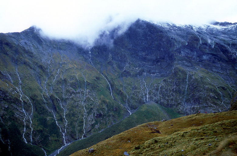
Waterfalls like veins
The sun peeking through briefly
I believe that's Mt. Elliot (left) and Mt. Wilmur
Jean on the trail
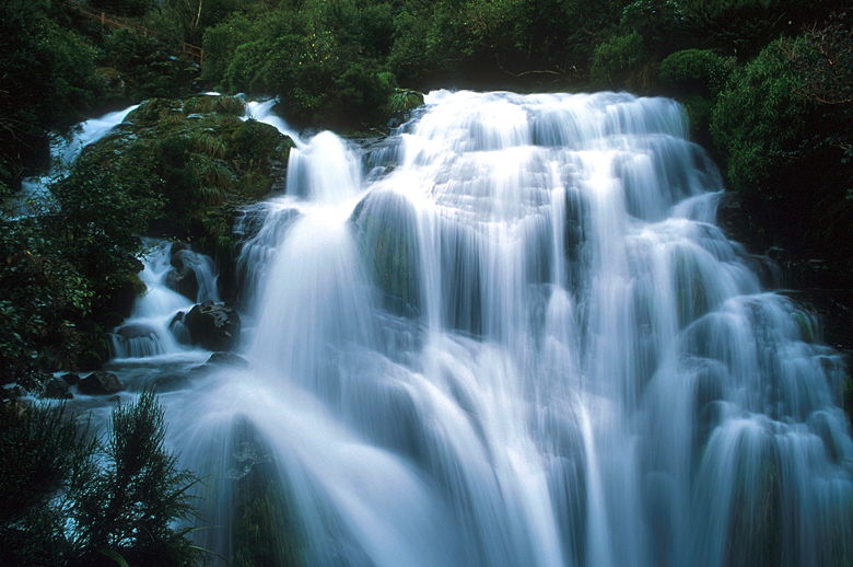
Falls visible from the platform
All that being said, I briefly switched back to using my 50-speed film on my tripod. It was one of the rare times
during the day when it wasn't windy or raining, so I could use the tripod. Besides, it's always better to take
a picture of a waterfall with a tripod so you can blur the water (and not the trees).
Cascading waterfalls above the trail
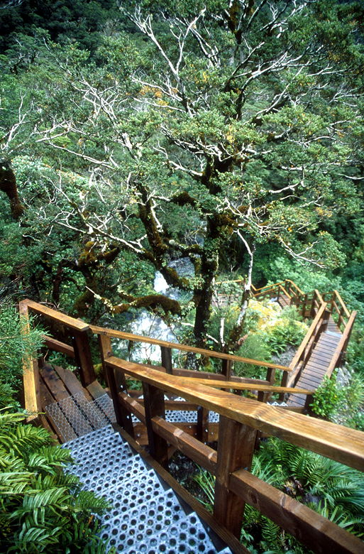
Staircase next to the river of waterfalls
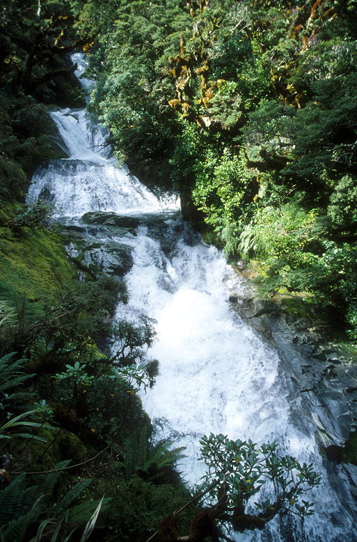
We continued our descent on a series of wooden steps which provide wonderful views of the water rushing down
on our left in a series of waterfalls. The water is part of the Roaring Burn river. The steps are one of the
highlights of the hike. After descending the steps we passed through beautiful rain forest with moss everywhere.
Jean crossing a bridge
Beautiful green section of the trail

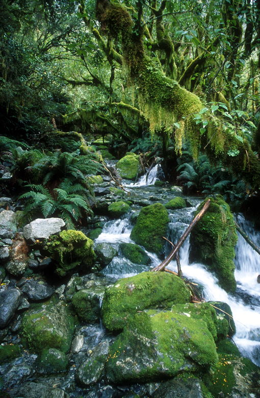
Ferns, trees, and moss
The descent is relentless, and remained rocky and slippery all the way to Quintin Hut (for guided walkers). A guide
passed us just
as we neared the hut and told us that we'd passed the worst of it. There's a side trail to the hut and onward
to Sutherland Falls. We were wet and tired, though, and didn't want to take the 4 kilometer (2 km each way)
side trip. Instead, we continued along the main trail. It started to rain again.
We now had views of the Arthur River to our left, with Sutherland Falls in the distance. The trail stays close
to the river for a while, but then gets routed inland. The trail was better now, but there were still some rocky
and some very wet portions.
At one point we encountered a sign which pointed the way to a flood detour. However, the main trail was still
very passable, so we stayed on it. Soon after we did we found ourselves walking over rocky terrain with pools
of water all over, fed by a cascading waterfall to our right. But since we were wet already, it didn't really
matter -- we just kept going.
View of Sutherland Falls from afar
The stream...er, trail
Cascade visible from the watery trail (I expertly balanced on a rock to take this picture)
The last section of trail just before Dumpling Hut is a long wooden walkway bolted to the side of the hill, following
all its curves 10 or 15 feet above the ground. It seemed to go on forever. It must have been a good five
minutes of walking on it before we reached the hut.
Dumpling Hut is probably the best of the independent tramper huts on the Milford Track, though not quite as nice as
the Routeburn Falls Hut. It has four bunkrooms with 10 bunks each. The one downside to the hut is that the toilets
and kitchen are separate structures. It was still raining, too.
The hut warden's name was Ruth, and she came by to give her talk at 7pm. She'd be walking out with us, having
served her 10 day period. We learned from her that the walkway we'd just been on was about 11 years old, and
the wooden staircase was only 4 years old. Before the walkway, trampers had to walk closer to the river, and the
trail would often be flooded.
After dinner I went outside to use the restroom. It was raining, and I wasn't wearing my rain jacket, so I
ran from the bunk building to the restroom. Unfortunately, when I got there I stepped onto the slick wooden
surface and my foot slipped right out from under me. I landed on my ass, bracing my fall with my forearms.
It wasn't until I got back to the kitchen that I noticed I had a little cut (and a lot of soreness). After all
this hiking in such bad weather, my biggest pain was from falling on my way to the restroom!
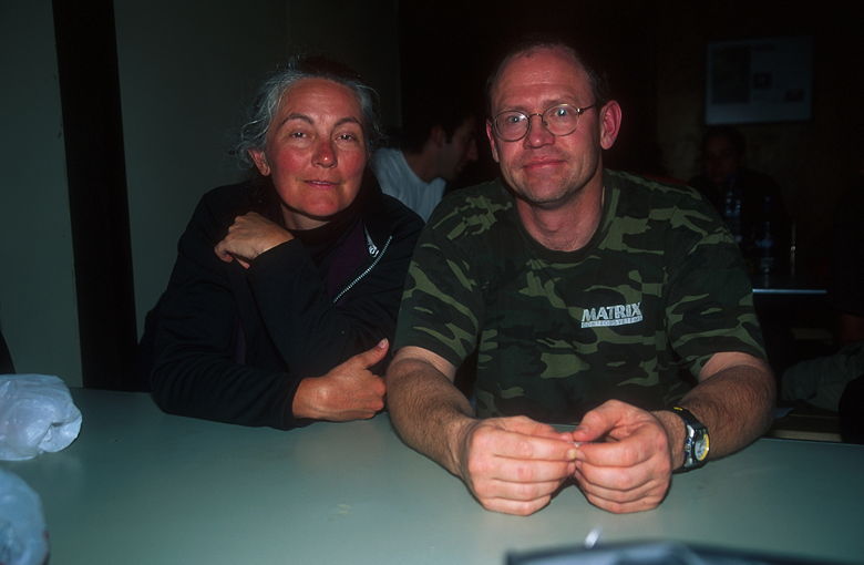
Tom and Rhonda
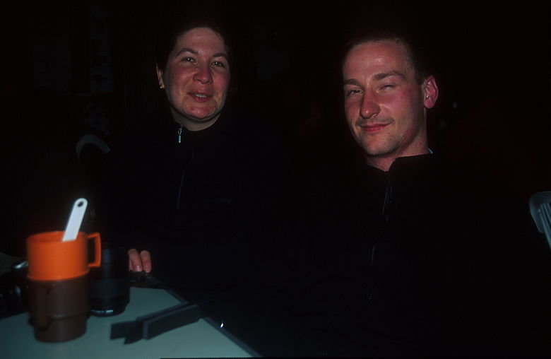
Martin and Heike
Ruth had mentioned that it had already rained 500mm this month. Today and tonight would add a lot to that total.
While we sat around after dinner, talking, there was heavy rain and thunder and lightning outside. After I went
to bed, there was one particularly loud thunder around 9:30pm which shook the whole bunk room.
| 

