|
Having fallen asleep around 8pm, I woke up at 4am to go to the bathroom. I put on my
Tevas and went outside, onto the deck. It was still pouring rain and windy outside.
Much of the deck near the women's bathroom was soaked, so I took the long way to
the men's bathroom. It was dark and misty -- I couldn't see anything beyond the borders of
the hut deck. I felt like I was on a ship lost at sea. The only saving grace was that it
wasn't rocking (I do get sea sick, remember).
I returned to the hut and tried to settle back down to sleep, only to find someone snoring
very loudly. I think the snorer was keeping 23 people awake; if anyone was still sleeping,
they probably awoke when someone's alarm went off at 5:15am. It went on for a while before
the owner turned it off; I don't think they actually got up. Then, to finish off any
hope of sleeping, everyone's alarms went off at 6:00am.
We went over to the kitchen to prepare breakfast. It was still quite dark outside. The
forecast called for rain today, and I didn't expect the updated forecast (around 8:30am
this morning) would be any better. So I taped a ziploc bag around my camera, leaving the
front of the lens open, partially protected by a hood. My camera bag itself isn't
waterproof or even water resistant, but I was hoping it would be enough protection to last
through the day. I draped a plastic bag over it, but it was more trouble than it was worth.
We left around 9am. I would say 75 percent of the hut had already left within the hour before
us, and the remainder would leave shortly after we did. I managed to get my pack wet even
before we started hiking in the rain, as I had a little accident with my Camelbak. I wish
there was some way to lock it so water couldn't come out of the tube until you wanted it to.
Seems like it wouldn't be very hard to add a locking device. [Note: I just discovered that
CamelBak just released such a device!]
Just before we left, we saw the latest weather forecast -- "clearing, then heavy rain in the
afternoon". We would do our best to be up and over the saddle before the heavy rain started.
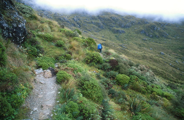
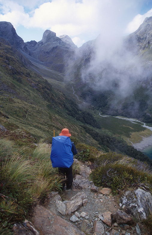
The rain had stopped, and it was clearing, but it wouldn't last for long. We made our way up
a steep climb, past the Route Burn Falls, a series of cascades above the guided walk hut.
The trail was rocky and filled with little pools of water, which slowed us down a lot.
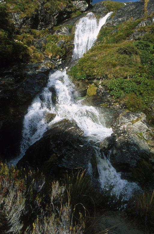
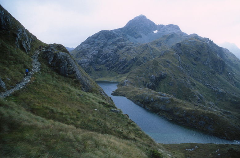
Routeburn Falls
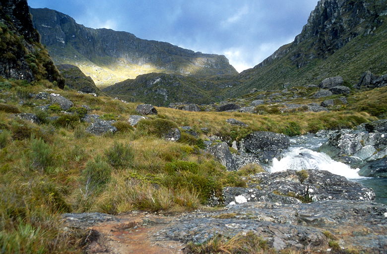
Valley
The sun played hide and seek in a losing battle with the clouds. A wall of mountains lay
before us. We were in a subalpine environment now, walking through a variety of low
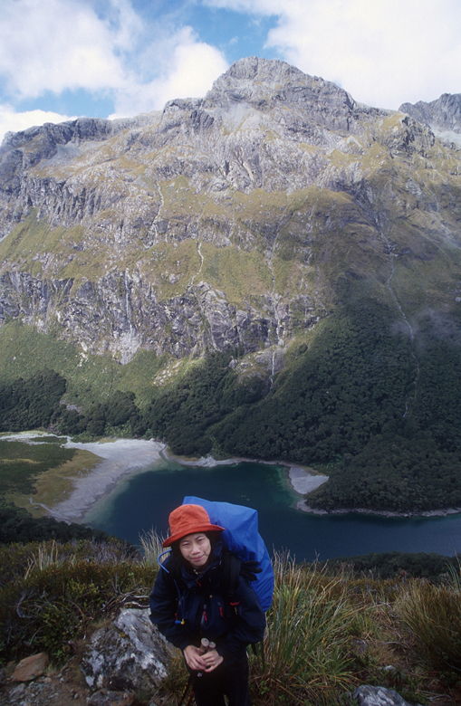
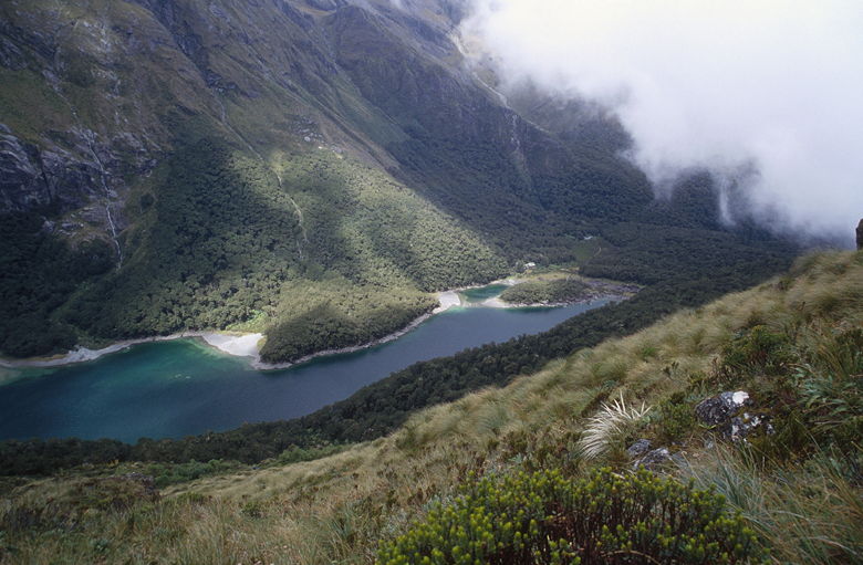
vegetation and a few trees. As we climbed we were rewarded with views of Harris Lake,
with a waterfall feeding into it.
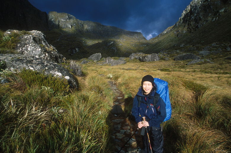
The sun came out shining brightly just as I took this picture, lighting up Jean's face like a light bulb.
A warning for those of you relying on the "Track Guide" provided by the DoC. The elevation
profile they provide is very rough, as you can probably tell by how smooth the lines are.
The map makes it look like it's about an 800 foot climb from the Routeburn Falls Hut to the
high point before the Harris Saddle shelter. Unfortunately, it's really about 1100 feet of
climbing and 200 feet of descent to reach the shelter.
Lake Harris
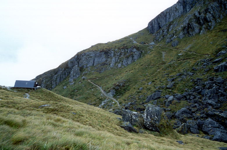
Climbing up to Harris Saddle Shelter
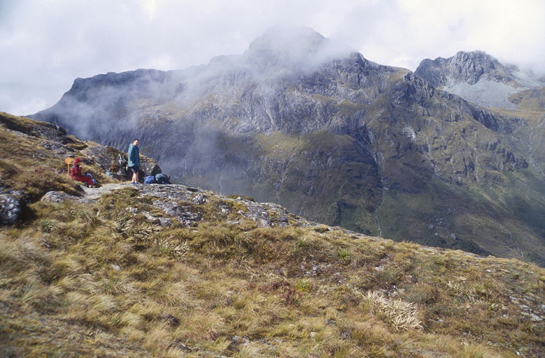
As we neared the shelter, it started to rain harder. We crested the climb and turned a corner
to see the small shelter, with the trail to Conical Hill clearly visible, zig-zagging up behind
it. Beyond the hut, we couldn't see much, as it was getting misty (it would get worse).
We took off our packs and entered the shelter around 10:50am to have lunch. There are two long benches in this
A-frame shelter, with room to sit about 15 somewhat comfortably. There are no facilities,
however -- only shelter. In the hut we saw the 4 men who'd waited at Bumbles with us. We
saw two women bring out an entire loaf of bread and a stick of salami. Everyone else seemed
to have brought lots of food, while we had to be content eating granola bars and peanut butter
squeeze from a tube. But don't underestimate the soothing effect of peanut butter -- it makes
everything taste better!
Conical Hill trail above the shelter
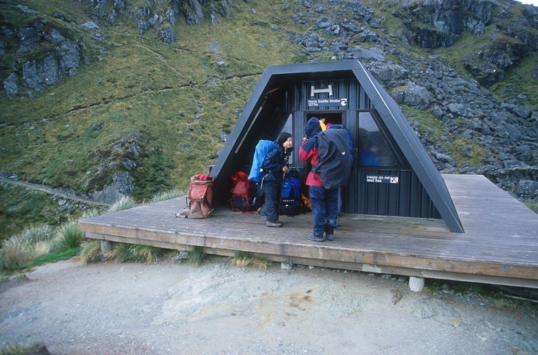
Harris Saddle Shelter
After lunch (around 11:20am) we started downhill just as the weather took a turn for the worse. The mist rolled
in, the rain started coming, and visibility went down to about 20 feet. Maybe less. I could
see Jean in front of me and that was about it. Despite the conditions, the trail was still
pretty crowded, as we passed a lot of people coming in the opposite direction (coming from
Lake Mackenzie Hut, we presume). A lot of them made jokes about the weather as they passed us.
The rain was not coming down heavy -- it was more like a persistent heavy mist, soaking everything
in its path. Having no other choice, we simply kept moving. Eventually, after about 20 or 30
minutes, the rain stopped and the mist cleared.
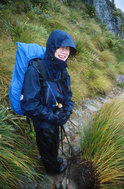
Jean enjoying the rain
The clouds remained, but at least now we could see our surroundings. We were traversing the
mountains high above the Hollyford River, apparently known as the Hollyford Faces. We crossed
a few bridges and saw some small waterfalls along the way, which is mostly level. Eventually
we could see a few buildings next to the Hollyford River below (it was probably Gunns Camp).
The mist starts to recede
After two long hours (from the shelter), we reached a clearing and decided to stop. As we rested, we saw a tiny patch of
blue sky start to grow and grow above us. We could see all around us now --the river below us,
the snow-covered mountains on the other side of the valley (through the fast-moving clouds),
the impressive range of mountains behind us. Birds soared through the air. We started singing
(no, not really).
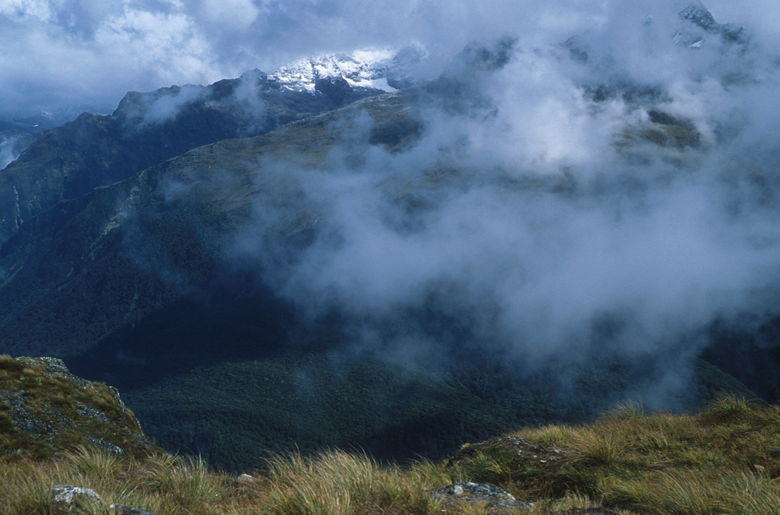
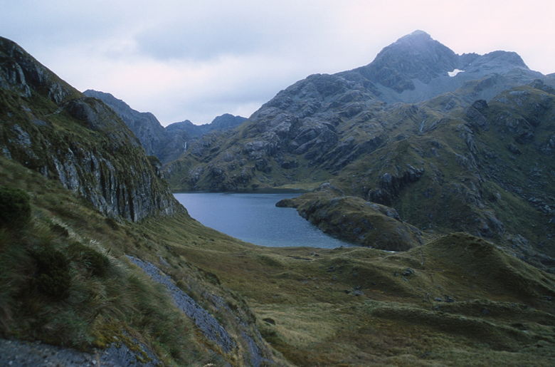
Mist clears a bit to reveal snow-covered peaks
Mountains visible from our rest stop
After enjoying this break in the weather, we continued on the trail which, as we discovered,
immediately starts descending. We basically turned a corner and immediately started our
descent down to Lake Mackenzie, which we could now see far below us. We could even see the
hut at the far end of the lake. It was nice to know we were near the end, but it was actually
a bit tortuous. We could see the hut and it looked so close, but it would take a long time to
get down there. The trail is rocky and switch-backs down the mountain face. We could see the
closed end of the mountains to our left, the lake being threatened by fast-moving clouds to our
right. The patch of blue sky which we'd just seen was now long gone.
Jean above Lake Mackenzie
Starting the descent
We would end up descending about 1000 feet from our resting point to the hut. After descending the
rocky switchbacks, we entered a beech forest. It's a beautiful place with green moss everywhere. As
we descended, we encountered a large group of about 15-20 trampers coming in the opposite direction.
I thought it was odd that we would see them this late in the day, since they wouldn't be able to reach
Routeburn Falls Hut until after dark. That wasn't our problem, though, as we soon emerged from the forest
and reached the hut.
Hut visible at the far end of the lake. Notice the mist coming in again.
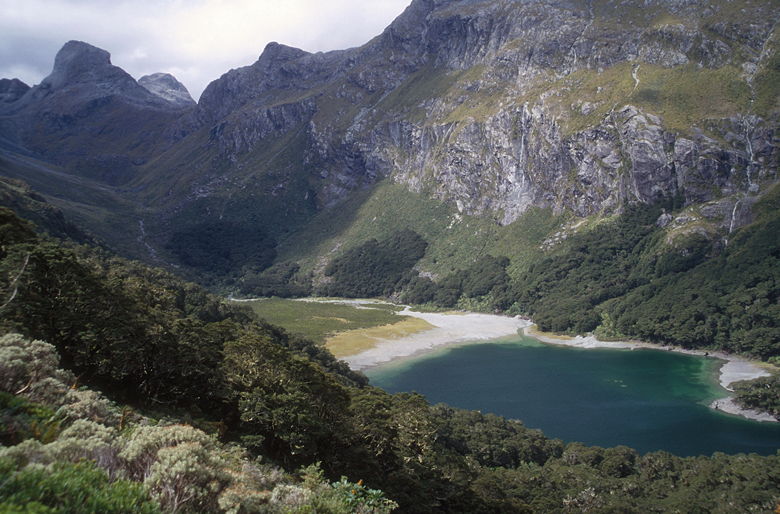
Lake Mackenzie
I had hoped to return to the beech forest to take pictures, but the rain started coming down harder and
it wouldn't let up. We were done for the day. The Lake Mackenzie Hut (elevation 950 meters) is not as nice (or new) as the
Routeburn Falls Hut. It has two bunkrooms. The one we stayed in was above the common room and had 12
bunks like at Routeburn Falls, and a single large platform which sleeps 12 side by side. We were on the
platform. The other bunkroom has about 8 bunk platforms sleeping 4 each; it has the disadvantage that you
have to walk in the rain to get to it.
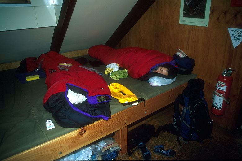
Napping in the hut
After cleaning up, we went to the kitchen to prepare dinner. Nearly everyone was gathered around the
coal-burning fire to keep warm. There were racks standing next to the fire where people put their clothes
to dry. We sat at a table with Tim and Jackie, a couple from Auckland. They were on the bus from Queenstown
with us, and if you look at my picture at the start of the hike, you can see Jackie and what I think is
Tim's head.
In any case, Tim and Jackie were pretty friendly and we struck up a conversation about all sorts of stuff.
Tim even mentioned Sean Marks, since he's the only Kiwi in the NBA right now. Which is interesting, since
Sean Marks went to the same college as me (Cal). While Tim and Jackie were from Auckland, they seem to have
been all over the world. They related buying a mountain bike in the United States and bringing it on the plane
because it's so much cheaper there. We compared food -- they were fascinated by our tube of peanut butter.
They'd never seen such a tube (we bought this empty, refillable tube from REI). They brought cheese and
crackers, which they were kind enough to share with us. Having done most of our trips in the Sierras, which
get very hot during the day, we never would have thought of taking cheese on a backpacking trip. But on
this trip, cheese definitely would have kept fine. It was not uncomfortably cold, but it certainly never
got hot. The Sierras are hot during the day and cold (sometimes freezing) at night.
While the water is probably safe to drink, I brought along my water filter and couldn't think of a reason
not to use it. Better safe than sorry. I don't think anyone else bothered to filter their water in the hut,
so I got a few strange looks. Finally, one guy comes over from the other table and asks me what I'm doing.
I tell him I'm filtering water and he says "oh!" and goes back to his table. He might have been confused
by the fact that my water was turning orange, but he didn't ask. I wasn't going to tell him that I'd put
Tang powder in the bottle. I would have just said I have a magic water filter.
The hut warden came by and collected our tickets, but thankfully didn't start talking about shorts and
gaiters and whatever else came to mind. New Zealand was switching from Daylight Savings Time to Standard Time
tonight (actually 2am on Sunday), so we set our watches back. We were now off by 4 hours from home. We
trudged off to sleep around 9pm (8pm according to our watches now). The rain was still coming down.
| 

