|
About a month earlier, we'd hiked in nearby Briones Regional Park. I
expected the terrain to be similar -- rolling green hills, oak trees,
and more wildflowers. Mostly, that was correct, but there's something
new on almost every hike.
It had rained a couple days earlier, but we were basically past the
bulk of the rainy season. We drove to the park and arrived under
partly cloudy skies. The fairly large parking lot (enough for maybe 40
or more cars) had only a handful of cars. After picking up a map,
Cammy, Jason, Jean, and I headed off on the trail around 11:40am.
We started off on the hikers-only Creek Trail. It parallels Bollinger Creek
for about half a mile. Because this part of the trail is mostly shaded,
it was muddy for some stretches, but nothing really that bad. The trail
then crosses the creek and emerges on the other side into the sunlight.
We stopped briefly to look back at one of the widest trees I've ever seen,
it's limbs stretching far out low to the ground. Then we turned left
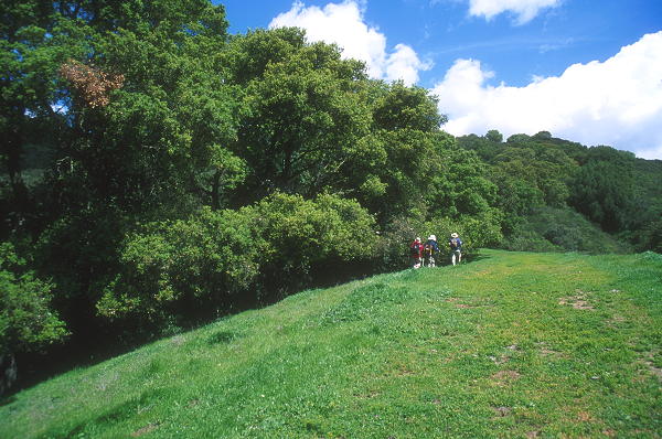
and continued along the Bollinger Canyon Trail, a wide dirt road.
Now the climbing began, pretty gently at first. Everywhere we looked
were green hills. While we could sometimes see cows in the distance,
we didn't actually run into any on the trail. If you've read my other
hikes or done them yourself, you know that it's very common to run into
cows on the trail in the East Bay.
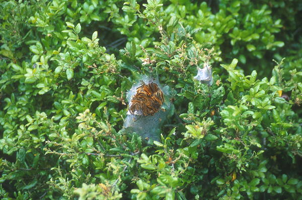
Caterpillar tent in the trees
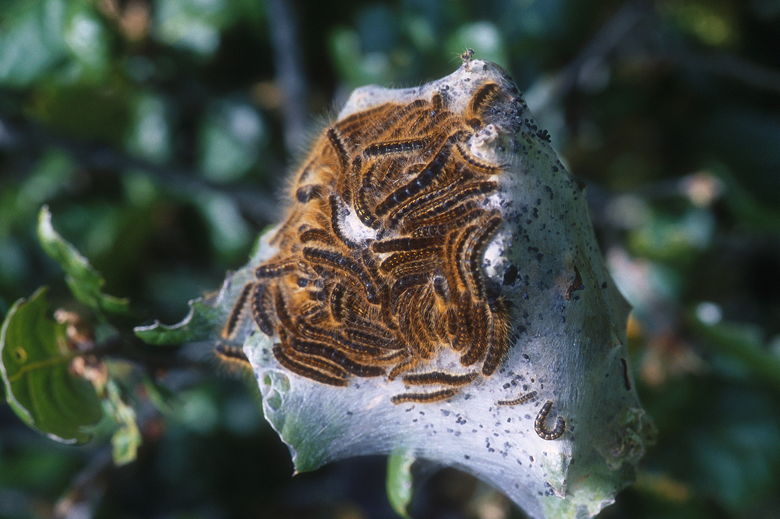
Caterpillar tent
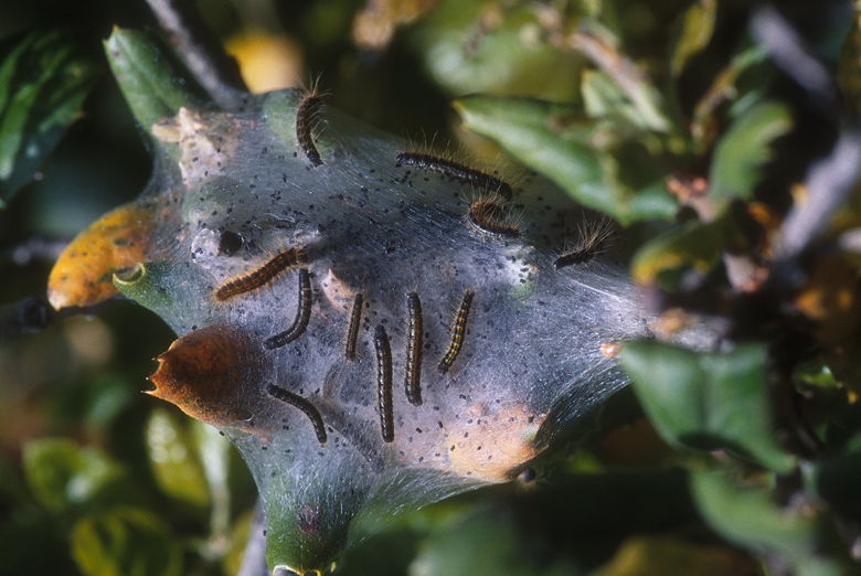
More caterpillars
Jason mentioned that at this time of year in Michigan, he would see
caterpillar tents in the trees. He wondered if we would see some here.
Not very long after he said this, we saw a tree filled with caterpillars.
The branches were right next to the trail, accessible at eye level.
We stopped for several minutes to marvel at them and take pictures.
I now wonder how many times I've walked past trees with what looked like
thick cobwebs, never realizing all the life that was teeming inside.
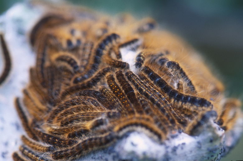
A closer look at the caterpillars
Looking up at the caterpillar tents in the trees
We continued climbing gently until we reached the next trail intersection.
Here, the main trail headed left and up toward Las Trampas Peak. That
trail basically dead-ends at the peak, though, and we were doing a loop
hike. So we took the right fork and started climbing up some steep
single-track. I say single-track, but the trail is supposed to be
hikers and horses only. Unfortunately not everyone follows the rules...
At the top, we rested briefly another intersection. A trail to the left
goes back up toward Las Trampas Peak. We saw two women come from that
direction and exchanged a few words. They took the right fork that
we would follow moments later. A couple minutes later we met them on
the trail again and we took each other's pictures in front of some
reddish flowers. Those were just some of the many, uncountable wildflowers
we would see on this hike. There were many more wildflowers than at
Briones, but that could be because it was closer to peak wildflower
season now.
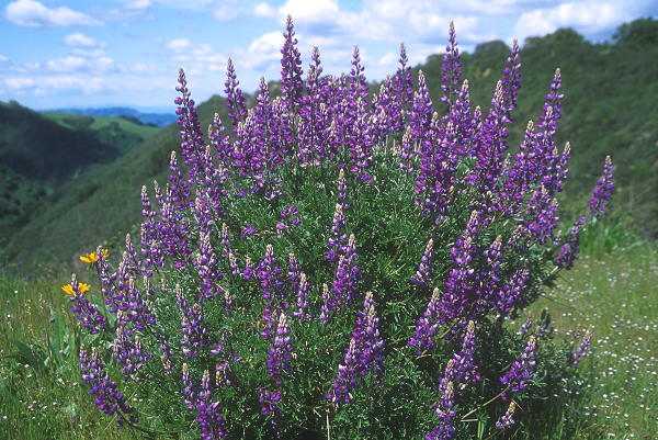
Lupine bush
The trail is fairly level here, mostly under shade of tree. Through
the trees, we saw a raptor or two soaring high above. We soon reached
Vail Peak, though we couldn't tell because there are trees at the top
blocking the view. We turned left and headed down the hikers-only
Corduroy Hills Trail. There are steps here, but each step is about
two feet high. After descending less than a hundred feet, we reached
a small saddle where we stopped briefly to admire the first of many
lupine bushes we would see on this hike.
Jean headed for the steep trail up
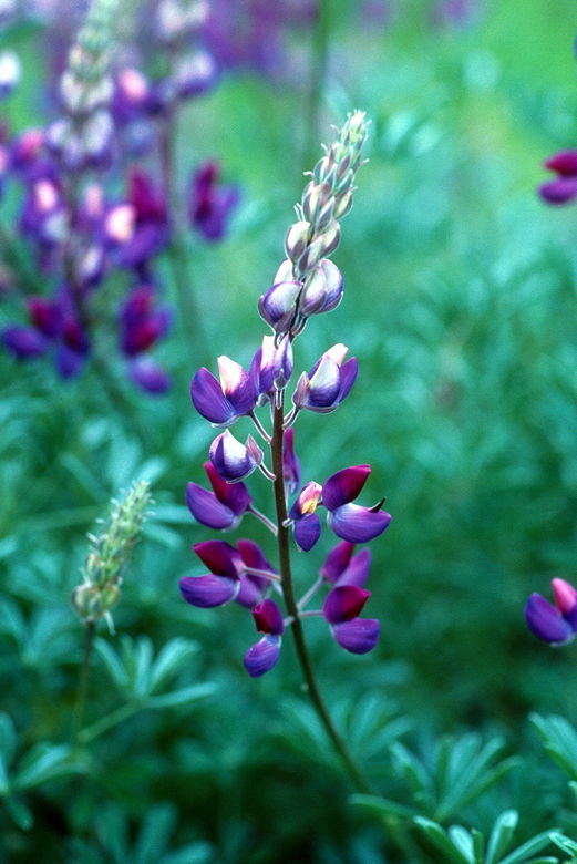
Close-up of lupine
Directly ahead of us now was a very steep trail heading up to some
rock outcroppings. We clambered up, then settled down for lunch
at the top. The sun played hide and seek with the clouds as we ate
and enjoyed the views of Rocky Ridge to the south west. After lunch
we explored the rock formations. I climbed up a small rock and saw
that the views were much better, although it was much colder being
exposed to the winds. From here I could see a wall of rocks running
along the summit ridge, extending for about 150 feet in total length.
It was good solid rock and fun to boulder on.
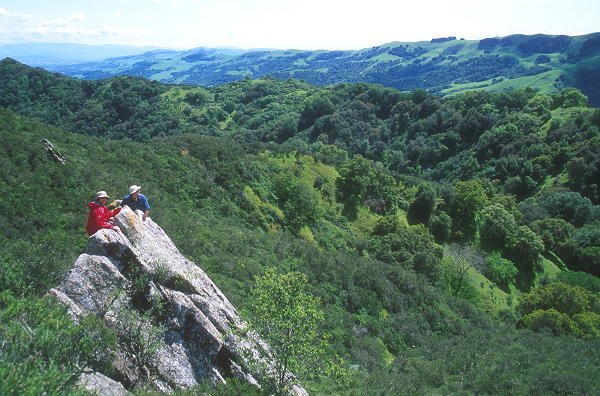
Cammy and Jason checking out the view
While we were at the top, we were passed by a small group of hikers,
as well as 2 or 3 mountain bikers. We didn't get a chance to tell
them that the trail is supposed to be off-limits to bikers. We were
a little amazed that they even attempted to carry their bikes up that
stretch of rocky trail we'd had to ascend to get there.
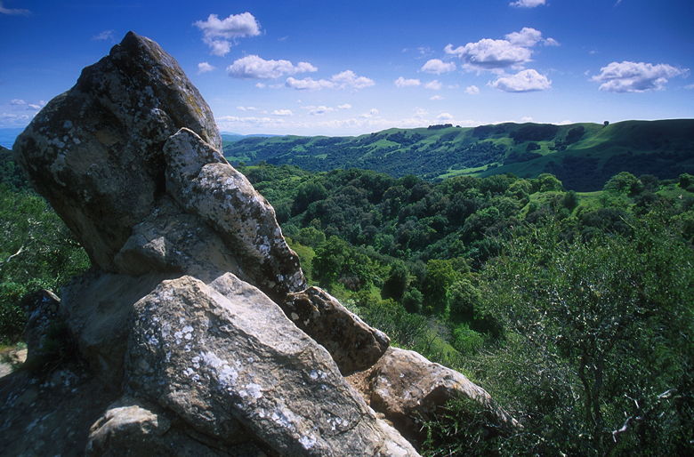
Rock at the top of the saddle, guarding the view to the south
After lunch we continued on the trail, reaching a small spur trail
that heads right and up to Eagle Peak itself (elevation 1720). There's
a bench here, pointed straight at Mount Diablo. From here, you can
pretty much only look east, across the 680 valley to Mount Diablo. We
stopped briefly, then continued the descent on the Corduroy Hills Trail.
This was one of the nicest parts of the trail, passing through open
oak forest and fields of wildflowers. We began to see more and more
poppies, soon passing more poppies than you can count. All the while
we were descending the north east side of Las Trampas Ridge, knowing
we would have to climb back up and over to return to the car.
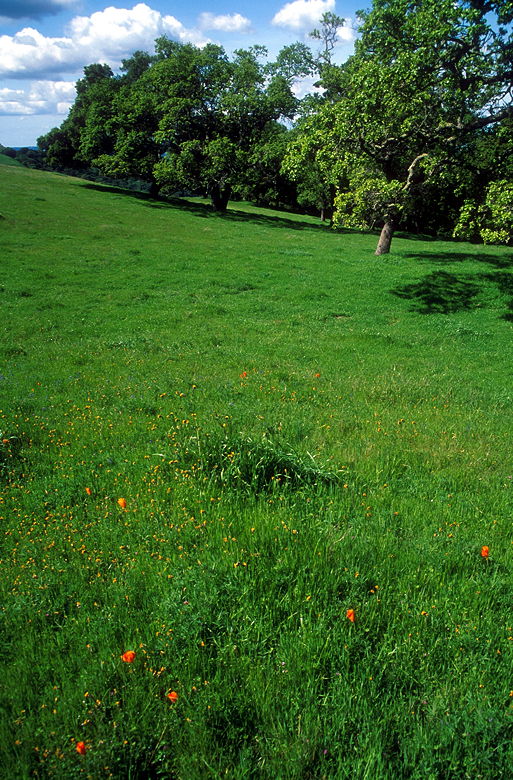
Poppies in the field
Eventually the trail drops onto a wide dirt road that flows straight
into the Madrone Trail. We turned right and continued heading down,
steeply at times. We could see we were headed nearly straight for the
Eugene O'Neill National Historic Landmark, whatever that is. We reached
a trail intersection and turned right to stay on the Madrone Trail, then
shortly turned left onto the hikers-only Virgil Williams Trail. This
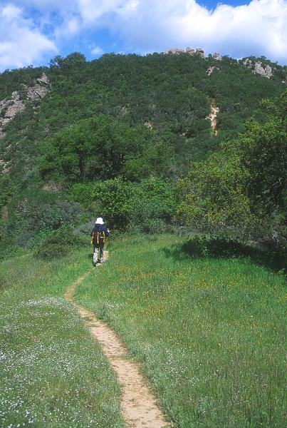
trail climbs, steeply at times, through a densely vegetated, shady forest.
We followed it for about a mile, but without gaining much in the way
of views because of all the trees.
Finally, we reached the Amigo Trail, a wide dirt road. It headed up,
at a very imposing angle. This short 0.43 mile stretch of the Amigo
Trail is not your friend -- it is very steep, and is especially painful
near the end of a hike. We slowly made our way up, past more lupine
bushes. I was surprised to see that some of the bushes had very thick
branches. I didn't know they could grow almost, well, bush-like.
I always thought of them more as wildflowers than as bushes.
After the steep haul up the trail, we reached another trail intersection.
Cammy and Jean decided to head down the Sulphur Springs Trail. Jason and
I headed up the Summit Trail. The Summit Trail is only slightly
longer (0.77 vs. 0.61 miles), and I think the better route. It goes up and
down, rather than down and up (as the other route does). If you reach this
part of the trail and see the climb, don't be alarmed -- all that you see
is all that there is -- as soon as you reach that, it levels off. When you
reach the next intersection, don't take it -- go straight (bear left) for
a few more yards to soak in some nice views of Rocky Ridge. The double
back like we did and descend down the Las Trampas Ridge Trail.
We reached the Oak Circle, then the intersection with the Sulphur Springs
Trail. Cammy and Jean shortly emerged from the forest and together
we continued along the Las
Trampas Ridge Trail. We climbed briefly before topping the ridge. While
we enjoyed the views, a turkey vulture came at us, swooping down and coming
within maybe 15-20 feet of us. It looked like he was right on top of us.
It was pretty intimidating.
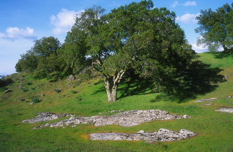
Oak tree at Oak Circle
We started our descent from the ridge. Rocky Ridge glistened in the afternoon
sunlight across from us. At the next intersection, we looked north to
see the distinctive saddle and rock formations where we'd had lunch
a few hours earlier. From here, we could see tall rock columns leading
up the south side of Eagle Peak.
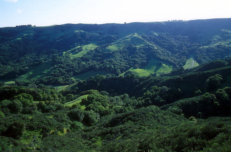
View looking west
We turned left and headed down the Chamise Trail, then turned right and
hiked down to a small parking area on Bollinger Canyon Road. We walked
along the road the last couple hundred yards to our car.
While this was a nice hike, with the added treat of the caterpillar
sighting, if I had to compare this hike with Briones I would have to give
Briones the nod. I'm not exactly sure why that is, but I think the
trails on the Briones hike afford better views as well as nice open
oak forest. Several of the trails here go through denser forest which I
find less appealing. That's not to say I won't return some day, to
explore the other side of the park -- Rocky Ridge.
| 

