|
In May the Sierras are still too snow-bound for backpacking, so I thought a trip to Cache Creek
would be nice. Cache Creek is located just a bit east of Clear Lake, which is just north of Napa.
Another way to look at it is that Cache Creek is south of Snow Mountain, where I'd gone hiking
2 years earlier.
This was the first backpacking trip that Jean and I planned with anyone else (we'd be going with
Cammy and Jason). That, along with
the fact that Jean was 5 months pregnant was cause for a few changes in our usual backpack
weight distribution.
See what's inside our packs.
On Saturday morning of Memorial Day weekend, we made the drive up to Highway 20, then took 20 to
the parking lot just past the county line. The lot is mostly unsigned. There are no map signs
or feel-good signs saying "Cache Creek Natural Area" or "Judge Davis Trail". You'll just have to
have faith that you're in the right place. We parked among the 3 other cars parked there, one of
which inexplicably had a half-eaten pear on its trunk. The car (and the pear) would still be there
when we returned the next day.
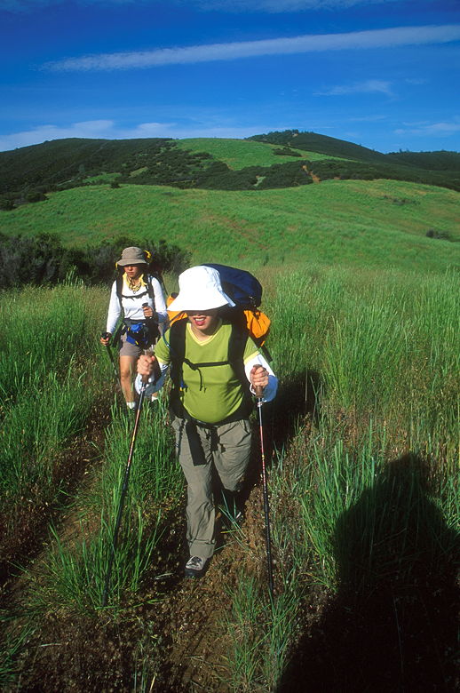
We started hiking around 12:45pm. The wide dirt trail immediately begins climbing through a
dense oak forest. The skies were clear
and it was quite warm -- I spent the whole trip hiking in a short-sleeve shirt and shorts.
As we climbed higher, we saw hillsides full of small purple flowers. It looked like the area was
past peak wildflower viewing time and things were starting to dry out, but there were still plenty
of wildflowers left.
After climbing a few hundred feet, we topped out over a rise and were subjected to stiff winds
which turned the grasslands into flowing rivers of green. The forest was now more open, but still
oak and some pine. The trail flattens out as it passes an old barbed wire fence. Here, there's
a trail
sign (literally, a sign that just says "Trail") that points forward, to steer you clear of the
dirt road that heads to the right. We went forward, through the fence, and shortly came to rest
underneath the shade of a tree to have lunch.
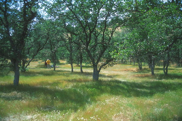
Jason standing amidst the oak trees
By this time my allergies were getting the best of me and I decided to take a Claritin. I probably
should have taken it sooner, as I would be suffering the rest of the day. The curse of spring...
It probably didn't help that the wind was still blowing. I thought it would be nice to take a
picture of the wind -- more to the point, a long exposure of the grasses blowing in the wind. You
know, for that painting-type quality. Unfortunately, it was too bright and the best I could do
was a half-second exposure. I really wanted a 10 second exposure. Next time I'll have to bring
a 4-stop neutral density (not graduated) filter. It's rare that I've needed such a beast.
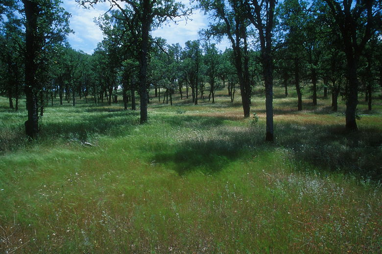
Grasses blowing beneath the oaks
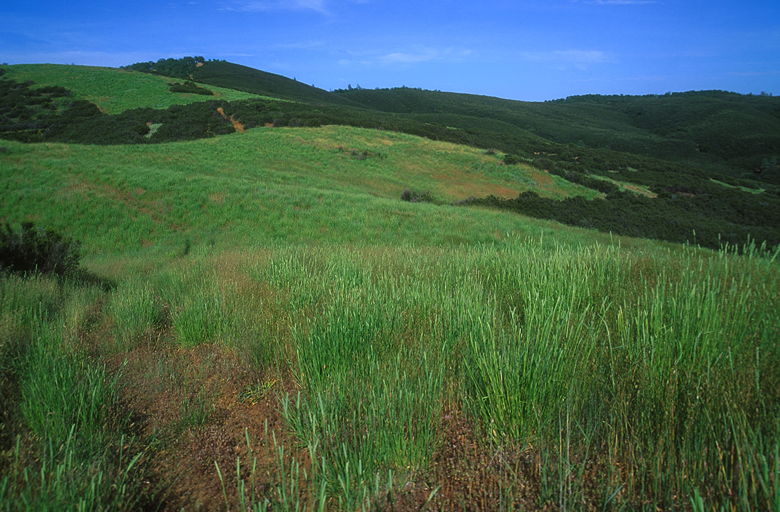
After lunch we continued on the trail, which climbs gently before reaching a ridge
with great views of the Blue Ridge to the east. Tiny yellow wildflowers dotted the hillside
below us. We then continued on the trail, which climbs steeply before leveling out. We passed another
ambiguous trail sign with a trail heading back to the right. Not sure where that leads. We
continued straight along the trail. We continued to have great views of the Blue Ridge as we
continued along the wide trail up and down the rolling hills.
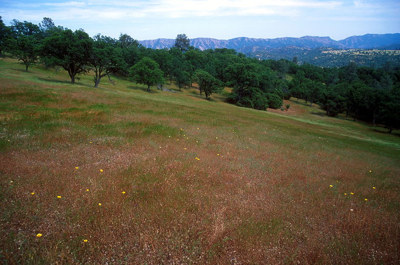
View of the flower-dotted slope
Everything was great until we
came to a sign that said "Cache Creek Ridge Trail" straight ahead. I knew we didn't want to go
there, as the Judge Davis Trail heads west and the Cache Creek Ridge Trail heads south. I couldn't
quite believe that we'd only gone a mile. It didn't help that the trail splits across two USGS
maps. I somehow convinced myself that maybe that faint trail heading west from here was the Judge
Davis Trail. We figured we'd take it a while and see. It descended into a large bowl with a peak
to the southwest and a pond at the bottom. The trail skirted the bowl before disappearing into
the grasses. I checked the map and verified our position -- it was pretty clear now that we
were about a mile south of where we were supposed to turn. It was already well past 3pm and we didn't
yet want to head back the way we came, so we tried to pick out a cross-country route. Unfortunately,
the geography didn't oblige -- heavy brush blocked the way in all directions. Eventually we gave
up and started back up the trail the way we came.
Part of the problem with going to a place like Cache Creek is that the trails aren't well-marked,
and there's not a lot of information to be gathered from books and web-sites. Sitting at home
now after the hike, I've perused the maps, books, and web-sites and there's nothing that really
would have helped us avoid this mistake. Other than me paying closer attention to the map and
being less trusting of the trail signs.
It was now past 4pm and I worried that we wouldn't get into camp until well past dark. So I
suggested we simply head back to the car. However, everyone seemed okay with going forward,
even if we had to hike in the dark (we all had headlamps), and even though we still didn't
know the right way. We came back to the trail sign near the top of the ridge, but convinced
ourselves that wasn't the right way. We descended and turned left onto the road next to the
barbed wire fence, even though there is no sign that points that way. It felt like the
right way.
The road parallels the fence on flat ground for a few minutes before a stiff climb up to the top
of an oak-filled ridge. We then followed a wide dirt road out into the open, passing through
brushland. A short distance later we found a trail coming in from our right (sharp right).
Now, I have no way of verifying this now, but I suspect that if we had found the right trail
to begin with, we would have come along this trail on our right. Perhaps that sharp right
from the top of the ridge would have taken us here. It certainly doesn't match the topo map,
though, which lists the intersection as a soft right. In any case, I was fairly confident that
the direction we now had to take was straight.
The trail climbs steeply. At the top, we now had grand views all the way down toward Cache Creek,
though we couldn't actually see the creek itself. What we did see looked disturbingly like a
building of some kind far below, which was disconcerting since there are no buildings on the map.
Eventually I chalked it up to an optical illusion in the late afternoon sun.
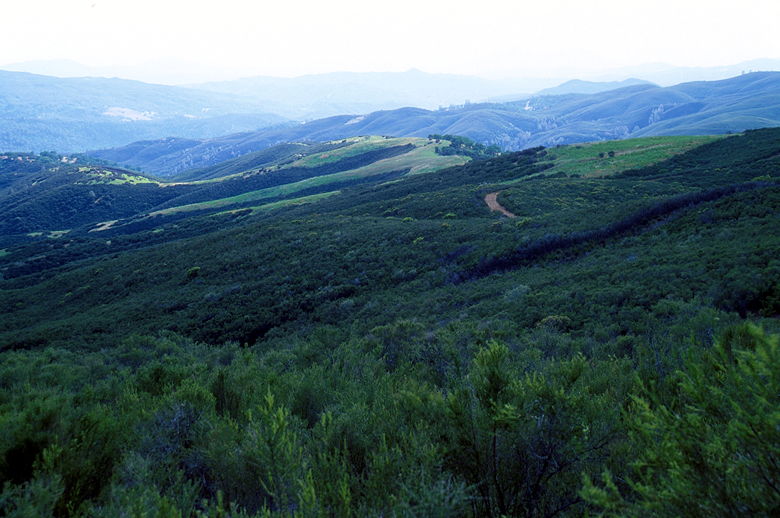
Looking down on the ridge
We turned left past a large green gate with another "Trail" sign that didn't tell us any information
(other than that we shouldn't be driving a vehicle here). We descended steeply, followed the trail
right and climbed to a flat area where I yelled out in triumph. Finally, we found a trail sign
that said "Judge Davis Trail" and pointed down to the left. We now knew we were on the right
track. It was a little after 5pm and we had about 3 hours of daylight left.
Jean and Cammy passing through the grasses
This part of the trail goes through some beautiful grasslands. I can't recall ever hiking through
such thick green grasses. It's interesting to compare and contrast the different vegetation on
this hike. There's the oak woodland, the grasslands, and then the brush. The trail now was
up and down (sometimes steeply), through the grassland before returning to the brush. On several
occasions, we encountered unmarked trail intersections with branches across one trail. Normally
this means that the trail was intentionally being closed and you should take the other route.
Normally I would do so, but I was in no mood to get sidetracked and it often appeared that the
other route would not take us to where we wanted to go. A trail sign here would be comforting, but
even then, based on past experience on this hike I'm not sure I would have believed it. I was
trusting the map now.
Looking back at the grassland
At some point on our descent we saw water far below to our right. At first we thought it might
be the creek. Then I realized it was probably from a side canyon (Jack Canyon). Even later
I realized that it wasn't a creek at all but an unnamed lake that's visible on the map. Whatever
it was, it gave us some hope.
I could now see the sprawling Wilson Valley far below. I didn't want to mention it to Jean, but
this part of the trail reminded me of the descent to the hut on the second day of the Routeburn
Falls hike in New Zealand. I didn't want to mention it because on that hike, we could see the
hut the whole way down but it took forever (an hour) to get there. This was no different.
We zigged and zagged our way down without seeming to get any closer. Finally, we reached another
unmarked intersection. A wide trail headed to the right (sharp right). Another trail continued
straight down the way we were going. And then there were several narrow (6 inch wide) trails
heading down to the right. According to the topo map, the trail heads straight down to the right.
So, partly out of frustration and the desire to reach the bottom by sunset, I headed down the
narrow trails even though they were hard to follow and disappeared at times. We basically
headed through the trees with one objective -- down.
Soon enough, we emerged through the trees into the valley. The sun was just setting as we reached
fields of yellow lupine growing next to the fast-flowing creek. We quickly set up camp, began
filtering water, and cooking dinner. We could see another group of backpackers camped across the
creek from us. They weren't actually on the other side of the creek from us (the creek was impassable,
without a boat, as the ranger said), but just around a bend. I think if we had taken the straight
route we would have ended up where they camped.
The water was actually fairly warm, as was the night, so I took a handkerchief and used it to
wash myself by the creek (no soap, of course). It felt good to wipe the dirt away. There was
no shortage of dirt and silt in the river; we had to clean the water filter several times to
keep it flowing well.
The ranger had said that bears were not a big problem and that canisters were not yet required,
but they recommended hanging food. We decided it would be easier just to take a bear canister,
so we made sure to put everything in there before we went to sleep to the sound of the rushing
water.
| 

