|
The trail for Folger Peak starts from the end of a road in the
western section of the Highland Lakes campground. I found a campsite
at the end of the road. While I was trying to figure out where the
trail started, a woman at the camp pointed to her left, saying there
was a trail there. So if you're looking for the trail, know that it
starts more on the left side, not next to the creek on the right.
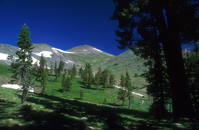
Folger Peak
I started up the hill around 9:30am, passing a small patch of snow
as I entered the forest. After a few minutes I could see Folger Peak
above to the right. As I approached a saddle, I could see a large
snow bank on the left. All around me were wildflowers, including some
bright pink ones I'd never seen before - they kind of look like scarlet
penstemon, only pink.
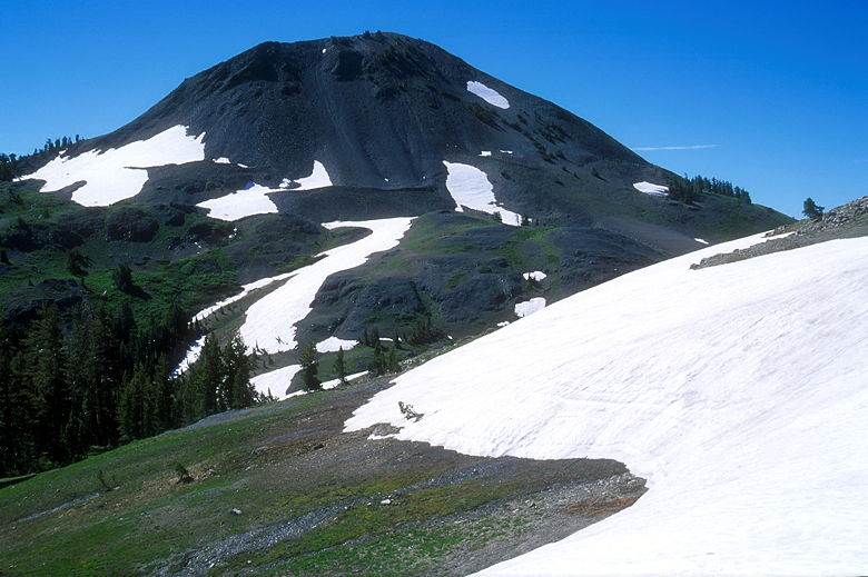
Hiram Peak
After a 250 foot climb, I reached the saddle. I went a brief ways past
the saddle just to check out the view. I could see a trail that continues
out to Milk Ranch Meadow. Then I went back to the saddle, and turned
north to head up to the peak. There's no vegetation to speak of other than
flowers, so you can see most of the route the whole way, even though there's
no trail. I say "most" because there are two intermediate plateaus.
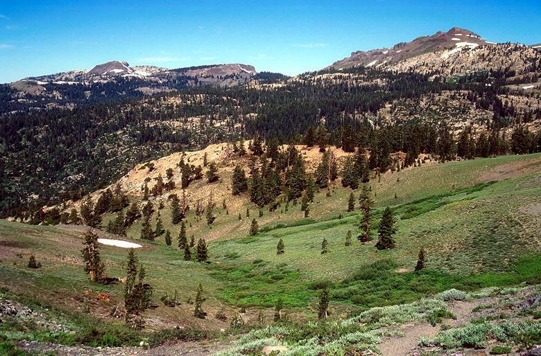
View southwest of the saddle
After climbing for about 75 feet, I reached the first plateau. Looking behind
me, I could now see Hiram and Airola Peaks dominating the view. Continuing the
climb, I found myself staring at a steep slope above a snow bank. To avoid
it, I veered to the left. If I had to do it again, I would stick to the
center of the plateau, rather than veering to the right as I originally did.
Staying on the right gives you nice views of the Highland Lakes below, but
is more dangerous.
After another 300 feet of climbing, there's another plateau. More like a
saddle, actually. Now the crux of the climb awaits. It's another 400 feet
to the top, and this is the steepest part. It's also very gravelly. Every
time you take a step up, you slide back down a bit. After a while, I found
it helpful to kick-in steps, as if I were snow-shoeing. In other words, I
would lead in with my toe and kick into the gravel. This seemed to prevent
the sliding.
As I ascended, I noticed some butterflies fluttering about. Two of them
(one larger than the other) seemed to be attached to each other. Don't
know what that means. They even flew together. Or rather, one was flapping
its wings and the other was along for the ride. They were also rather
slow -- if I wasn't careful, I'd end up stepping on one of them.
I was still acclimatizing, but eventually I made it up to the top. There's
a broad summit plateau with steep drop-offs to the north, east, and west.
There's no vegetation -- just rocks. The small summit block lies on the
northwest corner of the summit plateau. It's only a few feet higher than
the plateau. I put down my trekking poles and clambered up to the
9720 foot summit.
There's a summit register there. It's always interesting to take a few
minutes to read some of the things people write. One woman mentioned that
her three year old daughter came up to the top, holding her dad's hand.
I can't imagine a three-year-old coming up that gravel, but it is perfectly
safe. I might want a leash to prevent them from walking off an edge, though!
(you may laugh, but I did see a woman at camp with a leash on her toddler)
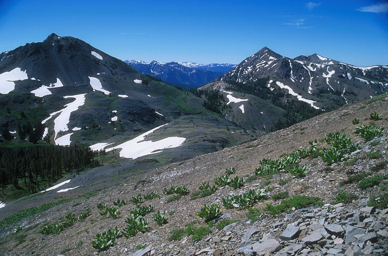
Hiram and Airola Peaks
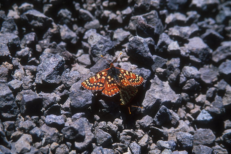
Butterflies
I signed the summit register (which is really just a bunch of papers stuffed
in a glass jar), then enjoyed the view. And another lunch of bagel and
peanut butter. Surprisingly, there wasn't too much wind at the summit.
While there weren't any mosquitoes, there were lots of flies, white butterflies,
and a few bees. Why do flies like summits? I'd encounter flies on Arnot Peak
the next day.
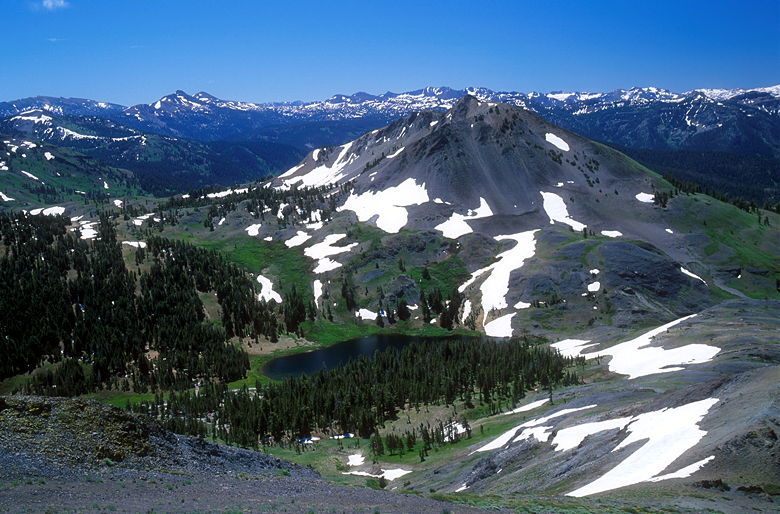
Hiram Peak above Upper Highland Lake
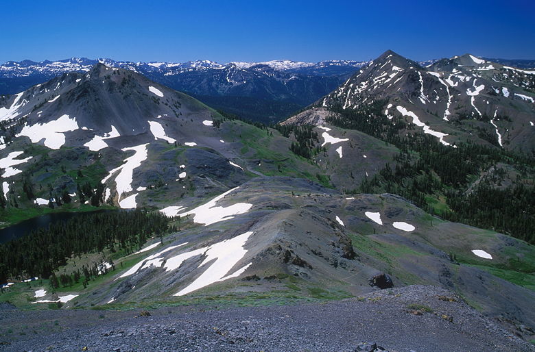
Hiram and Airola Peaks
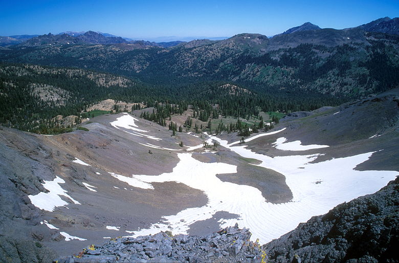
Snow slope below Folger Peak
On the way back down, gravel followed me with every step. I was glad to
have the trekking poles. I tried to be careful not to disturb the vegetation,
but there wasn't anything I could do about the gravel. When I got down to the
upper saddle, I noticed cow pies on the ground. What was a cow doing up here?!
There's nothing to eat as far as I can tell. While they do let cows roam
the wilderness here, I didn't see any (though I did see their effects).
Back at the main saddle, I decided to take a brief excursion to the south.
This area is a broad flat area, extending south until it overlooks Highland
Creek. I saw some interesting geology here. There's a lot of layering.
There's one rock that looks like a stack of pancakes balanced on its
side. There are fields of mules ears and those pink flowers. I was hoping
for some better views, but there's not much until you reach the very edge.
From there, there are great views of Hiram Peak looming over Upper Highland
Lake, as well as Airola Peak. The forested Highland Creek valley extends
off to the southwest. I noted that this would be a great place to watch
the sunset and take pictures tonight. Therefore, I timed my descent from
there back to the trailhead. It took me just 13 minutes, which cemented
my plans for the night.
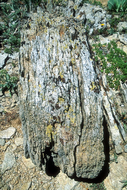
Layered rock
| 

