|
It was a beautiful sunny winter's day as we entered the half-full parking
lot. It was also quite chilly, much colder than down at bay level. As
the park is over 2000 feet above sea level, be prepared for a slightly
colder climate.
We started off on the main trail, which passes through low grassland,
brown at this time of year. Maybe in March or April it'll be green.
If you look through the haze in front of you, you'll be able to see
San Francisco Bay far below. Since the terrain slopes so gently here,
however, it's not a very impressive view. It's also about the only view
you'll see on this hike, as the rest of the hike is almost completely
forested.
Shortly, we turned right and followed the Franciscan Loop Trail slightly
downhill to another intersection. We turned left, into the forest and
onto the San Andreas Fault Trail. One of the main features of the park
is this 0.7 mile loop which contains 7 of the 9 interpretive stations.
Be sure to pick up a park map at the entrance, which explains what each of the
numbered sign posts refer to. There is no text displayed at the stations --
only numbers which you refer to the map for. I thought it might be
interesting to read about the geologic affects of earthquakes and see it
first hand, but for me it wasn't all that engaging. The effects are sometimes
subtle, so I think it's not a must-see. But you may find it interesting.
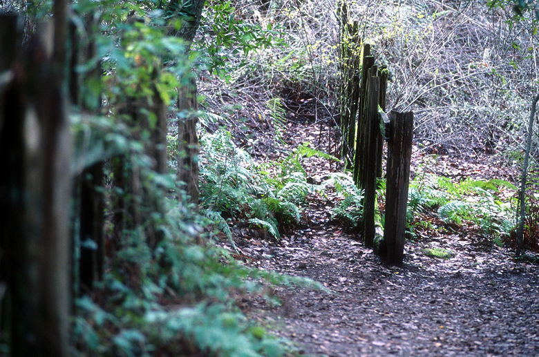
Demonstration of fence separated by fault
So while I found I'm not a geology nut, I did enjoy the scenery of the
San Andreas Fault Trail. In particular, there are lots of ferns and
moss-covered trees to enjoy. The trail goes slightly downhill, and then
back up again. Back at the start of the loop, we stopped at the
nice bench there to feed Nathan. Then we continued along the
Franciscan Loop Trail.
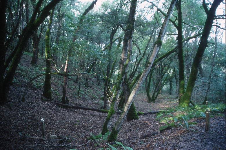
Forest
The park is closed to dogs and bicycles, but you will undoubtedly encounter
other hikers and trail runners, as we did. The trail briefly emerges into the
sunshine before going back into the forest, which contains madrones and oaks,
but no redwoods that I could see. We continued along the Franciscan
Loop Trail until we reached the Lost Creek Loop Trail. You can take
this loop in either direction, of course, and we chose to start with the
right fork.
While much of the park is the same, I would have to say my favorite part
is the Lost Creek Loop Trail -- in particular, the part that parallels
the creek which feeds into Los Trancos Creek. The sound of flowing water
is soothing and you feel like you are off in the wilderness, despite
the occasional sound of planes far above. This is unlike the other two
hikes I've done so far this year, where civilization is always in your face.
The trail goes down gradually in the counter-clockwise direction we took,
and then rises steeply as it diverts from the creek. For those of you who
want a gentler climb, I would recommend the clockwise direction. Keep in
mind that will require a steeper descent, and you may rush past the best
part of the creek, though.
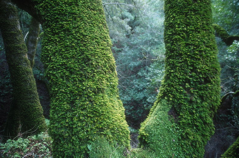
Mossy trees
Back at the start of the loop, we turned right to re-join the Franciscan
Loop Trail. Now the trail starts climbing for real, steeply in places.
The whole hike has only 580 feet of climbing, but about 300 feet of it is
probably right in this half-mile section of trail. We climbed through
the forest and finally emerged out into the grasslands signaling that we
were near the parking area. In a couple minutes, we were back at the car,
the only one left in the lot this close to sunset.
| 

