|
We were lucky enough to arrive just as someone was pulling out of the full
parking lot. There's a pit toilet at the trailhead. From there, the
trail heads downhill in the open sun to the first intersection just yards
away from the start. Here, you have to make a decision -- Taft Point to the
left or Sentinel Dome to the right. They're both about a mile from the
trailhead, with similar elevation changes. Both provide views of the valley
below. We decided to take the left fork toward Taft Point. I've never been
to Sentinel Dome, but I hope to take that trail another day. Alternatively,
if you have the time, you can do a loop trip and visit both places.
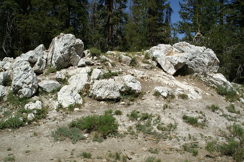
Rocks near the start of the trail
The trail heads into the forest, heading slightly downhill the whole way.
There are large rocks scattered here and there which are great for bouldering
for small kids. The trail crosses over a small creek, but it's narrow and
shallow enough that you can walk across easily.
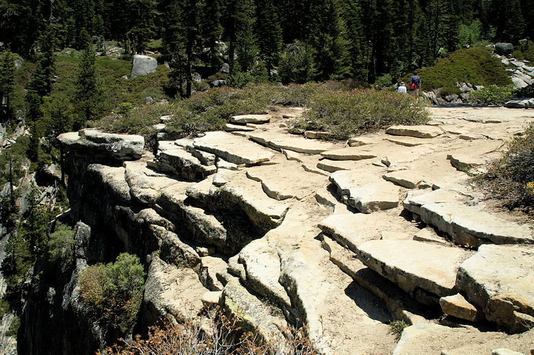
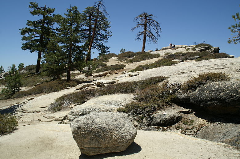
Eventually the trail turns right, the trees fall back, and you're rewarded
with some great views. You can now see the edge of the cliff, and the granite
walls of the valley rising up on the other side. From here, the trail descends
a bit more rapidly, down to the Fissures.
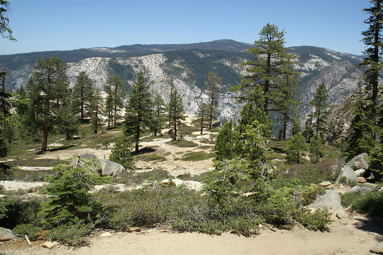
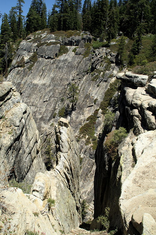
First glimpse of the edge
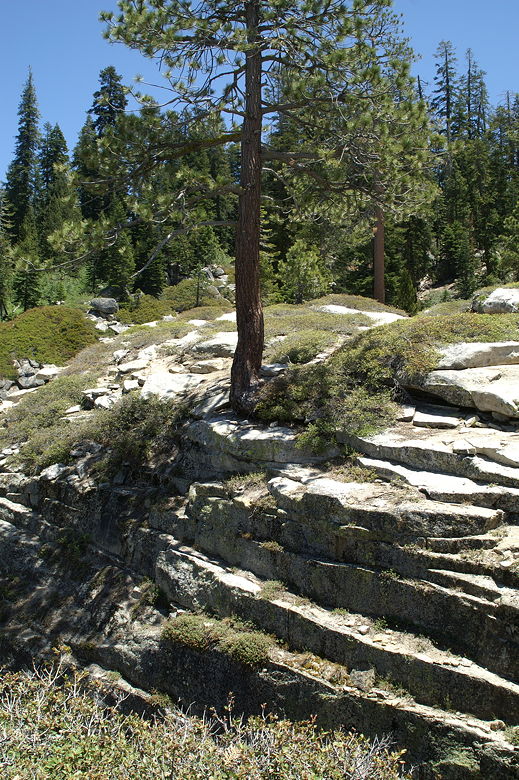
Tree hanging on to the edge of a fissure
If you have small children (like we do), hold onto them at this part of the hike.
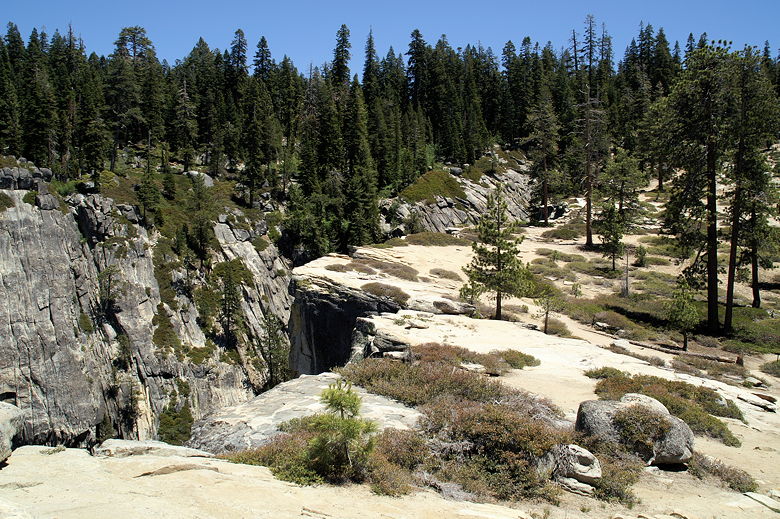
The Fissures is a series of cracks in the mountain and are a bit scary to look
down into. You can walk right to the edge and look down the narrow cracks which
drop off into nothingness. It's certainly not safe to let young children run
around by themselves here. It doesn't help that the ground is slippery because
of all the sand.
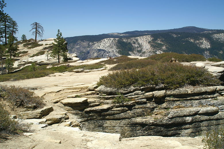
Looking over a fissure
One of the fissures
We stopped under the shade of a tree and had lunch, enjoying the views. The
wind did start to pick up a bit, so we didn't stop too long. Eventually we
packed up and continued the short distance over toward Taft Point. The obvious
landmark is the small railing at the top of Profile Cliff. I'm actually
quite scared of heights so sometimes I wonder why I like to hike to the
top of mountains. I got a sick feeling in my stomach as I gingerly stepped up
to the railing, carrying a 23 pound toddler on my back. I had visions of him
flinging his hat over the edge, watching it fall 3000 feet down to the valley
floor. Thankfully, he was pretty still and quiet as I carefully took my
pictures and turned around. I then had to hold my breath as Jean took Nathan's
hand and helped him up to the railing. I told him I was scared; he looked down
and said he wasn't scared; in fact, he didn't seem concerned at all.
I told him he should be scared!
Edge of one of the fissures
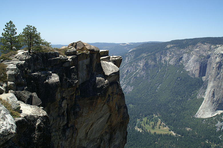
Taft Point
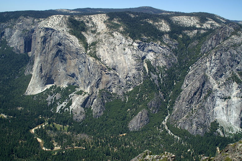
Looking down at the valley
To be honest, the sheer drop negated some of my enjoyment of the view. It's very
different hiking to the edge of a cliff vs. hiking to the top of a mountain.
Hiking to the top of a mountain rewards you with great views without that sick
feeling of vertigo. Hiking to the edge of a cliff is a different story. So
make sure you can stomach it.
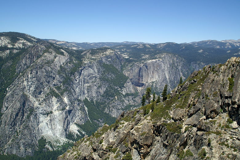
Yosemite Falls from Profile Cliff
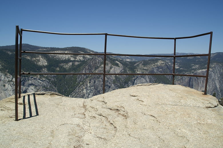
The railing
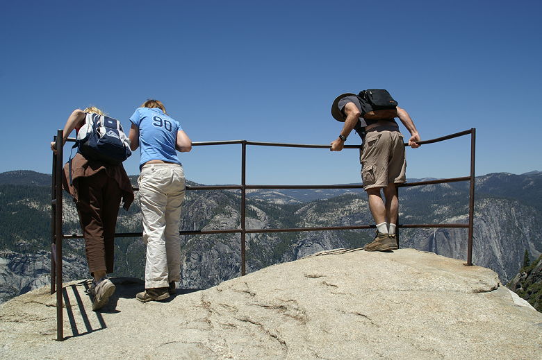
Peering over the railing
After taking in the views, we turned around and headed back the way we came.
Now that I think about it, I'm guessing I would have liked Sentinel Dome better.
But I still have to give this hike an 8 rating because the views are great and
the Fissures are unique.
Looking back over the fissures
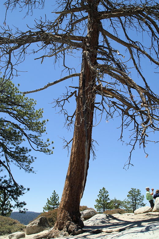
Tree near Taft Point
Looking back
| 

