|
I'd read that Manzanita Lake is best hiked early in the morning or late, near sunset, to
avoid the crowds. The lake is right next to the largest campground in Lassen, so I suspected
that it was good advice. So we had an early dinner and got started on the trail around 6:15pm.
There are several possible starting places for this hike, including the parking lot we chose
(the closest one to the lake), the camper store parking lot, the visitor's center parking
lot, or even the campground itself (there's a trail from there to the lake). From the parking
lot we chose, we walked right to the shore of the lake, where there are several picnic tables
set up. Several people were there, packing up to leave as we turned right and followed the
trail.
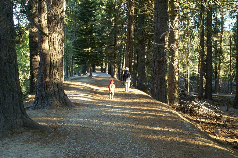
Despite the late hour, the weather was quite nice. In fact I did the entire hike in shorts and
a t-shirt. It's possible you might want to go for long sleeves and pants because of all the bugs,
but they didn't really bother me.
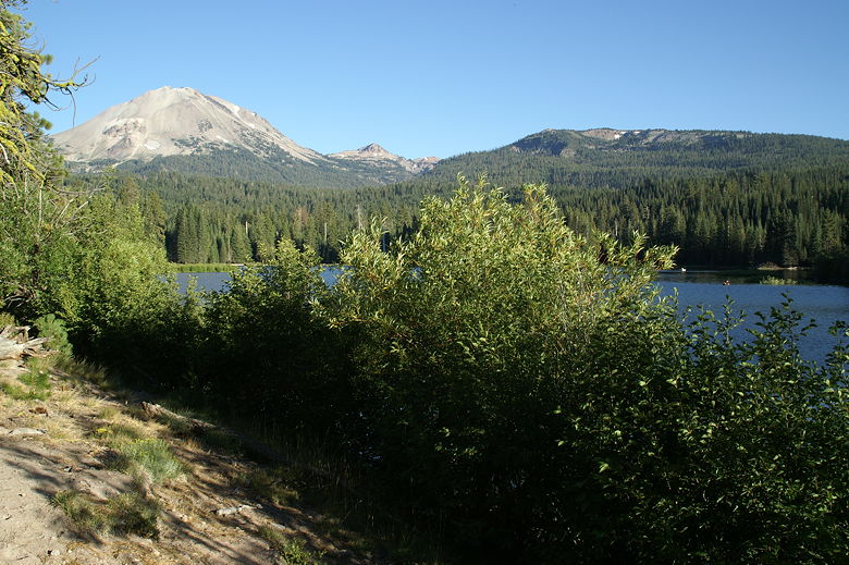
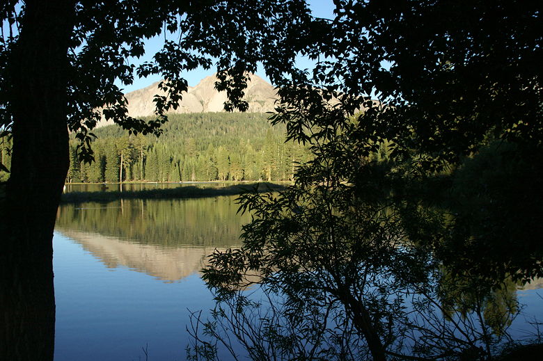
Lassen Peak above Manzanita Lake
Manzanita Lake
The trail briefly follows the shore before reaching a wide sandy area. It looks like the trail
used to cross Manzanita Creek here. In fact we could see the continuation of the trail on the other
side of the creek. Unfortunately there was no bridge here, and there are signs that some of the
area is undergoing habitat restoration. The creek was too wide and deep to cross, so we
backtracked to see if we'd missed a turn, but without
any luck. Eventually we followed the obvious trail heading right, up the hill. It didn't seem right
since it goes away from the lake, but it is the right trail. Shortly, we reached a trail
intersection, turned left to
cross a foot bridge within sight of the Loomis Museum, then turned left and headed downhill.
Lassen Peak above Manzanita Lake
Chaos Crags and Lassen Peak reflected in Manzanita Lake
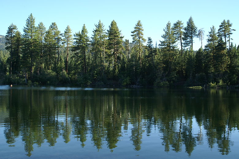
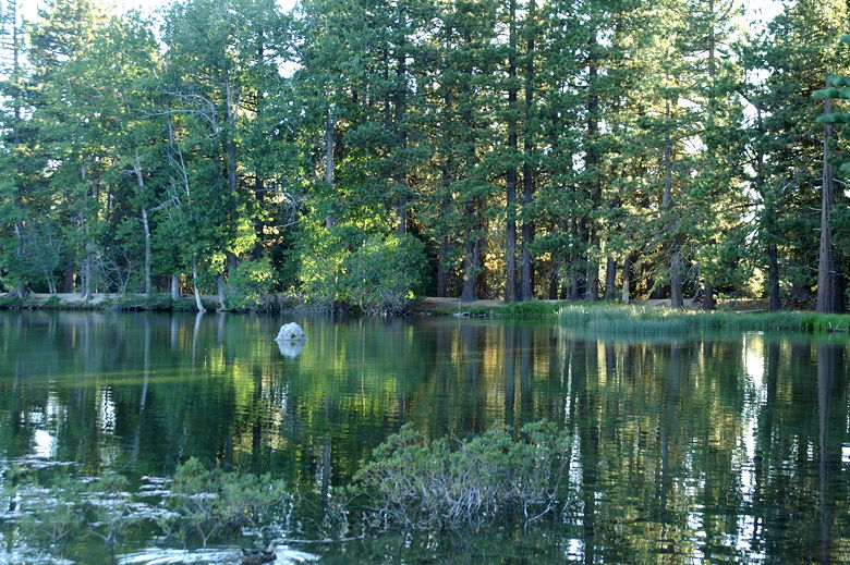
The trail here passes through a nice conifer forest, which has a beautiful color in the late
afternoon light, similar to the Lily Pond Nature Trail across the road. The trail threads between
the park road and the northern shore of Manzanita Lake. The trail gets closer and closer to the
road as it goes on, but there's not too much traffic, especially at this time of night. There
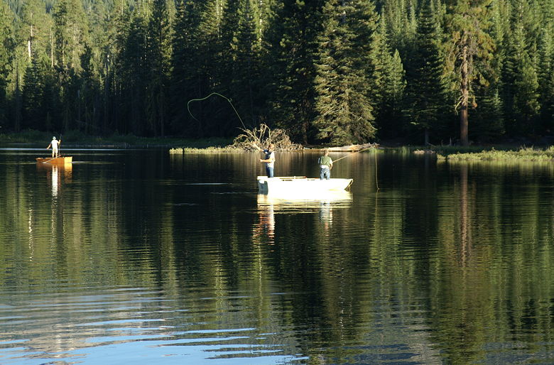
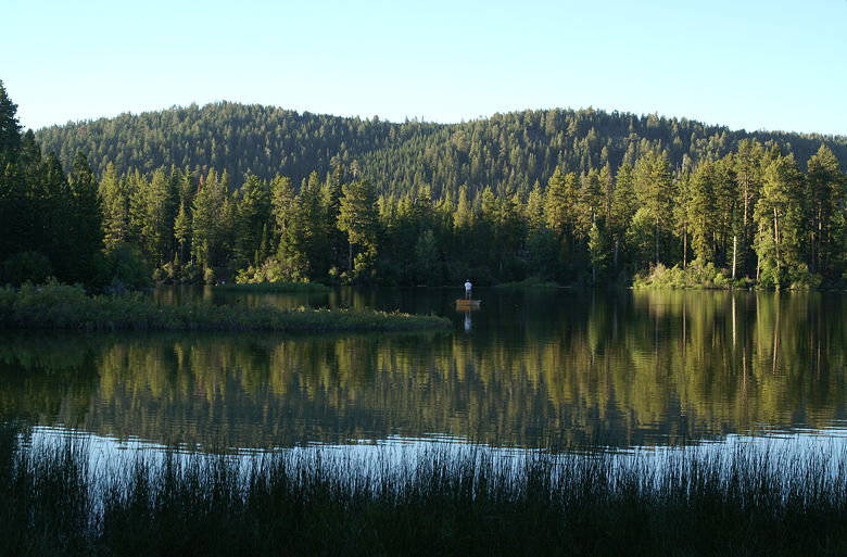
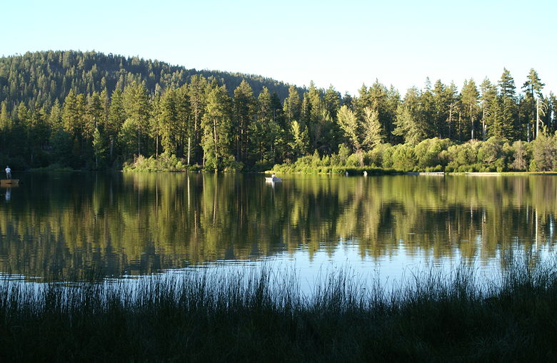
are also several places to stop and look out on the lake. We saw ducks floating on the lake,
and we also began to see more and more fishermen in boats on the lake. Birds flew along the surface,
undoubtedly gobbling up the flies that were buzzing above the surface of the lake.
Fishermen on the lake
Casting on the lake
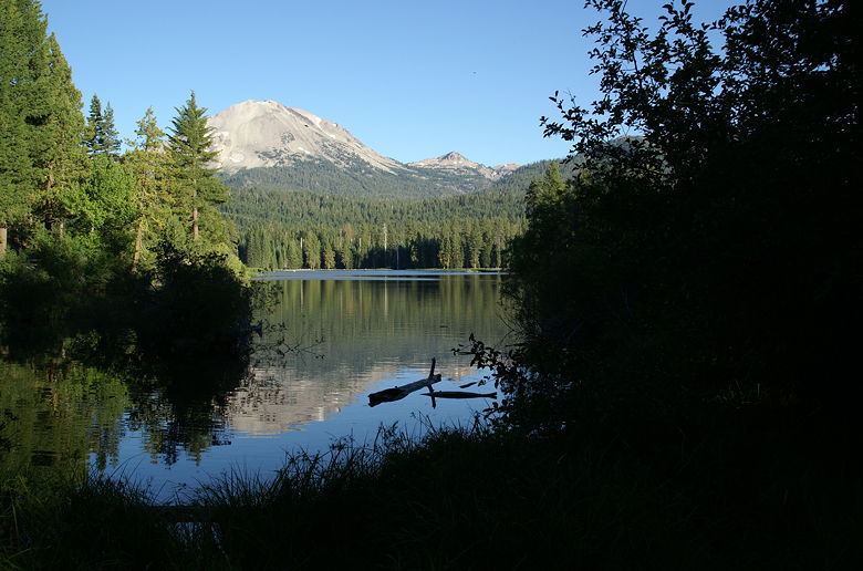
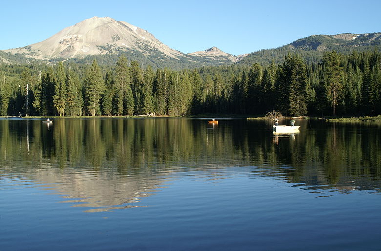
Further along the trail, you can see Chaos Crags and Lassen Peak rising over the lake to your left.
They reflect nicely in the waters of the lake. Eventually you'll be able to see the park entrance
on the road from the trail, at which point the trail makes a left hand turn and leaves the road
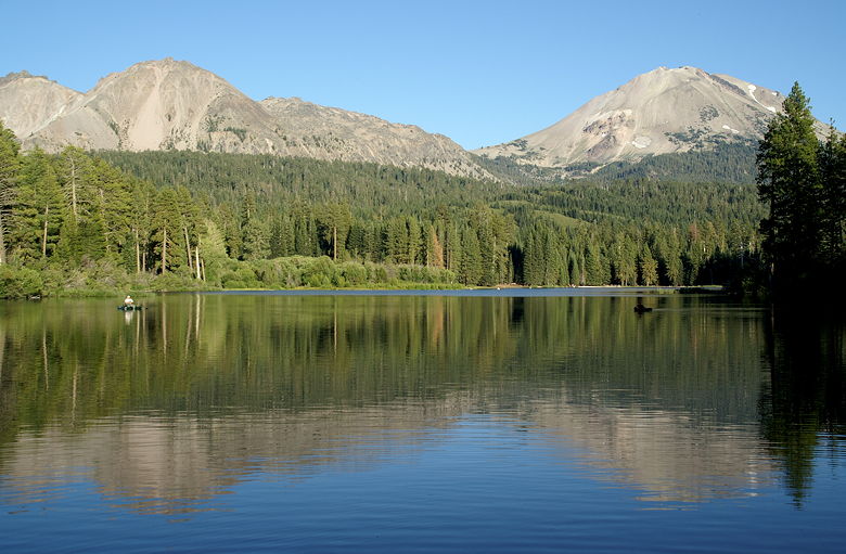
behind. Shortly thereafter you're treated to some of the best parts of the trail. You can see most
of the lake from here, and have the best view of Chaos Crags and Lassen Peak. A small group of
joggers came by at this point, and as I took picture after picture, one of them commented that it
was picture-perfect. Indeed it is.
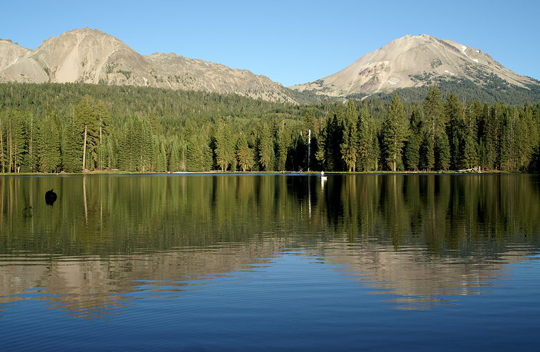
Chaos Crags and Lassen Peak reflected in Manzanita Lake
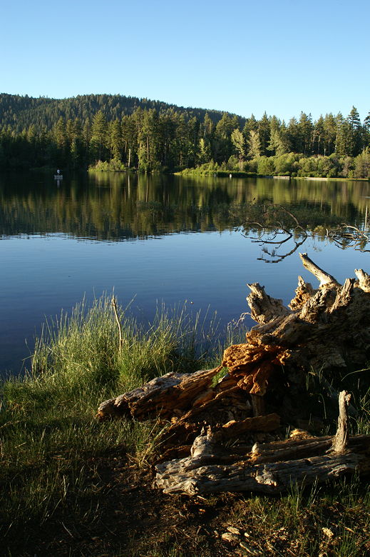
Manzanita Lake
We continued along the trail, enjoying the peace and quiet of the lake. Another treat is watching
the fly fishermen casting. There's just something peaceful and refreshing about that sight, even if
you don't fish (and I don't). The trail continues to hug the shore, and eventually crosses what
looks to be an earthen dam on the western side of the lake. It's perhaps 20 feet wide, with trees
lining either side. We spotted a deer and fawn at the end of the dam. We carefully approached
so as not to scare them, but weren't able to get too close.
The earthen dam at the west end of the lake
Chaos Crags
After crossing the dam, the trail turns left and continues along the southern shore of the lake.
The trail here is darker and more forested than the other side of the lake, and doesn't provide
the nice views of Chaos Crags and Lassen Peak. We could still see most of the lake and all the
fishermen. We could also see some of the thousands of bugs flying near the surface of the lake,
shining in the sunlight.
Manzanita Lake from the southern shore
Manzanita Lake
The trail reaches an intersection where you can turn right to head to the campground. We continued
straight and shortly returned to our car. While this is a short and level hike, if you go at the
right time of day it can be special. I might return and try it in the morning sometime as well.
The fact that it's so close to the campground lets you (if you're staying there) enjoy it early or
late in the day. If you stay at Manzanita Lake camp, be sure to check it out.
Manzanita Lake
| 

