|
(Note, the GPX file above only shows the return route of this out-and-back hike.)
If you are planning on doing this hike, consider bringing or renting chicken wire. Marmots
have been known to crawl underneath cars and eat radiator hoses. People wrap chicken wire
around their cars to keep the marmots out. And you will see marmots on this hike, almost
guaranteed.
After our ordeal in getting chicken wire (see the trip report), we started off on the trail.
The parking lot is the Eagle/Mosquito Lake trailhead, but we didn't take that trail. Instead,
we walked back along Mineral King Road, crossed the bridge, and then took a use trail from the
restroom up to the horse corral road, onto which we turned right.
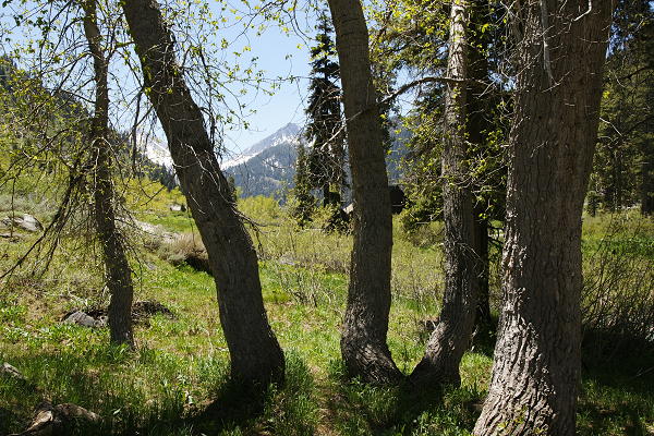
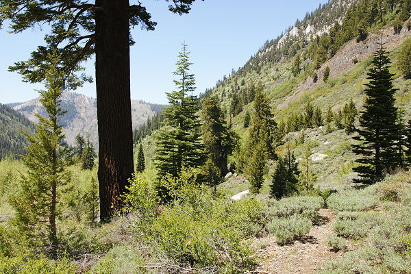
Glimpse of views through the trees
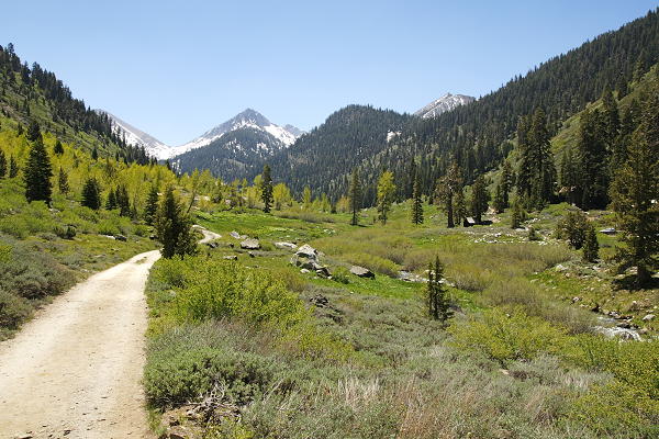
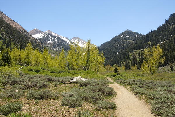
Trail leading into Mineral King Valley
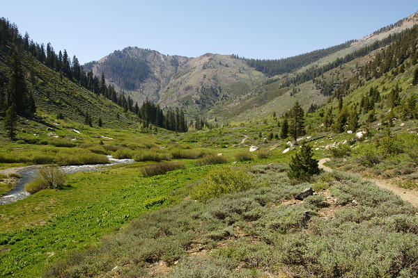
The horse corral road is a wide dirt road heading into Mineral King Valley parallel to
the East Fork Kaweah River. As we walked along the unshaded road, we saw a fat marmot bounding
quickly down the trail straight toward us, looking like a cross between a squirrel and a bunny
rabbit. (in fact, they are the largest member of the squirrel family). He disappeared into
the bushes off to the side before he reached us.
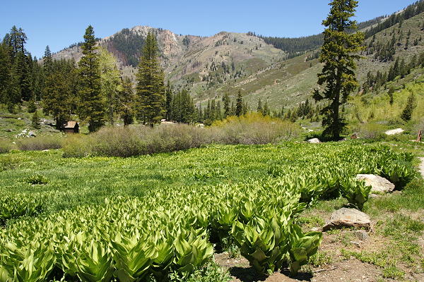
Field of green plants

Close-up of the green plants
As we walked along the trail/road, we saw fields of green plants on the right, and the parking
lot beyond them on the other side of the river. Mountain peaks were behind us and in front of
us. We shortly passed the horse corral on the left. There were no people or horses there at
this time (perhaps they come later in the season?), but there were marmots. There was at least
one marmot underneath one of the buildings. As we walked by, two of them played chase with
each other. We crossed our fingers and hoped they wouldn't damage our car.
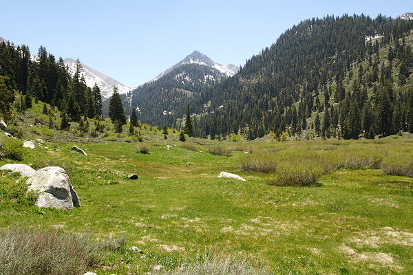
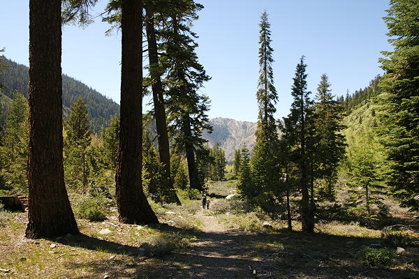
View of the valley
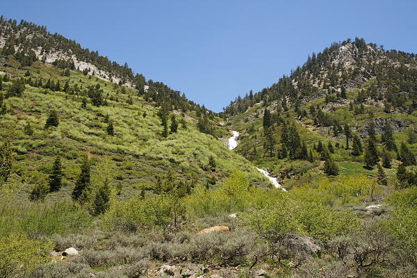
We walked over a small stream and continued on the trail past the corral. We now had a great
view of the snow-covered slopes of the mountains above Farewell Gap a few miles in front of us.
The trail goes all the way to the gap and beyond. We could also see the falls of what I'm guessing
is Spring Creek to our right.
Aspens
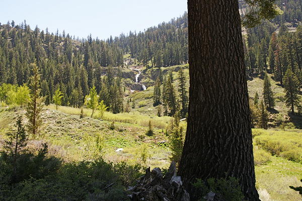
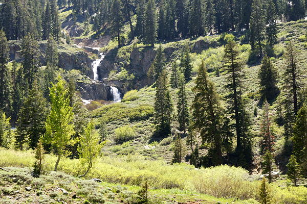
We continued into the beautiful valley, now seeing aspens in front of us. We passed through one
grove of aspens before seeing the falls of Crystal Creek to our left. Soon after spotting the falls,
we met the creek itself, spilling over the trail. It was still relatively early in the season, so
it wasn't a trivial crossing as it probably would be in a few weeks. There were a few branches
laid out across the creek, but some of them were not stable and some were covered with water.
Since I was carrying Jared, I didn't want to risk using the logs. There was no good way around it,
so we all (except Jared) took off our socks and shoes. Nathan at least had sandals; I wish I had
mine instead of having to walk with bare feet. Jean held Nathan's hand and they walked across,
and then I followed with Jared on my back. It was probably only about 6-8 inches deep at its deepest,
maybe about 20-30 feet wide, but it was freezing (the source probably being melted snow three
thousand feet above). But if my 4 (almost 5) year old son can make it, you shouldn't have any problem.
After putting our socks and shoes back on, we resumed our hike on the other side. We shortly came
to a sign pointing to the left, saying nothing but "Trail". There was clearly a trail to the
right, blocked by a couple branches. The left fork is the main trail (to Farewell Gap), but we
took the right fork which heads to Aspen Flat. On our way to Aspen Flat we came upon a grouse
(a largish bird), who stared right at us as we walked by.
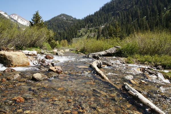
Crystal Creek tumbling down the mountain
White Chief Creek
White Chief Creek
We tried to find a picnic spot at Aspen Flat, but couldn't find anything decent. So we continued
on up the trail and found a great spot underneath the biggest pine tree around. It provided ample
shade as we enjoyed the views. To the right we could see the falls of White Chief Creek. While
we ate lunch, a small group of hikers walked past us, then turned around and headed back a few
minutes later. They were the only people we saw on the trail except for a backpacker we'd see at
the creek crossing on the way back.
The view looking back
Heading back along the trail
After lunch, we started the hike back. I believe that if you continue along the trail, you can
reach Soda Springs, but that was enough for us. The return trip was uneventful. We crossed the
creek again. When we passed the horse corral, the marmots were still out, running around.
We returned to our car to find it safe and sound.
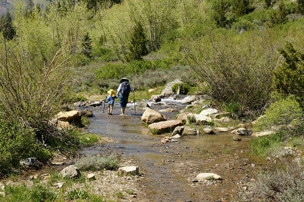
Fording Crystal Creek
Looking back at the Crystal Creek crossing
View of the river running through the valley
Marmot by one of the horse corral buildings (standing, near bottom left)
| 

