|
When we approached the Park and Ride, signs told us that both the Glacier Gorge and
Bear Lake parking lots were full. We parked and took the shuttle bus up (about a 10
minute trip). The parking lot at Glacier Gorge is much smaller than the one at
Bear Lake, so it's likely to be full unless you arrive early. There's also an alternative
trail which you can take from the Bear Lake trailhead which is roughly the same distance,
and joins the same trail after about 0.3 or 0.4 miles.
The nice thing about starting from Glacier Gorge is that there aren't nearly as many people.
At least, when we started there were just a handful of people getting off the bus. We
started off down the trail, which quickly levels off and then starts climbing on some
steps braced by logs. As we walked, we enjoyed the sight of aspens and some views of the
mountains to the south.
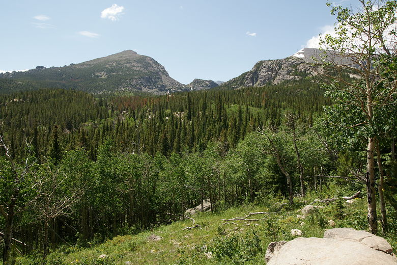
View of aspens and mountains
After 0.3 miles, we came to a trail intersection. To the right is the Bear Lake trailhead,
so we turned left to head toward Alberta Falls. Shortly after this intersection is a very
nice aspen grove. It is true that many of the aspens have been carved with initials,
although I didn't find this as disturbing as the author of the hiking book I was using.
Still, it is unfortunate.
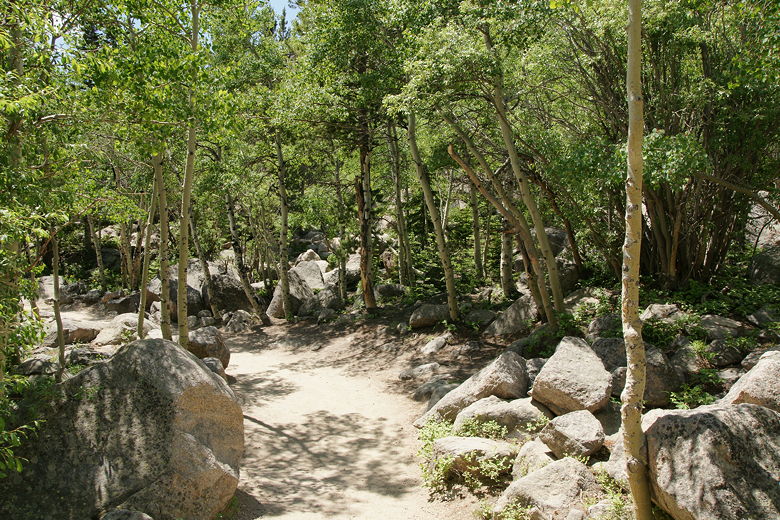
Aspen grove
We continued on the steady uphill climb and shortly came to Alberta Falls, after only about
45 minutes from the trailhead. The falls
are situated at a bend in the trail and it's hard to get a full straight-on view of the
falls. I mostly did so by walking down to the water and stepping onto a large rock jutting
out into the river.
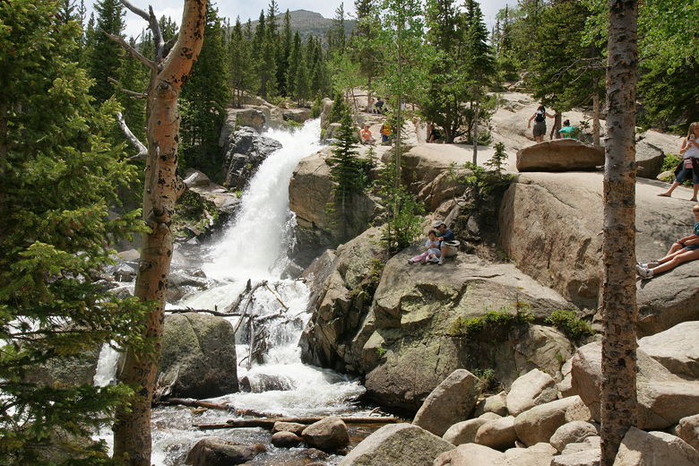
Alberta Falls
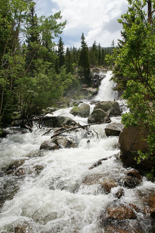
Alberta Falls
Since the falls are so close to the main trailheads, and people seem to love waterfalls,
it was a complete zoo here. There must have been 100 people stopped at the falls at once.
I'm much more of a lake person than a falls person. So after we took our lunch break off
to the side (away from the crowds), we continued on the trail past the falls. I wasn't
convinced we could make it all the way to Mills Lake, since Nathan had only ever hiked
3 miles by himself at once (and this would be more than 5 miles), but it was too soon to
stop hiking so we'd at least continue a bit further before heading back.
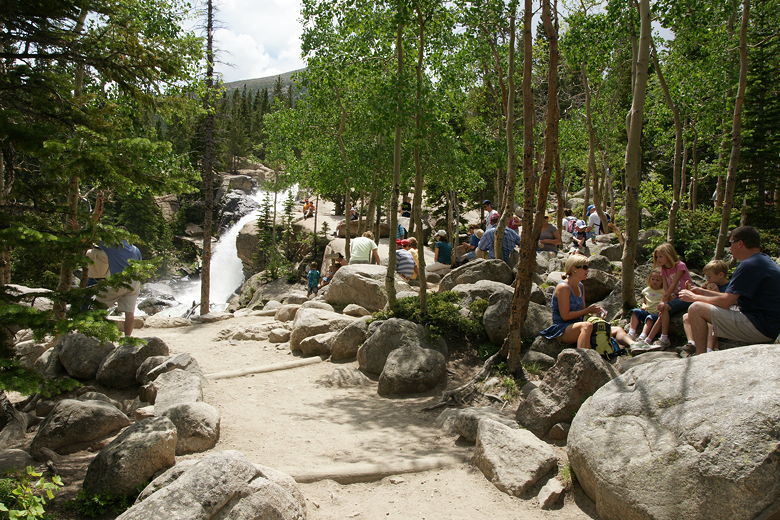
Hikers taking a break at Alberta Falls
As we started up the trail, we felt a few rain drops, and the clouds began to move in.
But the drops stopped shortly and we continued up the trail, which climbs steeply above
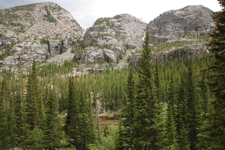
the falls. We were rewarded with better and better views of the surrounding mountains and
forests. This is the toughest part of the hike, and it seemed like forever before we reached
the next trail intersection. But we did make it and were rewarded with the best views yet.
Well, since we'd come this far (about 1.7 miles into the hike), what was another 1.1 miles to
reach the lake? We met someone else on the trail here and they said they thought most of the
climbing was over, so we went ahead and hiked on toward Mills Lake. The trail indeed does
flatten out for a while, heading on the trail through talus with a few sprinkled wildflowers.
Though the slope above is strewn with rocks, the trail itself is in pretty good condition,
mostly free of rocks.
View from the trail about a mile from Mills Lake
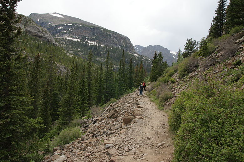
Trail through the steep talus
After this section, we shortly reached the next trail intersection (0.5 miles from the last
one). There are three choices here, and we took the leftmost one, which heads toward
Mills Lake. Unfortunately, it's not flat. It climbs, steeply at times, on a series of rock and
log steps. There are also a couple stream crossings over wooden logs. We also encountered a snow
patch or two.
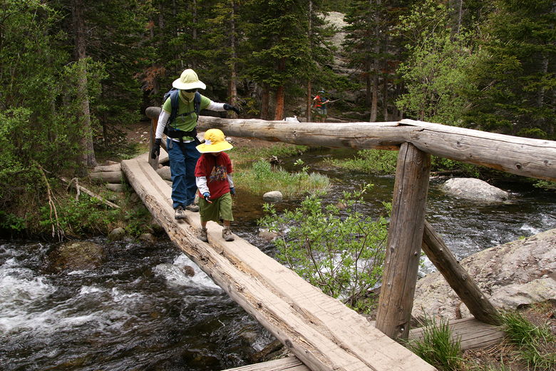
Crossing a footbridge over Glacier Creek
Near the end, the trail crosses over large rocks before reaching the edge. By this time it
had started to sprinkle again, and it really started to rain harder when we finally reached
the edge of Mills Lake. It had actually only taken us about 35-40 minutes to cover the last
1.1 miles. Unfortunately, because of the rain and distant thunder, we couldn't stay long.
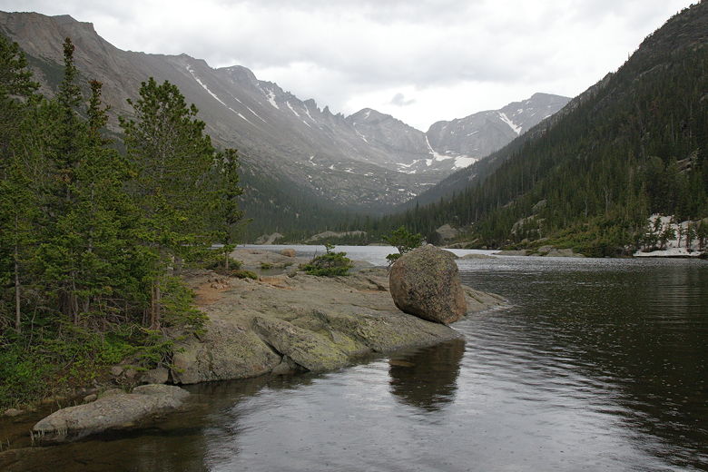
Mills Lake
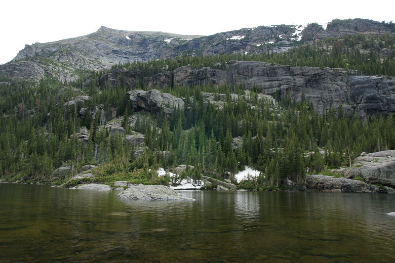
Mills Lake
A large group of hikers packed up and put on their rain gear as we arrived. A duck swam in
the lake. We took a short break, trying to enjoy the lake in the rain. It would be a great
place for a lunch break or extended stay, but because of the weather we packed up shortly
and headed back the way we came. We made good time heading back downhill, reaching Alberta
Falls in just over an hour. Along the way, the rain stopped. When we reached the falls, the
weather was pleasant and it was packed with people again.
Enjoying the view on the way back
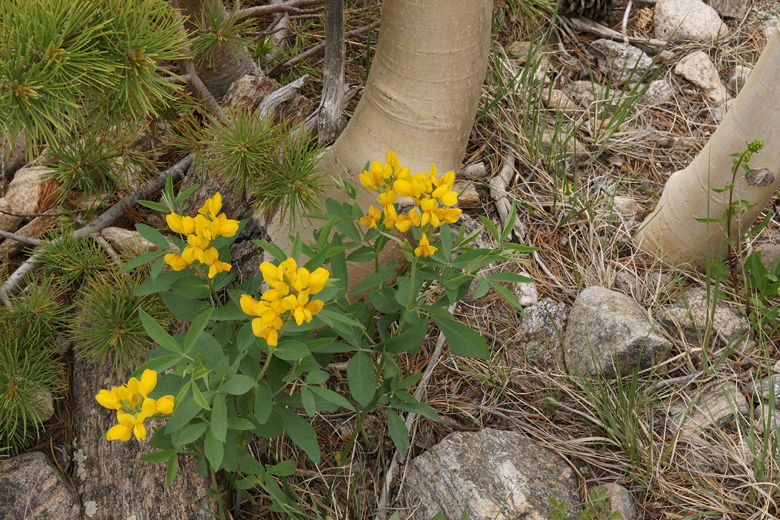
Wild flowers at base of aspens at Alberta Falls
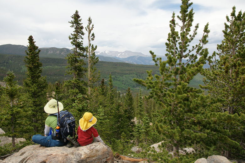
After all that hiking without much stopping, we were hungry, so we took a break to eat, then
made the easy hike back to the trailhead. Jared, much to my surprise, walked all the way back
to the trailhead from the falls by himself (he is only 2 1/2). I guess he didn't appreciate
being carried the whole time from the falls to the lake and back. This would just be a
precursor of what would follow two days later, though. Kids can amaze you sometimes.
We arrived at the trailhead just as a bus was leaving, so we had to wait about 10 minutes to
take the next one. After a long day of hiking, though, it was nice to just sit and relax at
the quiet bus stop.
| 

