|
[Please note: Big Basin suffered extensive damage in the August 2020 CZU Lightning Complex Fire, so
please check the official park website before planning any trip.]
The parking lot was already almost full when we arrived at the park headquarters.
In fact, the parking area at the Redwood Loop trailhead was completely full, so we had
to park a little further from there, closer to the museum.
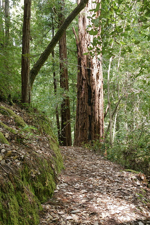
We started off on the Redwood Loop at 10:45am. We chose the left fork of the loop. If
you want to shorten the hike I describe here by about a half mile, you can take the
right fork instead and skip most of the Redwood Loop section, but then you'd miss most of
the biggest redwoods on the trail.
Unfortunately my GPS had a hard time getting a fix (probably because of the dense forest),
so the track above is missing the beginning of the hike. The GPS finally got a fix around
the time we stopped for lunch, so keep that in mind when you're viewing the track and reading
this description.
We passed a small meadow on the right, and then shortly came to a trail intersection.
The path to the left goes to the Blooms Creek
Campground, but we would take that on the return part of the loop. Instead, we took the
right fork and shortly came to the Mother of the Forest redwood tree. At 329 feet high,
it is the park's tallest tree.
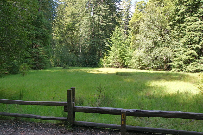
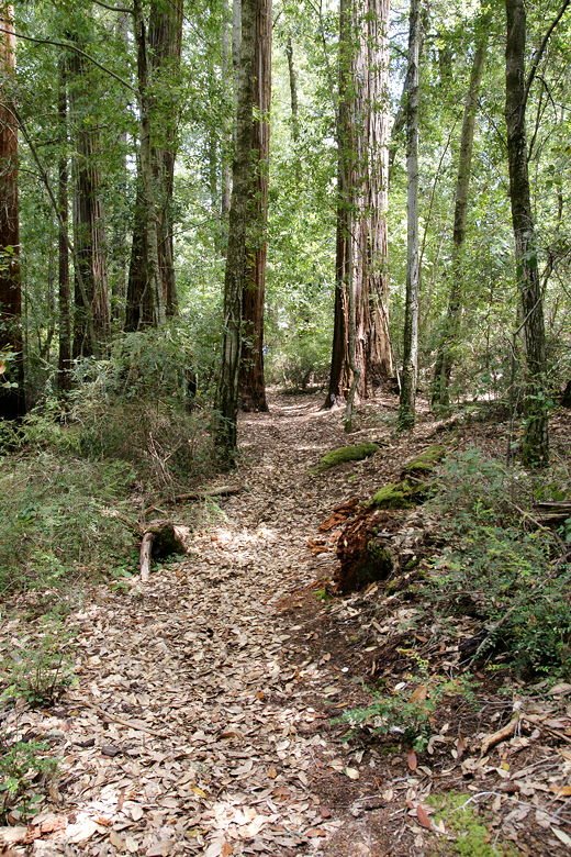
Meadow next to the Redwood Trail
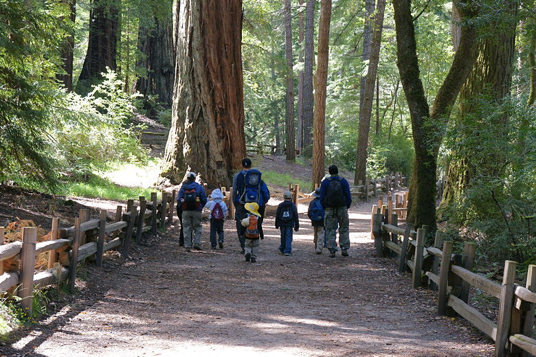
Walking along the trail
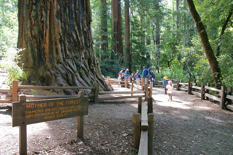
Mother of the Forest
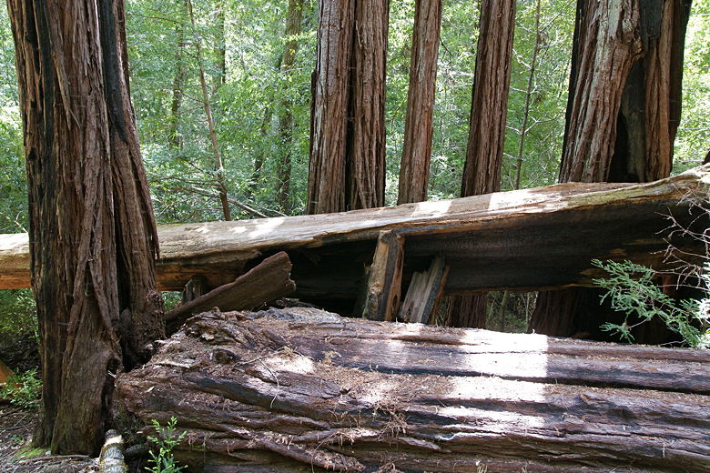
Continuing along the trail, we next came to the Father of the Forest tree, a relatively
modest (as far as tall redwoods go) 250 feet high. The trail continues past many tall
redwoods, some damaged by fire, some you can walk into, and some that have fallen over that
you can walk on top of.
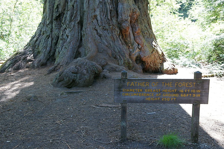
Father of the Forest
About a half mile from the trailhead, we were almost back where started, in sight of the
trailhead parking lot. Instead of turning right and returning to the trailhead, however,
we turned left and crossed the bridge over Opal Creek. Once across the bridge we turned
left to continue along the
Skyline to the Sea Trail, a trail Jean and I had done 12 years ago
(all the way from Castle Rock State Park to Waddell Beach).
Redwoods, some standing, some fallen
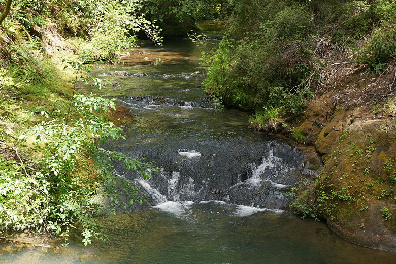
The trail now mostly parallels Opal Creek, and at the next intersection we turned left off
the Skyline to the Sea Trail to continue along Opal Creek. A little over a half mile after
we crossed the bridge over Opal Creek, we reached a paved service road (Hihn Hammond Road),
which we crossed over Opal Creek. We immediately found a large stone fireplace on the right
(perhaps a remnant of a structure built in the 1800's),
which we decided was the perfect place to stop for lunch.
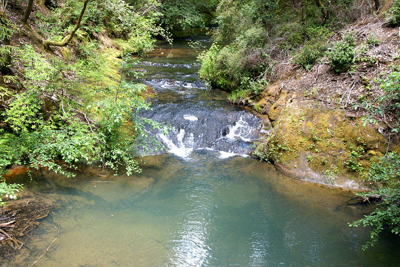
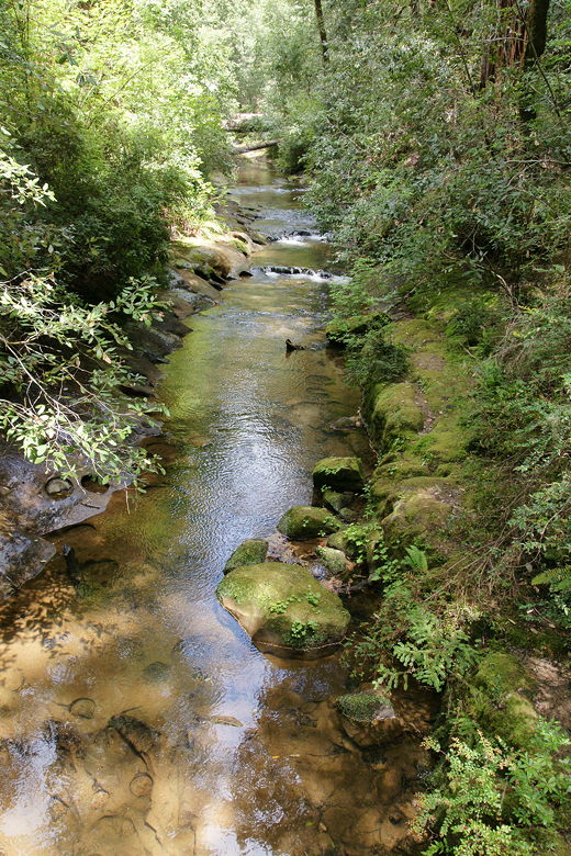
Opal Creek from the bridge
Opal Creek from the bridge
After lunch, we backtracked a few yards and took the East Ridge Trail. The trail is a bit
hard to see from the road, but it's between the fireplace and the bridge, so it should be
easy to find if you know that. The trail immediately crosses another creek, and then the
intersections get a bit muddled. After we crossed the bridge, we turned left and quickly
came upon a sign for the Blooms Creek Trail. Apparently unsigned is the
trail we actually wanted to take, the East Ridge Trail, on the right. It looks
menacingly steep, but the steep section is relatively short.
We climbed the East Ridge Trail and shortly came to another intersection. At first, it
looked liked a 3-way intersection, which didn't make any sense from the map I had. I
literally stood there for 2 minutes before I realized that there was a 4th trail leading up
straight in front of me. I had to call out to the rest of the group to have them come back,
as they had mistakenly taken the left fork, which is a section of the Pine Mountain Trail
leading down to the Blooms Creek Trail. On the right is the Pine Mountain Trail leading
up to Buzzard's Roost. We went straight, continuing on the East Ridge Trail.
If you look at the name of the East Ridge Trail and expect to see views, you'll be disappointed.
There aren't any to speak of. Instead, you'll pass through pleasant redwood forest, although
nothing as nice as the Redwood Loop at the start of the trail. We did find lots of banana
slugs here - I think the kids counted at least 17. You'll also find a bit more isolation,
as you'll be away from all the people near the park headquarters. If you don't have 7
kids with you, you'll be able to hear the birds chirping.
Looking back along the East Ridge Trail
The East Ridge Trail
After climbing for a while the trail starts a sometimes-steep descent. On this part of the
trail there were quite a few downed trees across the trail that we had to go over or under.
Near the bottom, we reached another trail intersection and turned left to head toward the Blooms
Creek campground. Shortly we reached the paved road of the campground.
We walked along the paved road, keeping to the left to walk to the other end of this section
of the campground. We then picked up the Blooms Creek Trail near the end of the campground.
It's not at the very end, but instead forks off to the right just before the last cul-de-sac
of camp sites. The dirt trail then parallels Blooms Creek, which flows to the right of the
trail.
Next we came to a bridge on the right which crosses the creek. We crossed it into another
section of the campground, turned right, then stayed to the left, almost reaching the main park road
(Highway 236) before turning left onto a little trail that parallels the road. From here
it's easy to find your way back. Before long, we rejoined the Redwood Loop near the
Mother of the Forest tree, passed the meadow, and were back at the Redwood Trail parking lot.
Blooms Creek from the bridge
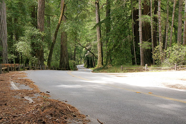
Highway 236 between park headquarters and Blooms Creek Campground
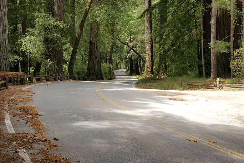
Highway 236 between park headquarters and Blooms Creek Campground
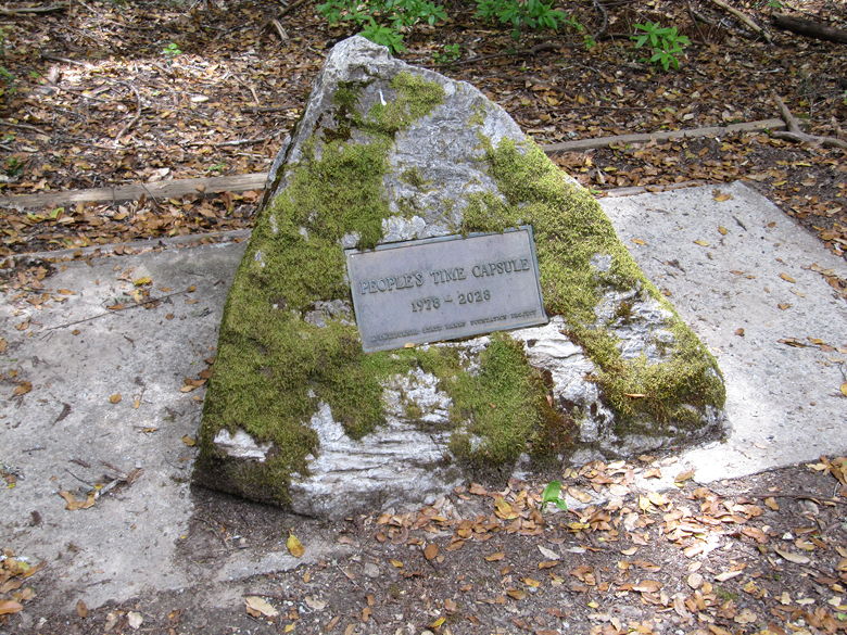
At the trailhead we noticed that there's a time capsule buried there. It was buried in 1978
and is not to be opened until 2028. Only 18 more years to go. I wonder what's inside. Somehow,
I get the sense that life inside Big Basin State Park has stayed pretty much the same since
that capsule was buried - parents taking their kids camping in a beautiful redwood forest,
day hikers heading out to Berry Creek Falls, and the timeless towering redwoods overlooking it all.
Time capsule at Redwood Trail trailhead
| 

