|
The Jakle's Lagoon trailhead parking lot, with room for about a half dozen cars, was
completely empy when we pulled in around 11am. One other car pulled in as we were getting
ready. I guess this wasn't all that surprising considering it was a Tuesday morning. Perhaps
this place gets more action on a weekend.
This is a loop hike, so you can start in either direction from the parking lot. We look the
right fork (the pair of hikers from the other car took the left fork). The trail immediately
starts climbing gently through a brown field dotted with wildflowers, mostly yellow and some
purple. For the most part, the forest is on the left and views of the ocean are on the right.
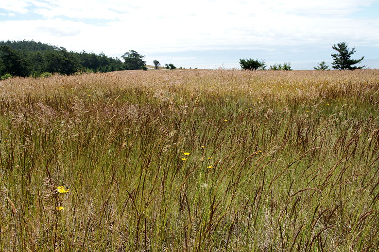
Field near the start of the hike
This continues for some time, with views getting better and better. The trail then pitches
steeply uphill, but this section is not too long. Soon after that we came across the pair of
hikers coming in the opposite direction. They'd probably completed about 2 miles to our 1 mile.
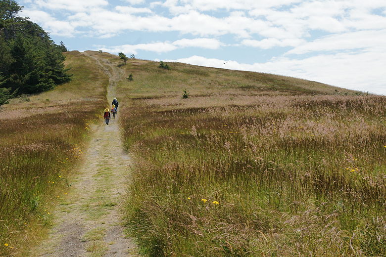
Approaching a steep section before the summit
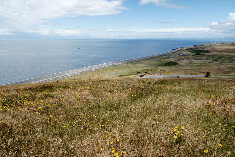
Looking back at the ocean across the fields and the road
View from the trail
The trail hugs the edge of the forest. 1.3 miles from the trailhead, we reached an intersection where the left fork
heads down to Third Lagoon (0.4 miles away). We decided to head straight toward the summit of Mount Finlayson.
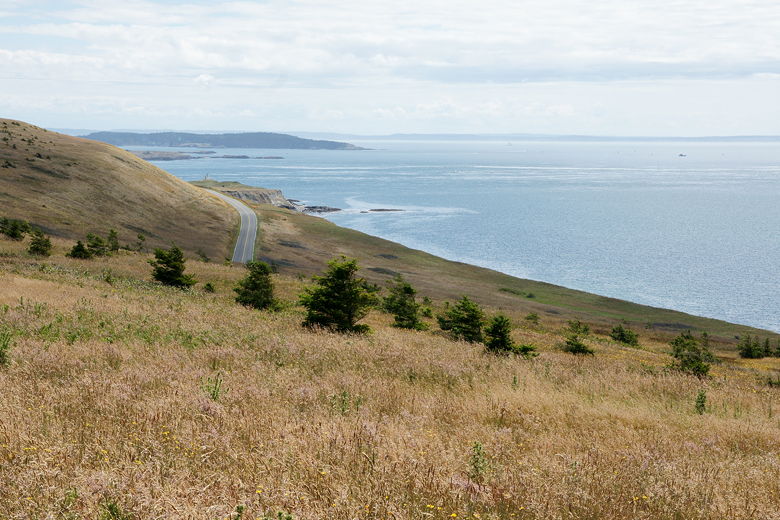
Soon after that fork, we saw an unsigned spur trail to the right. I decided to take it, while
the others waited for me on the main trail. I could see that this spur trail curved around the
edge of the mountain, through empty fields with great views. I scared off a deer when I sneezed
too loudly (my allergies acting up). I took some pictures of the lighthouse that I could
see from here, then turned around and rejoined the others.
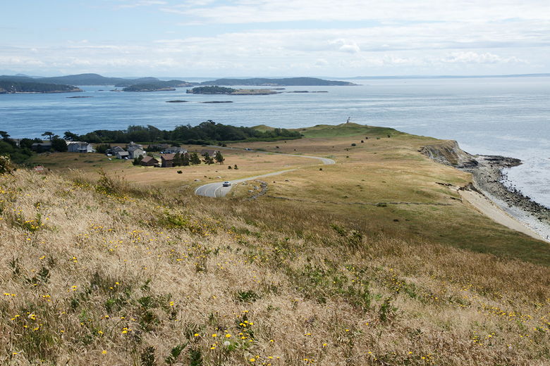
View from near the top of Mount Finlayson
Satisfied with those views, we backtracked to the intersection we'd just passed and turned right,
downhill toward Third Lagoon. This section of trail is also steep -- steep downhill, and through
a fern-filled forest. It's a completely different environment than the one we'd just been in.
Trees towered above us as we made our way down. We then turned right at the sign
for Third Lagoon.
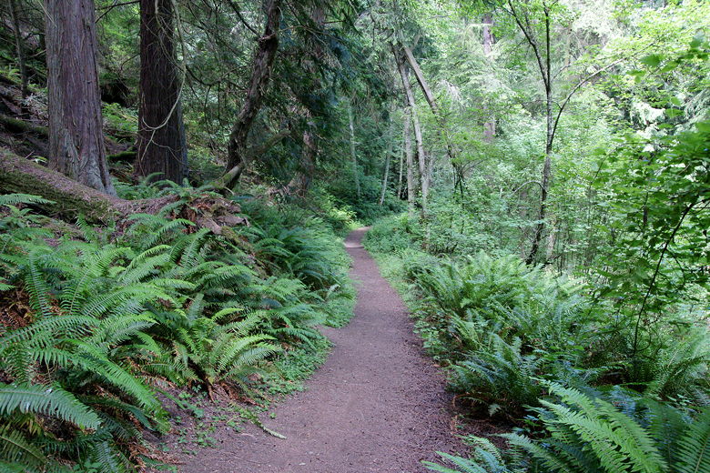
Heading down into a completely different environment on the way to Third Lagoon
Third Lagoon is not much to see. Just a lagoon, not too inviting. However, beyond it was
a large rock-covered beach. We could tell from the seaweed line that this was probably near
low tide. Considering our last hike to the beach, we picked a lunch spot well up near the high
tide line, near some driftwood. Here we stopped for lunch and then searched for seashells.
We spotted a few, and also a few baby crabs hiding under the rocks. We also saw a red raft
there, floating in the water, tied to some driftwood. We wondered where the owner was.
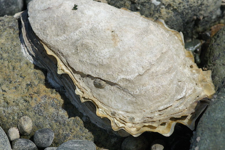
Shell near Third Lagoon
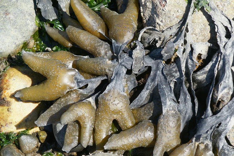
Not sure...some sort of kelp float, I'm guessing
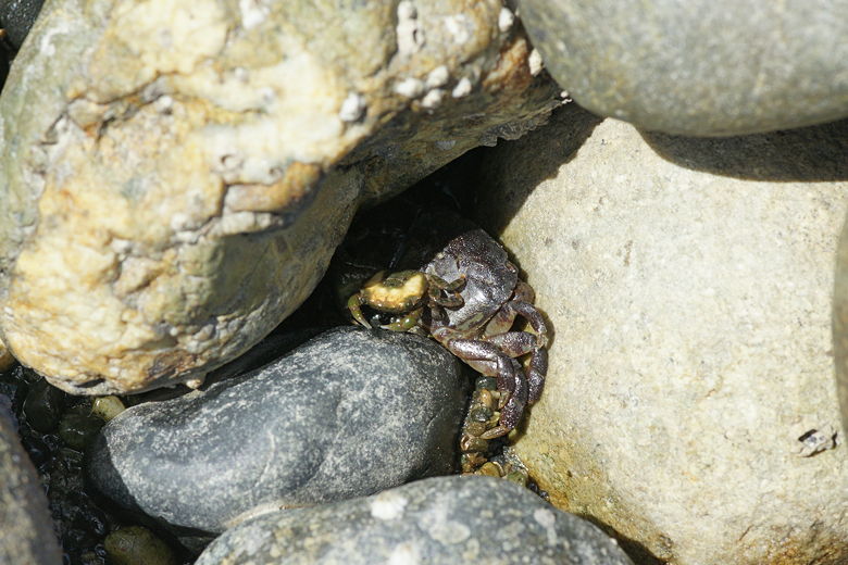
Little crab and baby crab hiding in the cracks
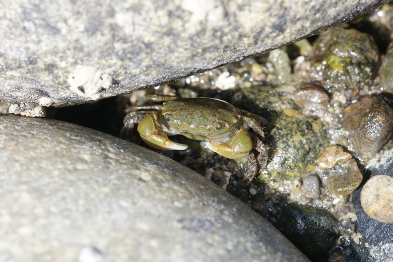
Baby crab
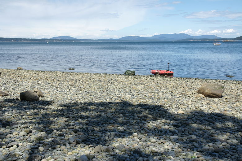
Rock beach near Third Lagoon
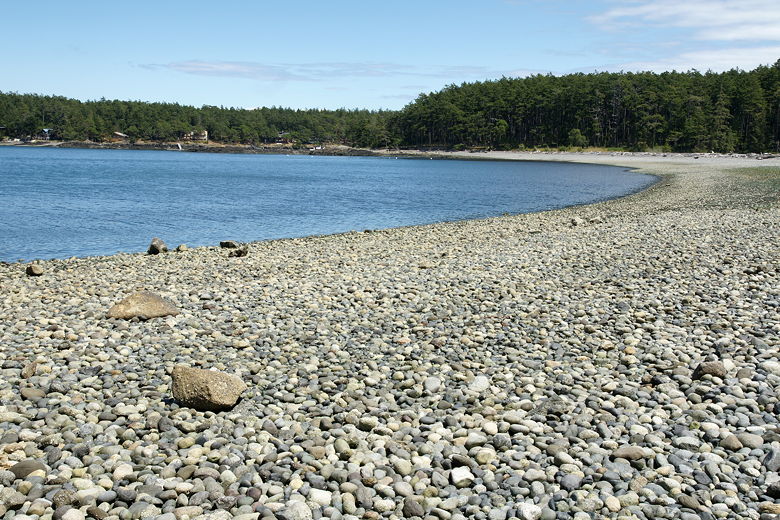
Rock beach

Path to Third Lagoon
After our break, we went back to the main trail, and turned right toward the parking lot.
From here, the trail was alternating level, steep uphill, and steep downhill, all pretty much
through fern-filled forest. At the top of one hill we encountered an older gentleman lying on the
ground next to the trail. Apparently he was fine, just resting. He told us that he felt sorry
that our kids had to wear their hats, which we found rather strange. He continued to try to
convince us that they were overdressed, and that we should value his opinion because his son
had climbed mountains with him when he was 4 years old. Hmmm...
After that strange encounter, we continued along the trail. We could see Jakle's Lagoon
to our right through the trees, but continued on without stopping. The lagoon did look
much nicer than Third Lagoon, but we wanted to get back to our car hopefully in time to see
some whales at Lime Kiln Point State Park.
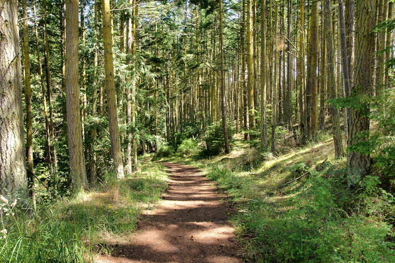
Forest near the trailhead
On the way back, one sign says there are two paths back to the parking lot. I believe the
left fork would have taken us back to the trail we'd started on, so we took the right fork
instead. This eventually took us back to the parking lot, completing the loop. We could
see the numbered interpretive signs counting backwards to 1 as we got closer. I would
have picked up an interpretive brochure, but there was only 1 available at the trailhead,
and it was marked "please return," so I had left it for someone else. The brochure
describes some of the plant life in the area.
| 

