Directions:
From Tuolumne Meadows campground, take Tioga Road west. Park along the road next to the
Murphy Creek trailhead sign on the right side of the road, which is right across from the
day-use parking lot for Tenaya Lake on the left.
View Driving Map
This would be the longest hike so far for Jared, our 4 1/2 year old.
We'd done a 4.6 mile hike last year, but this would be close to 6 miles. Still, it was
relatively flat and he was a year older, so I wasn't too worried. Just to be safe, though, I
tried to make sure we got an earlier start than usual.
There were lots of cars at the Murphy Creek trailhead when we arrived, but not many at the
Tenaya Lake day use lot. It was sunny and clear as we headed off on the trail. The trail
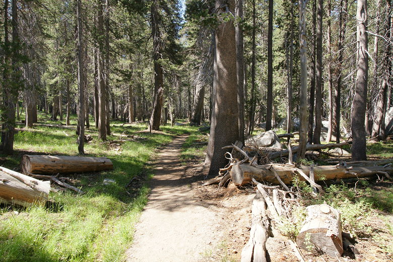
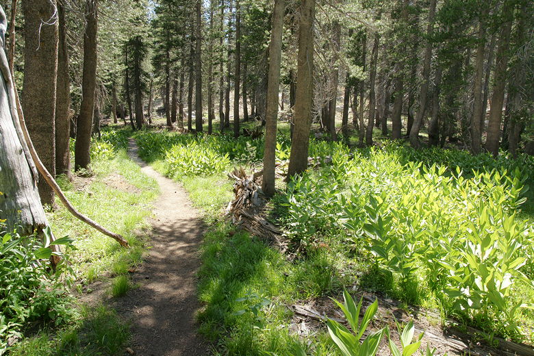
climbs very gradually, so much so that I hardly even noticed it. This first section of
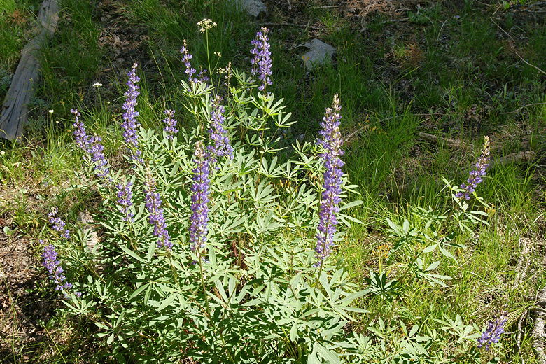
trail isn't all that interesting, passing through forest with a few occasional patches of
lupine and other wildflowers. Murphy Creek, on the left, was almost completely dry by this
time. Perhaps in June when the water is flowing this section would be prettier.
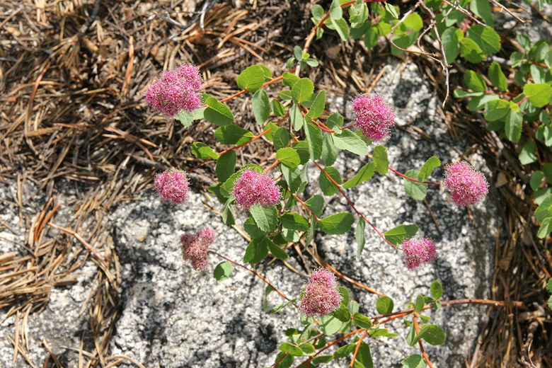
Lupine next to the trail
Trail through the forest
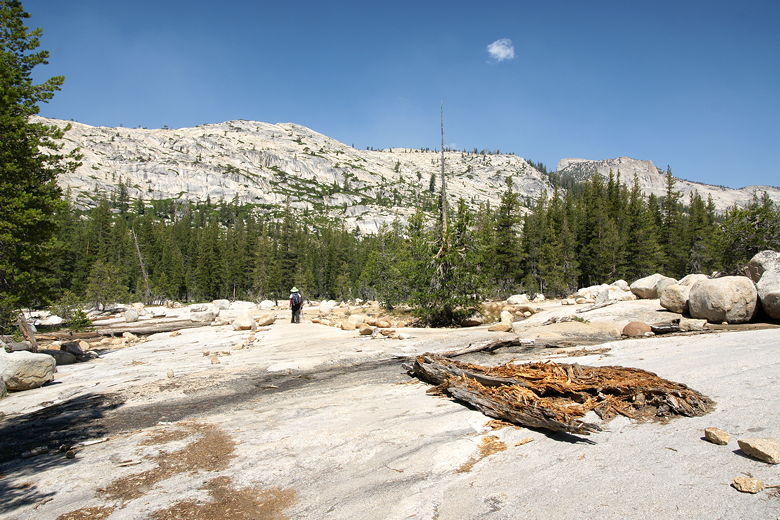
After about 0.8 miles, the trail emerges from the forest and starts a section on slabs
of granite. Rock ducks lead the way. From here, the trail alternates between forest and
granite sections.
The first granite section
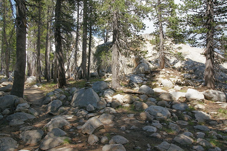
Glacial erratics
We encountered lots of backpackers, most of them coming in the opposite direction. However,
we hardly saw any day hikers. In some ways, it's a bit surprising because the lake is only
about 3 miles from busy Tioga Road. On the other hand, I've seen Yosemite trail maps where the
trail to Polly Dome Lakes isn't even shown. So perhaps it's not too surprising that we
didn't run into a lot of day hikers.
After 2 miles, we started keeping an eye out for the trail to Polly Dome Lakes on the right.
I knew that it was a use trail, not a main trail, and that it was supposed to come before
a marshy pond. Shortly, about 2.2 miles from the trailhead, we spotted it. If you're looking
for it, it's just past some corn lilies, and right before a granite outcropping.
The trail to Polly Dome Lakes is just before the granite outcropping ahead
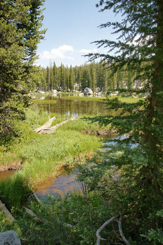
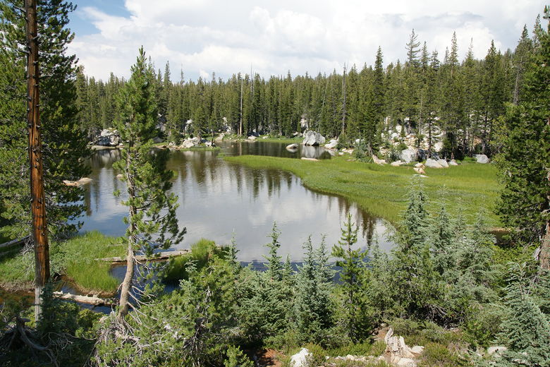
We turned right onto the use trail, shortly coming to a place where we could see the marshy
pond on our left. We also heard voices. There was a small group of backpackers camping
here. We passed by their camp as we continued on the trail to Polly Dome Lakes. After
leaving the pond behind, the trail starts to climb steeply, going in a roughly east-southeast
direction.
View of marshy pond from the trail (a better view is available from on top of the
rocks)
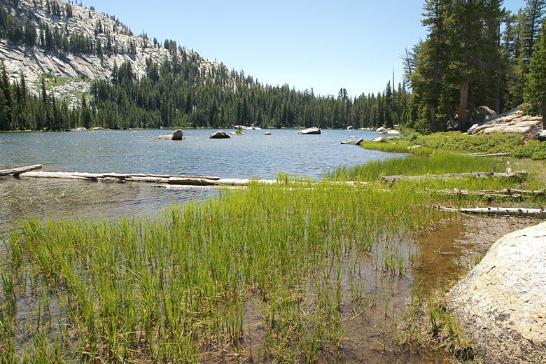
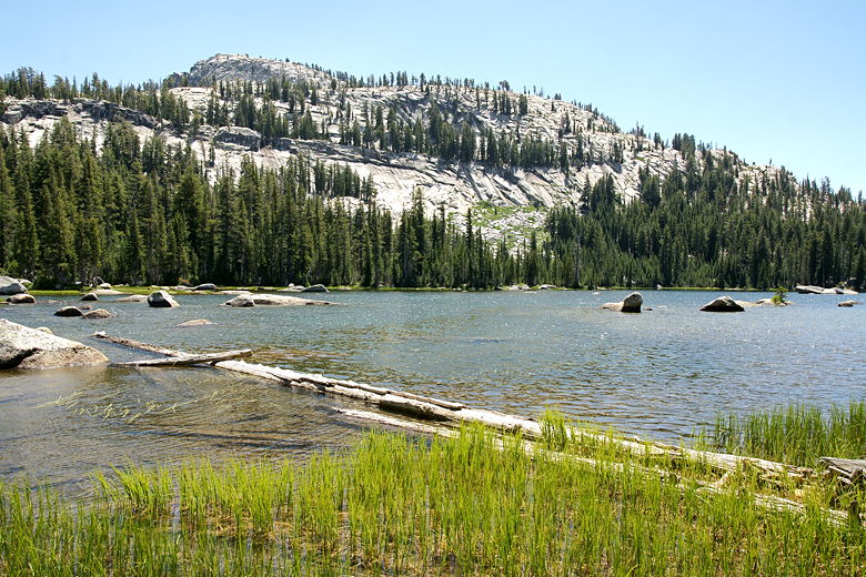
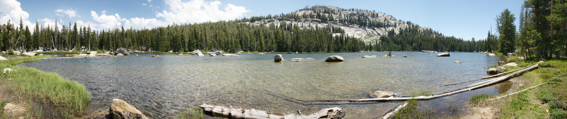
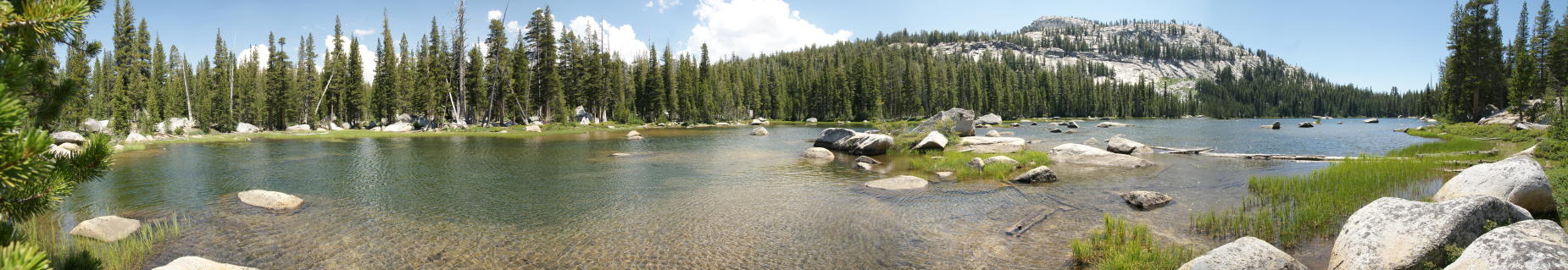
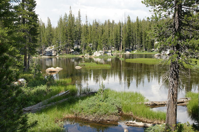
About a half mile from the main trail, we reached the largest of the Polly Dome Lakes.
Behind and above it loomed Polly Dome. The larger end of the lake is on the right, and the
narrower end is on the left. There are several rocks islands in the narrower section on the left
which make it more picturesque in my opinion. We found a big slab of granite above the shore
here to take our lunch break and enjoy the view. To be honest, the lake kind of surprised me.
The books I'd read didn't seem to gush with praise over the lake, but it was a pretty lake, well
worth the hike to reach it.
Polly Dome Lake
Polly Dome above Polly Dome Lake
Polly Dome Lake
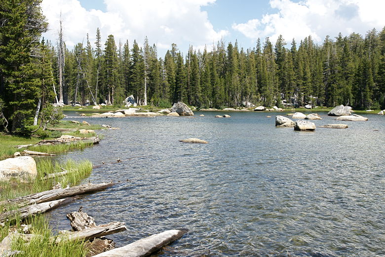
We seemed to have the whole lake to ourselves, but as we were eating lunch what looked like
a boy scout troop came up, setting up camp for the night. After lunch we explored the shore.
I inadvertently scared away a baby deer, which ran away and was soon was soon joined by its
mother.
Panoramic of Polly Dome Lake (Click image to view full size)
Another panoramic of Polly Dome Lake (Click image to view full size)
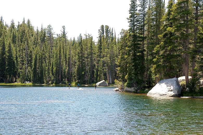
Hikers walking on water (actually, walking on submerged rocks)
After exploring the shore, we decided it was time to pack up and head back, over 2 hours after
we'd arrived at the lake. It then took us several
minutes to figure out where the trail was. I had actually thought that it would be hard and made
a mental note of where the trail was, but apparently my mental note was wrong. We eventually found
the trail far from where I thought it had been. If you're going, you might want to take a digital
picture of the trail leaving the lake when you arrive, and refer to that picture later.
We returned the way we came, stopping briefly near the marshy pond for some pictures. As we left
the pond, I heard thunder in the distance. I looked up and saw blue sky, but dark clouds loomed
to the east. We walked quickly to try to avoid any rain, and the clouds continued to move in on
us slowly even as the sun shone brightly on us.
Marshy pond
Marshy pond
Corn lilies near the trail intersection
As it was, we didn't have much to worry about it. While it would sprinkle a bit after our hike,
it never really rained. We made great time on the way back, leading me to believe that my GPS
is right and it was only a 5.6 mile hike and not the 6 mile hike that some books list it as.
I should also point out that the reason it's called Polly Dome Lakes is that there's more than
one. However, we only visited the first (and largest) one.