|
We were staying in a condo in Dana Point, and I scoured my guidebooks looking for potential nearby hikes. In the end, a semi-loop at Crystal Cove State Park seemed like the best choice -- less than half an hour's drive away, and a good hike distance, about 5 miles. Other choices like Idyllwild were 2 hour's drive away.
I didn't expect to find a lot of people here on a Friday just before noon, but I was wrong. There were quite a few cars in the large lot by the visitor's center. Parking is (at this time) $15 per day, which we paid at the visitor's center. There are maps here, and a few displays. (Alternatively, you can buy an annual pass for $125, which allows entrance to any state park.)
After we got ready under sunny skies, we tried to find the trailhead. There's a path from the restrooms outside, but that only leads to a small picnic area. There's another trailhead at the eastern (inland) end of the parking lot, but that leads to a different trail than the one we were trying to take. We eventually found the trailhead by walking back down the road from the parking lot. A dirt road led to the left, alongside a fence covered in green canvas (there was construction going on), and we followed it.
This first half-mile section of trail is a wide dirt road the entire way, mostly flat, mostly southeast, without much in the way of views. Eventually it crosses a bridge near what looks like a future large parking lot for the park. The pavement was already down and picnic tables up, although the lines weren't painted yet. From the looks of it, I would guess it'd be open early this summer. If you parked here (probably accessible from Highway 1), you'd save about a mile of hiking from the route we took.
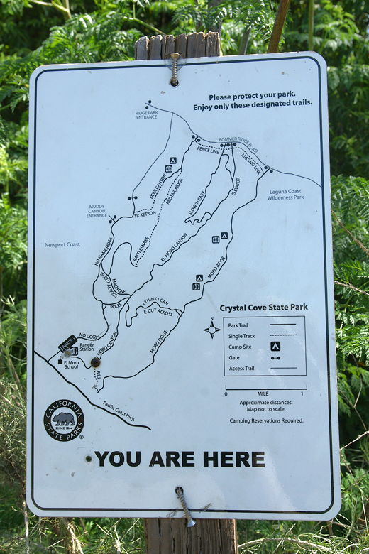
There are many trail intersection signs like this one.
After the bridge, we reached our first trail intersection at 0.5 miles. To the right is the B.F.I. trail, which we would return on; we instead took the left fork, the El Moro Canyon Trail. Again, this trail was just like most of the others on this hike -- a wide dirt road. It follows a stream uphill. Trees stick mostly to the bottom of the canyon; grasses dominate the terrain above that. We passed some scattered wildflowers, as well. Eventually we easily crossed over the thin stream which looks like it may be completely dry in the summer. At this time, there was enough water that we saw numerous tadpoles as we crossed the stream.

Most of the bottom portion of the trail is like this

Thistle
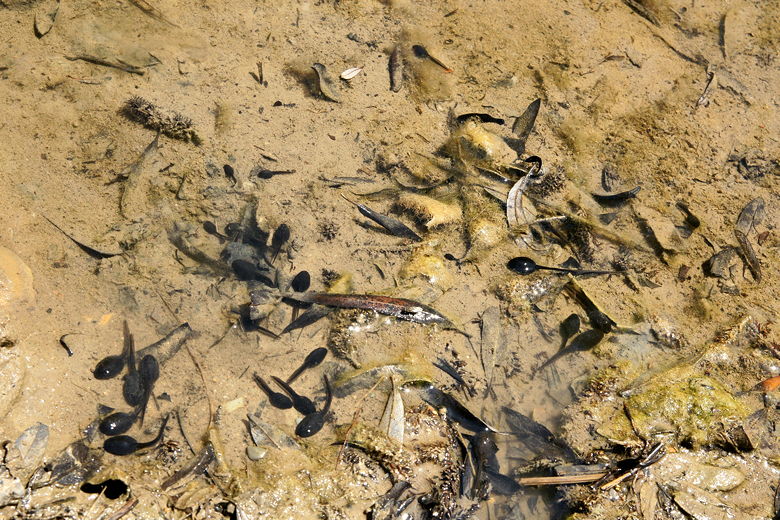
Tadpoles
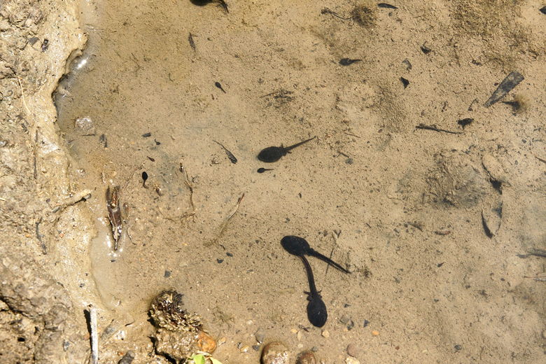
Tadpoles growing legs
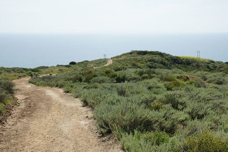
At 1.5 miles, we turned right onto the I Think I Can/E. Cut Across trail. This trail heads gradually uphill, gaining views of the canyon and the ridge to the northwest, as well as the Pacific Ocean. As you climb, watch out for mountain bikers on this and pretty much all the trails, as they are pretty common on these trails (all that we met were courteous).
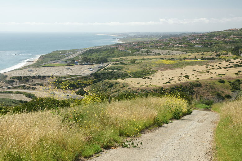
At the top, at 2.6 miles, there's another trail intersection, but it doesn't much matter which one you take. We took the one on the left, then turned right and quickly met the trail from the right fork. We now followed the Moro Ridge trail toward the ocean, looking for a place to stop for lunch. The choices aren't great. There are no obvious summits along the ridge, and no rocks or logs or shade from trees. The high grasses diminish some of the views from the flatter parts of the trail. We eventually turned right onto an unmarked spur trail which briefly led to a small summit near some power transmission towers. We stopped here for lunch, with some decent views of the beaches and ocean to the northwest.
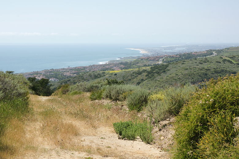
View looking up the coast from near our lunch spot
Raptors circled overhead after we concluded our lunch and returned to the main trail. We then continued down the Moro Ridge trail, encountering more hikers and cyclists along the way, many of them going in the opposite direction. As we started to descend, we received better and better views of the area - the city of Laguna Beach was visible to the south, the beaches and ocean to the west, and more coastal hillside homes to the north.
Heading down toward the ocean
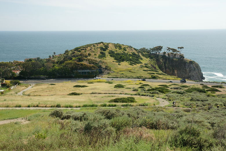
The trail becomes steeper and steeper (much steeper than our uphill trek), and there is pavement along some sections. I'm surprised some mountain bikers chose this direction, considering the steepness. Near the bottom, we turned right onto the B.F.I. trail, which is the only single-track trail section on this hike. It's also very pretty, with more great views of the ocean and beaches to the north.
Looking up the coast
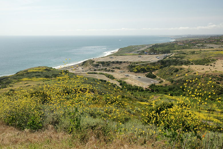
Notice the new parking lot
Highway 1 visible from the trail
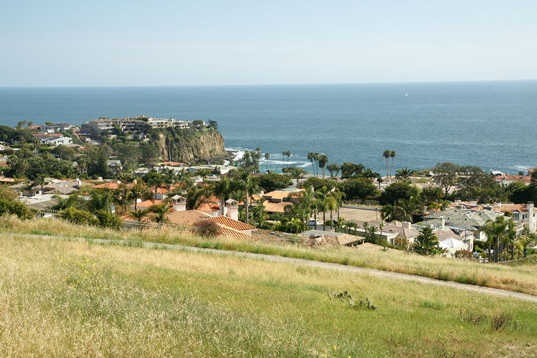
Looking back toward the city of Laguna Beach
After a short 0.3 mile section of this trail, we finished the loop section of the trail and turned left back onto the trail we'd started on, crossing the bridge and then walking next to the green canvas lining the fence.
Back at the parking lot, some folks were finishing up while some were just getting started on a late afternoon bike ride or hike.
This was a hot hike in spring; I can only imagine what it's like in the summer. It doesn't have the forests I'm used to in the Bay Area or the Sierra, but it does have some nice ocean views. We also only scratched the surface of the park, as there are many more trails, as well as beach access and backcountry campgrounds.
| 

