Directions:
To reach Santa Cruz Island, contact Island Packers for reservations for a boat
ride from Ventura. The boat takes a little over an hour. From the boat dock,
follow the dirt road up to the visitor's center; the trail starts here, continuing
on up the dirt road.
View Driving Map
We started this hike from the rusted cars by the visitor's center, on a mostly cloudy morning.
We headed up the dirt road past the lower campground, then turned right at the end of the campground
after about 0.3 miles.
An alternative route is to continue on the road past the upper campground, but I figured the route
we were taking would be more scenic, and I was right.
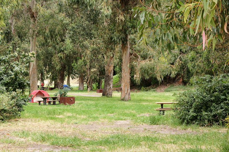
Lower campground
Walking along the road next to the campground
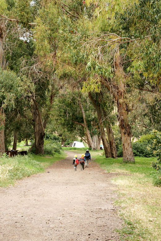
The narrow singletrack trail leading up from the lower campground is the same one we had taken down
from Cavern Point. This time, when we reached the top of the gully (at 0.6 miles), we turned left toward Potato
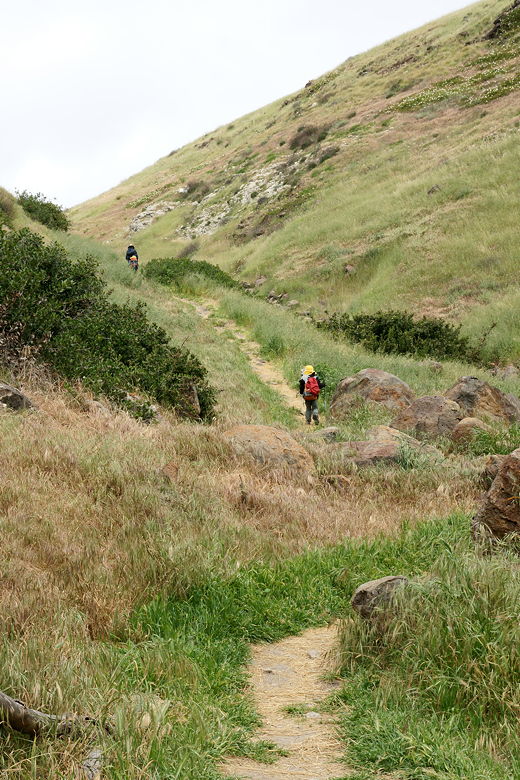
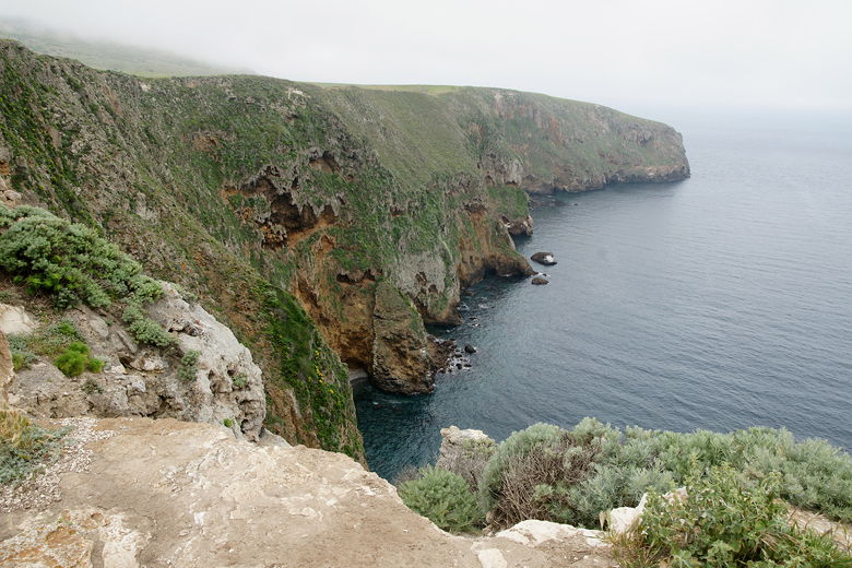
Harbor. The trail now follows the edge of the cliff, with grassy hills to the left and a steep
dropoff down to the ocean on the right. The trail is placed perhaps 10-15 feet away from the edge,
with numerous spots available to walk over to get a better look.
Up the trail from the edge of the campground toward Cavern Point
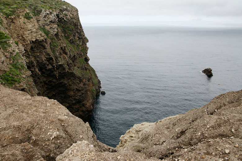
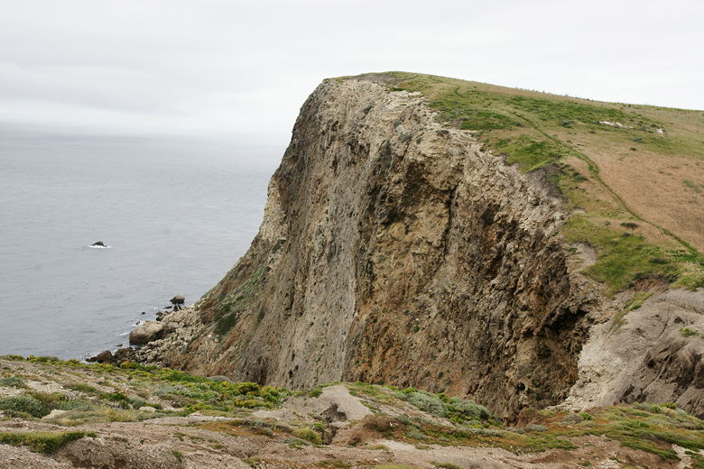
View from the edge
View of the cliff
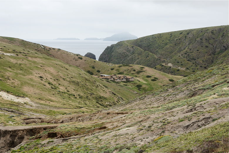
Looking back at the buildings above the campground, with Anacapa Island in the background
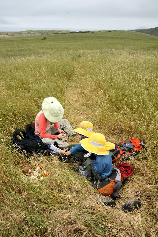
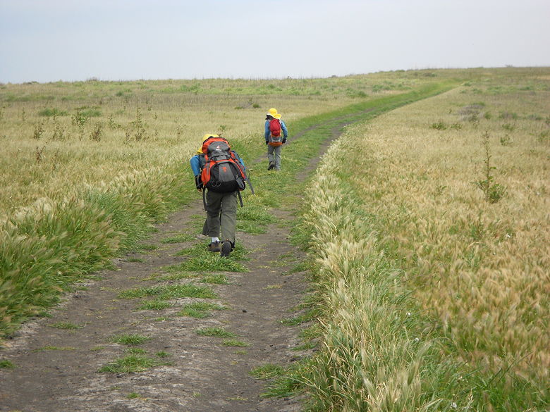
We stopped in the grasses for a short snack break before continuing on. As we left, we saw a raven
circling above. The trail is pretty level as it continues toward the harbor. At 1.5 miles, we reached a
trail intersection. Coming up from the left we saw 3 hikers; they'd come up from the upper campground.
We'd take that trail going back. For now, we continued straight.
Snack break in the grasses
Another great cliff view
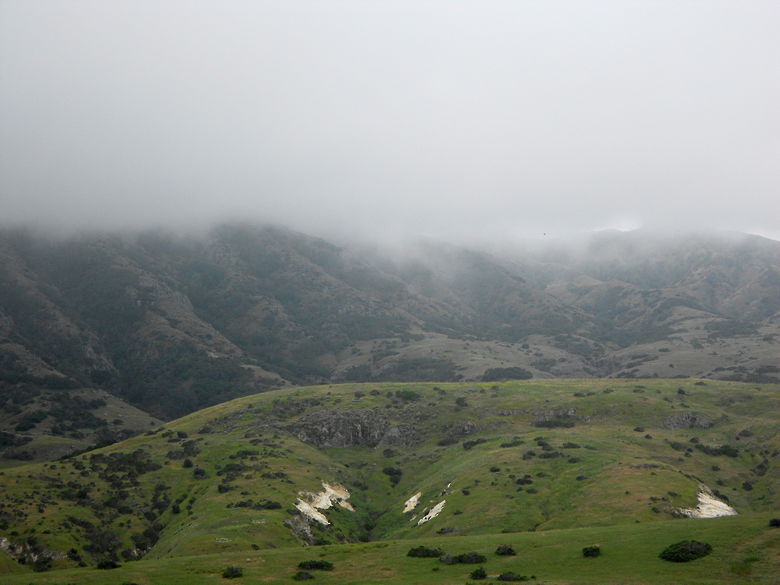
A very cloudy, foggy day
For once, the trail starts to veer a little bit inland, such that we could no longer see the cliff
edge through the fog. Soon we saw a fence, which the trail follows, and then shortly after that came
to the Potato Harbor overlook at 2.2 miles. Right above the overlook is a large flat area, but you can't
see much from there. We walked down to the overlook itself, where a sign says to go no further because
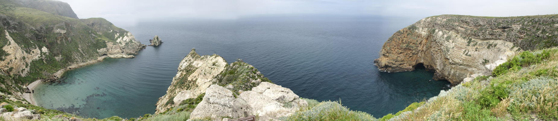
of revegetation. From here, though, are some fantastic views. Standing on a little saddle, you can see
Potato Harbor on the left, the ocean in front of you, and another cove to the right.
View to the right from the overlook
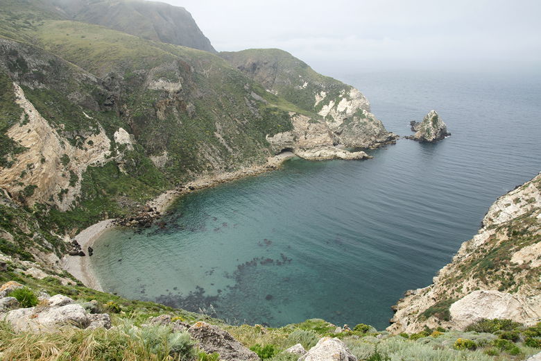
View of Potato Harbor from the overlook
Panoramic of the view from the overlook. You can't actually get this view all at once; you need to swivel your head. (Click image to view full size)
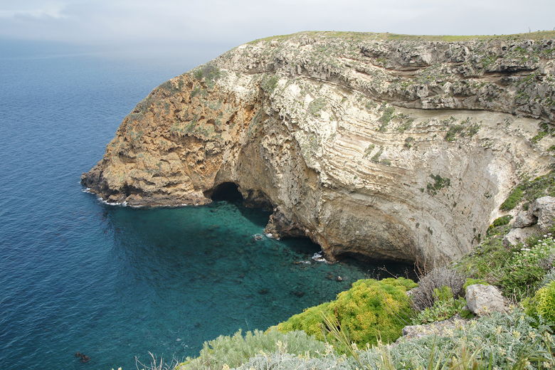
Potato Harbor sits below, perhaps a couple hundred feet. It has a narrow beach at one end, and rocky
beaches stretching on either side. The water is shallow and a beautiful turqouise color. Kelp is
clearly visible in the shallow water. The harbor is surrounded by steep terrain in all directions.
There's a pyramidal rock jutting out of the ocean at the entrance to the harbor.
The cove on the right has the same water qualities, and a sea cave is visible there, as well.
After enjoying the views in a brief stretch of sunlight, we backed up to the more solid ground above
the overlook and had lunch. We finished our lunch and started back just as a couple hikers were
climbing up to the overlook from the direction of the harbor itself. Perhaps they had ventured all
the way down; I'm not sure.
As we headed back toward the trail intersection, the fog started rolling in. We were lucky to have
been at the overlook when we had. Soon we were back at the trail intersection, and took the right
fork, heading down to the upper campground. This part of the trail is definitely not as scenic
as the route we had taken to get to the overlook, but it might be marginally faster, which is
important when you're
trying not to be late for a boat (we'd arrive in plenty of time).
Heading back from the overlook
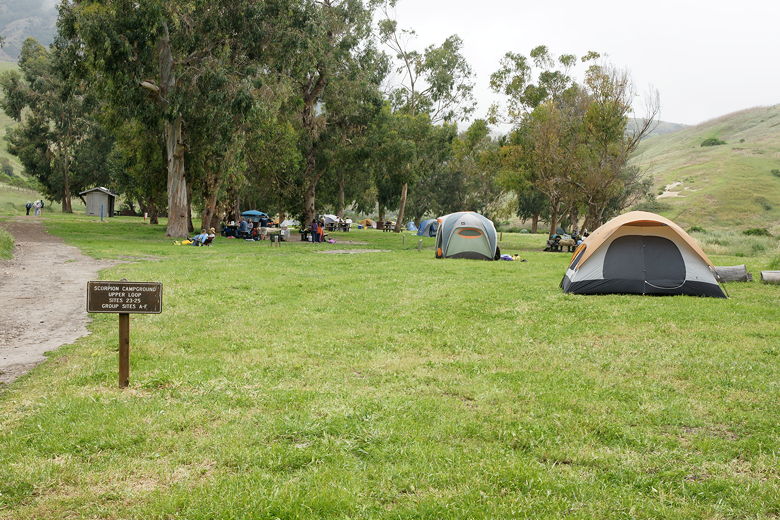
As we descended, the upper campground came into view quickly. It's another wide dirt road all the
way down. The upper campground looked distinctly different than the lower campground. The
upper campground has less shade, probably less wind protection, and several large group campsites.
I was glad we had camped
at the lower campground. Still, it's a pretty scene.
Rocky formations on the left side of the trail as we headed down toward the upper campground
Upper campground
We continued on the road, past the lower campground and back to the rusted cars.