|
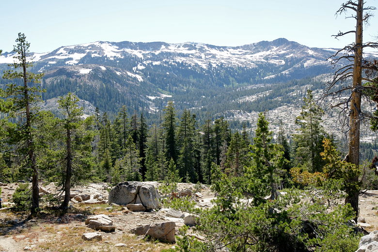
We woke up at 8am to sunny skies once again. It had been a bit windy for an hour during the
night, but the air was still now. The sun lit up the mountains behind the lake and the pass
we had peered over the day before (shortly before reaching Dicks Pass). The camper who had
been down by the lake the night before was gone. It looked as if we had the whole lake to
ourselves this morning.

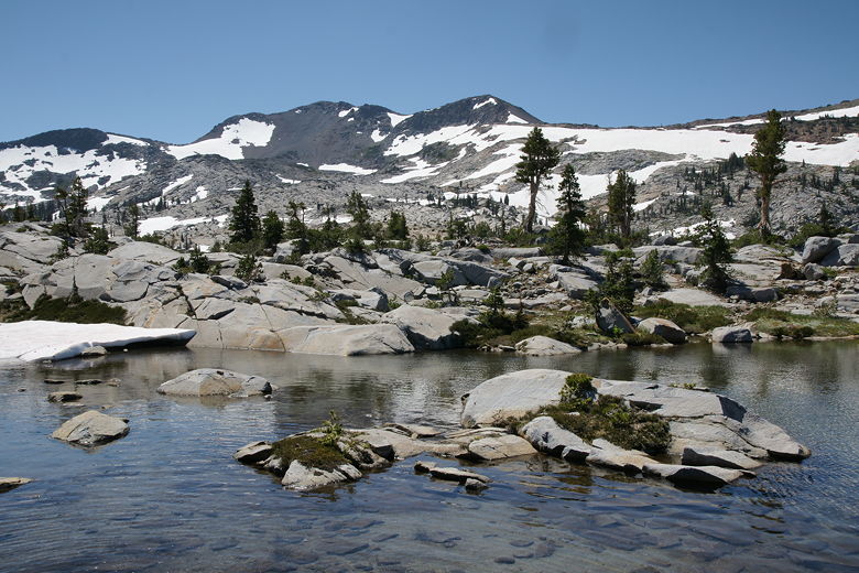
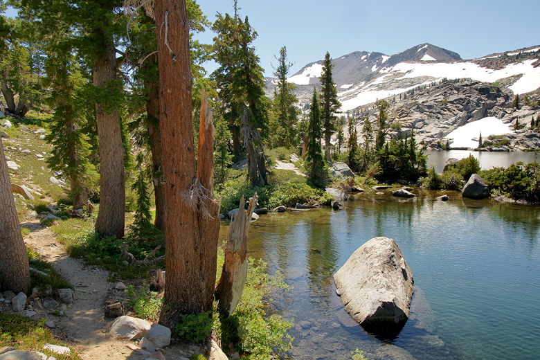
Heading down toward the dam at Dicks Lake
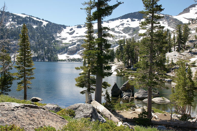
Dicks Lake
After packing up, we spent some time by the outlet dam, which results in a tiny waterfall into
an outlet stream heading toward Fontanillis Lake. It's a beautiful place to dunk your head or
at least your hands, which we did. After spending close to an hour here, we finally got underway
at 11:40am.
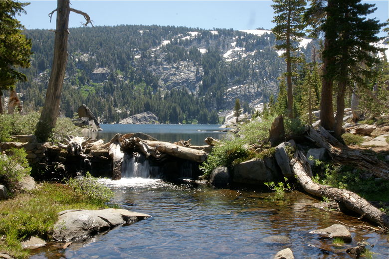
Dam at Dicks Lake
Dicks Lake as seen from the dam
Reflections in Dicks Lake
After making our way back to the main trail, we immediately turned left toward Fontanillis Lake.
Just a few flat minutes later, we caught our first glimpse of Fontanillis Lake through the trees.
A few minutes later, we were sitting out in the open in front of a small pond, with Fontanillis
Lake behind it out of sight. A group of 3 day hikers was there, and they stopped to ask about
our boys and our trip. Even though we were doing a 32 mile loop, we saw day hikers on every day
of our trip. I'm assuming the day hikers we saw here started from Eagle Falls or Bayview, from
which the lake is about 5 miles away.
Pond in front of Fontanillis Lake
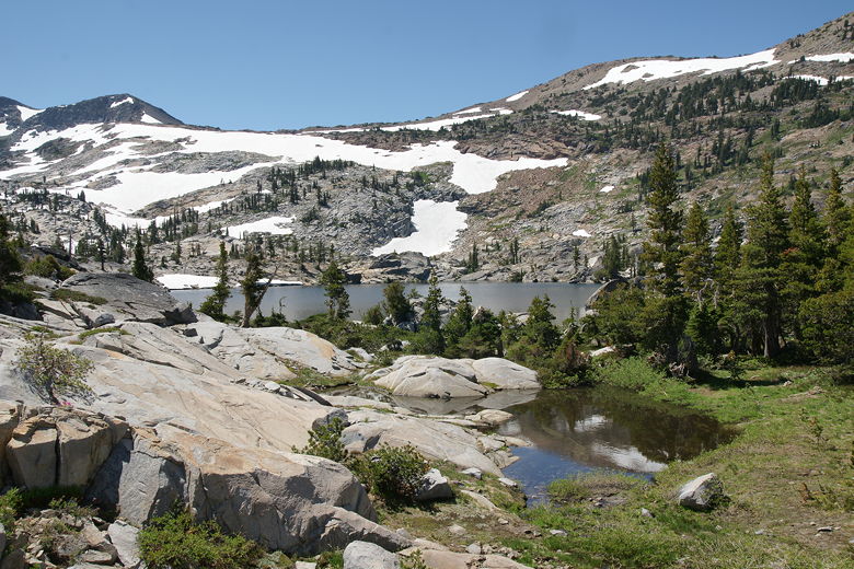
Approaching Fontanillis Lake
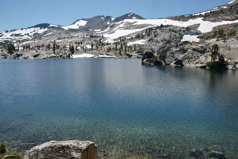
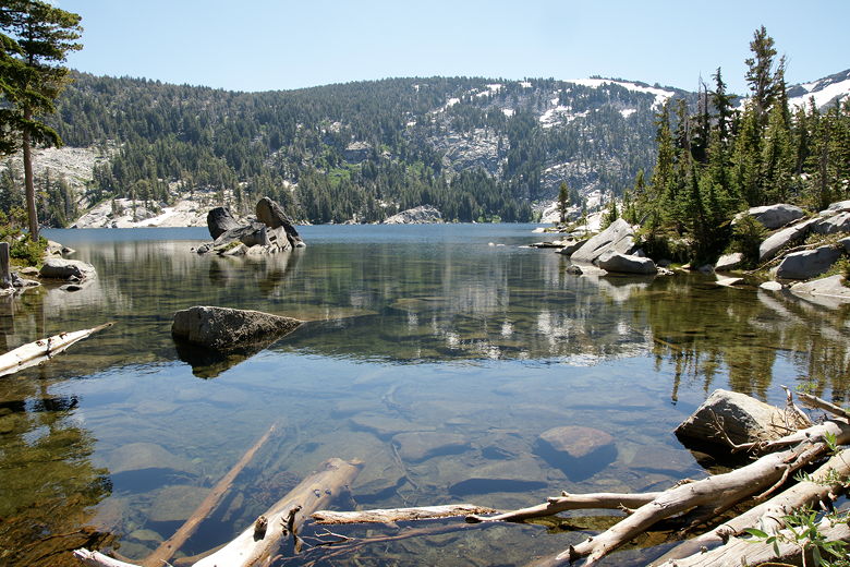
Clear waters of Fontanillis Lake
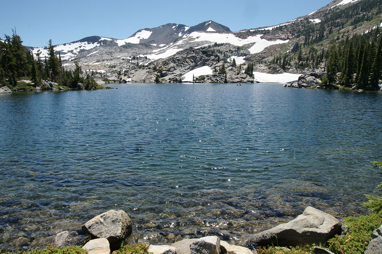
After a brief stop at the lake, we continued along the trail, which follows the shore of the
long lake. The waters of the lake were clear, much like Lake Aloha. It was backed by snow-flecked
mountains, and there was even snow right down to the edge of the lake in places. We stopped for
a lunch break at the northern end of the lake before crossing the outlet stream and continuing on
the trail away from the lake.
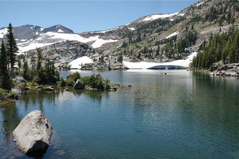
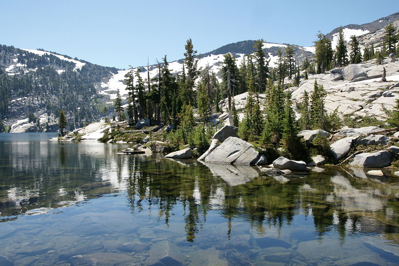
Fontanillis Lake
Trail along the shore of Fontanillis Lake
Crossing the outlet stream of Fontanillis Lake
Looking back across Fontanillis Lake
The trail now climbs briefly before starting a descent into the forest. 1.9 miles from Dicks Lake,
we reached a trail intersection in front of Middle Velma Lake. We'd been here last year,
having camped at the western end of the lake before hiking out to Eagle Falls. I knew the path
we'd be taking today wouldn't get close to the water's edge, so we hiked in just a bit and settled
down for a break with a view of the lake below. It wasn't a great view, as the trail is high above
the lake and we were too lazy to walk all the way down (and back up).
After the break, we returned to the trail and walked 0.3 mostly flat miles heading west, then turned
left onto the trail toward Camper Flat. This was the only 0.3 mile section of trail that we'd have
in common with last year's trip. Looking at the map and knowing what I knew from reading trail
condition reports, I imagined the 2.1 miles from Middle Velma Lake to Camper Flat to be dense forest
with lots of mosquitoes. Well, it was sort of like that for the first mile. It was dense forest and
there were a lot of mosquitoes. It was mostly downhill, although there was a bit of undulation.
But after about a mile, it changed in character.
The trail breaks out into the open and the trail becomes rocky. For a while, it's steep, very rocky and
a bit hard to follow, but it eventually becomes easier. It was also almost completely deserted, as we
saw all of 5 people and 1 dog on the entire stretch of trail between Middle Velma Lake and Camper Flat.
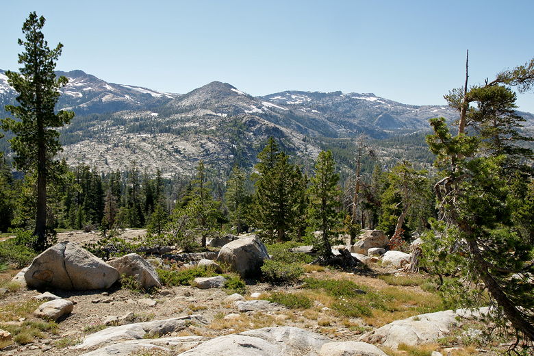
In addition to the relative solitude, we also enjoyed some nice views of the Crystal Range across
Rockbound Valley. Although we couldn't see the Rubicon River, our immediate destination,
it was clear from the topography where it was.
Descending down to the Rubicon River
View of the Crystal Range
We could hear the river before we could see it. We eventually made a final rocky descent and there
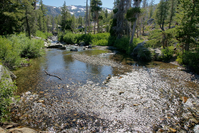
it was in front of us. And it did, in fact, look easy as the hiker I'd found on the Internet had told
me. It was perhaps 30 feet across, but wouldn't require us to cross any section deeper than a foot,
probably less. We took off our hiking boots and socks and put on our Keen sandals. Suddenly, I heard
Nathan cry out. What?!
Looking downstream along the Rubicon River
Where we crossed the Rubicon River
Standing on the edge of the shore, before we'd even started to walk across, he'd dropped one of his
trekking poles into the water, and it was floating away downstream. I tracked it while Jean (who
already had her sandals on) started after it. Thankfully, it got stuck in a pool about 150 feet
downstream, and Jean was able to retrieve it without too much difficulty.
After that excitement, we crossed the river and actually found it quite enjoyable. The cool water
at our feet was refreshing. After we crossed, the kids wanted to play in the water for awhile. We
probably stayed there for about 45 minutes (and didn't see anyone else the whole time).
We finally pulled ourselves away from the river, put our socks and boots back on, and continued on
the trail. Almost immediately we turned right onto the trail toward Camper Flat, then turned left
onto the Blakely Trail toward Lake Schmidell. It would be almost all uphill now to the lake.
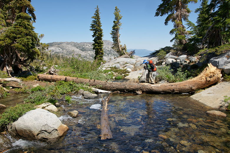
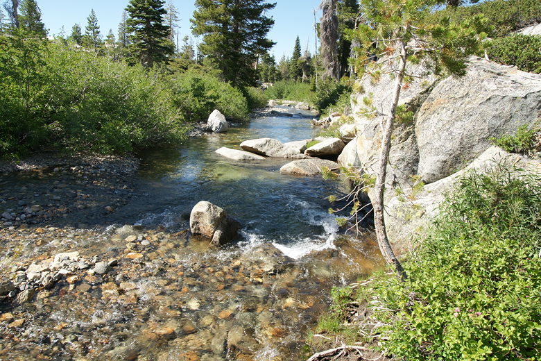
The trail started off gently, then gradually started to climb. Soon we reached a creek crossing.
Here the water was deeper and faster, but we eventually found a log crossing slightly upstream from
the trail. It took a bit of maneuvering across the log and rocks and bushes, but we eventually made
it to the other side.
From the map I knew we'd only have to cross a creek one more time today, so I was crossing my fingers
hoping it wouldn't be difficult. I hadn't been able to find any reports online about the condition
of this trail, so it was my one worry. What I did know was that the trail climbed, and that it did.
We climbed higher and higher, out into the warm afternoon sun. A couple of trail runners ran
past us heading downhill. Those would be the last people we'd see until the lake. We finally
crested the climb and enjoyed the view looking back east.
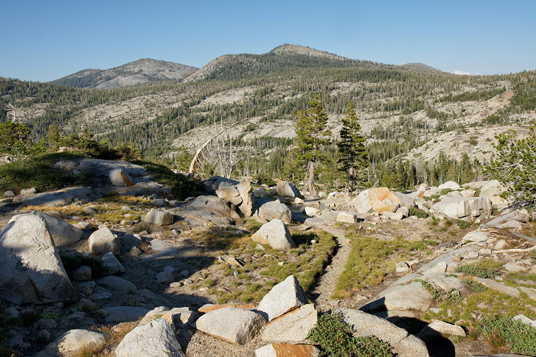
Looking back from the top of the climb on the Blakely Trail
We couldn't enjoy the views for long, however, as mosquitoes quickly descended upon us. After
a brief stay we got moving, trying to avoid getting bitten. The trail descends into the forest,
then quickly flattens out. Soon we reached a trail intersection, with the left fork heading back
downhill to the trail next to the Rubicon River. We continued on the right fork toward the lake.
A couple minutes later, however, we reached the aforementioned creek crossing, and it did not look
good.
The crossing did not look as bad as the lower creek crossing, except that there was no log crossing
here to save us. It looked to be doable by all of us except our 5 year old. We looked up and down,
trying to find a better route, but couldn't. Thick brush blocked the way upstream and downstream, and more
importantly a swarm of mosquitoes surrounded us, aggressively attacking us, making it hard for me
to think straight. I really didn't want to take the time to switch to my sandals, knowing that I'd
be a sitting duck for the mosquitoes (they weren't as bad if I could keep moving). But I didn't
really have a choice.
Eventually we gave in and all put on our sandals except Jared. We crossed the creek fairly easily,
except that Jean had to carry Jared across on her back (after transporting her backpack across).
Once on the other side, however, things did not get better. The mosquitoes continued to hound us,
but more importantly, I could see the trail was completely inundated with water flowing downhill.
Seeing this, we simply kept our sandals on and trudged uphill on the watery trail. The trail became
steep and watery, and then it just disappeared - into the snow.
So, at this point, put it all together. The trail is steep, the mosquitoes are the worst they've
been on this trip, the trail alternates between being covered by snow or running water, and to top
it off, it's starting to get late (around 6:30pm by this time). It was not a fun time. Thankfully
the topography was such that it was almost impossible to get lost - the creek was on our right while
a steep uphill slope was on our left, so the trail had to go between the two and the lake would be right
in front of us. That didn't change the fact that we had to hike up steep snow in our sandals.
At least we were assisted by our trekking poles.
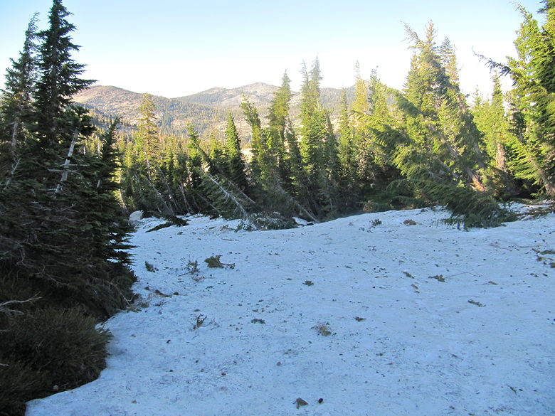
Looking back on the snow we crossed; signs of an avalanche?
Oh, did I mention I had taken off my pant legs for the creek crossing and was too lazy to put them back on?
This wouldn't
be a big deal except for the fact that the mosquitoes were devouring my legs at this point.
I was afraid that if I actually stopped and took the time to put my pant legs back on, it would
be even worse. So I just kept moving and slapped them away as best I could.
Finally, we left the snow fields behind and the trail became more manageable. It started to level
off and we could see a pond to our right. I knew from the map that we were very close now. Soon
we saw a sign on the ground (in front of a rock cairn), pointing us to the right toward Lake
Schmidell, a quarter mile away. Soon we were standing near the edge of the lake, near the outlet
dam. By this time it was just a bit past 7pm. We were just glad to be here. Next we set off in
quest of a good campsite.
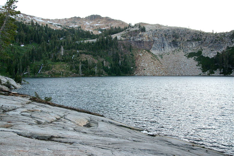
Lake Schmidell
We eventually settled on a site to the left, amidst the large rocky area on the southeastern shore
of the lake. We quickly set up camp and settled in. The temperature was noticeably lower here.
That didn't stop the mosquitoes from bothering us during dinner, though.
Lake Schmidell is backed by Red Peak, with talus slopes leading all the way down to the western
shore. Waterfalls run down the slopes above the southwestern shore. We couldn't actually see
any people, but we did hear some to our left and saw lights later that night across the lake
toward the right. I think there were about 3 other groups camped there that night, despite
the difficulty in getting there.
It was another moonless night, but for whatever reason the sky seemed to be the clearest of any
night on our trip. I looked up and clearly saw the Milky Way, along with hundreds or perhaps thousands
of other stars. I also saw 3 or 4 shooting stars in the few minutes I sat there looking up at the
night sky. It had been a rough trail to end the day, but now it felt like it was worth it.
| 

