|
We woke up around 8:30am, and it was already hot. The mosquitoes were thankfully not as much
of a problem now, although a few zipped around us. After packing up, we got underway just
after 11:10am.
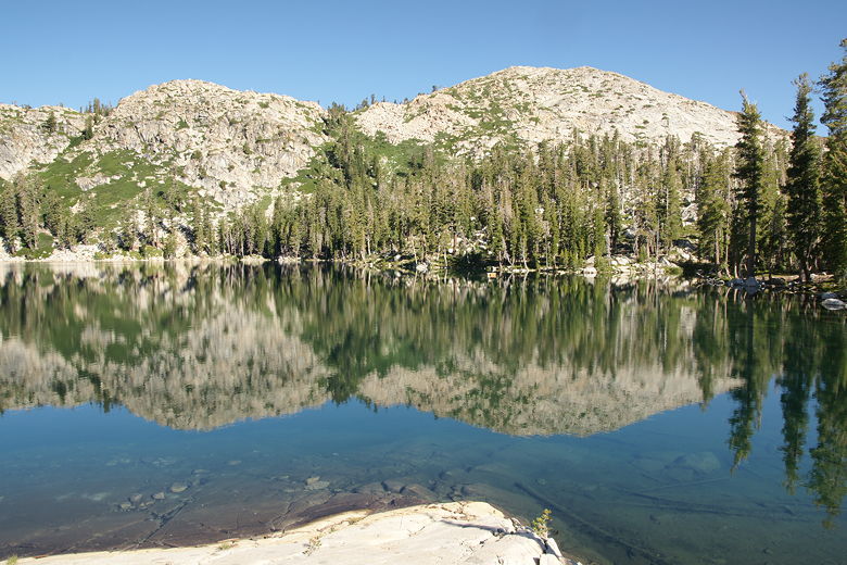
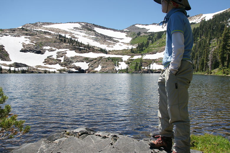
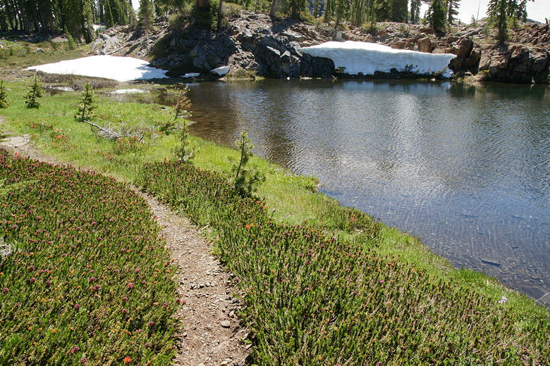
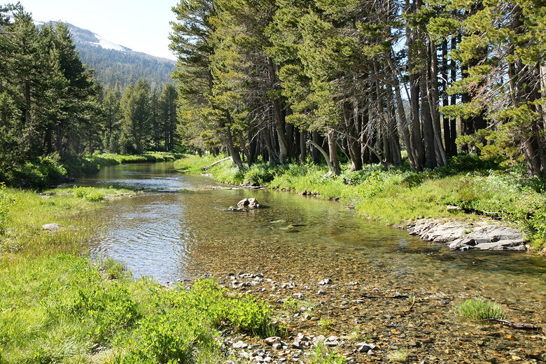
Morning reflections in Lake Schmidell
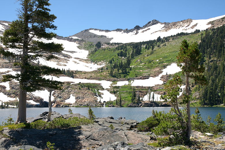
Lake Schmidell
The water was so still and clear, I was afraid I'd walk right into the lake
Our first decision was where to rejoin the main trail. I knew that we could backtrack on the
trail we had taken in, then turn right to rejoin the main trail. However, it looked like we
might be able to save a little mileage by cutting across directly to the main trail from our
campsite. I eventually decided that sticking to what we knew was probably better, despite
the extra 0.3 miles.
So we went back along the trail we'd taken yesterday, back past the pond next to Lake Schmidell.
We slightly overshot our target, as we completely missed the trail sign we'd seen yesterday.
It's not one of the standard trail signposts in the area, but rather a horizontal wooden sign
sitting behind a small cairn (behind coming from our direction, at least). We soon
noticed our mistake as the trail started to leave the pond, however. We backtracked and took
the left fork to stay on the main trail, instead of the right fork back toward Lake Schmidell.
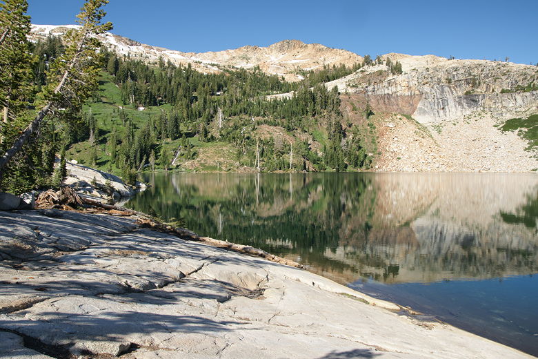
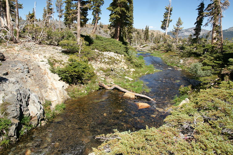
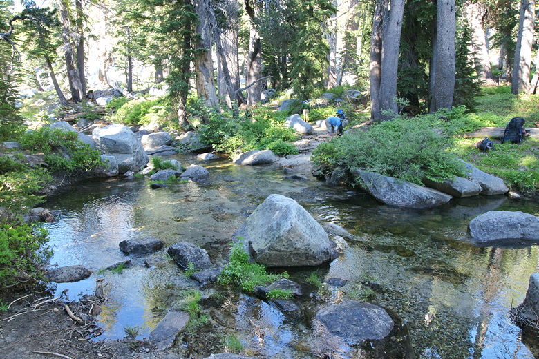
Lake Schmidell outlet stream
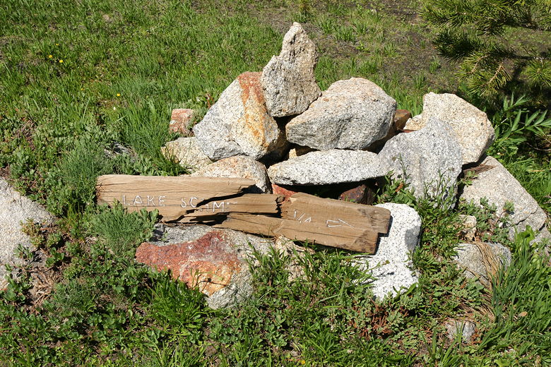
Trail sign we missed on the way out (coming from behind)
We followed the main trail, but soon lost it. The trail winds through grasses and was not
easy to follow. At one point we stopped, looking around for the trail. Thankfully, at that
point, some backpackers came by in the opposite direction and pointed us to the trail. They'd
been camped at Lake Schmidell last night, as well. In fact we'd seen them very briefly yesterday
as they passed us at Middle Velma Lake - a couple and their dog. They said they suspected an
avalanche had come down the slopes at some point, obliterating much of the trail we'd struggled
with yesterday. Based on the one picture I have of that area (I wasn't in the mood to take
many pictures, considering the situation and all the mosquitoes), I'm inclined to agree. It
shows a snow field and trees bent in unexpected ways.
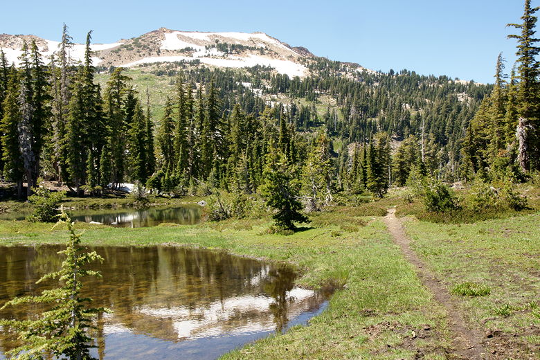
In any case, we continued on the main trail, then turned left at the intersection, toward
Lake Lois. From here, the trail starts to climb steeply, up rocky switchbacks. It's
about a 500 foot climb to the top. As we climbed, we obtained some views of Lake Schmidell
from above, although we could never see the entire lake because of the tall trees near the edge
of the lake. The trail was mostly easy to follow, and as we neared the top, we obtained
views of the mountains to the northeast.
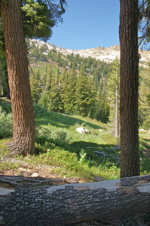
View from the trail
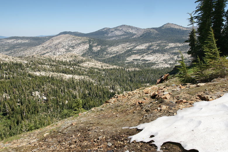
Looking out across the Rockbound Valley
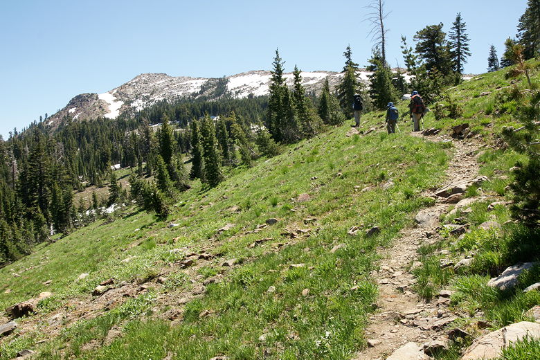
At the top the trail levels off. We rested at a snow patch before continuing on. Shortly,
we came to the next trail intersection. The Red Peak Stock Trail heads to the right; we
stayed straight on the trail toward Lake Lois. After a brief flat section, the trail descends
down to Lake Lois, a very pretty lake a bit smaller than Lake Schmidell.
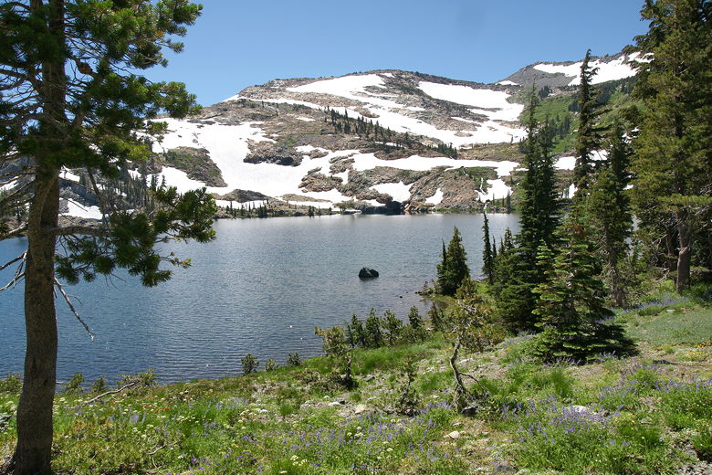
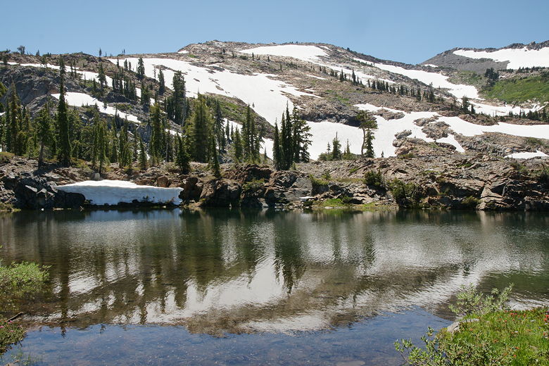
Lake Lois
Looking out at Lake Lois
A closer look at Lake Lois
We decided to take a break at the lake and enjoy the view. On the far side of the lake we
could see a waterfall tumbling down the mountain, which was half covered in snow. As far as I
could tell, we were the only ones at the lake. It looks like a prettier place to camp than
Schmidell, although I am not sure of the presence of good campsites. We weren't camping here,
however, so after our break we returned to the trail, which follows the northeastern shore
of the lake.
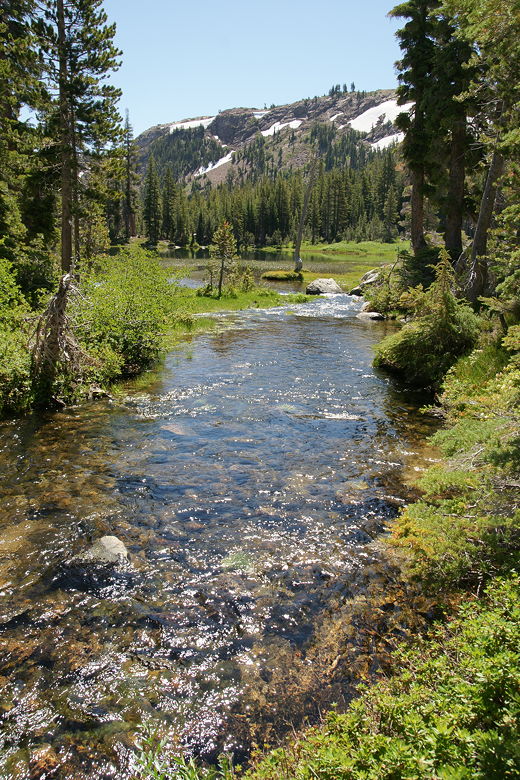
Lake Lois outlet stream
We crossed the lake's outlet stream, crossed a snow patch on the other side, then started a very
pretty section of trail. Three ponds in the area provided great reflective surfaces for the
mountains behind. The trail here was a bit muddy in places, but it was manageable. We encountered
two groups of day hikers here. Well, they looked like day hikers, although maybe they had camped
at Lake Doris (nar Rockbound Pass) and were doing a day hike from their base camp. The only other
thing I can think of is that they came from the Wrights Lake campground. That's a bit of a hike, though -- about
6.5 miles from Wrights Lake one way to Lake Lois. I probably should have asked them where they'd
started.
Reflections in pond near Lake Lois
Trail next to the pond
Looking back along the trail
After passing through the muddy meadows, we reached our next intersection (at 2.3 miles). Lake Doris was
just to our right, out of sight. Well, the lake was out of sight uphill, but we could see a
tent up there, so we knew where the lake should be. We considered climbing up to the lake and
taking a rest break there. Eventually, though, we decided we didn't want to spend the
extra time and energy. Instead, we turned left and headed downhill toward the Rubicon River.
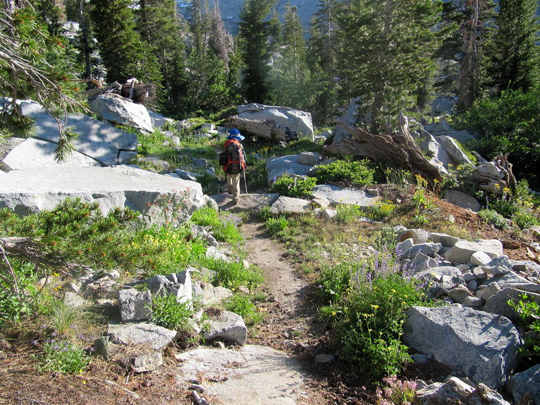
Trail headed up toward intersection near Lake Doris
We soon entered the forest again, and the mosquitoes returned to us, as well. About halfway
down, we stopped briefly for a snack break, then continued back on the trail. Before we knew
it, we were at the next trail intersection, about 3.8 miles from Lake Schmidell. To the
right was China Flat and our eventual destination for the day, Clyde Lake. Well, that was our
original destination. I did bring up the idea of going all the way to Lake Aloha today.
This would add a couple miles to our hike today, but take a couple off from our last day.
We decided we'd make a decision later in the day.
The trail now is relatively flat, mostly following the Rubicon River. Soon we had our first of
three river crossings today. We put on our sandals and crossed the river easily (the water was
less than a foot high), then stayed and played in the river for a while. I marveled at the
fact that we had the place to ourselves -- in fact, we'd only see one other hiker the rest of the
day. So we saw perhaps a dozen people on this day -- a couple at Lake Schmidell, about 9 or 10
near Lake Lois, and one near the Rubicon River later. This was a stark contrast to our first
day to Lake Aloha.
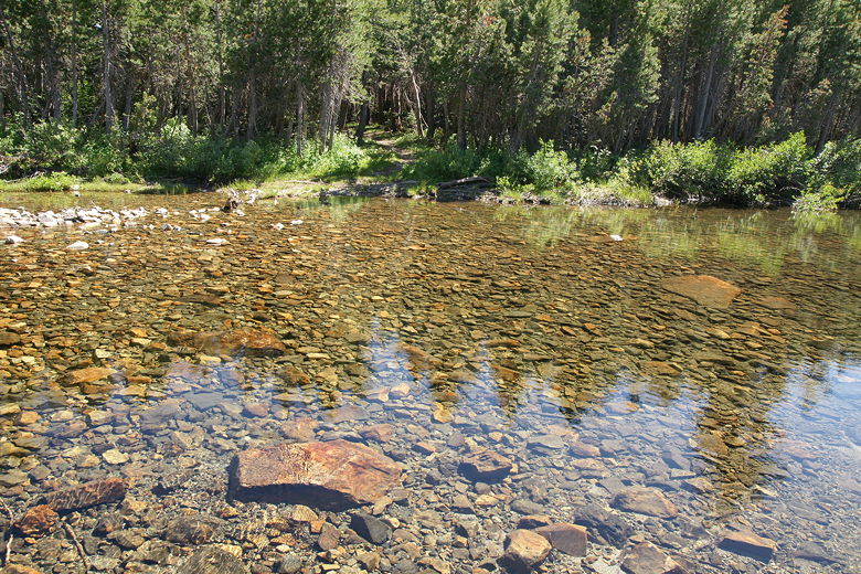
First river crossing of the day
We left on our sandals because I knew the next river crossing would come up soon. About 10 minutes
later we crossed China Flat, a large meadow, then reached the next river crossing. Once again we
took a long break here, enjoying the river. This time, we put our boots on afterwards, as we'd
have to hike for more than a mile before the next crossing.
Second river crossing of the day
The trail stayed flat as we hiked through the forest. About a mile later we reached our final
river crossing of the trip. This one was a bit deeper than the others, so Jean had to carry
Jared across. She also accidentally let go of a trekking pole and I had to retrieve it from the
water, stuck upside down in a pool about 50 feet away. Once we got to the other side of the
river, the mosquitoes were in full force, making it hard to put our boots back on.
Final river crossing of the day
Thankfully, once we did get back on the trail again, it climbed out of the forest and left
most of the mosquitoes behind. Instead we encountered some dense brush and wildflowers while
climbing steadily uphill. As we climbed, we obtained some views of the surrounding mountains,
but the late afternoon sun dulled most views to the west. After climbing about 500 feet, we
reached the next trail intersection. The trail continues straight toward Mosquito Pass
(and Lake Aloha), but it was already past 6pm by this point and we decided we would just turn
right and head down to Clyde Lake.
On the trail toward the Clyde Lake intersection
Unfortunately my GPS ran out of batteries at this point, so the GPS route you see from the
main trail to Clyde Lake is manually traced. In any case, it only took us about 14 minutes
to get down to the lake from here. The trail was steep and rocky, and blocked by downed
trees in one place, but it's easy enough to follow. We passed a small pond on our right
just before the lake, then reached the lake itself. Not seeing many camping options to the left,
we crossed the rocky dam to our right and discovered a large open area with obvious campsites
overlooking the lake.
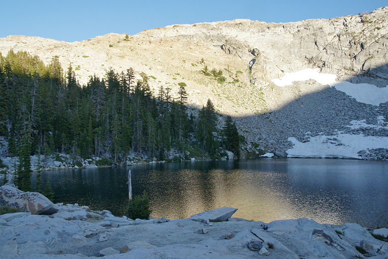
Late afternoon sun clinging to slopes above Clyde Lake
Clyde Lake sits at the bottom of a half bowl, with the steep slopes of Mount Price rising from
its southern shores, water tumbling down in a sliver of a waterfall past patches of snow and
talus as the bottom. Since there were high mountain walls to the west, the entire lake was
in shadow even though the sun was still shining on the mountains to the east and behind us to
the north. It also appeared that we had the entire lake to ourself. Considering we didn't see
anyone at the lake that night or the next day, I think it's a safe bet to say that was the case.
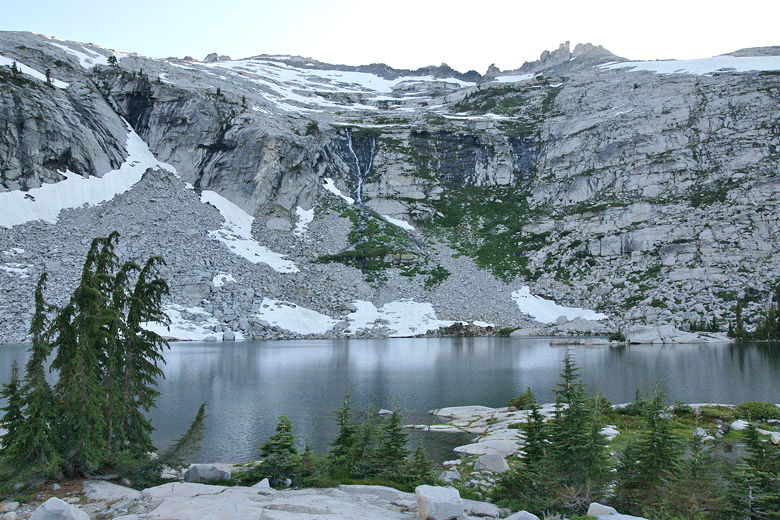
Mt. Price above Clyde Lake
While there are several camping spots here, most of them are mostly exposed, small, and slightly
slanted. We chose the only one that appeared to fit our tent, even though it was a bit
slanted and provided minimal wind protection behind a large rock. We had great views of most of
the lake and the mountains behind it. We set up, had dinner, and then settled in to try to
sleep.
| 

