|
Much to our chagrin, shortly after we entered our tent last night, the wind started winding up.
We could hear it rushing over the tops of the mountains above Clyde Lake, then it would reach our
tent a few seconds later. I was hoping it would die down after a while, but it never really did.
I would venture to say that I only got 2 or 3 hours of sleep during the night, but I'm really not
sure. At one point I closed my eyes and then later opened them to find it bright already, but I
didn't feel refreshed at all. I was too tired to ever look at my watch until it started to get
warm in the tent and we got up around 8am.
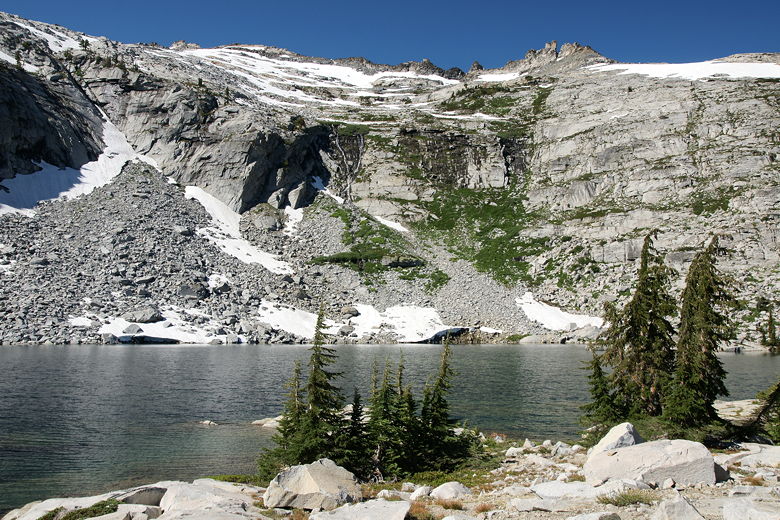
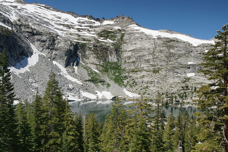
Mt. Price above Clyde Lake
Ironically, in the morning one of the first things I saw was that someone had created a
sheltered campsite around the corner. Near the trees was a site with a wall made of stacked rocks,
about 2 feet high and a dozen feet long. It looked like it definitely would have helped last
night (the site was vacant, as we were the only ones there), but I measured it and it was just
a few inches too small for our tent. That made me feel a little better.
Now, I completely understand why someone would have created such a shelter, and if I had seen
it the night before and our tent fit I certainly would have used it. But I do wonder about the
violation of leave-no-trace principles.
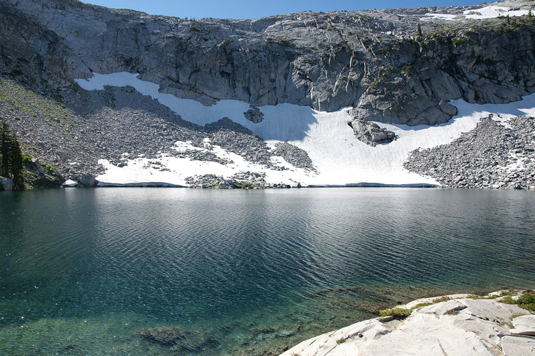
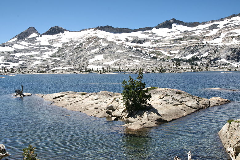
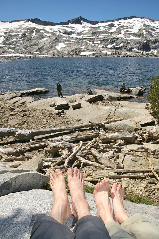
Clyde Lake
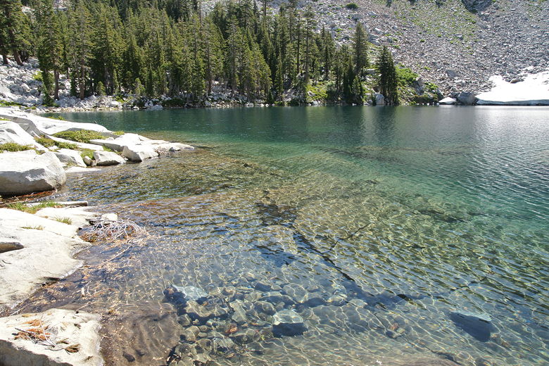
Clear waters of Clyde Lake
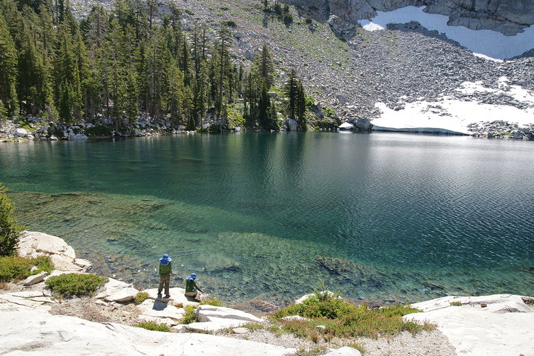
Enjoying Clyde Lake
In any case, we had breakfast, packed up our site, and left Clyde Lake around 10:45am. From there
we crossed back over the dam, then made the short uphill climb to the main trail, arriving there in
just 17 minutes.
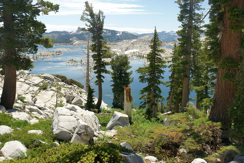
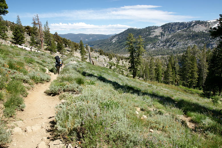
View of Clyde Lake from the trail to Mosquito Pass
We turned right onto the main trail, then continued the climb up toward Mosquito Pass. The trail
started to switchback, with some views of Clyde Lake below (partly obscured by trees). We had to
walk around one large snow patch, then over another on our way to the pass. Only about
40 minutes after we left Clyde Lake, we reached Mosquito Pass, where the trail flattens out. Then we
started the descent toward Lake Aloha.
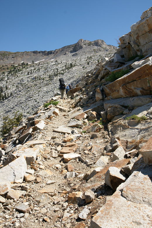
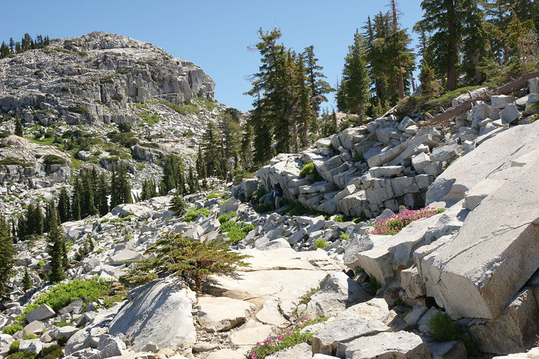
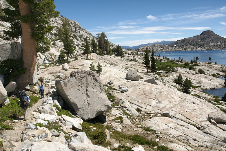
The rocky trail to Mosquito Pass
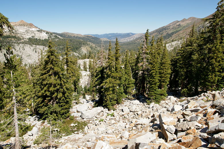
Looking back down the Rockbound Valley
The final stretch before Mosquito Pass
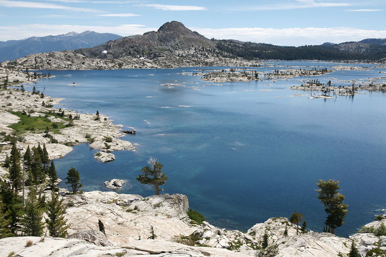
Only a few minutes after leaving the pass, we were presented with some astounding views of Lake Aloha.
The views were partially obscured by trees, but it was still awesome. We took a break here, looking down
at dozens of little islands sitting in Lake Aloha, glistening below in the late morning sun.
First look at Lake Aloha from the Mosquito Pass trail
After a 20 minute break, we were back on the trail. A few minutes later, we rounded a corner and the
trees fell away and the views opened up completely. And it was awesome. Even though we'd seen the
partially obscured view a few minutes earlier, the full view was still a bit stunning. In
front of us was a view of almost all of Lake Aloha, backed by Cracked Crag. The feeling
kind of reminds me of the drive up Glacier Point Road in Yosemite where you suddenly see Half Dome, as if it's
right in front of you.
Lake Aloha
Heading down the trail next to Lake Aloha
We followed the trail downhill as it followed the northwestern shore of the lake. It's not really a
big descent, so it wasn't long before we were basically near the same elevation we had been at our
Lake Aloha campsite on the first night. About 1.8 miles from Clyde Lake, we reached the trail
intersection marking the end of the
loop section of our trip. To the left was the trail toward Heather Lake that we'd taken on day 2 of
our trip. We stopped here briefly, then turned right onto the trail toward Echo Lake.
Mountains rising from shores of Lake Aloha
Pyramid Peak, Mt. Agassiz, and Mt. Price
By this time, a combination of factors mostly including the heat and my lack of sleep the night before
was causing me to be a bit light-headed. About a half mile later, we found a nice shaded spot to take a break
near the water's edge. We ate, relaxed, enjoyed the water, and I filtered some extra water just in case.
I had run out of water near the end of yesterday's hike, so I wanted to make sure I had some in
reserve.
Enjoying our last lunch stop of the trip
After a nearly 50 minute break, we got back on the trail around 1:40pm. I had heard on the first day
that the boat taxi ran up until 6:30pm. After that, you'd have to hike an extra 2.5 miles to get back.
We definitely wanted to avoid that, so that gave us some incentive to get back sooner than that. At
this point, we still had about 4.5 miles to go.
We soon passed our first night's
campsite. Up until this point we hadn't seen another person on the trail today. That would soon
change. We soon saw some people near the shore, although they weren't actually on the trail.
Soon we reached the end of Lake Aloha and took the left fork up toward Echo Lake, with about 3.4 miles
to go. The trail now climbs for about a mile, then mostly levels off for a while. We started to see
a trickle of a few hikers here and there.
We were making great progress and decided to basically keep going without stopping. Once we started the
rocky descent past Haypress Meadow, we started seeing tons of hikers. Every minute we saw hikers coming
up from the direction of the boat dock. That included a large group of about 20 backpackers.
We continued to see backpackers coming in the opposite direction all the way up until about 3:30pm,
which surprised me, since I wouldn't have expected to see them that late. Perhaps some of them
were headed to the closer Lake of the Woods instead of Lake Aloha.
Heading down the trail toward the boat dock
We passed the Desolation Wilderness sign, so we knew we had 0.6 miles to go. Soon we saw a trail
to the right with a sign above saying "Boat Taxi", "Public Phone". We walked down and
I went toward the
phone to call the boat at just a bit past 4pm. A woman approached me and said she had some other
friends who were picnicking
in the area who were going to head back now, as well. So I called in on the phone and told them that
we had 11 people and 4 dogs ready to head back.
Upper Echo Lake from the boat dock
Waiting for the boat taxi
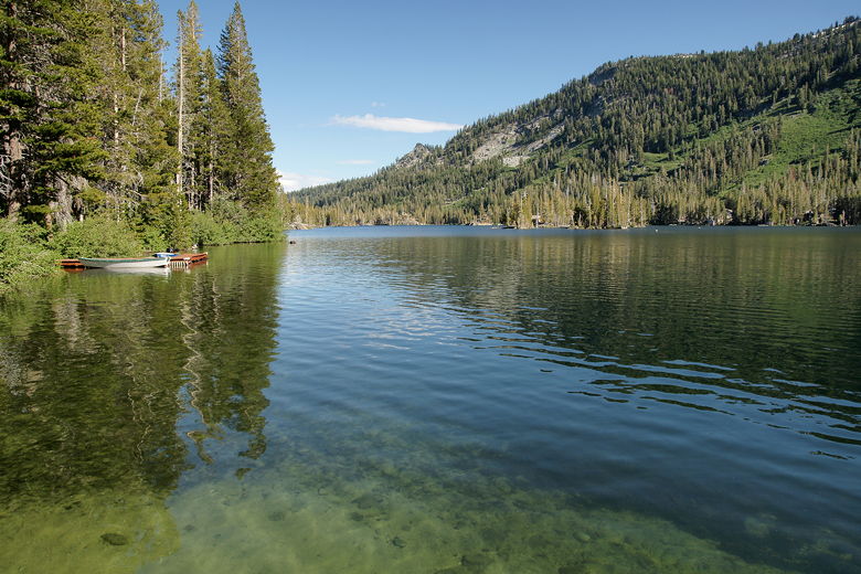
About 15 minutes later, the boat arrived. We loaded up and headed back across Upper and Lower
Echo Lakes. Once we got there, we walked over to the store for some much-needed soda and ice cream.
Then we trudged up the hill back to our car. After changing into some fresh clothes, we drove
down to Placerville for dinner, then on to the Bay Area by 10pm that night.
In deciding what to rate this hike, I knew it had to be at least a 9. There's no one particular
thing that steers me toward rating it a 10, but there was just so much good stuff that I feel
compelled to do so. Lake Aloha was great, as was Dicks Lake, Clyde Lake (minus the wind), and
Lake Lois. Just so many great lakes and cool rivers and tremendous views. Yes, the trail
between Echo Lakes and Lake Aloha is crowded, but beyond that there really weren't that many
people. In all, a trip I would highly recommend to anyone. Now I've got a year to plan next
year's backpacking trip. I'm looking forward to it already.
| 

