|
As we drove up Rock Creek Road, we didn't see much color at all. The lower sections were
mostly green, the upper sections were mostly brown or bare, with hardly any yellows in
between. At least the road was plowed and in good condition up until Rock Creek Lake.
After that, it becomes one lane and it was still covered in snow and ice. We gingerly
drove through this section and made it to the parking lot at Mosquito Flat, which was
(to my surprise) almost full.
We parked in one of the last remaining spots, then took in the sights. Almost everything
was covered in snow, including the parking lot.
During winter, the road isn't plowed at all past East Fork, so being able to drive up
here was a treat. As we prepped, we now had to decide whether to use our hiking boots or
snowshoes. I suspected that the beginning section of trail would be packed down fairly
well because the trail toward Little Lakes Valley is very popular. However, I wasn't
so sure about the trail up to Ruby Lake. We eventually decided to put on our winter boots
and bring our snowshoes, but not to put them on yet.
When I'd packed the car yesterday, I hadn't actually thought that we'd need to carry our snowshoes.
Luckily, I had a couple of bungee cords in the car, and they made the job easier.
We finally got underway around 11:30am.
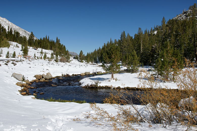
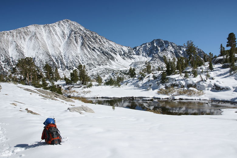
Rock Creek streaming away from the parking area
We started up the trail, which was in fact packed down hard and easy to walk on with our
winter boots and trekking poles. Rock Creek flowed past the snow to our left. After a
somewhat level start, the trail starts a climb to about 230 feet above the trailhead.
After this,
the trail levels off briefly before reaching a trail intersection, 0.5 miles from the
trailhead. To the left is
the trail into the Little Lakes Valley, including Heart Lake to which we'd hiked 2 years
ago (in the summer). This time, we took the right fork, toward Ruby Lake and Mono Pass.
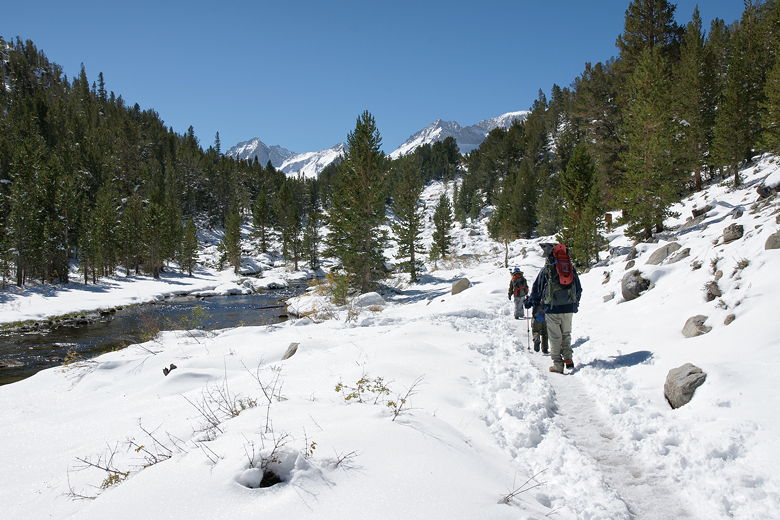
Walking along the trail next to Rock Creek
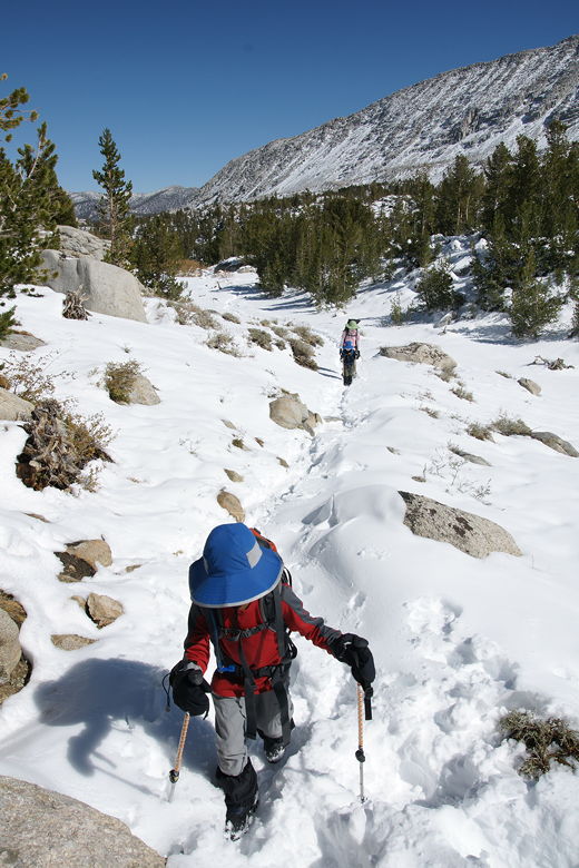
Heading uphill toward the first intersection
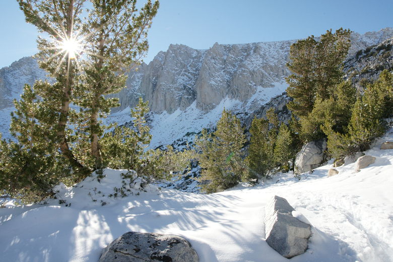
Almost immediately, the trail became harder. There were not nearly as many hikers heading
in this direction, and we had to pick our way through snow that had fallen just 2 days ago.
There were enough boot prints to know we were still on the trail, but it was still much
tougher going than the packed trail we'd just been on.
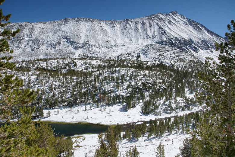
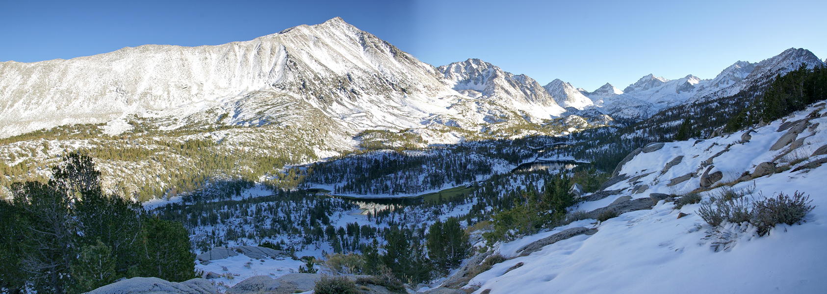
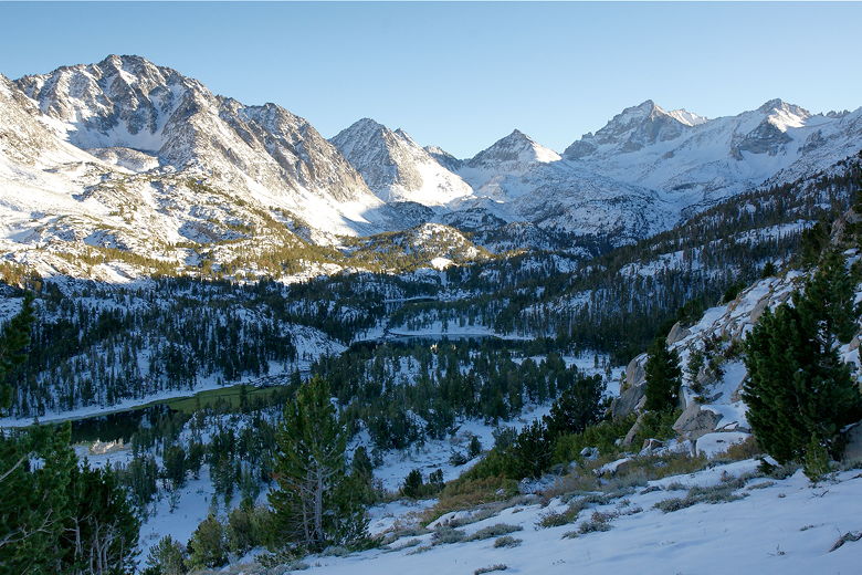
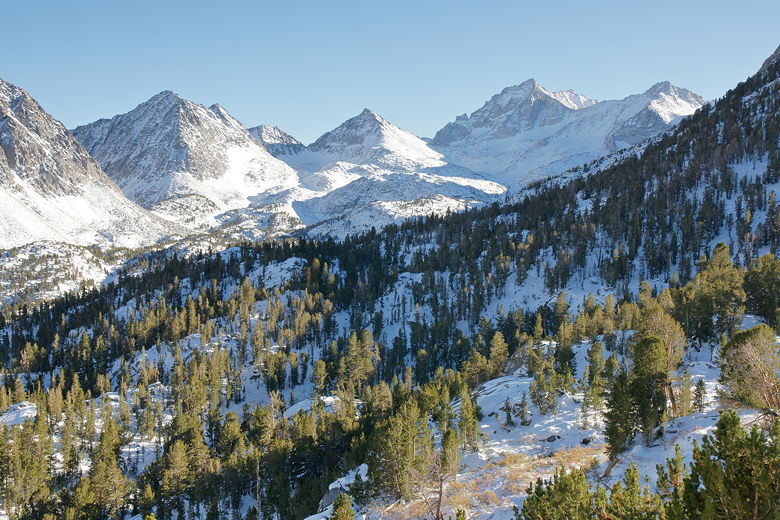
Looking out across Little Lakes Valley to Mount Morgan
A backpacker and his dog, who we'd seen prepping in the parking lot, passed us here.
He was also heading to Ruby Lake, which was to be his first night's camp. The trail
switchbacked uphill, and after slogging through this we stopped about a mile in,
stopping at the same place as the man with the dog. We all enjoyed the view of the
high mountains backing the Little Lakes Valley. We headed back onto the trail before
the man and his dog.
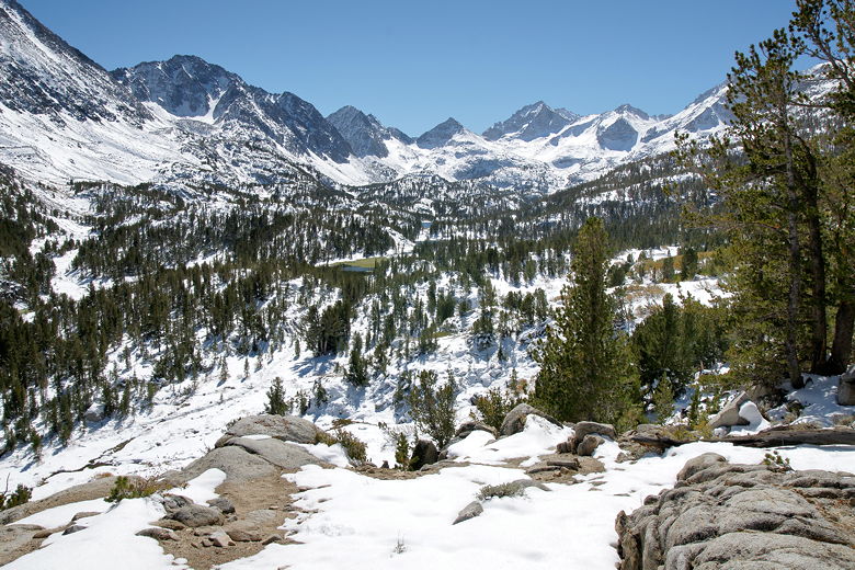
Looking up Little Lakes Valley
About 1.2 miles from the trailhead, the trail levels out for about a tenth of a mile,
then climbs again. I kept thinking I should be able to see the lake, but I couldn't.
At 1.5 miles, the trail mostly levels out for the next 0.3 miles. Finally, at 1.8 miles,
we reached a meadow (covered in snow, just like everything else). It now became clear
where the lake was -- we were running out of room, since the lake had to come before
the tall mountains we were approaching.
Meadow before the lake (Ruby Lake outlet stream is on the far left)
Looking back at Mount Morgan
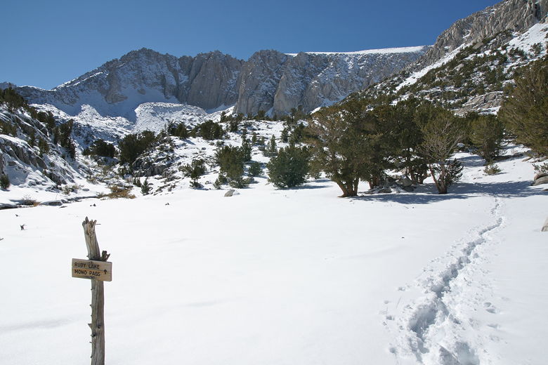
Shortly afterwards, we came to another trail intersection. Continuing
straight leads to Mono Pass. Only a single set of boot prints went in that direction.
We instead turned left, toward Ruby Lake. 0.2 miles later, after hiking alongside the
outlet stream, we reached the lake.
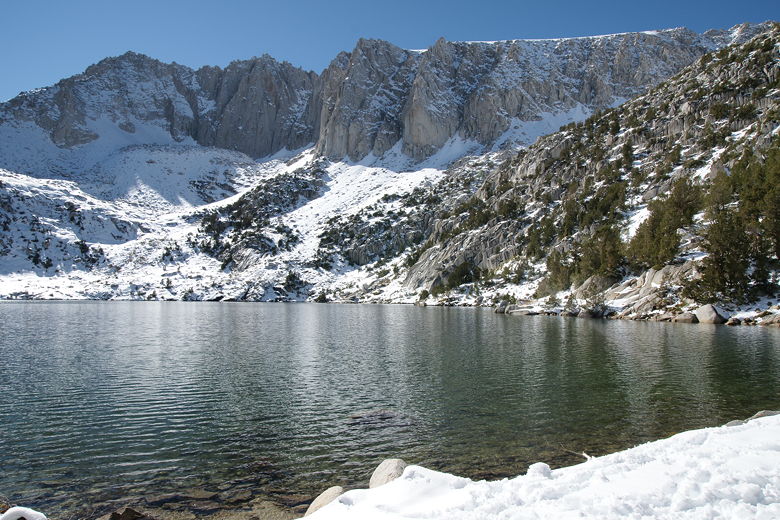
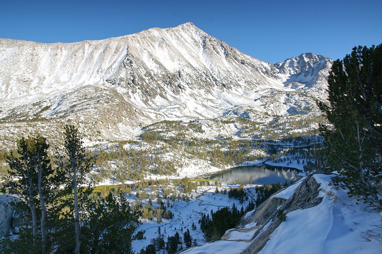
Ruby Lake
Ruby Lake
Ruby Lake sits in a bowl surrounded by mountains rising from most of its shoreline.
There isn't a lot of easy shore access. We followed the shore counterclockwise,
eventually finding a lunch spot partway uphill, overlooking the lake.
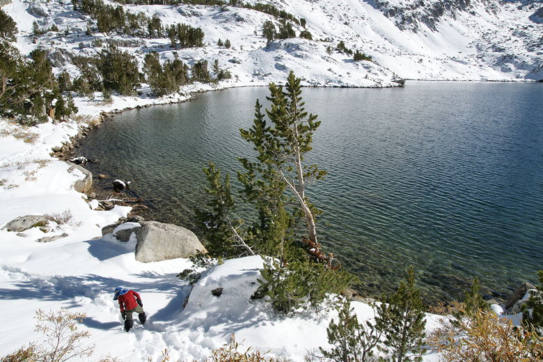
Ruby Lake
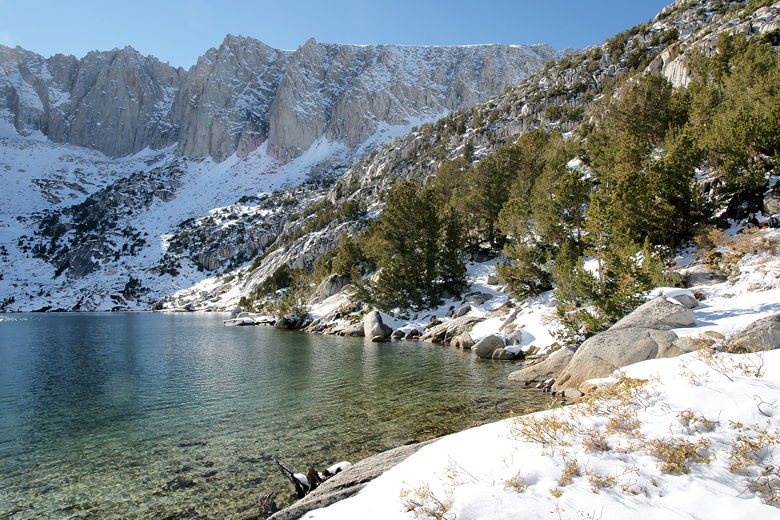
Northwestern shore of Ruby Lake
We didn't arrive at the lake until 3:10pm, nearly 3 1/2 hours after we'd started.
That was a tough 2 miles! Our slow pace was partly due to the high altitude (Ruby
Lake's elevation is about 11,200 feet) and partly due to the snow conditions.
I don't think actually putting on our snowshoes (which we didn't use at all
on this hike) would have helped much, since the snow wasn't very deep. And in fact
we did get to the lake before the man and his dog, who appeared to arrive around 3:30pm.
Besides the man and his dog, we shared the lake with only 3 other day hikers, to our
right. We could hear their voices but they were hidden behind some trees. We ate
our lunch, then the boys made a snowman. I wanted to leave around 4pm, though, since
I didn't want to be stuck hiking in the dark and the cold. We packed up and headed
back at 4:05pm.
After seeing the blanket of snow everywhere, the man with the dog abandoned his plans
to camp by the lake, instead opting to return to the trailhead just like us.
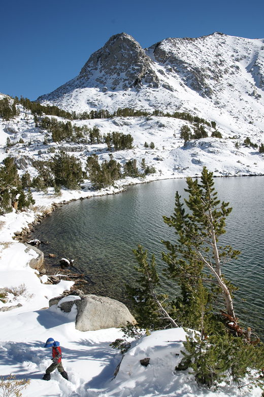
Looking back at the mountains above Ruby Lake
We retraced our steps back along the trail. Of course since it was mostly downhill,
it was easier. But because of the snow we still couldn't generate a lot of speed
heading back. That's ok, though, since we were able to enjoy some tremendous views
of the afternoon light on Mount Morgan to the east of the Little Lakes Valley.
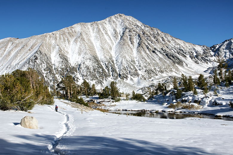
Mount Morgan on the way back
Mount Starr perhaps? (mountain to the left of us as we returned)
Mountains at the end of the Little Lakes Valley
Looking across the valley to Mount Morgan
|