|
When we arrived at the Ke'e Beach parking lot, it was completely full. We backtracked to an overflow parking lot about a quarter mile down the road. This lot was nearly full, but we managed to come just as someone else was leaving, and we took their spot in the dirt lot. A word of warning -- the lot is very bumpy (unless they've fixed it since this writing). One end of it was also covered in water, resulting in people backing up their cars a long way when they couldn't find a space.
Since it was already noon, we decided to eat lunch before starting the hike. We ate lunch in the car, and it rained lightly while we ate. By the time we were finished, though, the rain was gone. This fit a similar pattern we saw while on Kauai - rain in the mornings, and sunny in the afternoons. Of course this may vary from season to season or even week to week, but that was our experience. My advice is to ask the locals when you get there, and be aware of how the weather behaves while you're there. I'd also recommend taking the weather forecasts on websites with a grain of salt. I found them to be unreliable for both Maui and Kauai.
We started off just before 1pm, walking along the road's edge toward the main parking lot. Along the way we passed some irrigated taro fields (it's used to make poi). We also passed a large cave where there's 20 minute parking for those who want to check it out. We just kept walking. Within about 10 minutes, we reached the main parking lot. There are bathrooms and outdoor showers here. Most of the people just go to the nice beach here. But a fair number head onto the trail we were doing.
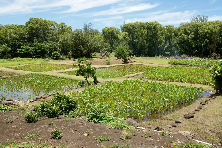
Taro fields
The trail starts by the signs and map on the left (inland) side of the road. There's a sign here that lists several destinations, including the beach we were heading to (2 miles), the falls (4 miles), and the entire trail (11 miles). If you plan to hike past the falls or the beach, you'll need to get a permit.
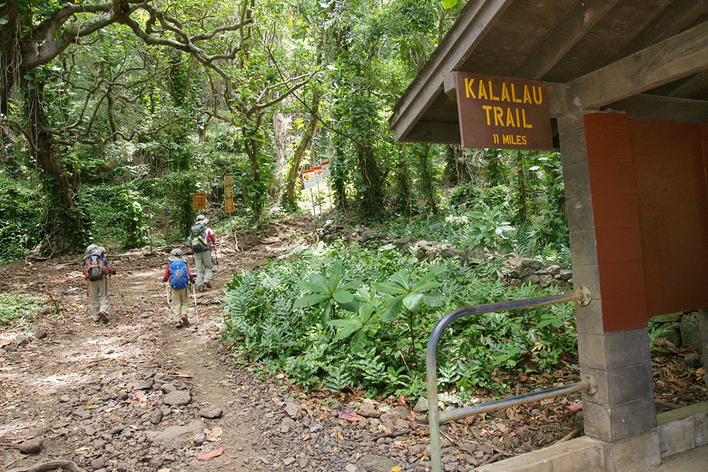
Start of the Kalalau Trail
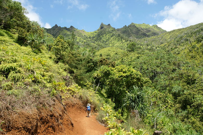
The trail immediately starts climbing, a rough rocky trail, slippery and a bit muddy at times, but nothing like the Pihea Trail we'd done a few days earlier. Most of the mud was easily walked across or rock-hopped over. Given the fact that the trail starts from a beach access, based on past experience I was surprised that I didn't see anyone walking the trail in flip-flops. Everyone seemed to be wearing either tennis shoes or (more commonly) hiking boots. We were using our hiking boots, of course, but we also brought our Keen sandals since I knew we'd be crossing a stream. I didn't know how deep it would be, but I wanted to be prepared.
Before I go any further, I should point out that doing the entire 11 miles of the trail is something I'm probably not prepared to do. I've read that it's dangerous, with one particular cliff section that's not for the faint of heart. Also, in winter, crossing the stream we'd be crossing might not be possible. If you are planning to hike this trail in winter, or the entire 11 miles at any time of year, do your research and see if it's something you're up for. It's possible it's something we'd consider, but not until the kids are older and bigger.
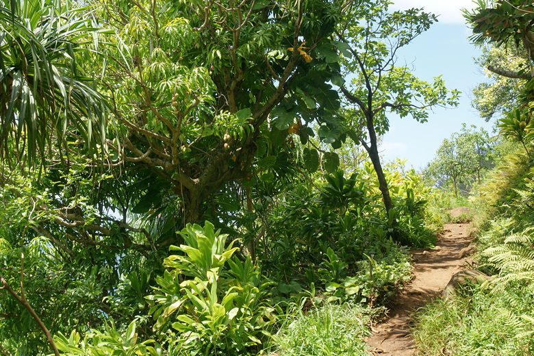
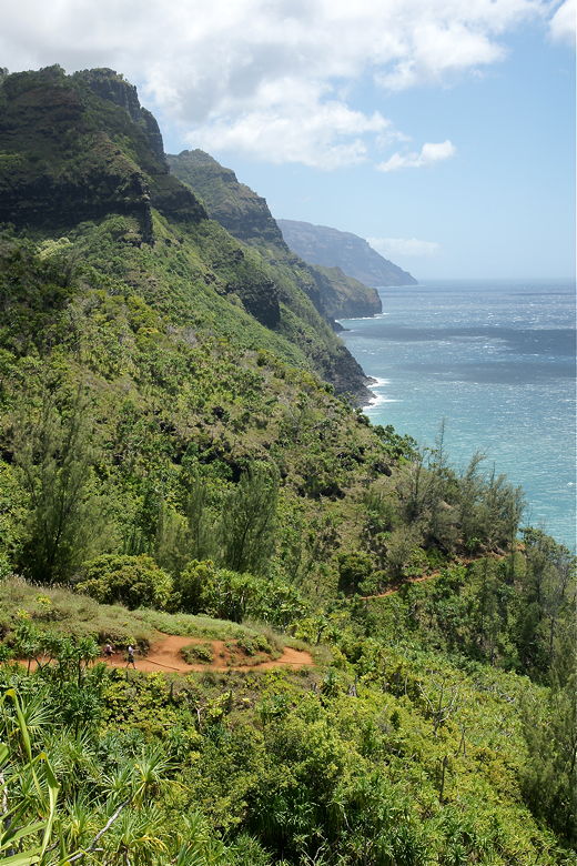
Ok, so let me continue with the trail description. After climbing steadily for a while, the trail breaks out of the humid shade of the forest and out into the open. At a bend a half mile into the trail, there's a nice view of Ke'e Beach below to the right. It's hard to enjoy it much, however, as the wind is howling here. We looked for a bit, then continued on up the trail. The trail now provides views of the ocean on the right. Along the way, we passed hala trees, avocado trees, mango trees, and banana trees. All growing right next to the trail.
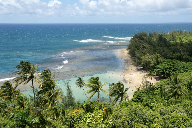
Ke'e Beach
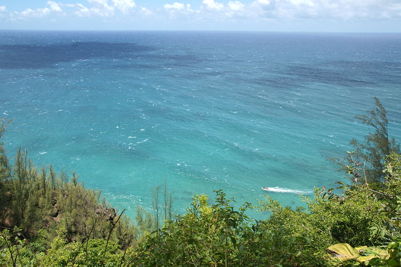
Ocean near the half mile point
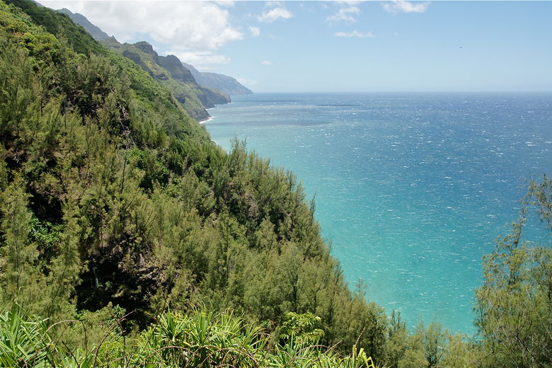
Looking south along the Na Pali coast
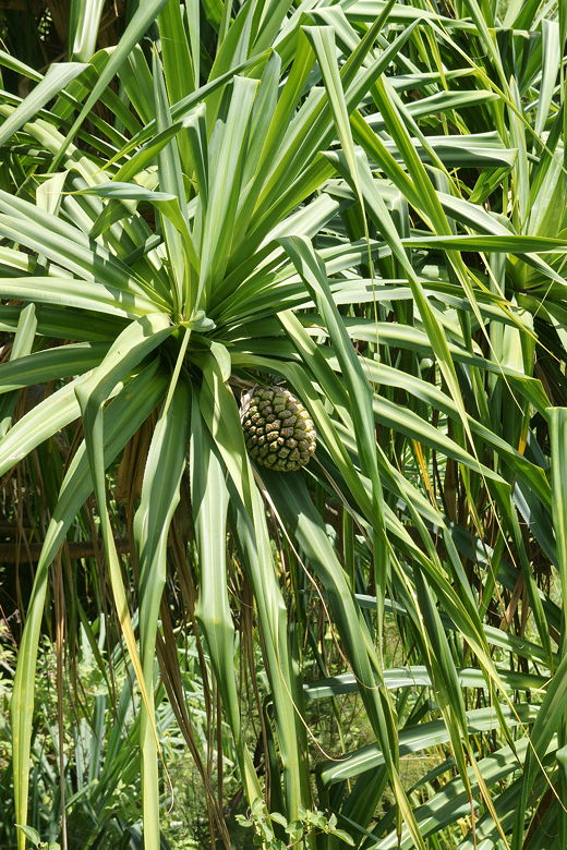
Hala fruit (aka "fake pineapple")

Avocados
Mango tree next to the trail
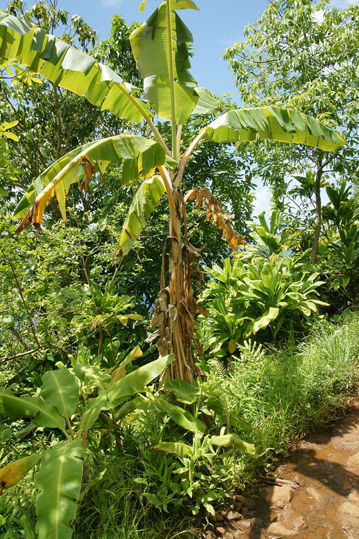
Banana tree
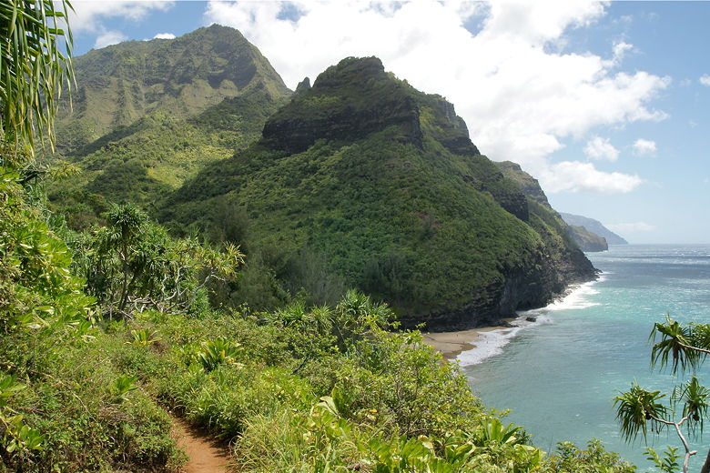
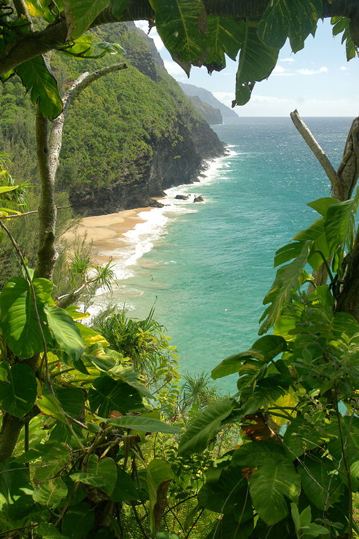
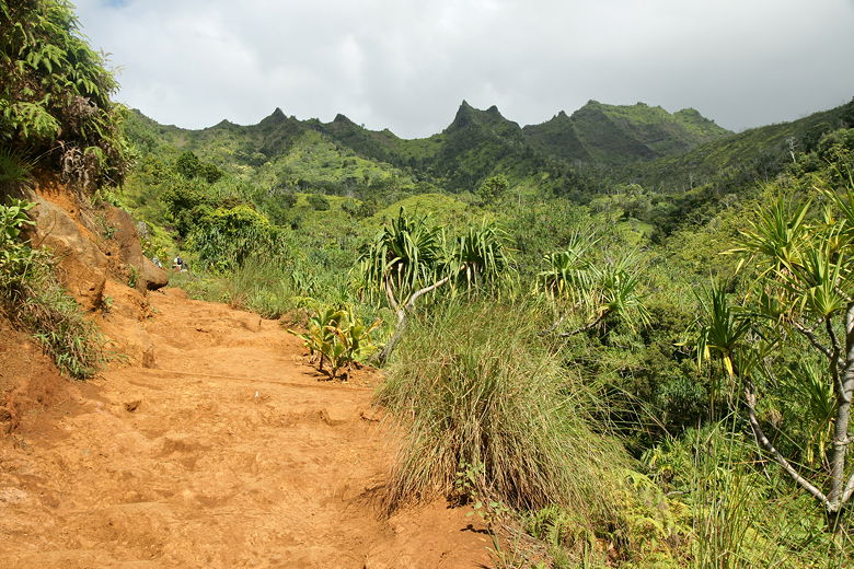
At various points of the trail, there are views of the inland mountains. The trail goes up and down for long stretches at a time, with not a lot of completely flat trail. As we continued, we could see the dramatic cliffs to the west. We saw lots of hikers coming in the opposite direction. We asked one of them how far it was, and they responded about 20 minutes. Soon after that, we could see the beach itself far below, with people walking on it. We now began descending, past a sign warning visitors not to go into the ocean (because of strong currents). Soon we reached the stream we'd have to cross.
Trail descending along the Na Pali coast
Inland mountains above the trail
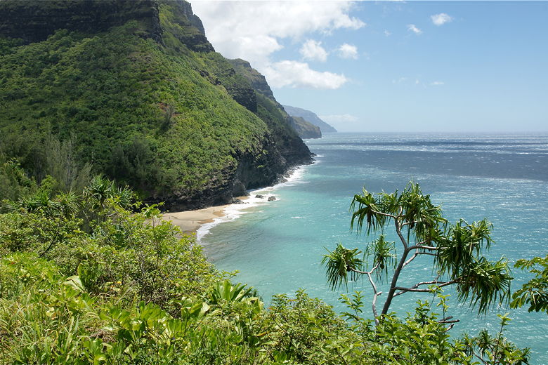
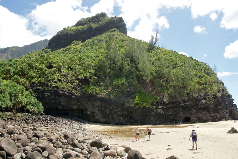
A glimpse of Hanakapi'ai Beach
Mountains above Hanakapi'ai Beach
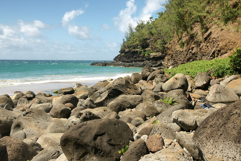
While other hikers rock-hopped across the stream, we put on our sandals, then easily walked across the stream, which was no more than about 10 inches deep in most places. It was quite refreshing walking in the water. The kids loved it. After we walked across, we walked down a large boulder field to the beach itself. We heeded the warnings to stay away from the ocean and set up on the boulders near the beach. There were at least a couple dozen others in the area. A few of them decided not to heed the water warnings and were swimming or just playing in the water.
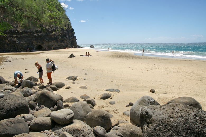
Hanakapi'ai Beach
Hanakapi'ai Beach
A rock cairn was in the middle of the beach, possibly a memorial to someone who died here earlier, though I don't know that for sure. The ocean waves were powerful here. Every once in a while a gust of wind blasted us, spewing sand into our faces and knocking us off-balance if we weren't sitting. It was not a particularly peaceful place to be, but it was beautiful. On the other side of the beach was a small cave. Inland, above us, we could see the mountains rising up.
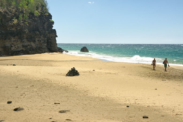
Cairn at Hanakapi'ai Beach
Rocks near the mouth of the stream at Hanakapi'ai Beach
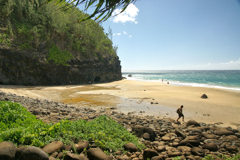
Hanakapi'ai Beach
After enjoying the beach, we packed up and returned to the stream. The kids enjoyed playing in the stream for quite a while, although we were aware that flash floods are a possibility here, so we kept a wary eye upstream.
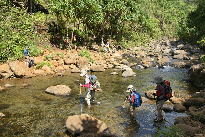
Crossing the stream
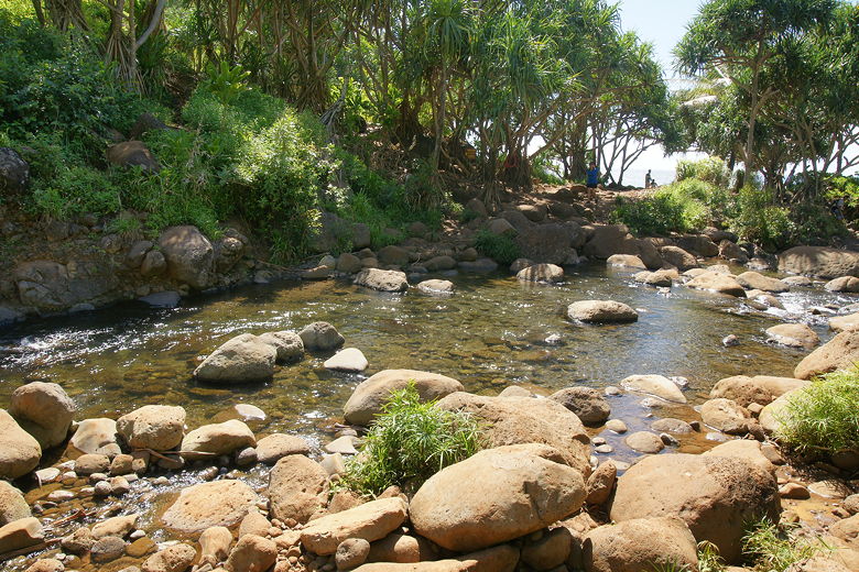
Hanakapi'ai Stream
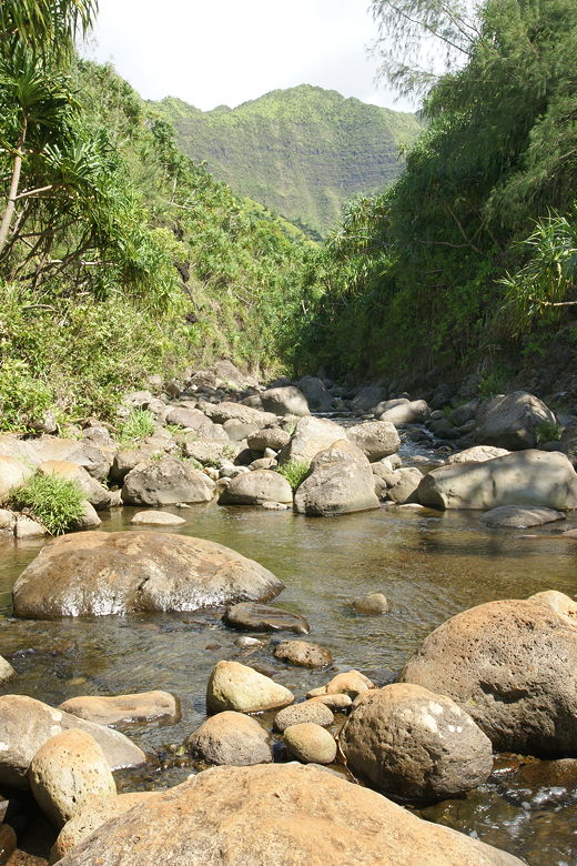
Looking upstream toward the mountains
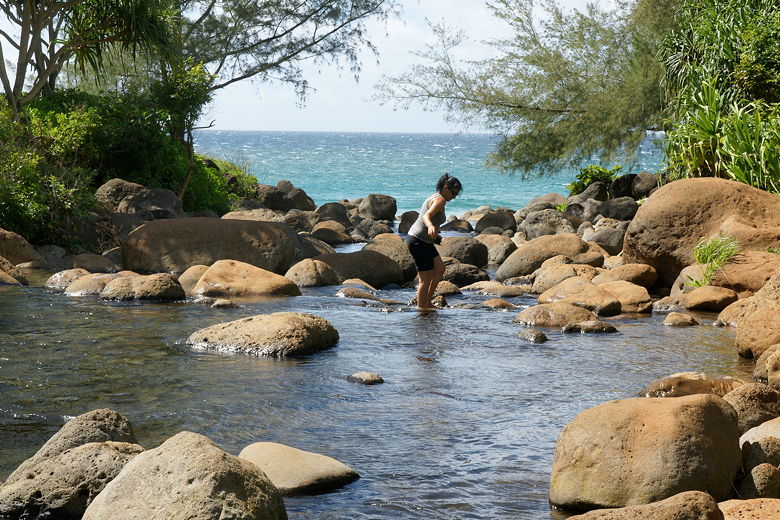
Hiker crossing Hanakapi'ai Stream, which leads straight to the ocean
After spending almost an hour and a half at the beach and stream, we started the return journey. It was
hot and humid; a little rain now would actually have been nice. We made it back in about an hour and a
half. Back at the trailhead, some guys were selling coconuts out of the back of their truck. They
would cut the top off and give you a straw to drink the coconut water. Two dollars apiece.
Not really my thing, but Jean seemed to like it.
Peeking back at Hanakapi'ai Beach
Mountains above the trail
At the trailhead, a woman asked us how difficult the trail was. She saw that our
two boys had done the trail, so I wonder if she got the impression that it was easy. I
couldn't bring myself to tell her that our boys were actually experienced hikers and
probably not indicative of most 6 and 8 year olds. In any
case, after a short break, we gathered ourselves and continued the rest of the way back
to the overflow parking lot, which was now only about half full.
| 

