|
We arrived at the parking lot around 12pm, and it was almost completely full. Or rather, all the marked spots were full and people were starting to make their own spaces. We found a spot by the curb, then prepped as sprinkles began to fall.
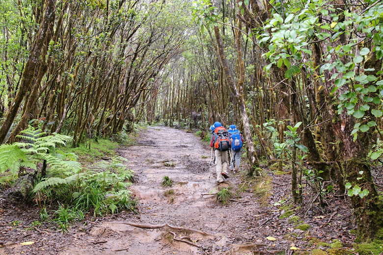
We walked up the paved path between the hand railings. Shortly, we reached a sign denoting the distances on the Pihue Trail. The sign was also next to a small use trail, but make no mistake, the main trail goes forward -- a wide muddy path.
There were no views to speak of at this point. There's an overlook here, but clouds obscured basically the entire view. We were hoping it would clear up later, so we simply started the hike. Down the muddy trail we went, which had a clay-like look and feel. Reddish, bumpy, and slick from the light rain. Small puddles formed in indentations. We were glad to have our trekking poles.
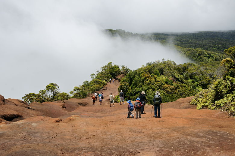
Descending at the start of the Pihea Trail
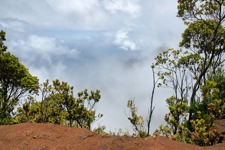
Clouds and mist obscured the view toward the coast
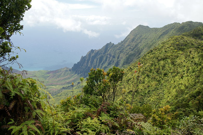
Soon, we reached a point where we could look across the forest to the right, and the clouds parted a bit in that direction to let us have a view. But clouds still mostly obscured the view toward the ocean on the left.
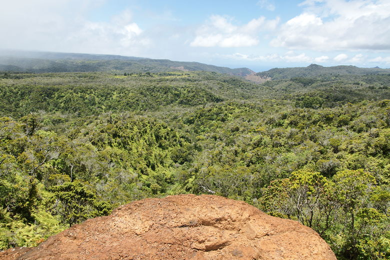
But sunny skies were visible inland
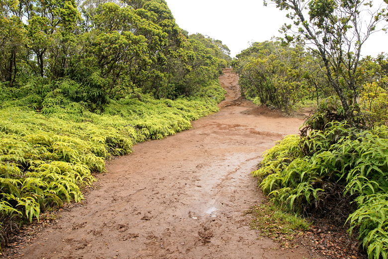
Looking back up the muddy trail
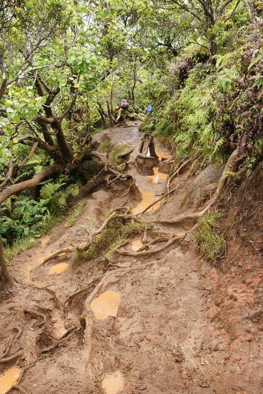
The rain started again, and we found cover under some trees. A minute or two later, the ran let up and we continued as the trail started to level off and then start to ascend. At times we hiked with a steep drop-off on the left, but it was still obscured by the clouds. After about seven tenths of a mile, the trail became much worse. Large puddles of water and mud blocked our path. We had to pick our way carefully, especially the kids, to avoid getting our feet completely engulfed in mud.
Continuing along the rain-soaked trail
Our progress slowed considerably as we inched along. Occasional boardwalks helped, but they were few and far between. My thoughts of reaching the Alakai Swamp were now disappearing. Now I was hoping to reach the lookout (at 1 mile) and hopefully see if the trail was better then. It wasn't.
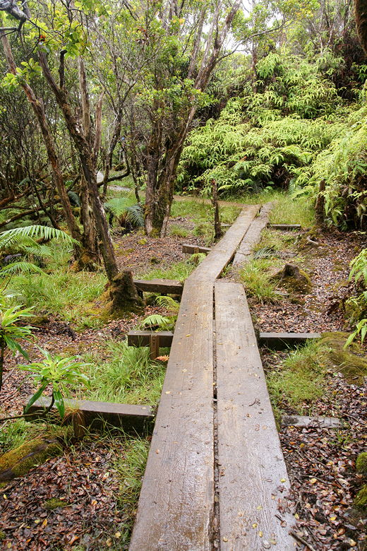
Occasional planks are few and far between on this part of the trail
In fact, the trail got much worse. At times, I hesitate to call it a trail. It was more like a
suggestion of where to go. If it wasn't for the fact that it was the only path cut through the
trees, I would not have followed it. The "trail" was now very steep, more like scrambling with hands and feet, up and over tree roots. The clayish mud formed steep steps at some points, and slick slides at others. Progress slowed to a complete crawl as we used our hands, feet, and poles to try to make progress without sliding and slipping into the mud.
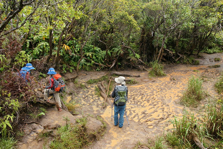
At times the mud seemed almost impassable, at least without getting really dirty
I managed to mostly make it through unscathed, but our kids were not so lucky. They were simply too small
for some of the "steps". They fell several times and got their shoes, pants, and the bottoms of their backpacks thoroughly covered in mud. Jean and I took turns reaching the top, but the boys didn't make the final push to the top.
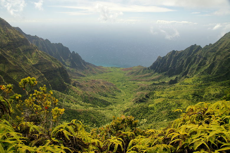
By this time, the rain had stopped, and it was starting to clear up. We could now see far below to the
northwest, mountain ridges leading out to the ocean. The dome we'd driven past earlier was clearly visible on the range to the far left. It was a beautiful sight, but it was hard to enjoy it much given what we'd been through and the fact that the kids couldn't make it up to the top. That being said, you don't actually need to make it up to the top to see most of the same views. It's possible there are nice views in the opposite direction from the top, but clouds obscured that direction when we were there.
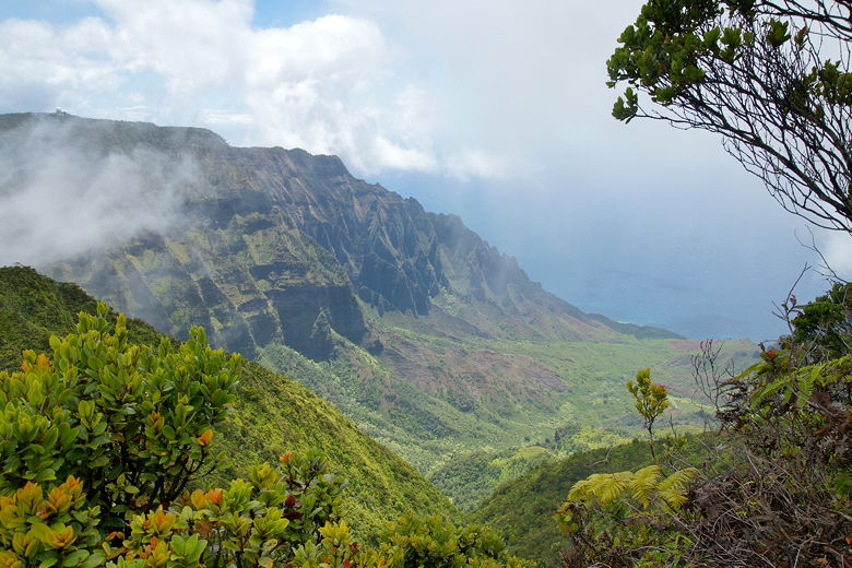
A break in the clouds provides a view of the Na Pali Coast
Mountain ridge leading down to the coast
We retreated back down to the kids, then started to head back. There was no thought of heading toward the swamp today. On the way back, we could see the dramatic views toward the ocean on our right as the clouds lifted even further. It was now strange seeing the drop-offs we sort of knew were there on the way in, but had been obscured by clouds.
The trail was even worse than this
Na Pali Coast
Since the rain had stopped and the sun was now out, the trail near the beginning of the hike had
started to dry out. It was much less slippery than before. If I had to make a suggestion, I would
say not to do this hike at all if it's raining. If it isn't raining but has been raining recently,
then hike part way -- the path is reasonable for about the first seven tenths of a mile, but after
that it becomes difficult. You'll get most of the same views you'd get by going further, anyway. Only
if it's dry would I recommend going to the top. I haven't seen the trail continuing on to the
swamp, but I've read that there are more planks on that part of the trail, which should help.
However, the fact that this is one of the wettest spots on earth (as signed at the lookout next to the parking
lot) means your chances of getting a dry trail seem remote.
| 

