|
It sprinkled lightly as we drove up Waimea Canyon Drive and Kokee Road after lunch.
As far as I know, there are two different places we could have started the hike.
We followed the directions from our book and arrived at the Pu'u Hinahina Lookout. Wild chickens roamed the lot, as they do most of the viewpoint parking lots along the road. I got out of the car and walked to the end of the lot, finding a small clearing there as mentioned in the book. There was a trail to the left, just like in the book. However, it wasn't signed at all. This made me a bit uneasy. The trail also wasn't on the map I had. All those factors combined to encourage
me to use the other trailhead. We drove about a mile further up the road to the intersection
with Halemanu Road. There, a sign was clearly visible denoting the Canyon Trail.
There were about 15 cars parked in the dirt pullouts on either side of the road here. Predictably, other cars on Kokee Road would slow down or stop in the middle of the road, wondering if they too, should stop (since other people were doing it). I'm guessing these were people looking to stop at every lookout and viewpoint. But there's nothing to see from near the road here. For that, you need to get out and hike from here.
It was still a bit cloudy, so we simply waited. A bit after 2pm, we finally got started as the skies began clearing. We carefully crossed Kokee Road, then followed the dirt Halemanu Road downhill. The road is actually open to 4WD vehicles. It's a basic dirt road, nothing particularly rocky, but it does have a few rocks in places and it's steep in places. I wouldn't risk driving our rental car on it, particularly since doing so only saves you about half a mile each way.
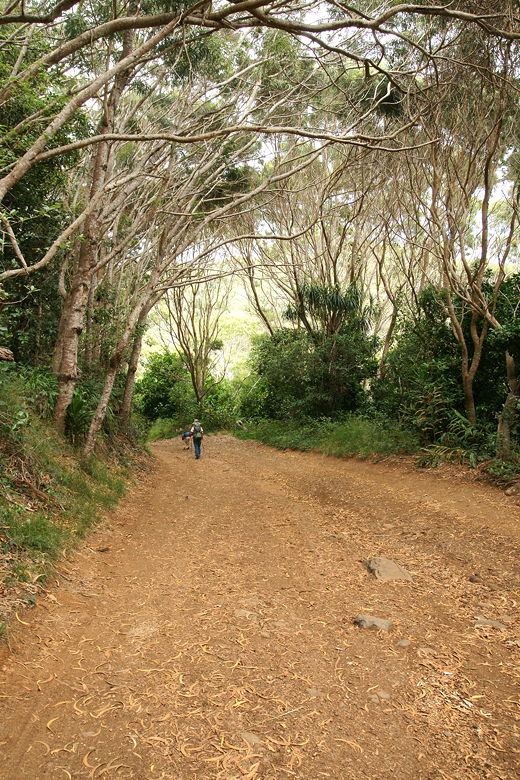
Descending the wide dirt road
The trail at the start is not much to speak of, passing through forest and past some berries and flowers of different sorts. It's downhill for a stretch, then levels off for a bit before climbing again. After 0.6 miles, it reaches the first intersection. We saw 2 cars parked here. To the left, the road continues. To the right is another unpaved road toward the Canyon Trail. You could actually drive along this road, as well, to reach a large circular parking area for the start of the actual Canyon Trail.
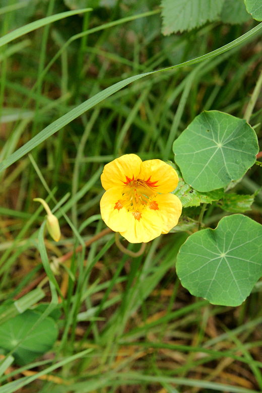
Wildflower along the trail
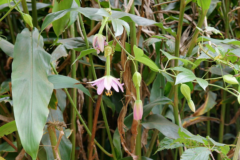
Wildflower along the trail
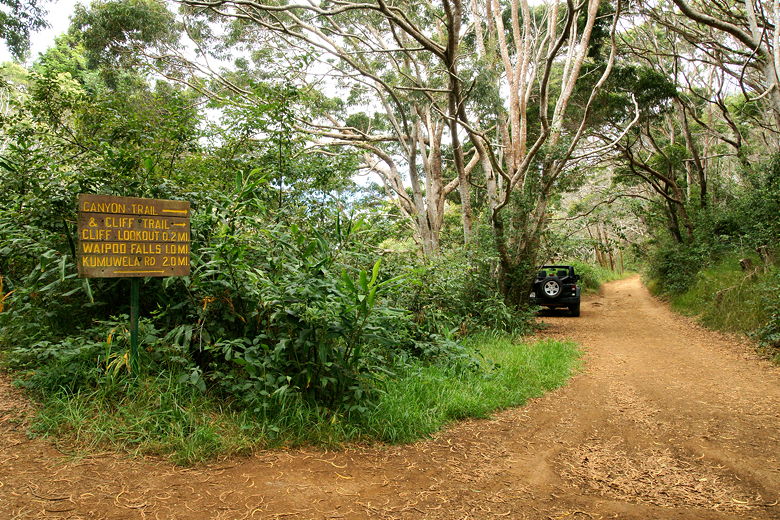
First trail intersection
As soon as we reached the start of the Canyon Trail, we could see a sign for a spur trail to the right, leading toward the Pu'u Hinahina Lookout. Presumably, that's the same trail I saw from the other end.
We started off on the Canyon Trail and immediately came to another trail intersection. To the right is a spur trail, the Cliff Trail, leading to a lookout. We decided to skip it, as the book said it wasn't any better than views we'd get on the main trail.
The Canyon Trail is now singletrack, descending steeply at times. Views to the right started to appear between and over the treetops - views of the cliffs on the other side of Waimea Canyon. Next, we reached another intersection. The Black Pipe Trail forked off to the left. Scratched on the Black Pipe sign was a note that said "FALLS ->" (to the right). After checking the map, we followed the right fork.
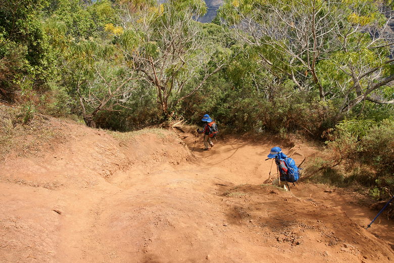
Descending near the Black Pipe Trail intersection
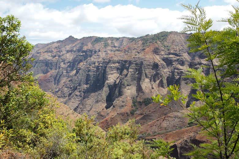
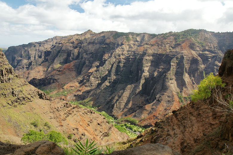
View across the canyon
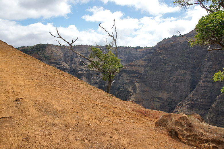
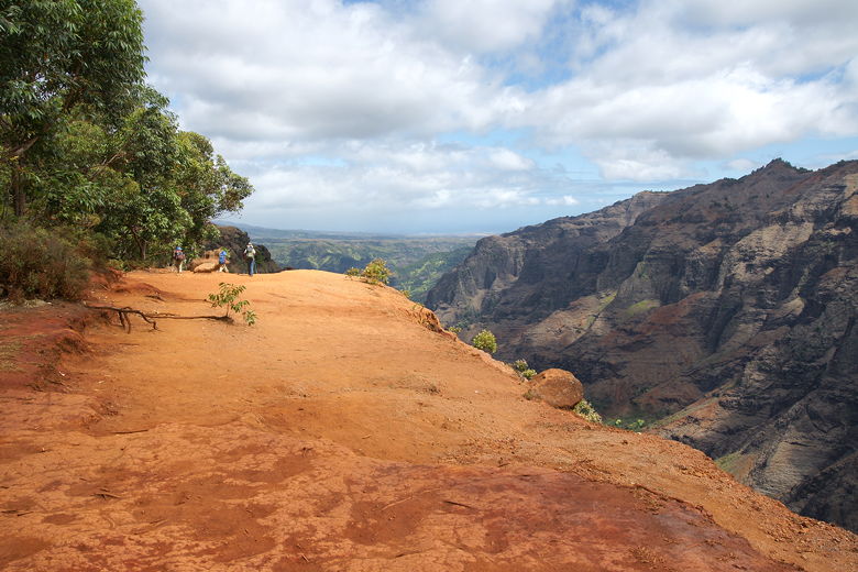
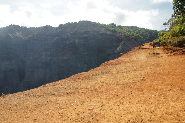
After a brief descent, the trail starts to climb, and then it climbs past the trees and out into the open. Here are astounding uninterrupted views of the cliffs on the other side of Waimea Canyon. The trail in front of you meanders across a strip of barren land about 40 feet wide, with jaw-dropping drop-offs to the right, forest on the left. To be honest, this part of the trail kind of freaked me out. I've previously admitted my fear of heights, and this activated that fear. I stayed well to the left, inching to the right only to get a few photographs.
About to head steeply uphill
This section of trail kind of freaked me out, with a steep drop-off to the right
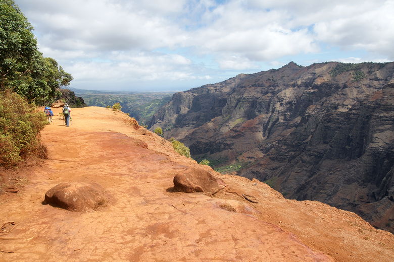
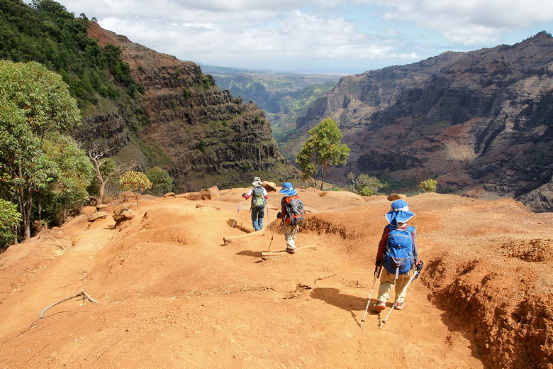
After ascending, the trail then descends, with even more views to the right and straight ahead. As I stopped to take pictures, I'll have to admit that at one point it looked like my family far in front of me was going to simply walk off the edge of a cliff, leading me to yell at them to stop (if only just for my sanity's sake).
From my perspective here, it looked for all the world like my family is walking off a cliff
Thankfully the trail simply descends steeply on the other side
After these fantastic views, the trail curls left (if it didn't, it would go over the edge), and back into the safety of the forest. Soon we could hear the sound of rushing water. As we reached a T-intersection, a departing family told us the trail to the left didn't lead anywhere, but the trail to the right led to the falls. We took it, and soon reached a rocky section above the falls.
After a bit of surveying, we decided the best path was to cross the lightly flowing stream (no need to get wet at all at this time of year - just walk on top of the wide flat rocks). Then we descended to the pool in front of the tiny falls, only about 15 feet high. I knew from the book that we were at the top of a larger fall that tumbles some 800 feet in two steps. The water flow was basically a trickle at this time, however. Still, we were standing on the edge of a very long drop. The waterfall was pretty, and the boys enjoyed playing with the pool. In front of us were tremendous views across to the nearby cliffs and across the canyon. I'd read that mountain goats sometimes are visible, but I didn't see any across the way; I did see what looked like their trails, though.
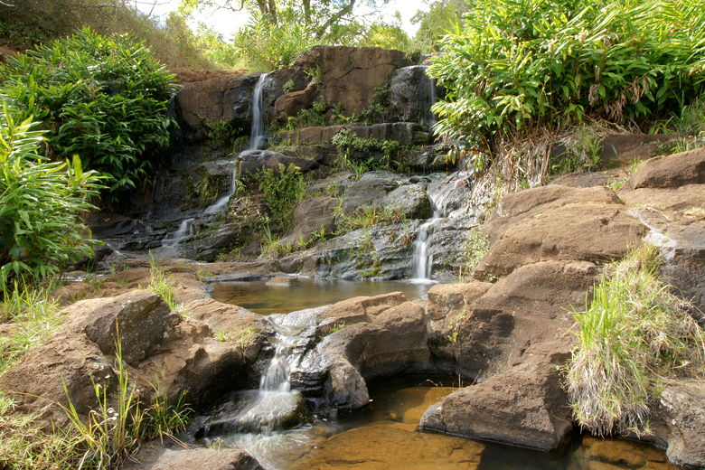
Tiny falls above Waipo'o Falls
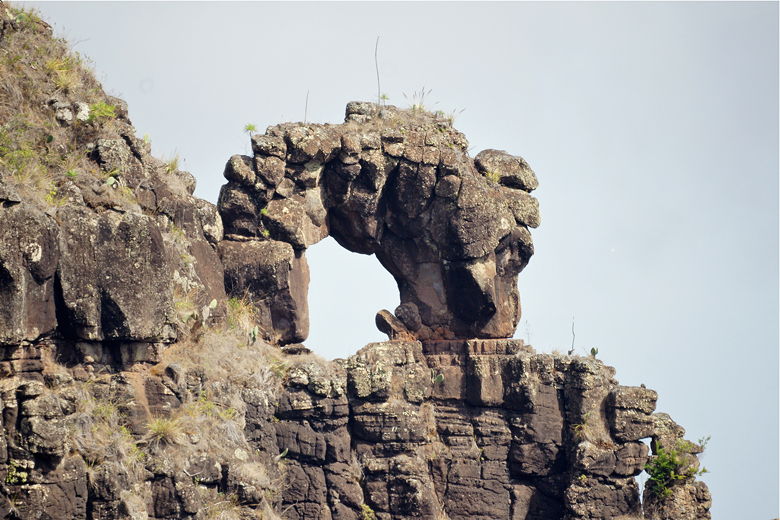
Looking across to the nearby mountainside
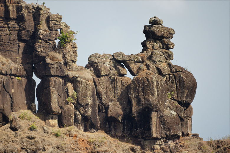
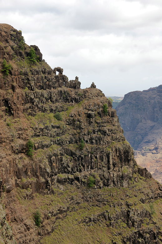
Close-up of stonehenge-like formations
I don't know if they're man-made or not, but they sure look unnatural
Looking across the canyon
More views from the top of the falls
While we were there, we could see helicopter tours pass through the canyon. Birds with long tails soared through the canyon. And we had the place to ourselves for almost an hour. Only one couple stopped by briefly. Then as we began to leave another family of 4 started descending to where we were. On the way back we ran into perhaps a dozen hikers coming in the opposite direction. One couple stood near the edge of the section that freaked me out,
as they got a stranger to take their picture. On the way back I dispensed trail info to a couple different hikers who asked.
Heading back up the trail
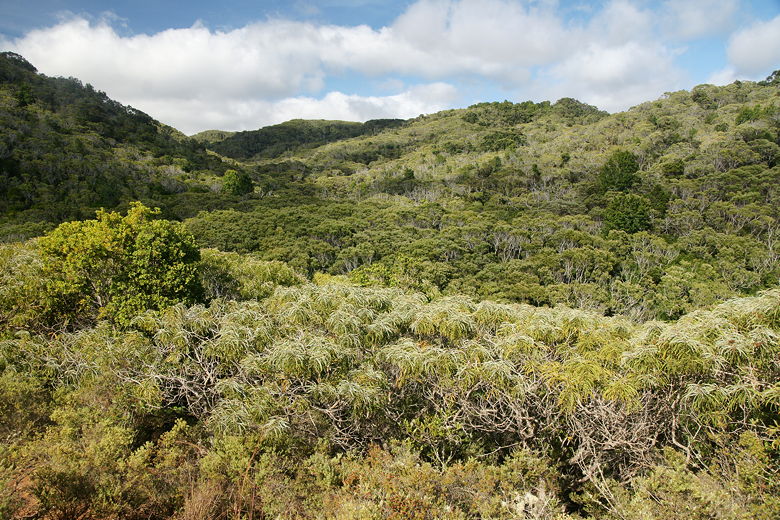
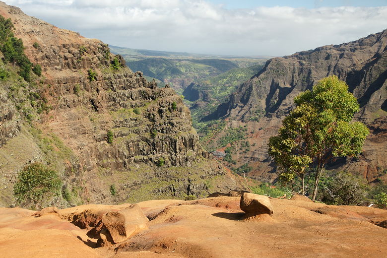
View across the forest
The trip back took about an hour. The two cars parked along the trail were gone by the time we returned. There were still a fair number of cars parked back at the start, even though it was now past 5pm. It was a bright sunny day now; I was glad we waited to do the hike in the late afternoon. If we'd done it earlier, it would have been a cloudy and probably wet hike.
| 

