|
Monday morning, it was bright and clear, so we wouldn't have to race across the Sierra
to beat oncoming rain or snow. This meant we could visit a few places in search of
fall color at our relative leisure.
After packing up, we left our rental house a bit after 10:30am. Driving north on
highway 395, our first stop was McGee Canyon. I'd forgotten the last mile of the
road is unpaved, but it's easily driven. When we reached the end of the road, we
parked and briefly checked out the area. We'd been here before for a hike, but this
time we were just looking.
There's not much to see from the trailhead. Well, there is a decent view of the mountains
to the west, but having been on the hike before, and knowing the views are better on
the trail, it didn't interest me much. There were a few spots of yellow next to the
parking lot, next to the creek, but I knew there were better spots further back along the road.
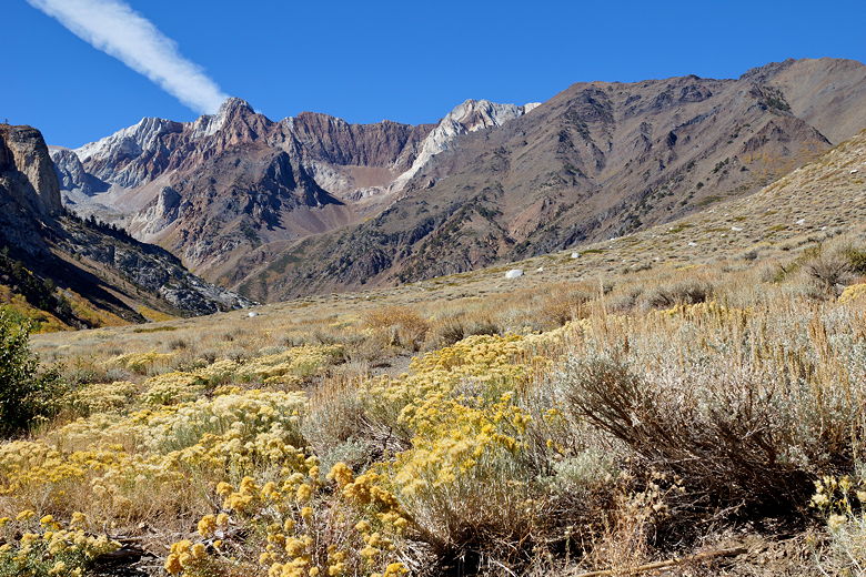
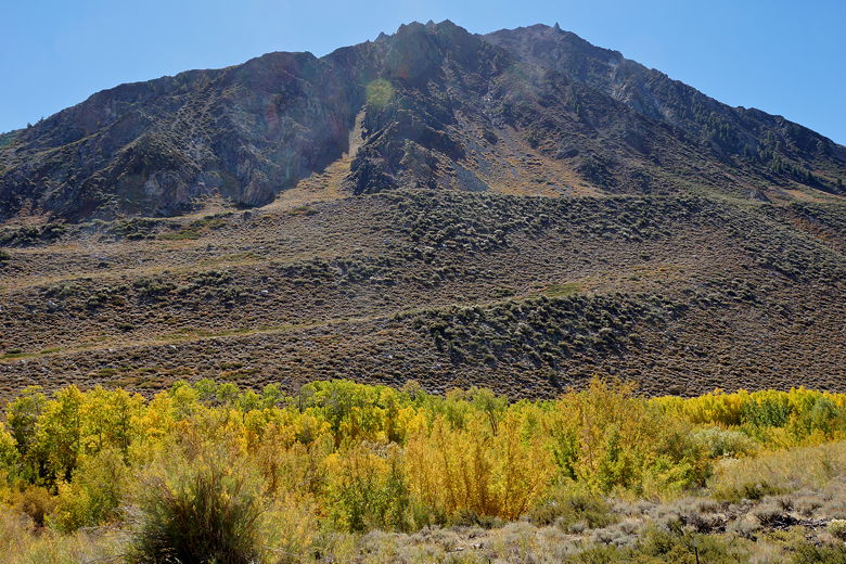
McGee Canyon
So we drove back a bit, then stopped in a gravel turnout just a bit before the road becomes
paved again. From here, there are views west to the aspens in front of the trailhead
and below the mountains. There are also nice views of the aspens to the south, next to
the creek. There's also a little path down to the creek. We took it, and enjoyed a few
nice scenes along the creek.
Mountains over McGee Creek aspens
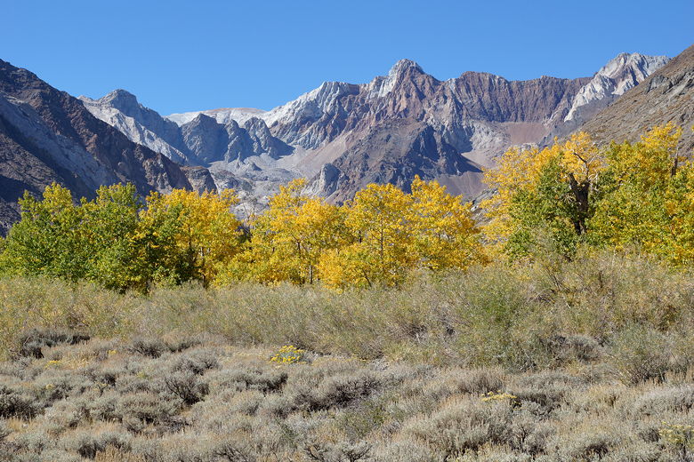
Aspens and McGee Canyon
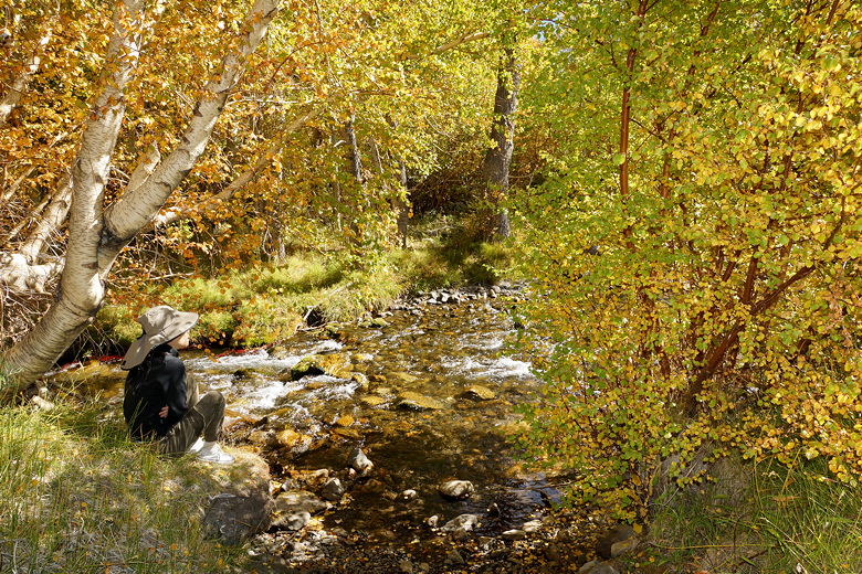
McGee Creek
Back in the car, we drove back along the road and stopped at a lookout over the valley.
From here we had nice views of Crowley Lake, but not much in the way of color. We
continued north along Highway 395, stopping at Whoa Nellie Deli for some lunch. Afterwards,
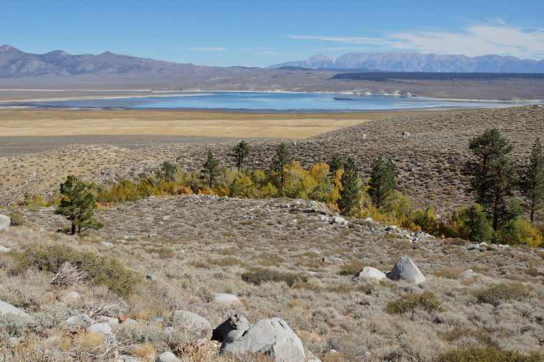
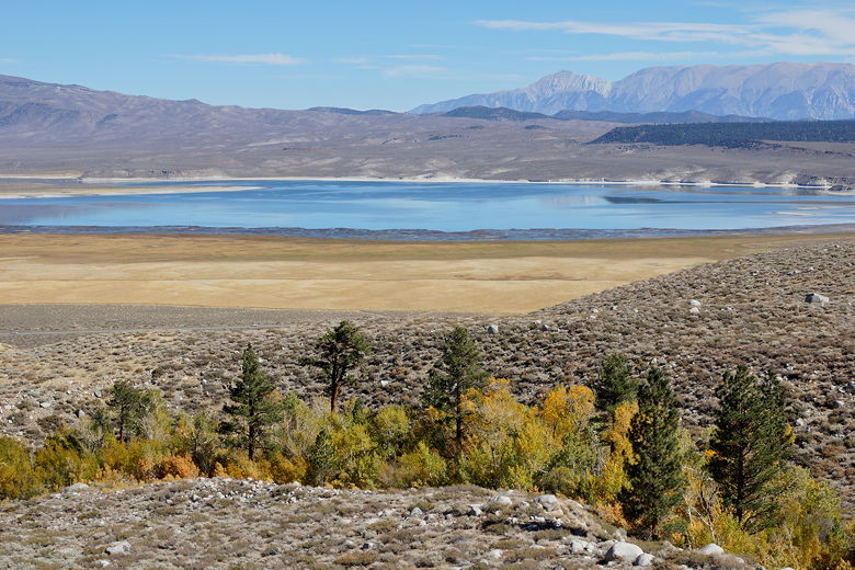
I drove up to the viewpoint at the end of the short road past the gas station. From
here there are decent views of Mono Lake, but the vantage point is not high enough for
a compelling view.
Crowley Lake
Crowley Lake
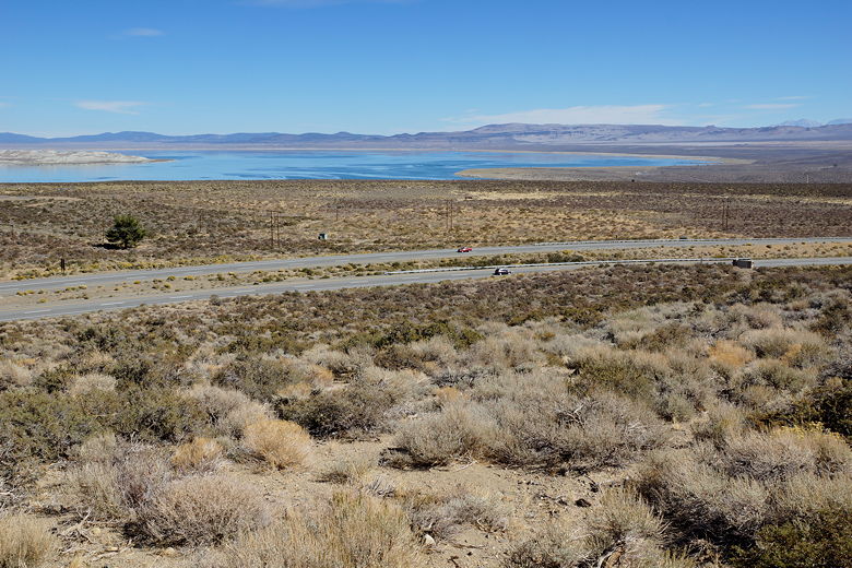
Mono Lake
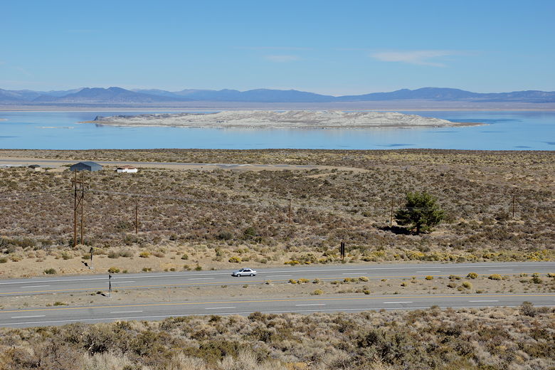
Mono Lake
Then it was back onto 395 north. I decided not to take Tioga Pass Road back home for
3 basic reasons: (1) I figured there might be a wait to get through the Yosemite entrance,
(2) I wanted to view Sonora Pass Road, and (3) I wanted to stop at Virgnia Lakes.
So we drove north a bit more before turning left toward Virginia Lakes. We followed the
easily driven paved road past some nice colorful aspen displays at Conway Summit. In
retrospect maybe I should have stopped on the way up for some pictures, since it's harder
to stop on the way down (most of the best pullouts are on the right going up). In any
case, there were yellows, oranges, and even some reds visible on the slopes to the right.
Further along the road, some trees were almost completely bare.
After about 6 miles, we reached the end of the pavement, and shortly after that the end
of the road at Virginia Lakes. We parked and spent some time at the lake, enjoying the
view and taking pictures. There were people fishing along the shores. Aspens and
bright yellow bushes dotted the shore, as well as the slopes of the mountain above
the lake. There's a trailhead here, so I should research some hikes in the area; it
looks like a nice place to start a hike.
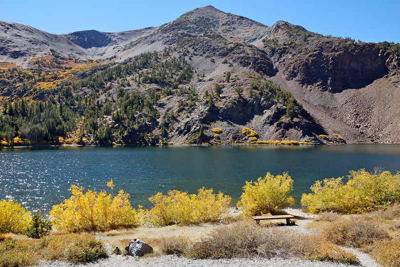
Virginia Lake
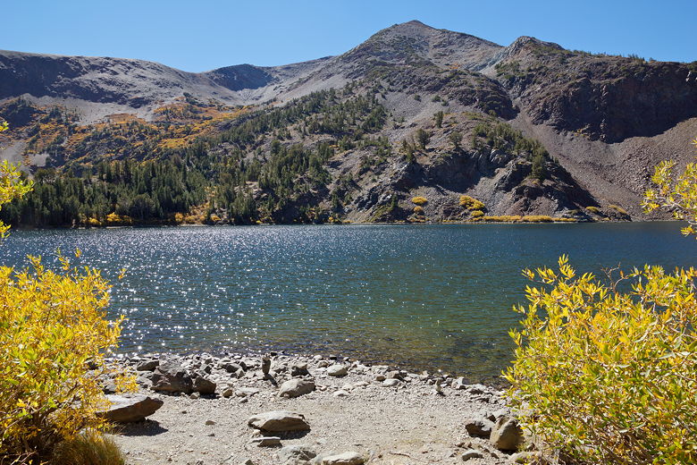
Virginia Lake
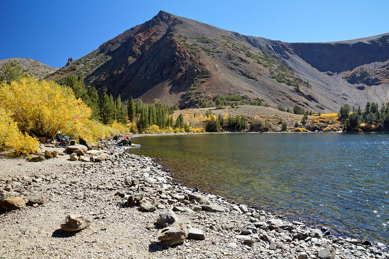
Virginia Lake
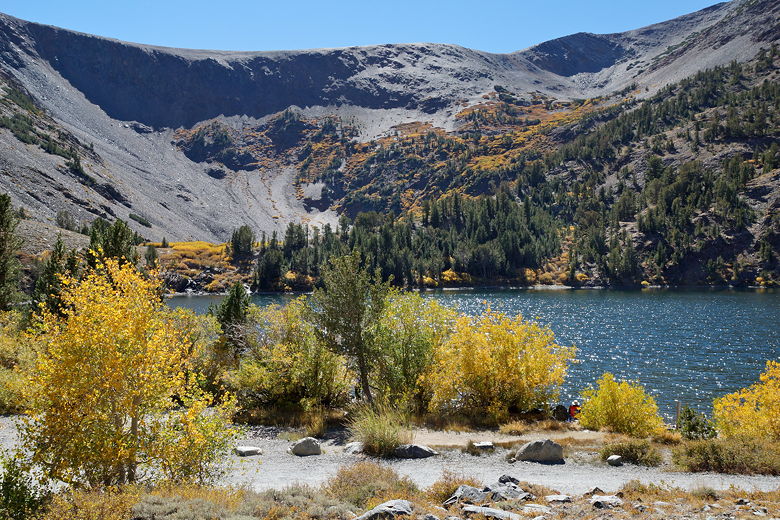
Virginia Lake
Now it was time to head back. We returned to Highway 395, then continued north.
There was a major repaving project in/near Bridgeport, which delayed us for about
10-15 minutes. Eventually we got through and turned left onto Highway 108 (Sonora
Pass Road).
We could see Marines from the Mountain Warfare Training Center out and about. Some
going on runs, some milling about near the roadside. After we passed the training
center, we started to see some color along the road. There weren't convenient places
to stop along the road, but it was a pretty drive. We continued on up and over
Sonora Pass, then started the descent.
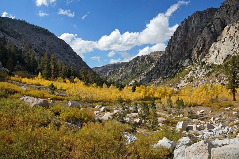
We rounded a corner and then I suddenly found myself looking at a gorgeous view of
a line of aspens in an impressive granite valley, blue sky and a few small clouds
clearly visible in the open V directly behind it. I slowed down, eyed a dirt pullout
on the left, waited for an oncoming car to pass by, and stopped on the left. If I
had been going in the opposite direction, I might not have noticed the view. Since I was
stopped there by the side of the road taking pictures, a couple other people stopped
next to me and took pictures, as well.
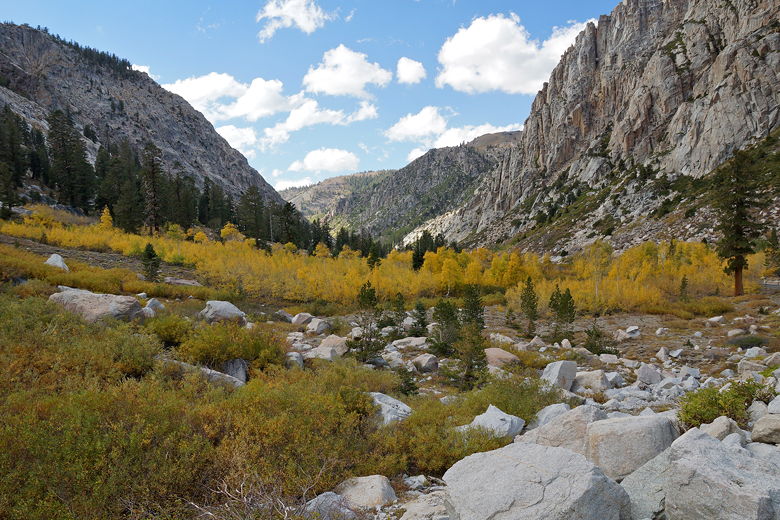
Aspens next to Sonora Pass Road
Unfortunately while I was there, passing clouds blocked the sun most of the time.
Still, it was a great view. I was just about to leave when the sun started
popping back out, setting the aspens on fire. I quickly got back out of the car
and took even more pictures.
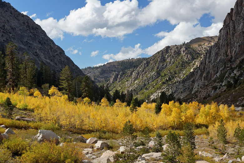
Sun lighting up aspens near Sonora Pass Road
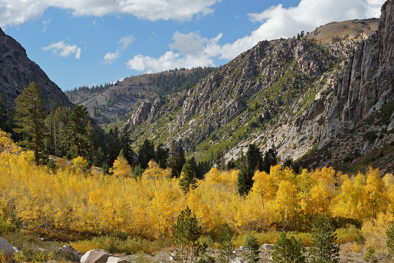
Aspens near Sonora Pass Road
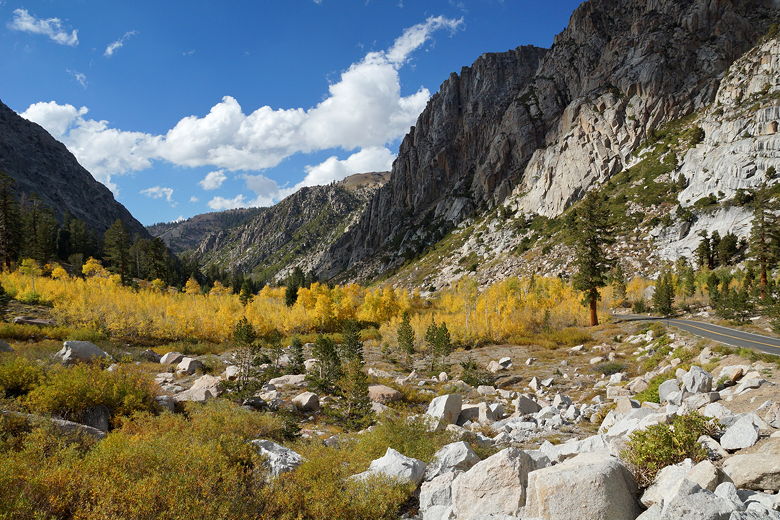
Aspens near Sonora Pass Road
Aspens near Sonora Pass Road
Finally I was done, and we continued the drive back home. We only stopped once more,
at a farm stand outside Escalon, before arriving back in the Bay Area around 6:30pm.
| 

