|
Despite the dry winter, I still couldn't bring myself to plan a spring backpacking
trip in the Sierra. I read reports of late snow and rain; in fact reports from
Desolation Wilderness reported the trails as having several inches of water. So I decided to plan a
short backpacking trip in Henry Coe State Park. Despite it being a huge and pretty
park, I had only backpacked here once before, way back in 1999. One of the main
reasons why I hadn't done more here is the brutal nature of some of the climbs -
not in distance and elevation, but in steepness.
Still, after investigating a trip to Kelly Lake from the Hunting Hollow entrance
(which I'd never used before), it seemed like a manageable trip. 7 miles in with
about 2000+ feet of climbing. So on Sunday morning we arrived at the Hunting
Hollow entrance a bit before 11am. It was overcast and cool; the fog had yet to burn off.
The nice thing about backpacking at Henry Coe is that, unless you are camping in the
western region near headquarters, there are basically no quotas. We self-registered
at the parking lot (there's no staff or facilities here). There weren't any
camping permits in the box, though there was a display explaining how to fill one
out. I scribbled the information on a sheet of paper and included it in the parking
payment envelope.
The parking lot had cars parked all the way around, but it's a huge lot and there
was still space for cars to park in the middle if need be. It seems like a popular place
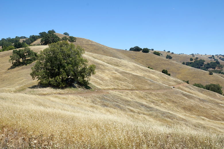
for both backpackers and mountain bikers. We started off on the trail and then
almost immediately turned left to head up the Steer Ridge Trail. And almost
immediately the steep climbing began. It is not uncommon to find grades of 15-25% in the park,
and occasionally more.
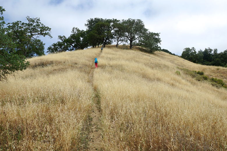
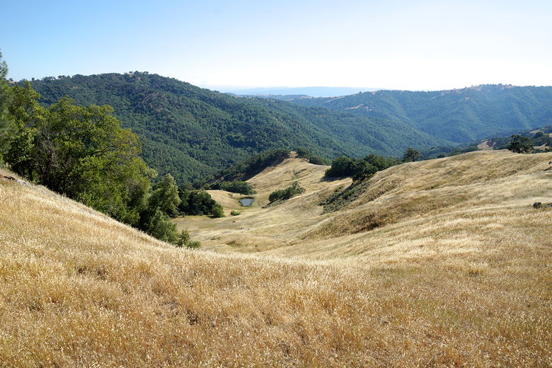
Heading up Steer Ridge Trail
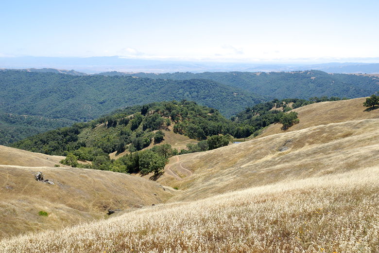
As we climbed, the fog began to melt away, and we gained views of the hills and valleys
below. Most of the grasses had turned brown by now, though there were still
splashes of green underneath trees in some areas. The climbing was mostly
relentless, gaining about 1600 feet in the first 1.8 miles. After about 1.4 miles
there is a trail intersection; the trail to the right (the Jim Donnelly Trail)
leads back to Hunting Hollow. It is a longer (3.1 miles) alternative, and looks
like it doesn't climb nearly as steeply. We stayed to the left
to stay on the Steer Ridge Trail.
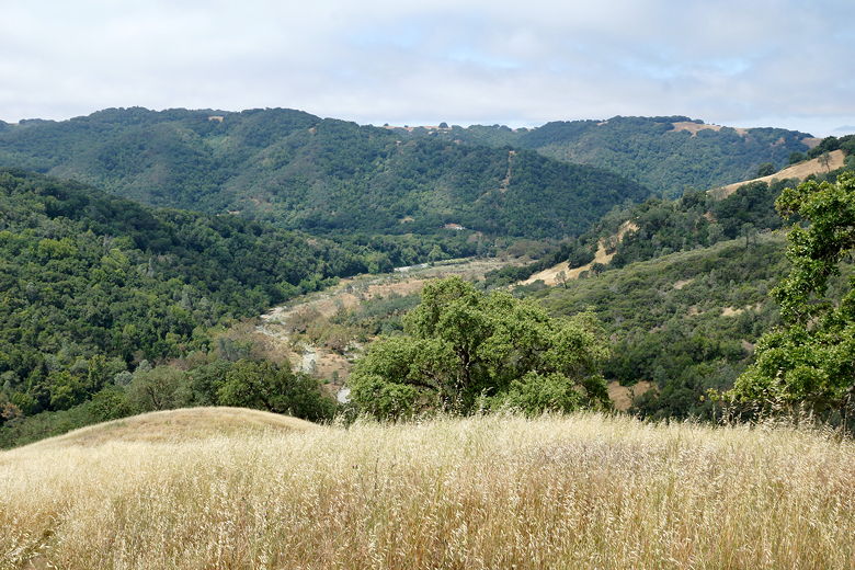
Looking back down toward the park entrance
View from the Steer Ridge Trail
View between the trees
View of the Jim Donnelly Trail
At 1.8 miles, the Spike Jones trail to the left heads toward the Coyote Creek entrance
(where there is no parking lot). We stayed to the right to stay on the Steer Ridge
Trail, which finally relents in climbing. For the next mile the trail is relatively
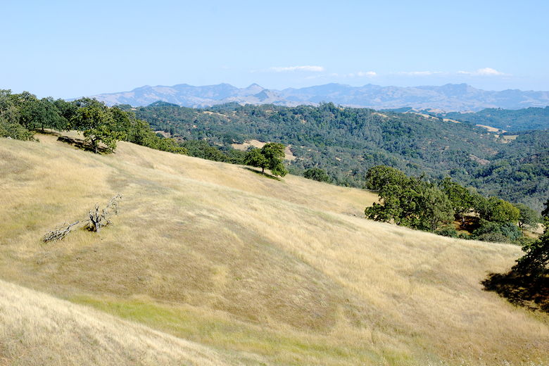
flat. We now turned left onto the Wilson Peak trail, stopping in the grasses
near Wilson Peak for a snack break.
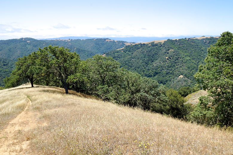
Looking back to the southwest
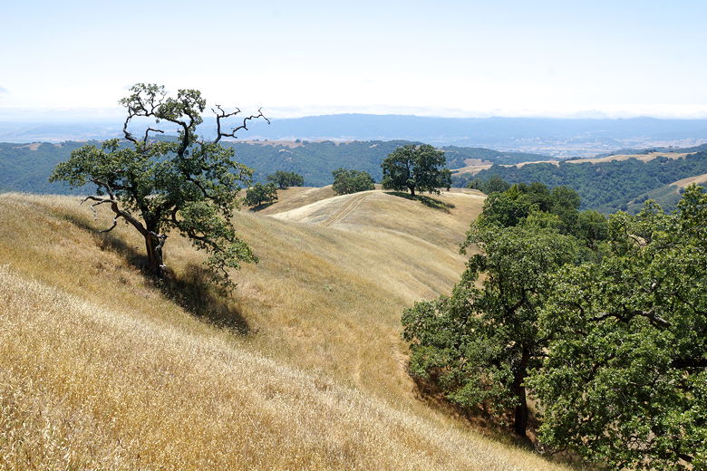
View from near Wilson Peak
After our break, we now headed downhill (fairly steeply in places) for the next mile. At
the bottom, we turned
left onto the Grizzly Gulch Trail. This trail basically parallels the (mostly dry
at this time) creek before climbing gradually away from the creek. About 5 miles
into the day's hike we turned right onto the Dexter Trail, which again climbs
steeply with no shade to speak of. As we climbed, I glimpsed two
backpackers ahead of us, just as they hiked out of sight. Those were only the
second set of hikers
we'd seen on the trail since the beginning.
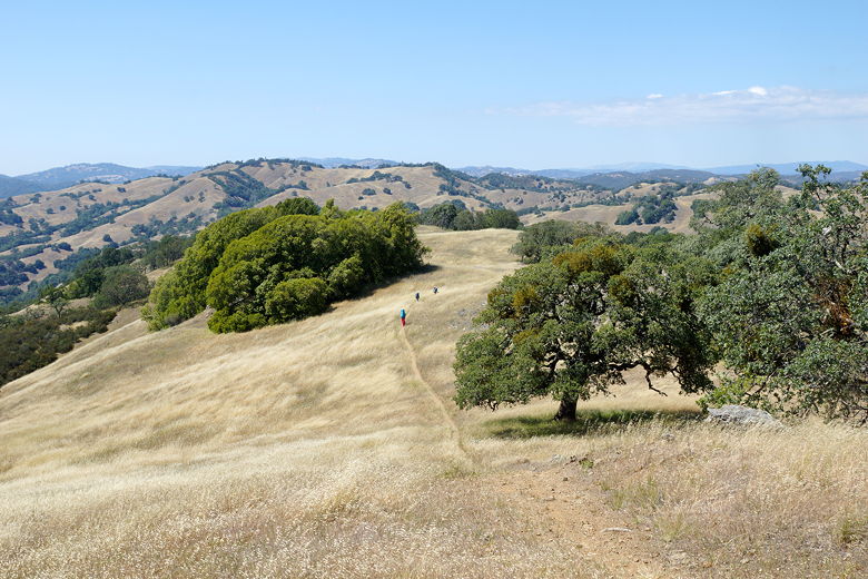
Heading down the Wilson Peak Trail
Unnamed pond
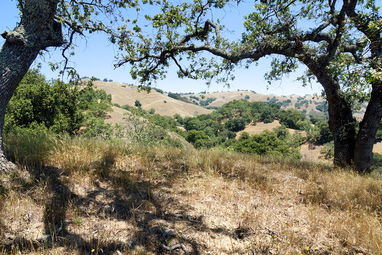
View of the mountains from the Dexter Trail
Reaching the top, we turned left onto Wasno Road (a wide dirt road), then very shortly
turned right onto the Kelly Lake Trail. The trail climbs briefly, and at the top
we hiked past a group of 6 to 8 twenty-somethings stopped next to the trail. It
seemed as if they were leaving Kelly Lake, but I'm not sure where they would be headed
since it was already close to 5pm by this time.
The trail now descends steeply down toward the lake. We finally reached the lake
at around 5:30pm. It was prettier than I expected. Black birds with orange highlights
on their wings fluttered around reeds along the edge of the lake. On the opposite
shore we could see that most of the best camp sites were already
taken. There were about a half dozen tents we could see. We made our way past
them, finding a decent flat site close to the trail; there wasn't much of a view
from here, though, so we kept looking. Eventually I found a site high above
after following a use trail close to the main camping area. The site has the
best views in the area, but does have the downside of requiring a steep hike down/up
to get water, and the site itself is not quite flat. Still, we couldn't ask
for a better view, so we settled in.
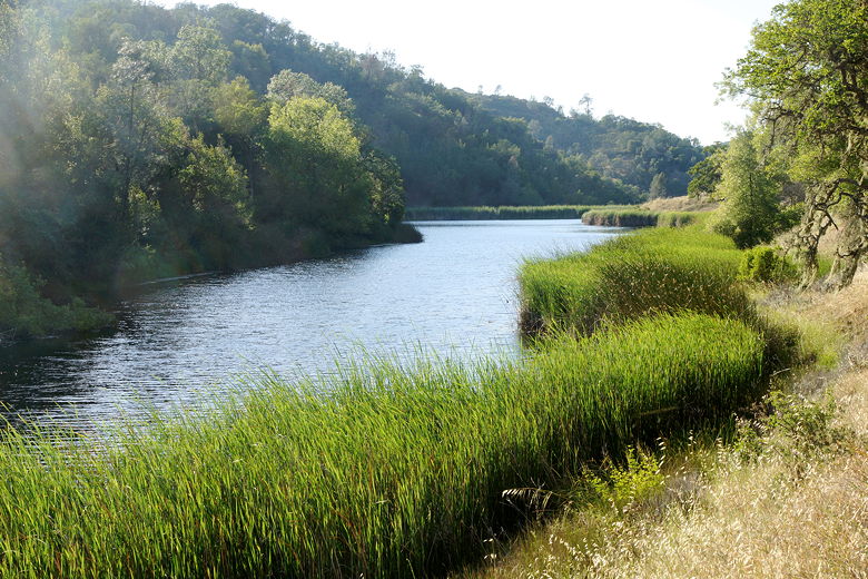
Kelly Lake
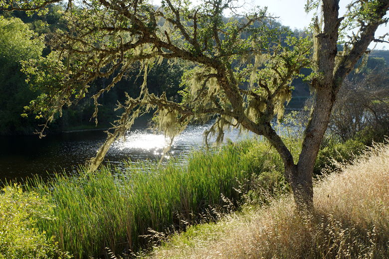
Kelly Lake
After starting to set up, I walked down and enjoyed a little walk next to the reeds
along the narrow southeastern section of the lake. I gathered some water to
filter - there's basically one spot along the shore where it's convenient to get
water (near the main camping area).
| 

