|
I can't recall exactly when I first learned of the John Muir Trail (JMT). Perhaps it was in 1997,
when my high school friend Elizabeth did the entire trail solo.
I don't think I quite understood the scope of the
trip, or had any inkling that I would one day do it myself.
When I did day hikes to Vernal Fall, Half Dome, Cathedral Lake, and Lyell Canyon in the late
90's, I'm sure I didn't even notice that I was on part of the John Muir Trail. I think it
was after a failed attempt to day hike Mount Whitney in 1999 that I began to think seriously
of hiking the John Muir Trail. I think I figured that it would ensure that we would be well
acclimatized by the time we got to Whitney. Elizabeth showed me her JMT pictures and I
remember being impressed.
We did some backpacking trips from 1998 through 2003, but then we had kids and
stopped backpacking for a while (though we still did day hikes and car camping).
Then a couple of co-workers of mine did the JMT,
perhaps planting a seed in my head. I think it
was in 2009
that the idea of doing the JMT as a family first struck. We took our kids on a short
little 3-day, 8 mile backpacking trip in the Carson-Iceberg Wilderness. The kids were
3 and 5 years old. They handled
the trip easily. It was then that I thought, hey, we can do this! I mapped out a
5-year plan to add days and mileage each year, culminating in doing the JMT in 2014.
And so the next year we went for 4 days and 19 miles. Then 5 days and 32 miles in 2011.
Then 6 days and 47 miles in 2012, followed by 7 days and 58 miles on the North Lake to
South Lake trip (including parts of the JMT) in 2013.
It didn't *quite* turn out according to plan, as we decided that either the kids or
my wife and I weren't
ready to do the JMT last year. So instead we did an 8-day, 76 mile trip last year.
In reality, though, the kids were actually ready last year; when we were done with that
trip the kids were fresh and full of energy; it was us the parents who knew we had
some work to do.
And so it began... In January, I started a month of faxing in permit
applications (yes, you can only apply for a JMT permit by sending in a fax). Since
the line was often unresponsive or busy, I probably attempted over 100 faxes. I don't
understand why they use this archaic, inefficient system, but
we all had to live with it. Hopefully by the time you read this, they'll have
changed the system.
In any case, day after day I received rejections, saying quotas for the day had
already been filled. Ideally, our hike would start at Happy Isles, the traditional
start for southbound (SOBO) JMT hikers, and camp at Little Yosemite Valley the
first night. I'd be open to other close choices, though. Finally, one day I
got the confirmation email that our application for starting at Glacier Point (and
camping at Illilouette Creek) had been accepted. I had to read it a few times
before I realized it had been accepted. This was in late January. We now had less
than 6 months to get everything ready. I had a sense of nervous excitement.
[Note: on February 2nd, they changed the permit process so that (among other things)
you can no longer get permits to
start the JMT from Glacier Point and camp at Illilouette Creek the first night, and there is a
quota for the number of hikers
exiting Yosemite over Donohue Pass.]
I continued to try to get permits starting from Happy Isles, but to no avail, so
we were stuck with our Glacier Point starting point. Still, this was nothing
to be sneezed at. Many hikers didn't even get that and had to start at later points,
such as Tuolumne Meadows or even outside Yosemite. So we were fortunate in that
respect. The JMT has encountered a surge in popularity, even before
such media
exposure as the "Mile... Mile & a Half" documentary, or peripherally
the "Wild"
movie. Yosemite reported less than 500 JMT hikers in 1998, rising steadily to
nearly 3500 hikers in 2014.
Permit in hand, we now had to start training.
With work, school, and youth sports, it was hard to get in training together as a
family. We did manage a few day hikes and a short backpacking trip to Henry Coe.
Unfortunately after a series of day hikes in late April, I developed numbness in my
right foot that I eventually discovered was caused by a ganglion cyst I've had for
years. Apparently it was pressing on a nerve. With less than 3 months to go until
the JMT, this made me nervous. I hoped it would get better on its own, but it didn't.
Eventually I had the cyst aspirated in June and crossed my fingers. Thankfully, that
helped and it didn't cause me any problems during the JMT.
In the meantime, I gathered maps, books, and used online resources to plan. I
created a day-by-day itinerary with planned campsites. I calculated all the calories
we'd need for each resupply, and mailed them out weeks in advance. We made a list of
everything we'd carry in our packs and how much they would weigh. We also had to
figure out a resupply near Onion Valley, and transportation from Whitney Portal
back to Glacier Point.
The planning can get a little overwhelming at times. We put everything in place
that we could think of, and then seemingly very suddenly,
our journey was about to start!
Our permit entry date was July 16th.
We started off our adventure on Monday, July 13th, driving from the Bay Area in the afternoon.
Leaving at 2pm, we arrived in Oakhurst at 5:30pm, bought some groceries and then headed
into Yosemite, where we stayed in a nice cabin in Wawona. We'd stay there for 3
nights before starting our JMT hike.
On the way to our cabin I noticed a sign for a wilderness permit office, so I was
glad to know we wouldn't have to drive into the valley to get our permit.
On Tuesday, the 14th, we went to the permit office in Wawona. Unfortunately the
ranger told us we couldn't get our permit yet; we had to wait until the day before.
I suspected this might be the case, but wasn't sure. No problem; we'd come back
tomorrow. In the meantime, we headed down into Yosemite Valley to do a day hike
from the Happy Isles trailhead (the traditional start of the JMT)
along the JMT up to Nevada Fall, which was just past the point where we'd join the JMT on Day 2
of our hike. This way, we'd see the whole John Muir Trail.
After the hike, we got stuck in a Yosemite Valley traffic jam, stuck motionless for about
25 minutes until we could escape back to Wawona. We stopped in the Wawona store (which
is thankfully open until 8pm) for some supplies before dinner.
On Wednesday, the 15th, we returned to the permit office. The ranger giving us our
permit warned us of an active bear at the Evelyn Lake junction, where we were planning
to camp on night 4. She said our kids (ages 9 and 11) were the youngest she'd seen for JMT permits.
She proceeded to give us 4 WAG bags, which we'd need in the Whitney zone. I was confused,
since I knew we could pick them up at the Crabtree junction before heading to Guitar Lake.
I had no intention of lugging those 4 bags for over 200 miles before needing them.
I checked the JMT Facebook group just to make sure this was the case; on verification I'd
ditch the bags that night. I suppose they prefer you bring them from the start so that
they don't have to helicopter in more bags, but I couldn't bring myself to carry the extra
weight (264 grams) for over 200 miles before using them.
Unfortunately the ranger also told us that we couldn't pick up our Tuolumne Meadows
resupply on Sunday, since the post office is closed on Sundays. She even called the
post office to confirm this. Again, I was confused, since I had read that people
had done this before and it was fine (we'd just need to ask the store). However,
she scared us into thinking we had 2 options: drive to Tuolumne Meadows today and
get our resupply and put it in an accessible bear box near there, or arrive on Saturday
or Monday. None of that sounded appealing, but we didn't really have any set plans
today so we decided to drive to Tuolumne Meadows.
Two hours later, we arrived at the Tuolumne Meadows post office. The two guys working
there were really friendly. They assured us that we'd be able to get our resupply
on Sunday. They just told us that Ron (from the store) would have to get it, at
1pm, 3pm, or 5pm, and we should just arrive a little before that and ask for it.
They even told us our buckets were stored up above, so we could tell Ron where to find
them.
Relieved, we went next door to get some soft serve and then took this opportunity to
do a little acclimatization. Wawona (similar to Yosemite Valley) is only at about
4000 feet elevation, while Glacier Point (where we would start the hike) is at
about 7200 feet elevation. Tuolumne Meadows, on the other hand, sits at about 8600
feet elevation and I could tell it was affecting me.
We made the very short drive over to the Lembert Dome parking lot, where we just
walked around, walking up the face of Lembert Dome for a little bit (Jean and I had
hiked to the top before using the trail, but didn't want to go that far this time).
After having our little bit of fun, we made the long drive back to Wawona, where we
ate dinner at the Wawona Hotel, our last real dinner before our trip. Then it was
back to the cabin for some final gear prep. One of my final decisions was to
bring the Wenk JMT book, but not before ripping out pages that I wouldn't be using
to save weight.
It's an awful feeling tearing pages out of a perfectly good book, but it had to be
done. I'll have to buy a new copy later.
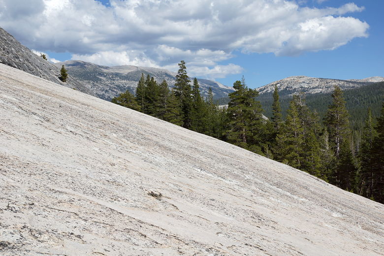
View to the east from Lembert Dome
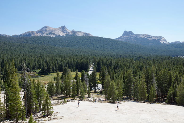
View to the southwest from Lembert Dome (with Cathedral Peak on the right)
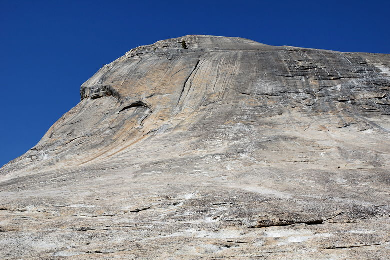
Lembert Dome
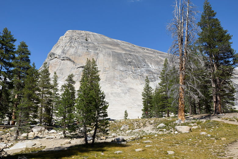
Lembert Dome
Click here if you'd like to see what we brought on our trip (including resupply food).
|


