|
Our trip would begin at Glacier Point since I hadn't been able to get a permit
starting at Happy Isles.
I had read that there would be a mandatory shuttle service to Glacier Point
(wilderness permit holders would be exempt). However, at the time we drove along
Glacier Point Road this morning, the shuttles hadn't started yet. The parking
lot for Taft Point/Sentinel Dome was full, but there was still plenty of parking
at the Glacier Point lot when we arrived at 11am. By noon, though, the lot was
full.
I had the bright idea of parking near the far outhouse, thinking it might mask
any food smells from the car (deterring any bears). Of course we still put any
scented items in the bear boxes nearby, in a bag marked with our intended return
date. Of course the smells from the outhouse made it bothersome while we prepped
(oddly, it didn't smell at all *inside* the outhouse).
I noticed the car next to us had a form on the dash saying they were
parking overnight. The ranger hadn't given me anything like that, and I noticed
other cars without it (and I know they were backpacking), so I wasn't too worried.
Plus, I didn't really want to put a target on my dash telling people I wouldn't be
there anytime soon.
After prepping and eating, we got underway around 12:15pm. We walked over to
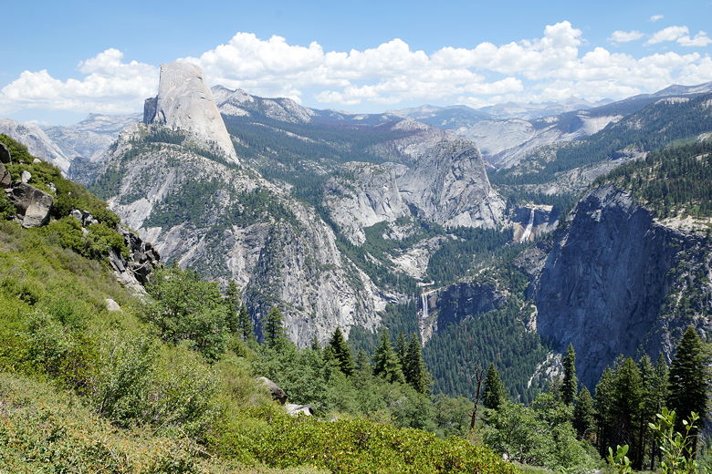
the Glacier Point viewing area, where it was very crowded with tourists milling
about. Half Dome stared us in the face, as well as Nevada Fall.
It was a great view as always, but we were here to hike. So off to the
right we found the trailhead for the Panorama Trail. And off we went!
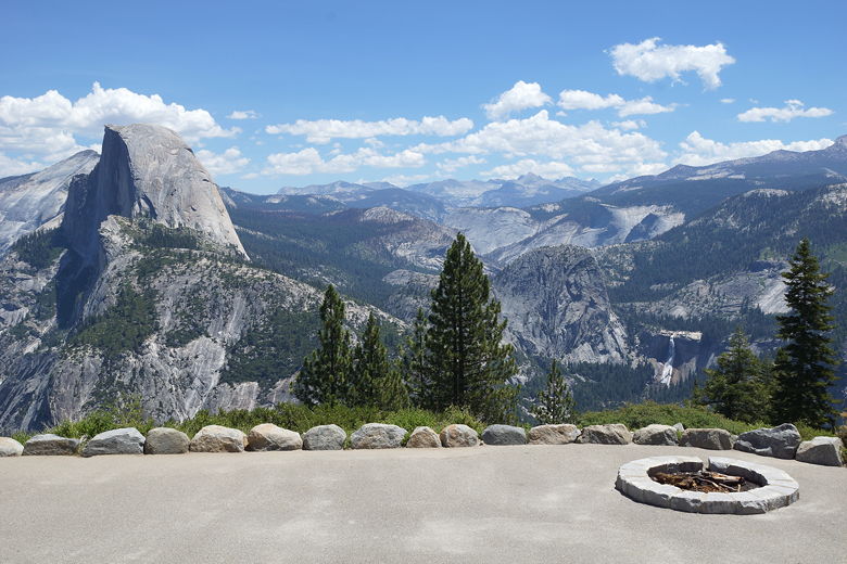
Half Dome and Nevada Fall from Glacier Point
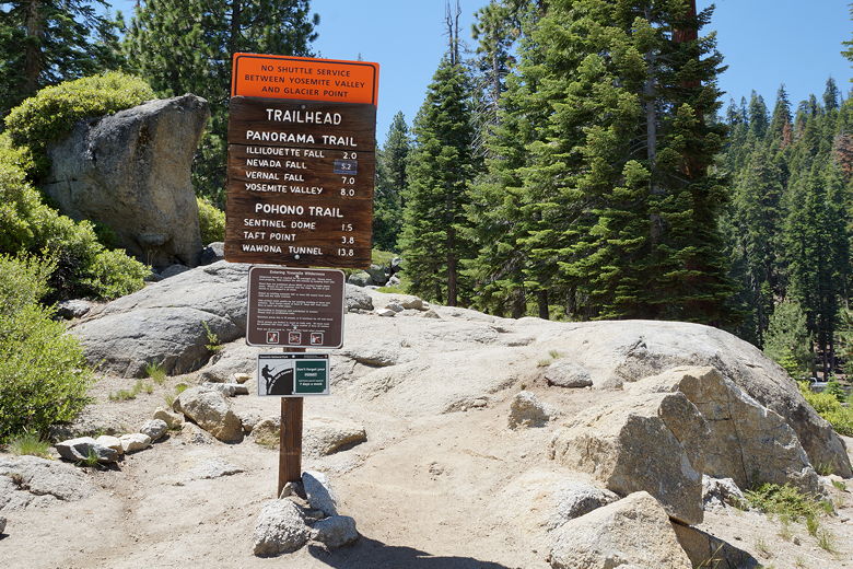
Panorama Trailhead
The trail climbs very briefly, then starts a long, mostly gradual descent, mostly
southward.
It's mostly unshaded, and it was a warm day. I had looked at the forecast before
I left and it had called for mostly clear the first 3 days, then a chance of rain
starting on Sunday.
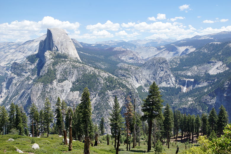
Half Dome and Nevada Fall from the Panorama Trail
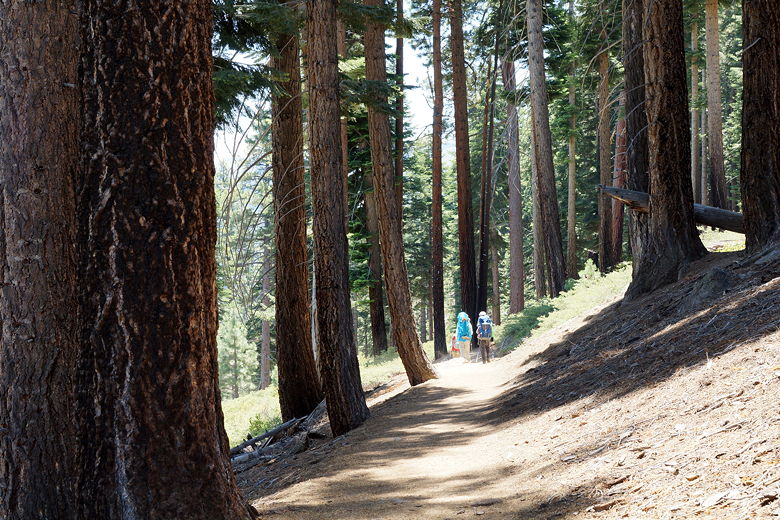
Descending through the forest
The trail was not very crowded at all, especially by Yosemite standards. We
only saw a handful of other people on the trail, and I don't know if we saw any
other backpackers. After about 2 miles we passed a trail intersection, staying
straight (the trail to the left heads to Illilouette Falls). After this intersection,
we didn't see anyone else on the trail at all.
Half Dome, Vernal Fall, and Nevada Fall
The trail then roughly parallels Illilouette Creek, high above the creek. Eventually
the trail crosses the creek (an easy rock hop for us), then starts to climb through
a previously burned area. This was a bit brutal, as we were still getting used to
our pack weight and it was now a hot afternoon. Thankfully, the climbing portion was
very brief (about 300 feet).
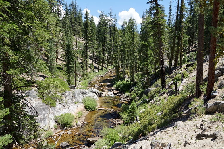
Illilouette Creek
The trail crosses the creek again, where there's an intersection. We took the left
fork and came to the creek again. There were some empty campsites nearby (I don't
think anyone was camping nearby at this time), but we
decided we would cross the creek and camp on the other side. After crossing the creek
we couldn't find any decent sites on the other side, so we continued
on the trail up to the ridge. Here, we paused at another intersection.
According to my GPS, if we continued along the trail, we'd reach another creek, so
we could probably camp ahead. It didn't look far, so we forged ahead. About five
minutes later, we changed our minds. Ahead of us we could see the creek bed lay in
a burned area, with hardly any trees and not much apparent water. It didn't look
like there were any viable campsites.
We turned around and returned to the intersection to look for sites. I noticed
what looked like a large flat area slightly downhill to the west. I didn't know
how close it was to the water, but it looked promising. We eventually found that it
was a great site not that far from the water (which was just down the hill).
In fact, we were very pleased with the site and the kids had a great time playing
in the creek (which was easy to walk into and play in). We also arrived in camp
at 3:30pm, giving us plenty of time to enjoy it.
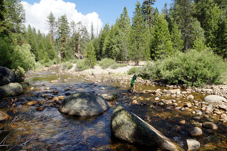
Playing in Illilouette Creek near our campsite
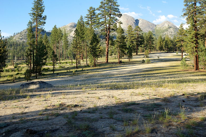
View to the east from our campsite
We thought we would have the entire place to ourselves, but then around 6:30pm a
group of hikers showed up on the other side of the creek. They stayed a bit, then
we saw them hike past the intersection toward the burned area. I said out
loud, "what are the chances they turn around?" Five minutes later, they had backtracked
just like us, and ended up camping next to us. There was plenty of room, though.
After dinner we saw two bucks roam around near our camp - the first two of perhaps
two dozen deer we'd see on our trip. Despite the late company, I thought this was
a great start to our JMT trip. I thought it might have been our only opportunity to
camp alone (I'd heard that many JMT camp sites were crowded), but that was not to be
the case. In fact, we'd be very alone on the very next night...
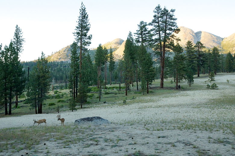
Two deer near our campsite
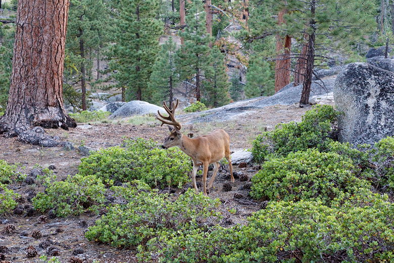
Deer at our campsite
| 

