|
We were now almost back on schedule. After viewing some peaceful lake
reflections in the morning, we were a little delayed in getting started
in the morning. Eventually we did get going, but not until 9:50am,
which would be our latest start on the trip.
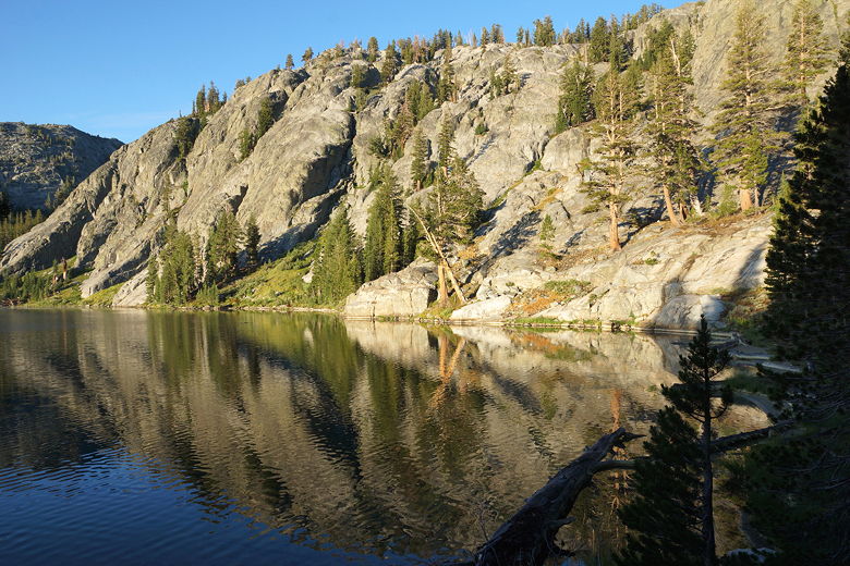
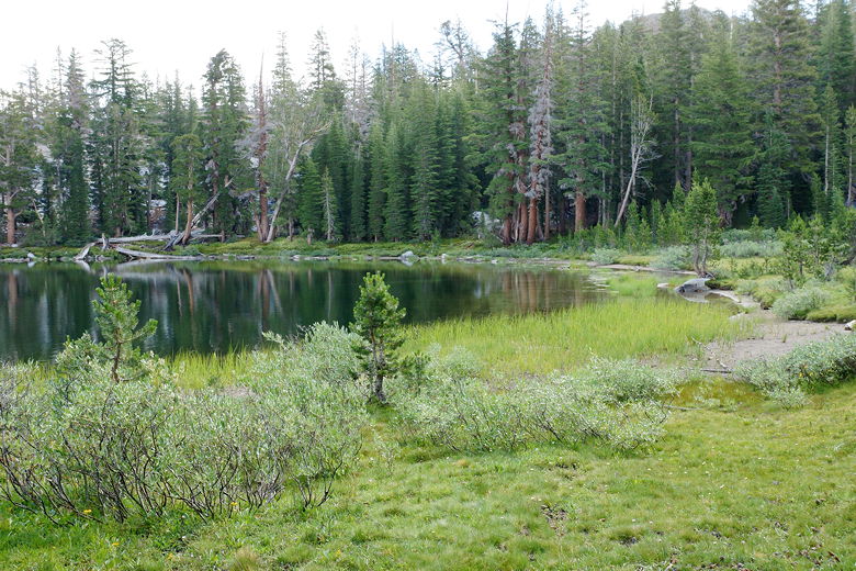
Rosalie Lake reflections
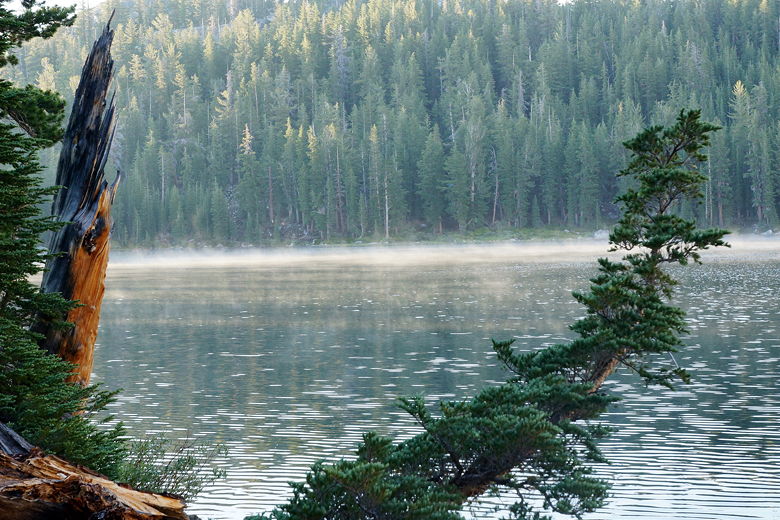
Morning fog on Rosalie Lake
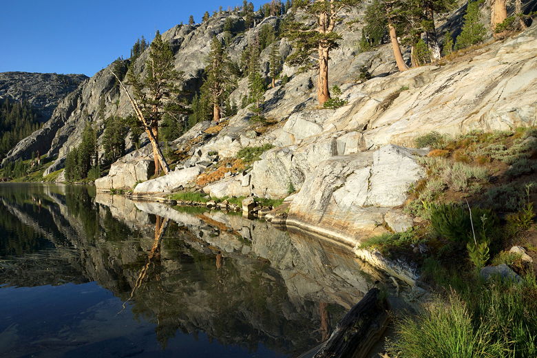
Rosalie Lake reflections
Rosalie Lake reflections
We left camp and then followed the trail along the northern and
eastern shores of Rosalie Lake. After crossing the outlet stream
and getting sidetracked into some empty campsites, we continued
along the trail as it climbed about 250 feet to Gladys Lake.
This lake was our original camping goal for the previous day,
but it's much smaller than Rosalie Lake and doesn't appear to have as
much camping available. So we were glad we had camped at Rosalie.
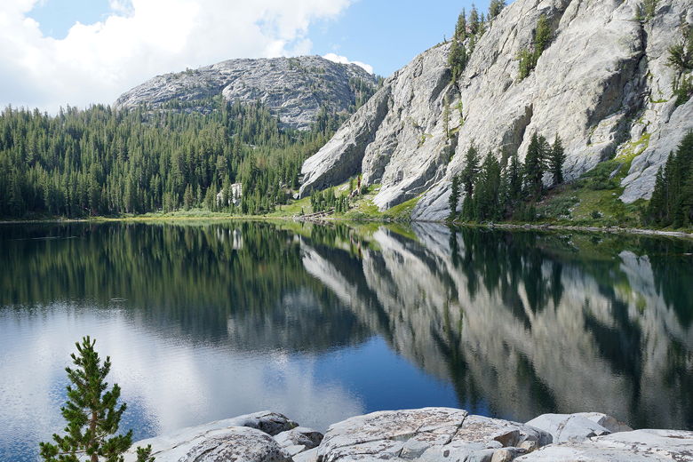
Gladys Lake
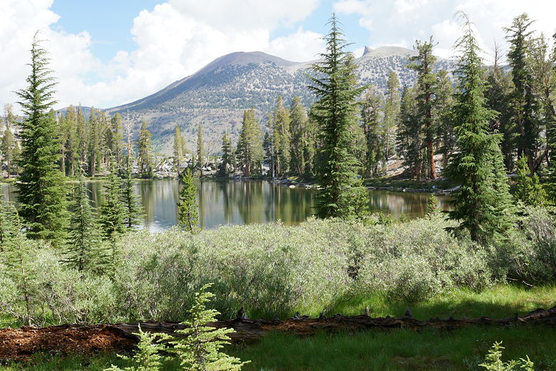
Gladys Lake
Today was mostly clear and we hoped that the rain would finally let
up today. After climbing about 100 feet out of the Gladys Lake basin,
it was all downhill for a long time - 2200 feet of downhill, in fact.
Along the way we stopped at one of the small Trinity Lakes for a food
break. From there, the descent was long but pretty easy, without
too much in the way of views (it was forested pretty much the whole way).
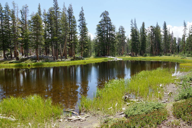
One of the Trinity Lakes
After about 1500 feet of descent (from Gladys Lake), we reached
Johnston Meadow, then turned left at the intersection. Here the
trail levels off for about 0.7 miles, crossing a creek before
reaching another intersection and resuming a steep descent.
Around this time the trail breaks out of the forest, providing
views of Mammoth Mountain to the east. I had heard that if you can see
Mammoth Mountain, you can probably get cell phone reception.
Wanting to check the weather, I turned on my phone and indeed got signal.
Chance of rain today, but clearing starting tomorrow (and clear for
the next several days). I also
sent a message to let our resupply friends know we were on schedule.
Mammoth Mountain (back)
At the next intersection we ran into a group of hikers who advised
us that if we wanted to go to Reds Meadow Resort, we should
probably get off the JMT and take the left fork. My oldest son really
wanted a cheeseburger, and we could use some other lunch food, so
we decided we would visit the resort even though we didn't have
a resupply there.
Turning left also meant that we'd get a good view of Devils Postpile.
We had visited the park years ago, doing a day hike past the top of
the postpile and visiting Rainbow Falls. This was the first time
we'd see the bottom of the postpile, though. It's an impressive
sight.
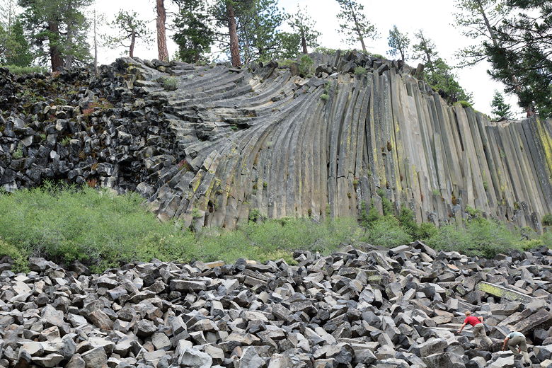
Devils Postpile
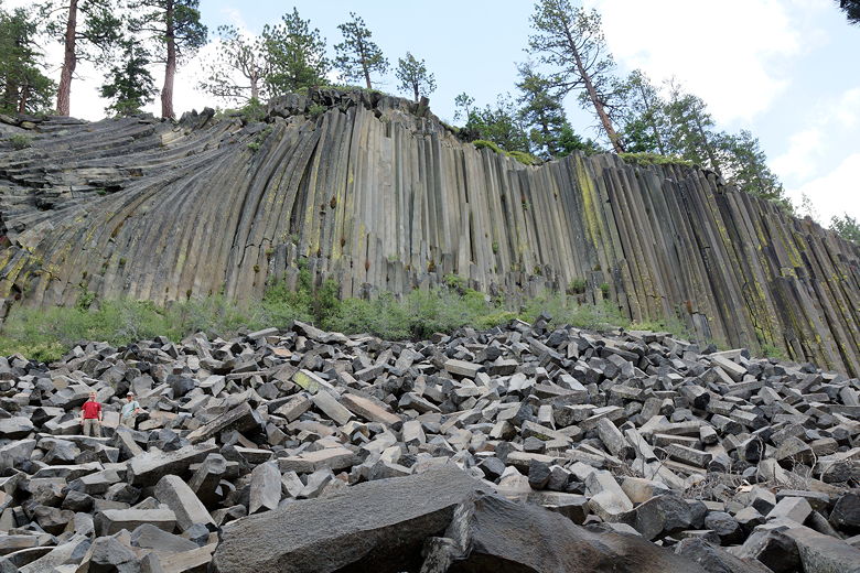
Devils Postpile
While we were there, we happened to run into the same group that
camped near us at Illilouette Creek (the Cullen family). We hadn't
seem them since Day 2. They were doing a resupply at Reds Meadow
Resort and were spending the night there. We still had about
3 miles of uphill to go to our campsite, and that was after reaching
the resort.
At the next intersection, I saw a sign that said Reds Meadow to the left,
but that wasn't for the resort but rather the meadow. I wasn't sure from
the map whether we should take that or rejoin the JMT at this point. We
decided to keep right and rejoin the JMT before reaching the resort; this
was a mistake, as taking the left fork would undoubtedly have been
easier. As it was, we had to take a slightly longer and uphill route to
the resort. Still, we got to the resort all the same, around 2:45pm.
The resort has a cafe and a store. We purchased a few granola bars and corn nuts
to supplement our dwindling lunch supplies. Then we stopped in the
cafe for some cheeseburgers that the kids devoured. Be prepared to stay
here a bit, though, since you have to eat in the cafe (not outside like you
can at Tuolumne Meadows).
The Cullen family was here, as was the couple we'd seen on Day 2, though
we didn't get a chance to talk to them. It was past 4pm and we needed to
get going. After dumping our garbage, we were finally off a bit past 4pm,
leaving all the other hikers who were spending the night here (either in a
bed or a campground).
From the resort, it was about 850 feet of climbing (in about 3 miles) up to
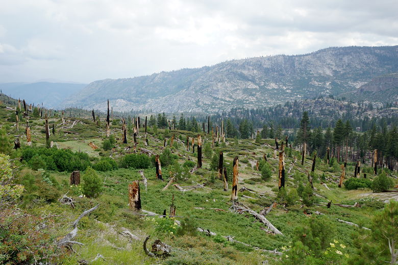
our campsite at Crater Creek. First, we had to climb through an area burned
by the 1992 Rainbow Fire. Burned trees spread out as far as we could see.
It was now overcast but still warm, rain clouds sort of looking mildly
threatening, and even some distant thunder. We would end up feeling a
few raindrops but nothing to even
prompt us to put on our pack covers.
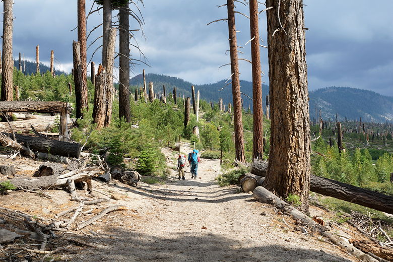
Entering the burned area
Area burned by the Rainbow Fire
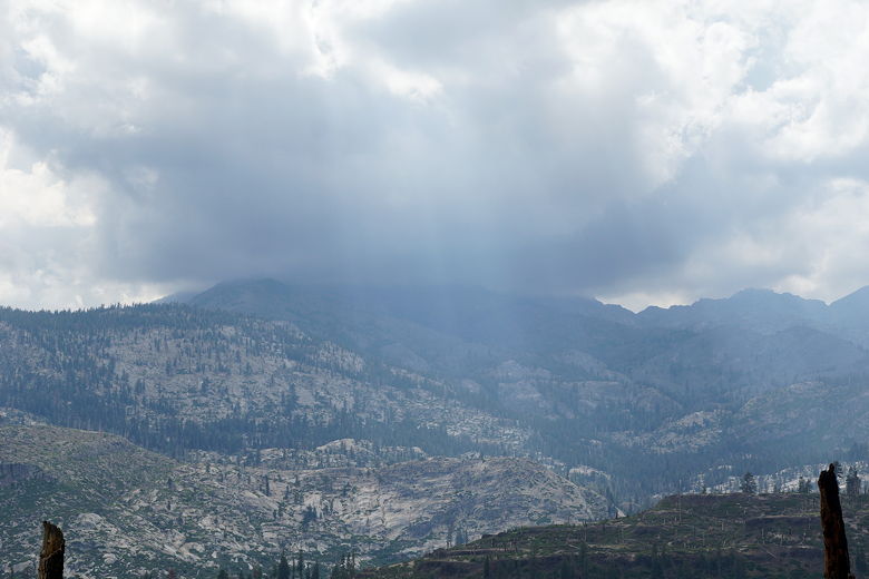
Crepuscular rays
As we climbed, I regretted eating that cheeseburger. But it tasted so good at
the time I ate it. At least the climb was very gradual. I saw one backpacker
on the way down and asked him about Crater Creek. He assured me that there
was ample camping up there.
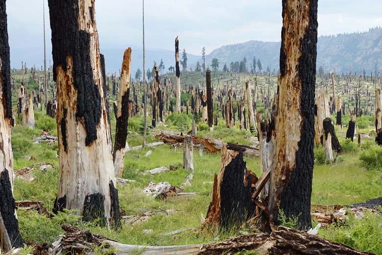
More of the area burned by the Rainbow Fire
As we hiked we could see one of the Red Cones clearly visible above. That was
basically where we were headed. Eventually we exited the burned area and
entered the forest, then started switchbacking (still gradually) up the slope.
By the time we reached the top, the clouds were clearing. We crossed a bridge
over Crater Creek, just as the sun sparkled onto a campsite there. We
continued a little further to find ample campsites further along near
the creek. We chose one with a nice view of the other (shorter) Red Cone,
looking so tantalizing close that we were almost compelled to climb it (but
we didn't). It looks like it would be an easy day hike to climb one (or
both) starting at Horseshoe Lake (which I've visited in the past on a short hike
to McLeod Lake).
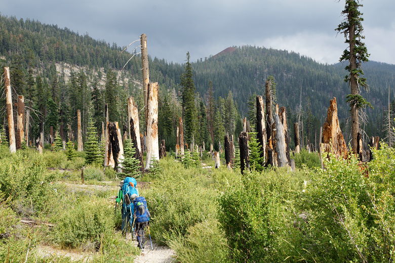
Hiking toward Red Cones (top center)
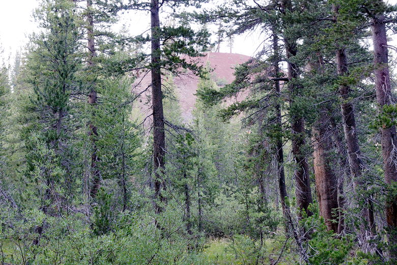
One of the Red Cones
Though I know many hikers had opted to stay in Reds Meadow for the night, I was
glad to have put this climb behind us, making tomorrow's hike that much shorter.
By the time we finished dinner, the skies were completely clear and we looked
forward to good weather the next few days, though it was definitely colder now.
| 

