|
We got a late start in the morning, partly because I knew today would not
be a hard day. We got up around 8:30am, as the sun doesn't really make its
way into the camp area here. The mosquitoes were still a bit of a nuisance,
but not as bad as last night. I retrieved the stuff from the bear box and we took
our time getting ready, finally leaving a bit after 11:30am.
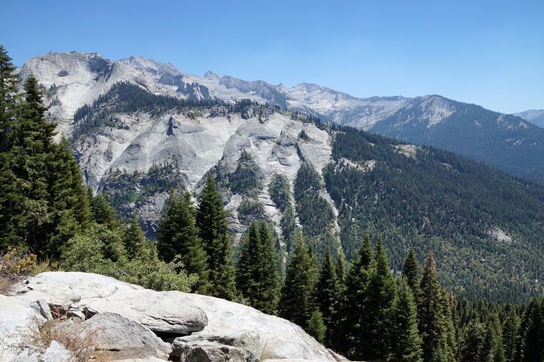
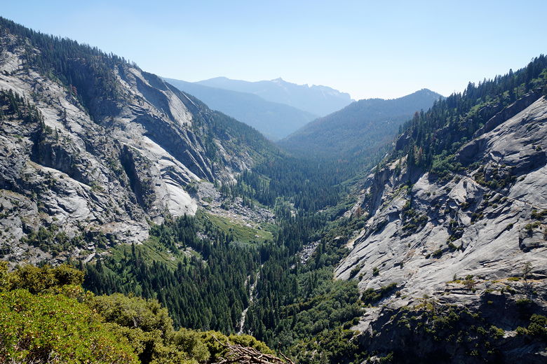
Heading east along the High Sierra Trail, we soon reached Buck Creek after about
40 minutes. This area is much more open, with a bear box and a few clustered
campsites in the trees just off the trail. If there were already people
camping here the previous night, as we had been told, there really wouldn't have been
any privacy. While it was sunnier here, I was glad we hadn't camped here the
night before.
Descending to Buck Creek
Climbing up from Buck Creek
While the trail so far today had been easy, mostly flat or downhill, we now crossed
Buck Creek and climbed steeply away from the creek. Even after we returned to the
forest, the trail continues to climb toward Bearpaw Meadow. Eventually we reached an
intersection, with the trail to Redwood Meadow coming in from our right. I knew that
we'd return on this trail as part of our figure eight in a few days. We continued
straight along the High Sierra Trail, mostly in forest. A couple minutes later we
passed the trail to Elizabeth Pass on our left; we'd be taking this trail later.
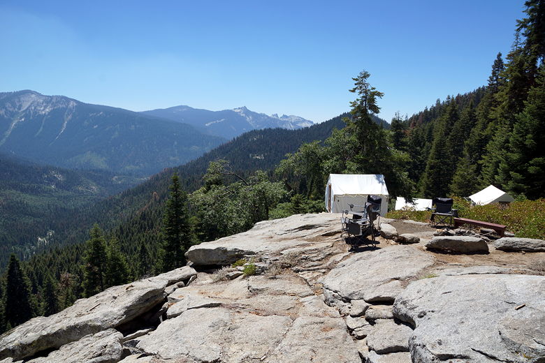
A few minutes later, we arrived at Bearpaw Meadow camp. While the backpacker's camp
was downhill to the right, the camp is a set of buildings and tent cabins available for
rent. There is a ranger station here, along with a building used to serve food
to the camp guests (reservations required). We put our packs down to rest and
have a snack. Just before we had reached the camp we had been passed by a couple of
strong hikers. I talked to one of them; he said they were doing the HST to Whitney;
I'm guessing many of the people passing through were doing the same.
Sign at Bearpaw Meadow - Fear the Deer!
View from Bearpaw Meadow camp
View from Bearpaw Meadow camp
Tent cabins at Bearpaw Meadow
We stopped in the camp building briefly just to look around. They had a small
selection of food and gear for sale to backpackers - chips, brownies, lemonade,
beer, medicine, fuel, maps, etc. We didn't buy anything, but made a note of it
since we'd be returning here in the middle of our trip.
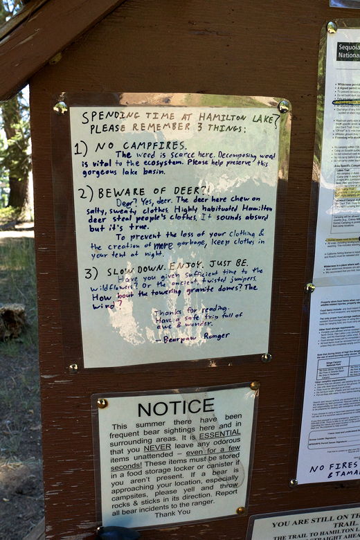
One thing I had read about online earlier was that deer had a habit of munching on
backpackers' clothes because of the salt. There was a sign here that said the
same thing of deer in the Hamilton Lake area, saying to keep your clothes in your tent.
If you left your clothes out
you might have soggy deer-licked clothes the next day, or maybe they'd just take
the clothes completely.
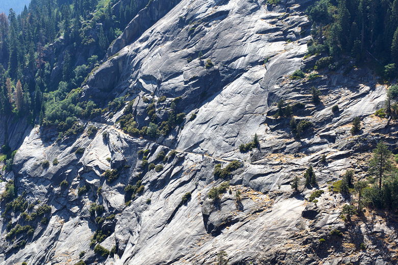
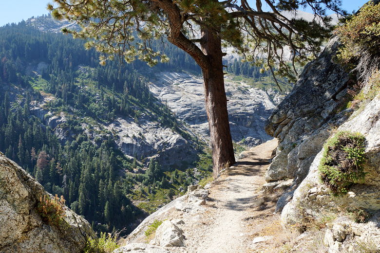
After our break, we continued along the HST as it descends gradually about 450 feet to
Pine Creek. Along the way we passed an impressive granite block with trees hanging
on for dear life at the top. The granite sloped inward at the bottom, and I got
vertigo looking down at it. You may miss it coming from this direction, as you'll have to
look backwards to your right to see it.
View from the trail to Pine Creek
View from the trail to Pine Creek
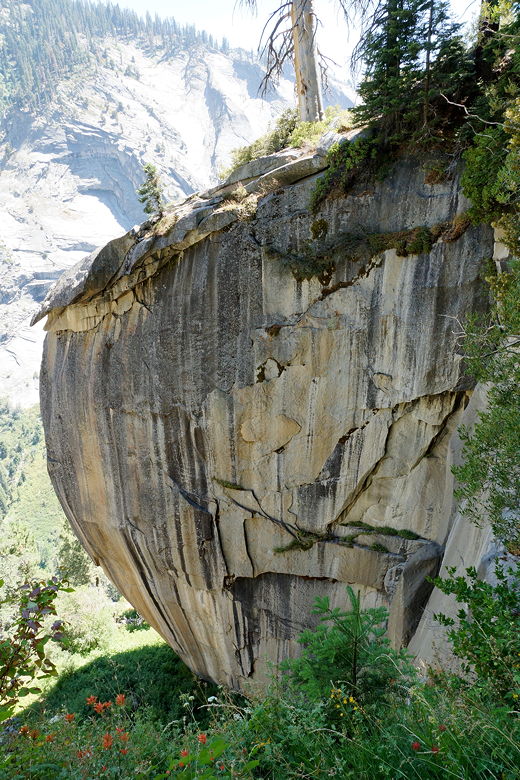
Overhanging granite
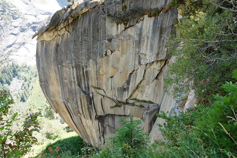
Overhanging granite
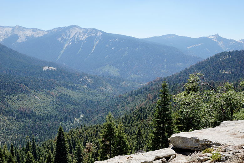
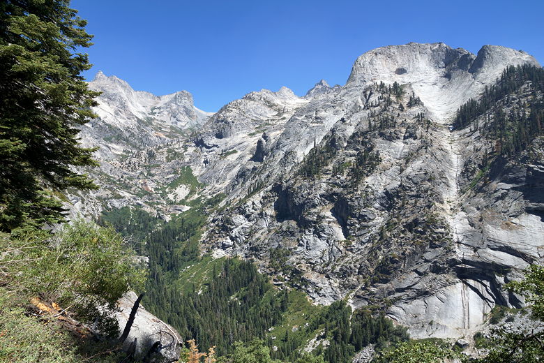
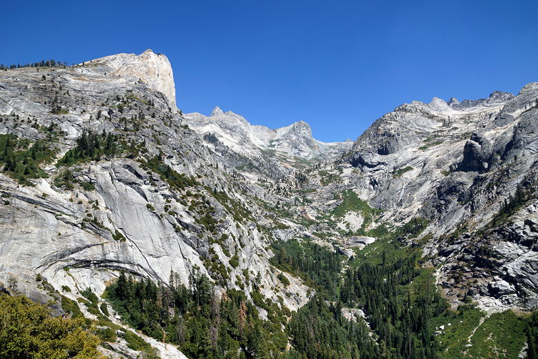
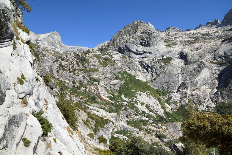
The views now started to open up, mainly to the east. Granite peaks loomed above
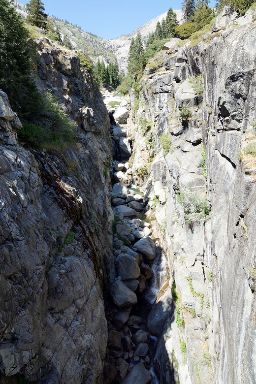
us. When we finally reached the bottom we saw that there's a solid footbridge over
the creek. In fact the bridge is far above the creek, traversing what can only be
described as a chasm. Standing in the middle of the bridge I had the unsettling view
of the old, twisted, rusty bridge - collapsed and sitting about halfway down the chasm.
I can only guess an old storm had destroyed it and it was too much trouble to remove it.
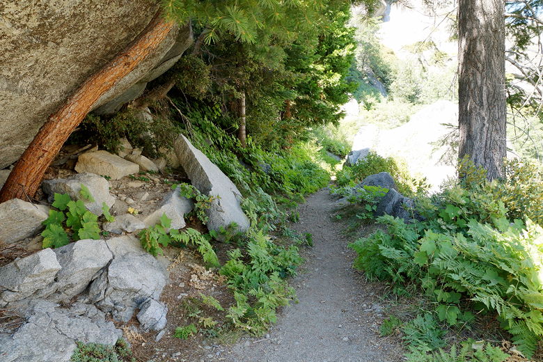
Trail to Pine Creek
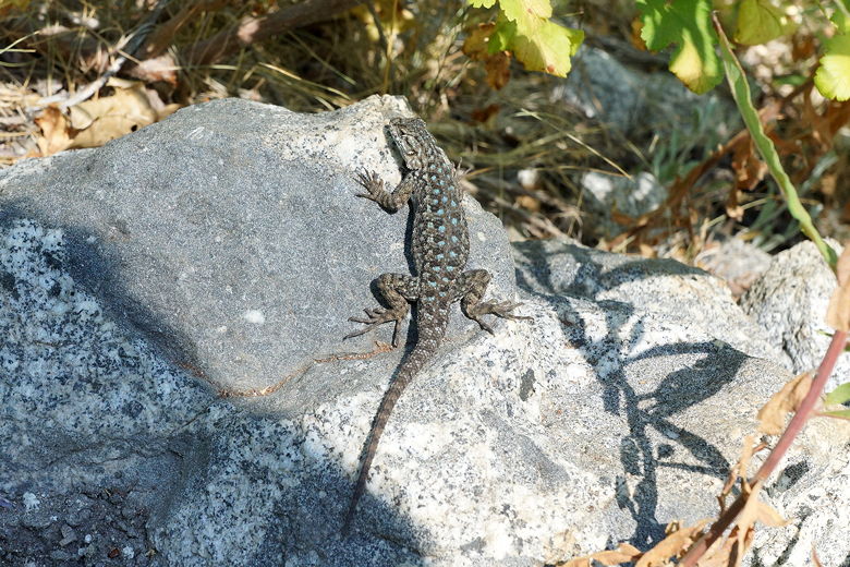
Lizard
View from the trail to Pine Creek
View from the trail to Pine Creek
Pine Creek
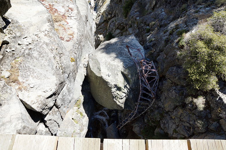
Old broken bridge hanging below the new Pine Creek bridge
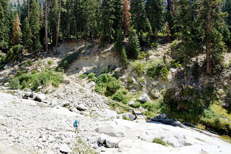
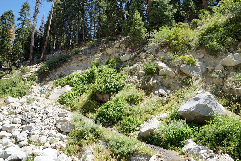
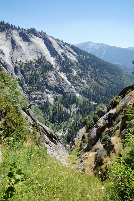
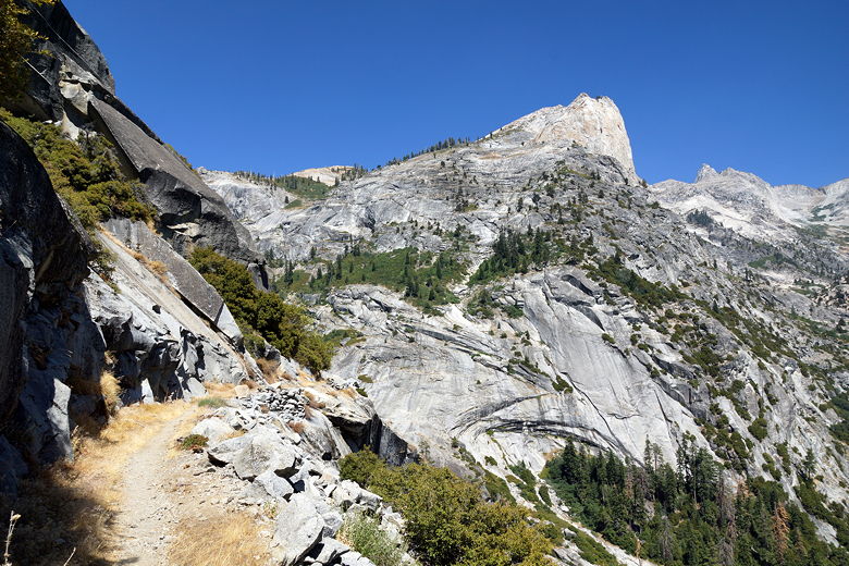
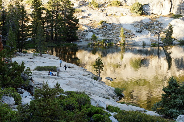
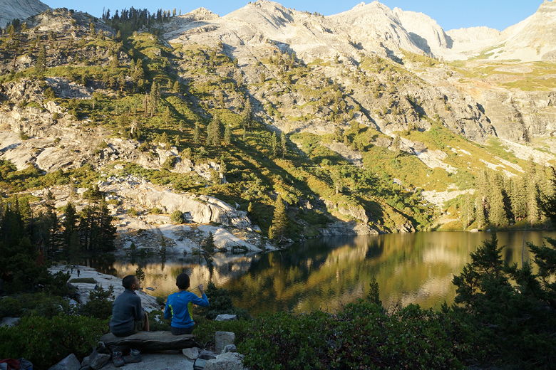
Now we ascended, steeply, up switchbacks in the brutal midday heat. While we climbed
we could look back at the trail on the other side, seeing we had been walking on the thin
edge of a trail etched in granite. We stopped in whatever shade we could find to rest.
Looking down the valley
Looking back at the trail we were just on
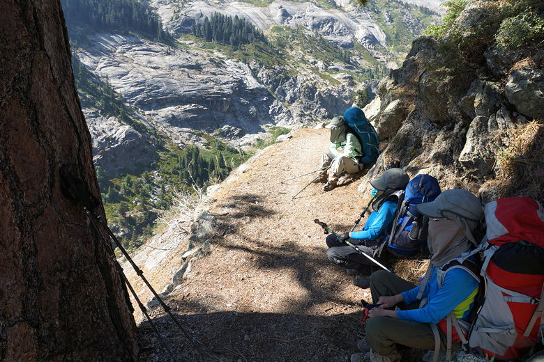
Taking a break on the trail to Hamilton Lake
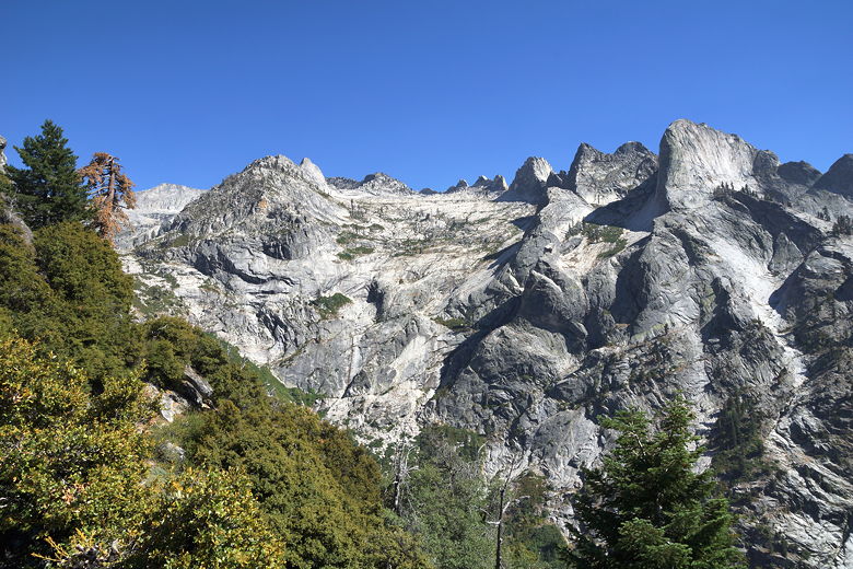
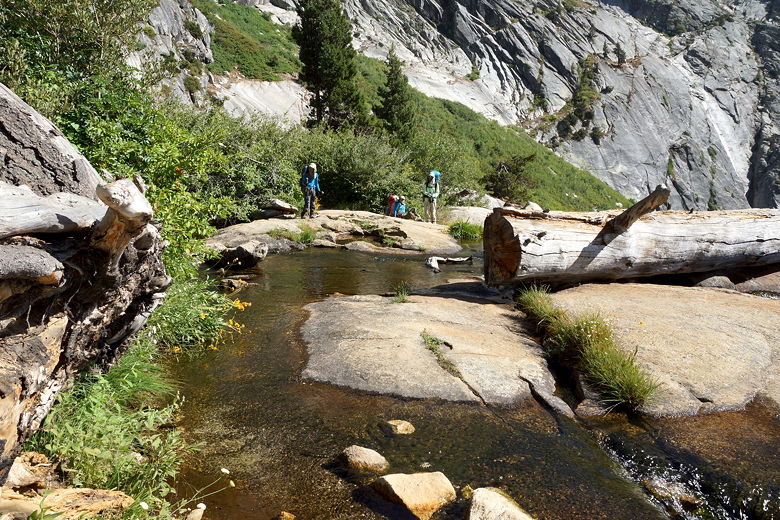
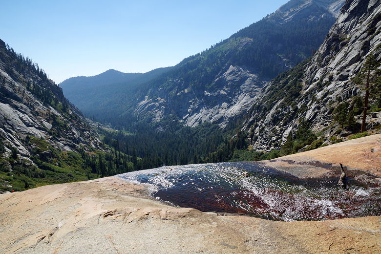
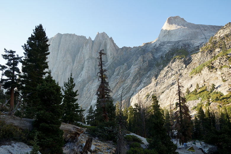
The views were impressive. After climbing for about 550 feet, we descended
a bit and crossed the Hamilton Lake outlet stream, near where it tumbles over a
cliff. Now we still had another 500 feet to climb. We passed the first small lake,
imposing granite mountains (named Valhalla) rising from its northern shores. I ran out of water around
here (it was a hot day), but I knew we didn't have much further to go. Soon after that we reached
the main Hamilton Lake, where several people had already set up camp (it was about 5pm by
this time).
View to the east
Looking back at the trail
View from the trail
Crossing Hamilton Lake outlet stream
Hamilton Lake outlet stream going over a cliff
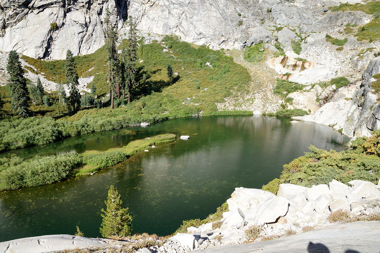
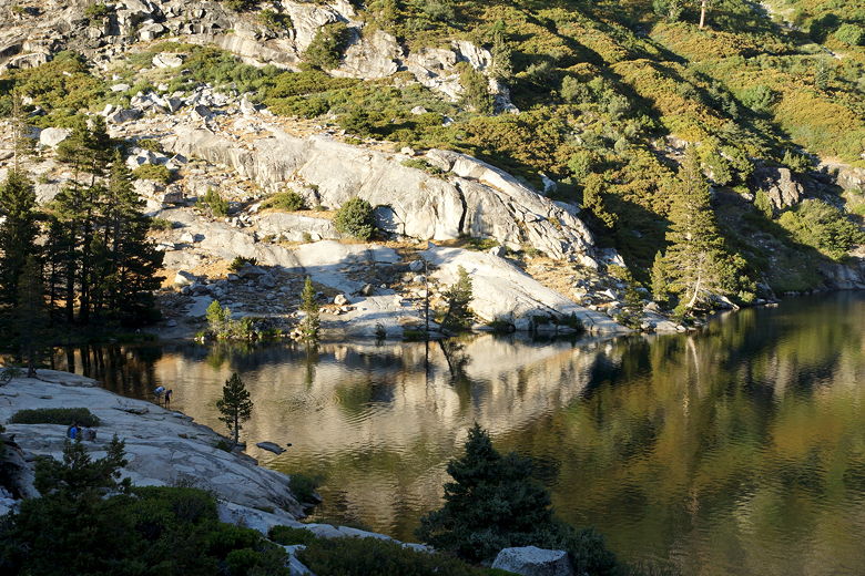
Small lake/pond below Hamilton Lake
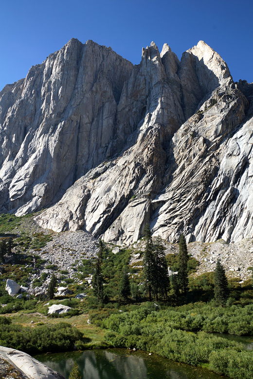
Valhalla
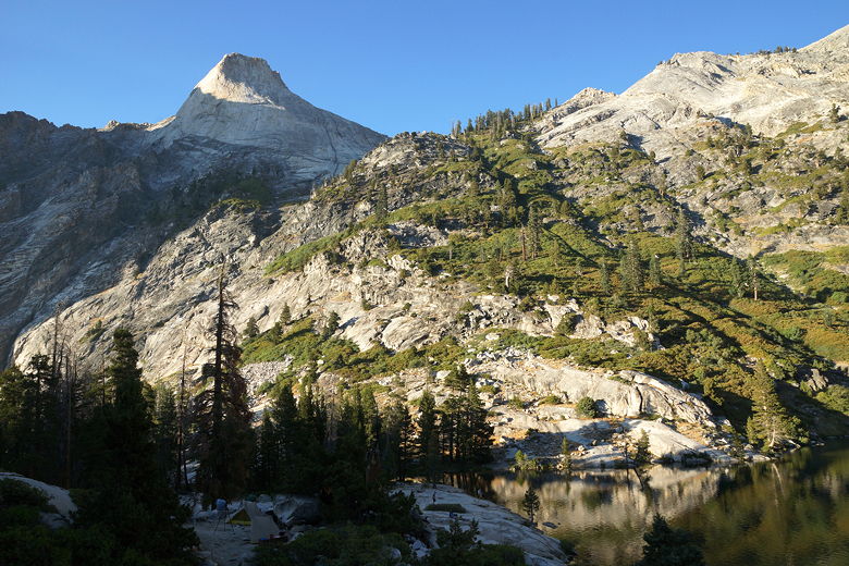
We searched for a good campsite. There weren't many left to be found, but as we often do we
found one of the best sites, at least for us. The site we found was probably the furthest
established site from the lake, up a use trail on the western shore. It was a bit of a
hike down to get water, but it had the best views. It had just enough space for our
4 person tent, a large cooking area, and even a makeshift wooden bench overlooking the lake.
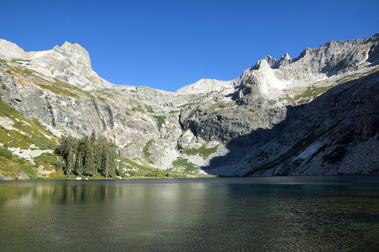
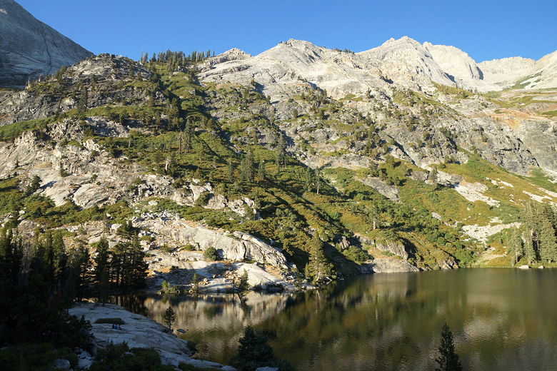
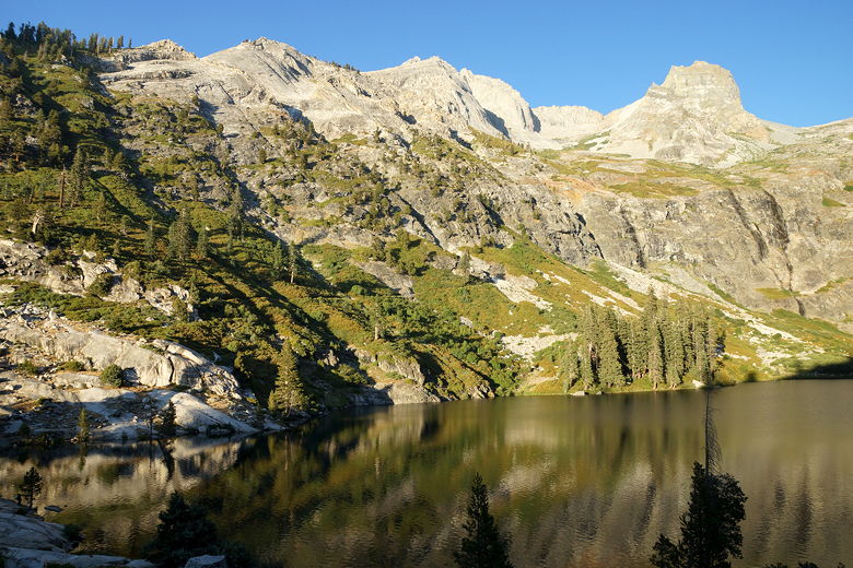
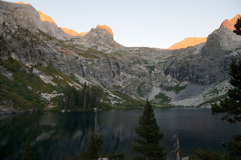
Hamilton Lake
Hamilton Lake
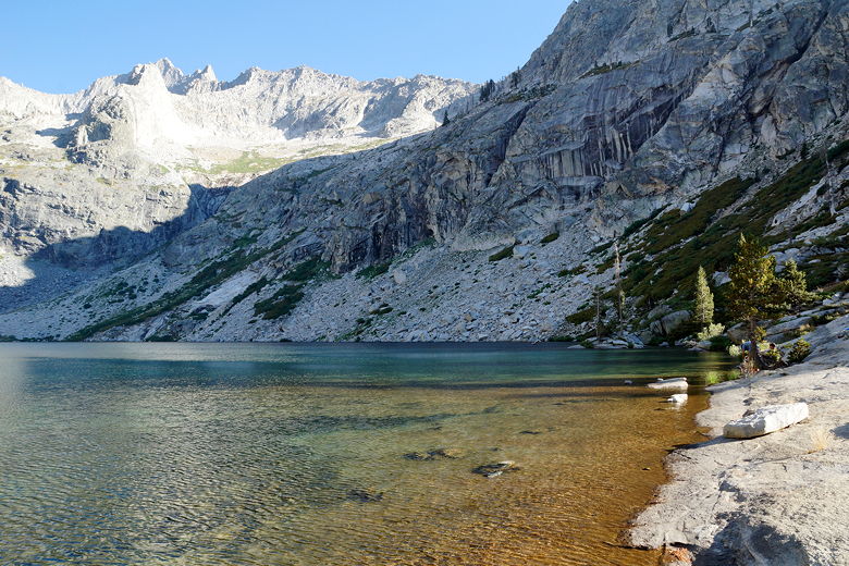
After setting up camp, we went down to enjoy the lake, which has a large granite area
on the northwestern shore. I walked right into the water and dunked my head. Ah. Many
people did the same, though I was a bit surprised I didn't see anyone try to swim.
While there were a fair number of people here, it didn't seem overly crowded. There were
maybe 30 people here tonight. There are at least two bear boxes and a pit toilet. There are
fish in the lake, and we could see some of them jumping near sunset.
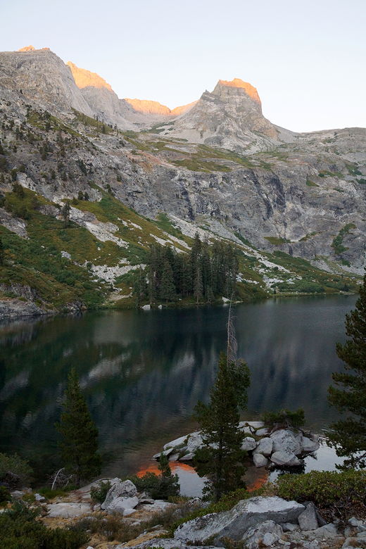
Hamilton Lake from the northwestern side
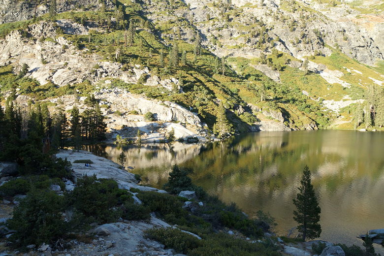
Looking down at Hamilton Lake
Valhalla
Hamilton Lake
The two hikers camped closest to us were photographers. They'd brought full-sized
tripods. I asked one of them if he was a professional; he hemmed and hawed a bit
and said sort of - he worked at the Ansel Adams gallery in Yosemite. I mentioned
night photography and he whipped out his phone and showed me an app called Moon Seeker
which showed when and where the moon would rise. In fact, it was just behind those
mountains to the south right now and would be rising soon. We both went to get our
cameras to capture the moment.
Granite at the Hamilton Lake shore
Not a bad view while eating dinner
Hamilton Lake sunset
Hamilton Lake sunset
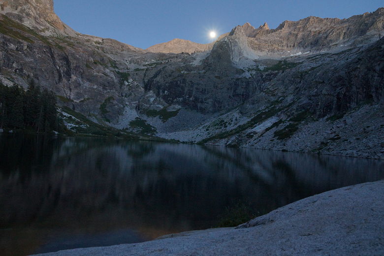
Moon rising above Hamilton Lake
After dinner and the moon pictures, I helped clean up our camp. While I was doing so,
two eyes peered back at me in the darkness - it was a deer, feet from our campsite. No doubt looking for
sweaty clothes to lick. Finding nothing, it walked around our camp and down toward the
lake and the other campers.
| 

