|
(Note: the trail route above was created post-hike using electronic maps and was not created
using GPS, so it might not be completely accurate. It's probably pretty close, though.)
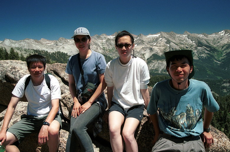
CJ, Jean, Jennie, Weihaw and I hiked in Sequoia National park.
While we were getting ready at the Wolverton parking lot, a couple
of backpackers returned to their cars next to ours. They'd just
been on a 5-day trip in the area. We asked them for some information
and they obliged us with some useful info, including the fact
that there were places to filter water just in case we needed
to. They also extolled the virtues of freeze-dried food, which
they told us we could get from some Mormon organization (apparently,
Mormons are supposed to have 2 years of emergency food; these
backpackers weren't Mormon, but were happy to buy their freeze-dried
food from them).
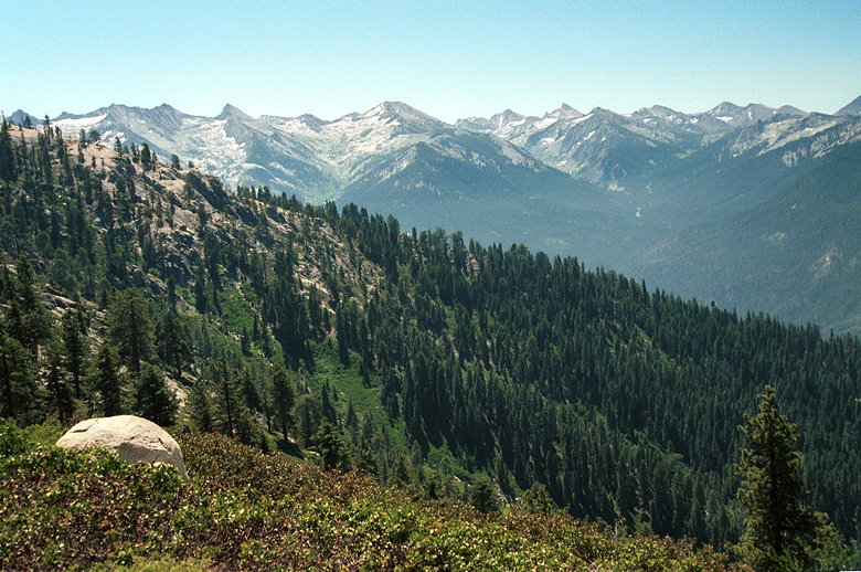
At 9:35am we hit the Lakes Trail. It starts out climbing immediately,
up some very dusty switchbacks. There were occasional peek-a-boo
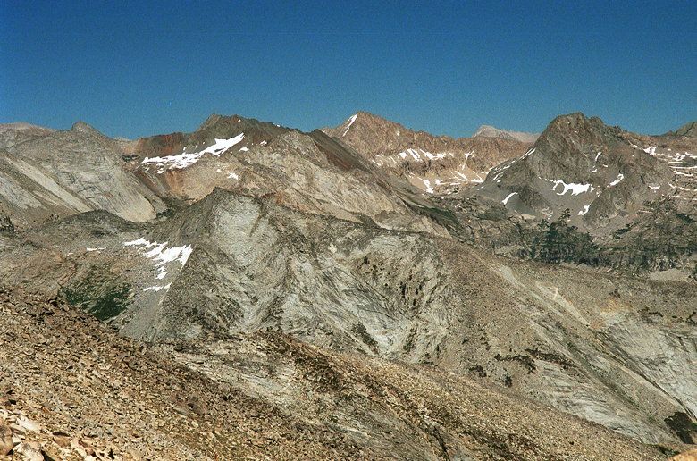
views through the trees to the left. I'm not sure which mountains
we saw -- perhaps Mt. Silliman (11,188 feet) and friends.
That might be Mt. Silliman, or at least a peak along the Silliman Crest
After climbing for a while, the trail levels out. Noticeably absent
are sequoia trees. Instead, the vegetation is more typical of
Yosemite. We passed a small green meadow on our right. Tree mushrooms
were common. After 1.7 miles, there's a trail intersection. To
the left is the Lakes Trail, which leads to the Watchtower, Heather
Lake, Emerald Lake, and Pear Lake. There's a ranger station near
Pear Lake.
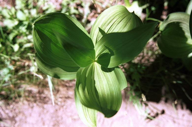
Jean saw this leaf and told me to take a picture of it, so I did.
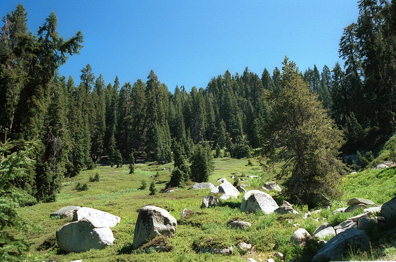
Slanted meadow
A large group of people were gathered here, perhaps deciding which
way to go. We took the fork to the right, toward Panther Gap.
We shortly encountered a beautiful hillside -- green flowed above
us up the hill and below us as well. It was a slanted meadow,
with a small creek running through it of course. A beautiful mid-morning
sight.
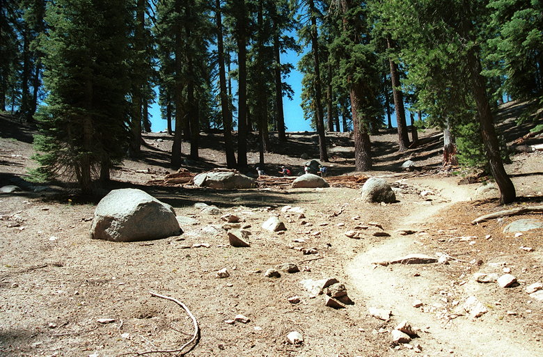
Climb up to Panther Gap
The trail actually descends for a bit before making a steep ascent
up an even dustier trail than before. A solo hiker passed us by,
leaving a cloud of dust in his wake. The trail ascends the inner
part of a bowl. At the top of the bowl is Panther Gap, 2.7 miles
into the hike. Here we had wonderful views to the south, stretching
from the San Joaquin Valley in the west to the Great Western Divide
in the east. Beautiful green valleys stretched on forever below
us. Birds sailed high above the trees, yet well below us. We enjoyed
these views before turning left onto the Alta Trail -- toward
Alta Peak and Alta Meadow.
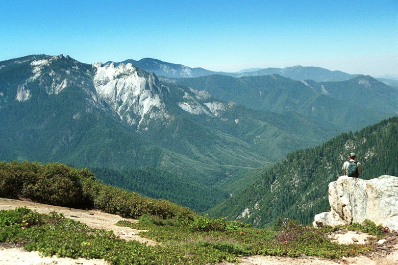
View from Panther Gap
More views from Panther Gap
We were now on a ridge line, with Panther Peak behind us. The trail
climbs a bit before curving right and flattening out for awhile.
We could now see granite rocks above us to the left, and steep
drop-offs below us to the right. Wildflowers of all colors lined
the trail. In the distance, seemingly deep in the valley below
us, we could hear a deep drum-like sound. Most likely a bird or
owl sending out a mating call, but it sounded more like Native
American drumming.
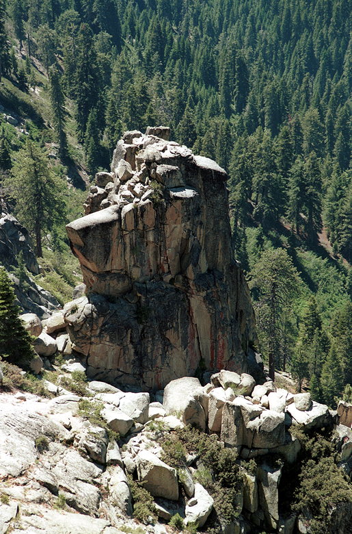
Rock or Bear? You decide.
Four miles into the hike, we reached Mehrten Meadow. It's a relatively
small meadow with a creek feeding it from above (to our left).
Some backpackers were there picking out a place to set up camp.
We stopped here to have lunch. We only had 2.9 miles to go to
reach the top, but half the climbing yet to come.
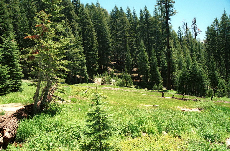
Mehrten Meadow
After lunch we continued along the trail, which continued to be
relatively flat. 4.8 miles into the hike, we reached the trail
intersection with Alta Meadow to the right and Alta Peak to the
left. From here we had impressive views of Tharps Rock and what
appeared to be Alta Peak high above us. To the left were two shorter
but more impressive rock spires which looked like they require
rock-climbing equipment.
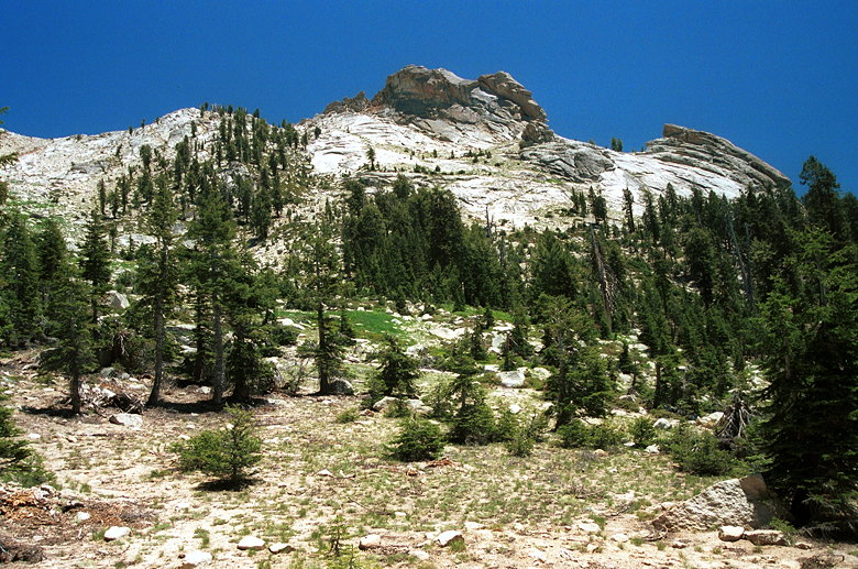
Tharps Rock (right); Alta Peak is behind the center peak
We were at about 9140 feet -- with 2.1 miles and about 2070 feet
still to climb. Steep! An average grade of almost 19 percent!
We started climbing switchbacks in another bowl, this time with
little shade. As we climbed higher we glimpsed a tarp and sleeping
bag below, in a nice small meadow near the Alta Meadow Trail.
Looked like a nice place to camp.
We re-entered the forest and began our journey around the southern
side of Tharps Rock. While the day was relatively warm, it wasn't
too uncomfortable, and wonderful breezes cooled us in the forest
shade. We soon reached a rock outcropping which we climbed onto
and had great views of the Great Western Divide to the southeast.
While we were admiring the views, a large group of hikers passed
us coming down from the top. After our rest stop, we continued
on up the trail.
View from rock outcropping along the trail
One woman we passed who was coming down said we were only half
an hour away, but I knew we couldn't be that close. Soon after,
we encountered a pair of hikers Jean recognized from the parking
lot. They'd left about 30 minutes before us, and told us we still
had about 80 minutes to go to get to the peak.
As we rounded the corner we had new wonderful views to contemplate.
Below us to the right (southeast) lay Alta Meadow. A large meadow,
it looked like a beautifully manicured golf course from our vantage
point over 1000 vertical feet above it. Above the meadow lay destruction.
Up, up, steeper and steeper was a slope filled with sharp rocks
big and small. It looked like the summit of Mt. Tallac, only larger.
Marmots started to play hide and seek with us. One ran away from
us as we headed up the trail. We turned the corner to the left.
As we turned right, more views opened up. Sandstone formations
towered above us. It looked just like Zion National Park. Quite
a contrast to the typical granite of the Sierra Nevada. It looked
like a rock climber's dream, with tons of cracks lining the walls.
Tharps Rock itself looked more impressive from this vantage point.
We ran into another hiker coming down from the top. It turned
out he was the owner of that sleeping bag we'd seen earlier! He
told us it was definitely worth it, and there was a summit register
waiting for us at the top.
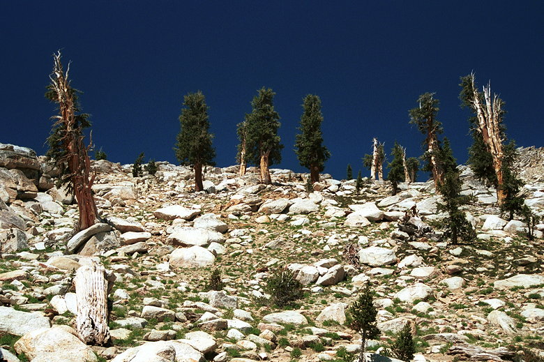
Foxtail Pines near the summit
We were very close. The trail deteriorated into traversing over
rocks and dirt. Our only guide to the trail were faint footprints
and small stacks of rocks arranged to mark the trail. We were
nearing 11,000 feet elevation, the trail was getting steeper,
and the altitude was making a difference. We slowly made our way
up. But soon we had a view of the peak itself, and our objective
was clear.
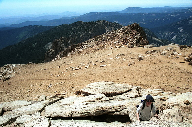
We reached the ridge crest and took some group photographs. The
peak itself lay just a few dozen yards further up the trail, massive
rocks at the top. Persistent patches of snow lined the northern
face of the mountain below us. A small group of people made their
way down as we reached the top, so we had it to ourselves for
the most part.
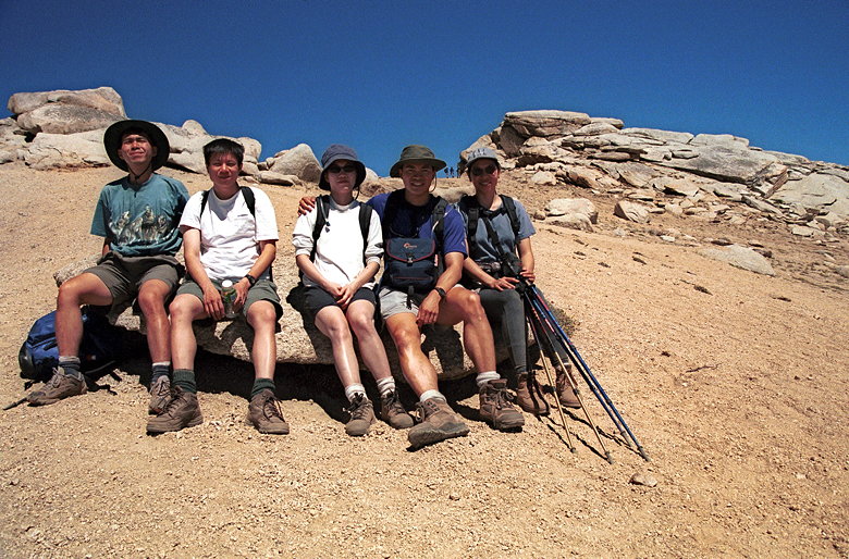
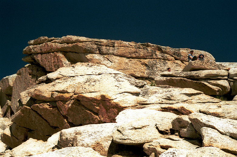
Summit at right (next to Jennie's head)
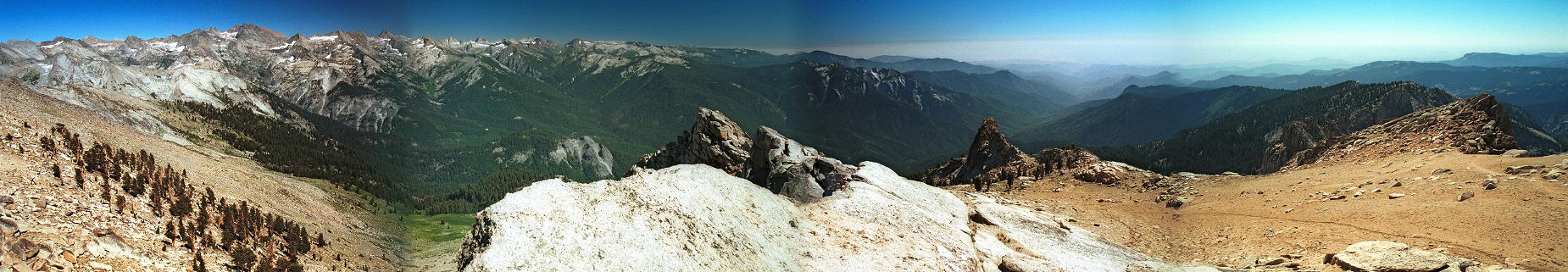
We walked up to the top, then scrambled up the rocks to the very
peak. Wow. From the top, everything is visible. So many peaks
to the east. The San Joaquin Valley to the west. Moro Rock, impressive
when we were on it, looked so tiny from way up here. Unfortunately
smog marred the view to the west. Interestingly, a couple of peaks
appeared to pop above the smog, though I'm sure there aren't any
coast peaks tall enough to do so. Perhaps it's some kind of optical
illusion, some sort of reflection.
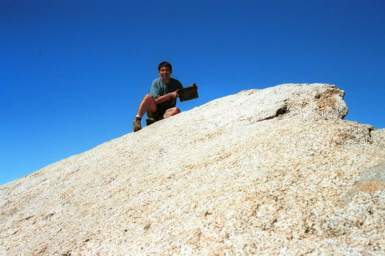
Daredevil Weihaw with the summit register
The register itself is at the edge of the top rock. Weihaw crawled
out to it and signed our names. The rest of us decided it wasn't
worth the risk. It's probably relatively safe, but there's a tremendous
amount of exposure. The mountain drops off almost vertically to
the east and north.
The summit rock
View looking west from the summit rock
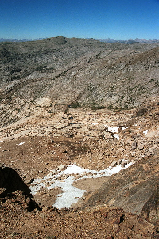
View looking down and to the north (no, I'm not getting any closer to that edge)
I walked over to the north face and got a glimpse of what's probably
Pear Lake, about 1700 feet below. I didn't take any pictures of
it for fear of falling off the face of the earth (or at least
falling 1700 feet straight down the north face of Alta Peak).
Supposedly there's also a view of Emerald Lake, but I didn't bother
looking. Mt. Whitney is supposed to be visible through a gap in
the Great Western Divide to the east. I think I have it below,
but I'm not sure.
|