|
Jean and I hiked in Sugarloaf Ridge State Park, north of Sonoma.
We started our hike under a blazing mid-day sun. A couple weeks
ago it'd been literally freezing in the Bay Area. But today was
at least in the 80's. Not a cloud in the sky.
We started up the Lower Bald Mountain trail. A group of 3 hikers
walked closely behind us as we navigated past a few remaining
mud patches in open meadows. Soon we were hiking under shade of
trees, up a few switchbacks.
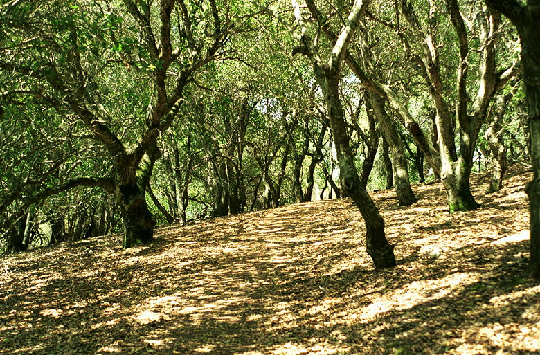
Lower Bald Mountain Trail
I'd brought my trekking poles anticipating a climb, but when we
reached the Bald Mountain Trail, we discovered it was a paved
road. Apparently there's some sort of antenna tower near the top,
and maintenance vehicles go up there. We didn't encounter any
cars or even any mountain bikers, but it was still disconcerting.

Flowers by the side of the trail
The unfortunate thing about the wide paved road is that there's
no shade. As we climbed and climbed we passed a few wildflowers
and scattered hikers. As we got higher we saw better and better
views, including the lower also-named Bald Mountain to the south
(2275 feet elevation). But our sights were set on a slightly higher
goal.
We passed the Red Mountain Trail. Soon after that intersection
we got our first glimpse of Bald Mountain to the northwest. Then
the pavement ended and we were on a dirt fire trail curving its
way to the top. As we climbed we saw the big ugly tower on an
adjacent peak.
We passed one pair of hikers going in the opposite direction,
and then it was just us at the top of the peak, 2729 feet. To
the south we could see the tower and the other Bald Mountain.
To the southwest we could see what I'm guessing is Sonoma. To
the north, Mt. St. Helena. Birds soared on the noticeable current,
but stopped while we were at the peak. A couple of signs list
prominent points on the horizon. Unfortunately, it was a very
hazy day so we couldn't even see as far as San Francisco, let
alone Snow Mountain or Pyramid Peak (which you can see on clear
days).
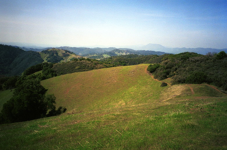
View from Bald Mountain
After a nice break on the top, we started down. As soon as we
did, the birds reappeared. But we still had a long way to go,
so we continued on our way. my hiking book said we should take
the Gray Meadow Trail. Unfortunately, I didn't see any Gray Meadow
trail, and we hadn't gotten a trail map from the park entrance.
There was a Gray Pine Trail which looked like it went through
a meadow in the right direction, so we took it. It turned out
to be the right trail.
We were all alone for some time, not running into anyone for at
least an hour. Eventually we made it to the Brushy Peaks trail.
This trail goes up and down along a ridge. There are no switchbacks
-- whatever the ridge does, the trail does. About 15 minutes into
this trail we ran into one hiker going in the opposite direction.
We convinced each other that we were both headed in the right
direction, and continued.
The Brushy Peaks trail is, unfortunately, very aptly named. There
are lots peaks, as the trail goes up and down, up and down. But
they're all very brushy. There aren't many great vista points,
as there is on Bald Mountain (which had a completely unobstructed
view). There aren't really many tall trees -- just a lot of brush.
Bushes. And the further along the trail we got, the more they
encroached on the trail. Soon we were virtually bush-whacking
through the thicket. Leaves, branches, and thorns met bare skin
on legs and arms. Ouch, ouch, ouch.
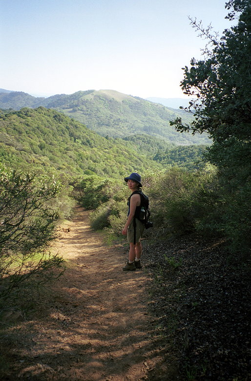
One of the wider sections of the Brushy Peaks Trail
I really have nothing good to say about the Brushy Peaks trail.
At the main vista point, we saw a decent view, but nothing compared
to Bald Mountain. Then there was a precipitously steep rocky trail
which we decided we didn't want to descend. So we backtracked
a little and took the horse trail around the lookout. Unfortunately,
this meant more bushwhacking. And even after that there were more
steep rocky sections of the trail which we couldn't avoid. I was
glad to have my trekking poles with me to prevent me from slipping
and sliding down the hill.
Finally, after a seeming eternity, we re-entered the forest and
the trail actually had switchbacks! Finally, relief. This part
of the trail is actually fairly nice, criss-crossing Sonoma Creek.
The trail is shaded almost the entire way. Soon we were having
a gentle late-afternoon stroll next to Sonoma Creek along the
Meadow trail.
By the time we returned to the car, the rest of the parking lot
was almost empty. The temperature was much more bearable. I'd
say the views from Bald Mountain are worth the climb, even on
a hazy day. But I'm never, ever, going to do the Brushy Peaks
trail again. I wonder why anyone would even consider blazing a
trail through that part of the park.
| 

