|
Kane, Lan and I hiked in Rancho San Antonio Open Space Preserve.
We started our hike at 10:20 in the morning. The sky was perfectly
clear, a typical spring day in the Bay Area -- temperatures in
the 70's. Perfect hiking weather.
The path starts out in shade over a gravelly surface before shortly
turning to dirt. It's well-packed however -- suitable for running,
as Lan would say. The first mile is a fire trail which starts
climbing almost immediately.
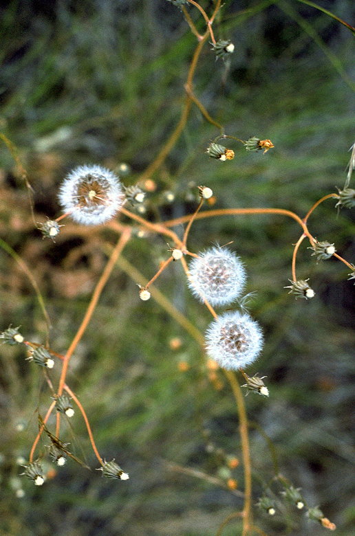
Bloom along the Black Mountain Trail (taken a week after this
hike)
After about a mile there's a fork in the road where you can go
left to join the Chamise Trail and take it toward the main Rancho
San Antonio area, where you'll meet hordes of people. Instead,
we took the right fork and continued along the Black Mountain
Trail.
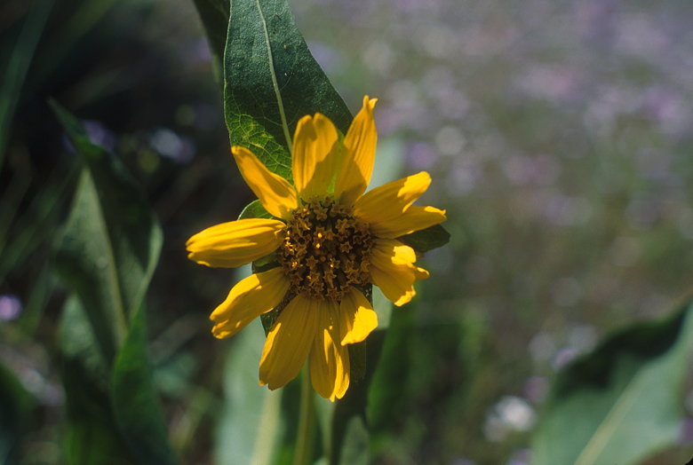
Flower
The singletrack trail dashes in and out of sunlight as it curves
around on a slight uphill. Along the way is a beautiful shaded,
fern garden. As we climb higher and out in the open, we have nice
views of the Santa Clara Valley below.
Somewhere along the way the trail becomes a fire trail again.
And from then on, there's little shade. The trail continues up,
up, up. There are short pitches which approach 20% grade, though
there are periodic flatter sections to rest on. This is not the
most wild of trails, as we pass by electric towers and we get
a wonderful view of a quarry being mined below.
The trail has a fair amount of traffic. But it's mostly hikers;
bikes are not allowed, and we only saw a handful of runners. And
the traffic is nothing compared with the main Rancho San Antonio
area.
When we reached a gate at the top, there was a bunch of satellite
dishes and towers behind a locked fence to greet us. We reached
the gate in an unexpectedly blazing-fast time of 1 hour, 33 minutes.
We were about to be very disappointed with the top and head down,
but two hikers came by and told us there was a great view just
a little further on.
We continued down the trail, made a right onto Montebello Road,
and were soon (less than two-tenths of a mile) greeted with a
great picnic area nestled among rocks, with a view of rolling
green hills to the west. A USGS metal stamp marked the top of
the mountain. We stopped and relaxed for a while here, eating
and taking pictures of lizards jumping around the rocks. Mountain
bikers coming up Montebello Road stopped by for a few minutes
to soak in the view.
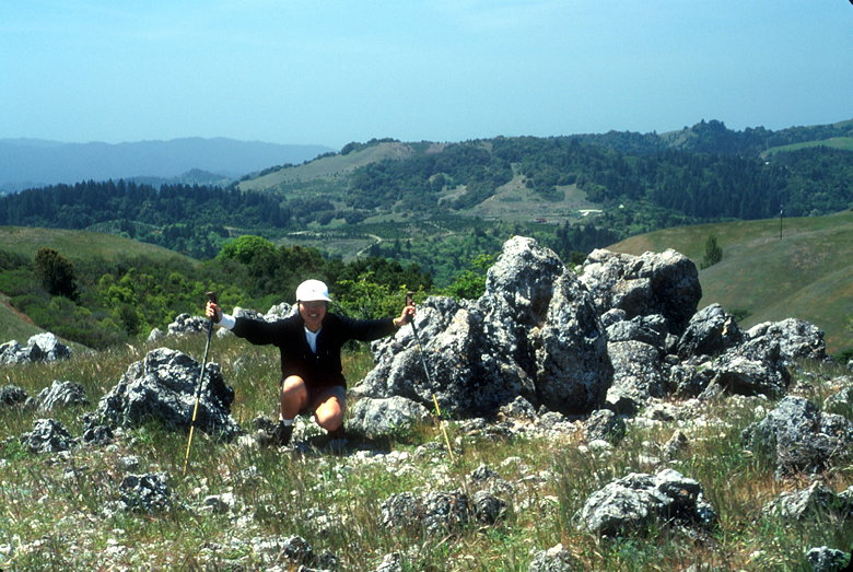
Lan standing on the summit
There's also a campsite less than half a mile away; we saw a couple
of backpackers (at least they had big packs on and were headed
in that direction). I believe the campsite (which requires reservations)
is the only one in the vast Midpeninsula Regional Open Space District.
After lunch we headed back the way we came. Along the way we enjoyed
the view more; going uphill we had had our heads down concentrating
on the uphill (and the view was at our backs). We also stopped
to appreciate the wildflowers more.
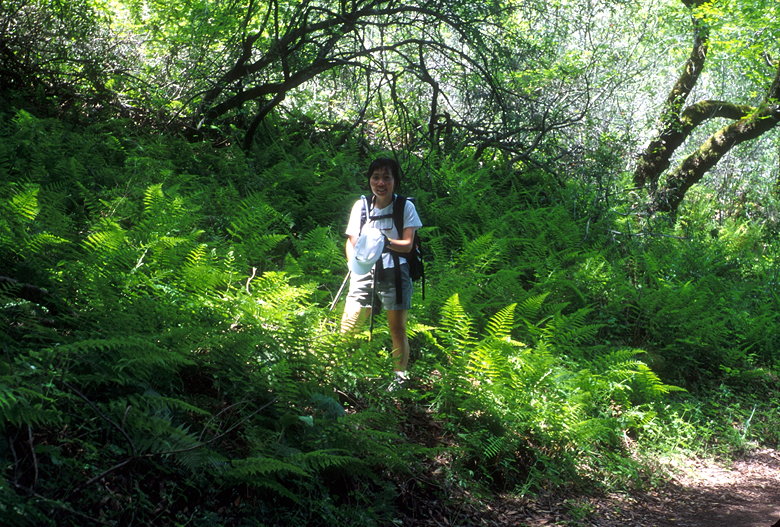
Lan(d) of the Ferns
About 1.5 miles before the bottom there are two trails to the
left for "Hidden Villa". We're guessing the two trails form a
loop, but we didn't have time to investigate. One of the signs
tells us that Hidden Villa is private property open to the public
for hiking. But it is not open during the summer, when they have
camps there. Perhaps we will have to investigate the trail sometime
in the future.
Near the very end of our hike Lan spotted a couple of gray squirrels
humping on a tree. Alas, we were too slow with our cameras and
that image will not grace my website.
| 

