Angie, Dave, Jennie, Joe, Randy, Reza, Weihaw, and I went to Yosemite
and hiked up Half Dome.
Finally. After months of planning, training, and waiting, the day
was finally here. We arrived in El Portal, just outside Yosemite, the
night before, prepared to handle the toughest hike of our lives.
Unfortunately, arriving early didn't help with acclimation because El
Portal is only at 2000 feet elevation. The Yosemite Valley floor is
at 4000 feet elevation, and Half Dome stands at 8842 feet. We all
felt the effects of elevation to some degree; for me, I began to
notice the thinner air somewhere between 6500 and 7000 feet.
We parked at Curry Village (the closest parking to the trailhead).
From there, it's a short 3/4 mile flat walk to Happy Isles, the start
of the hike to Vernal Falls, Nevada Falls and, ultimately, Half Dome.
You can also take the shuttle bus from Curry Village to Happy Isles.
We started our hike in the chill morning air around 7:30am. That
gave us about 12 hours to complete the hike before 7:11pm sunset, and
we would need it.
We started up the Mist Trail to Vernal Falls. The climbing begins
immediately. Up, up, we went, chewing up the distance between
ourselves and Half Dome. Half of us had done the hike to
Vernal Falls two years earlier. The
difference in speed was striking. Before we knew it we were at the
Vernal Fall Bridge (0.8 miles and 400 feet of climbing into the hike)
with the first look of the falls, which had noticeably more water
than when we'd seen it in October two years earlier. Restrooms and
the last treated water lie shortly after the bridge. One noticeable
difference was the lack of other hikers. There were a few, but it was
a Friday and early in the morning, so there were a lot less hikers
than we'd seen 2 years before. Then it was more climbing up to the
rock stairway up to the top of the falls -- over 500 steps, many of
which are a foot or more in height. And then we were at the top --
1000 feet of climbing in 1.3 miles -- in a blistering 52 minutes. I
was rather amazed.
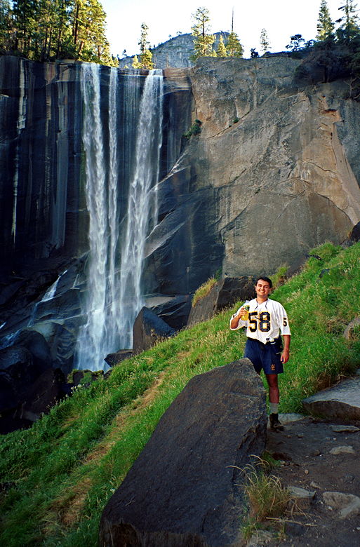
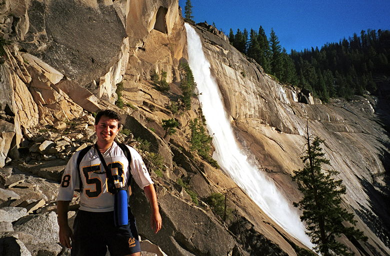
Rez, sipping All Sport in front of Vernal Falls
After enjoying the view from the top of the falls and visiting the
outhouse, we moved on. It's hard to find the trail here, but shortly
we made it to the bridge, crossing the Merced river above Vernal
Falls. The next mile was a relatively small grade through dirt trails
under lots of trees. Mt. Broderick and Liberty Cap loomed high above
us on our left. We passed some hikers coming in the opposite
direction -- they'd hiked up Half Dome and camped out that night, and
were on their way back. Then the fun began again -- an unshaded
series of switchbacks on a trail filled with rocks and more rocks,
alongside Nevada Falls. It wasn't as bad as I thought, however. We
made it to the top of Nevada Falls 2 hours into the hike (2.5 miles
and 1960 feet so far). At the top of the falls is a nicely built
shack with solar panels on top and two non-flushing toilets inside.
Apparently the energy from the solar panels is used to help break
down the waste.
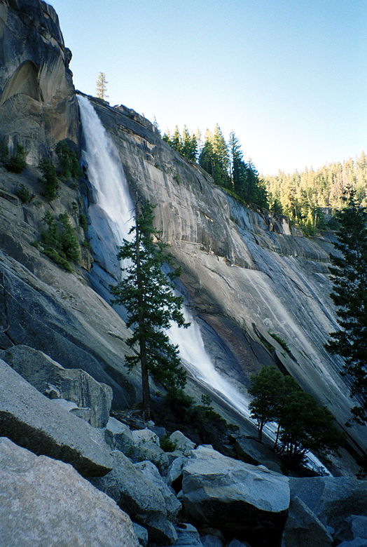
Nevada Falls
The actual top of Nevada Falls is a short 0.2 mile detour along
the John Muir Trail from the top of the Mist Trail, but we decided
not to stop on the way up. It turns out we didn't have time on the
way down. The John Muir Trail is also an alternate route which goes
around the falls, leaving the Mist Trail at the Vernal Falls Bridge
and rejoining it at the top of Nevada Falls. It's longer but not as
steep -- a couple of experienced hikers said it probably takes about
20 minutes longer going down the John Muir Trail. It's 1.2 miles
longer to go that way.
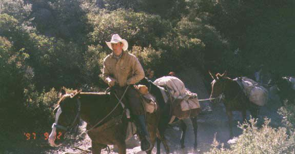
Horses and mules carrying supplies passed us while we were at the
top of the Mist Trail. We'd have a constant reminder of that fact
while hiking the next mile or so.
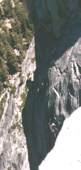
The horses and mules we saw (Click image to view full size)
The trail continued up a few more switchbacks -- at this point,
partly shaded and a few rocks. In general, the rocks on this hike
were much more tolerable than the ones up Mt. Tallac. Most of the
rocks up to Half Dome are embedded firmly in the ground, whereas the
ones up Mt. Tallac are small, loose, and omnipresent.
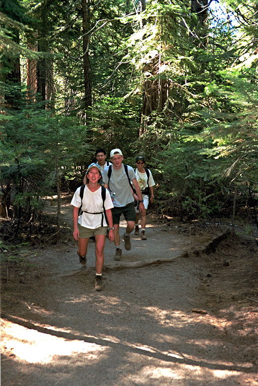
Angie, Dave, Joe, and Jennie, in the forest just past
Little Yosemite.
We then hiked through Little Yosemite along the Merced River -- a
very flat, unshaded portion of the trail which deteriorates into sand
in places. I grew worried as we continued without climbing -- every
step meant that the portion ahead of us would be steeper. The trail
basically becomes steeper and steeper as we neared the top.
We finally entered the forest again, and the climbing started
almost immediately. The steepness and length of the trail began to
take its toll and we stopped more frequently for water, food, and
sunscreen reapplication. The morning chill had given way to a
pleasant temperatures in the 70's, with not a cloud in sight (well,
we couldn't see much above the trees at this point, anyway, but trust
me...). At this point we also started seeing the same hikers over and
over again as we would take turns passing each other.
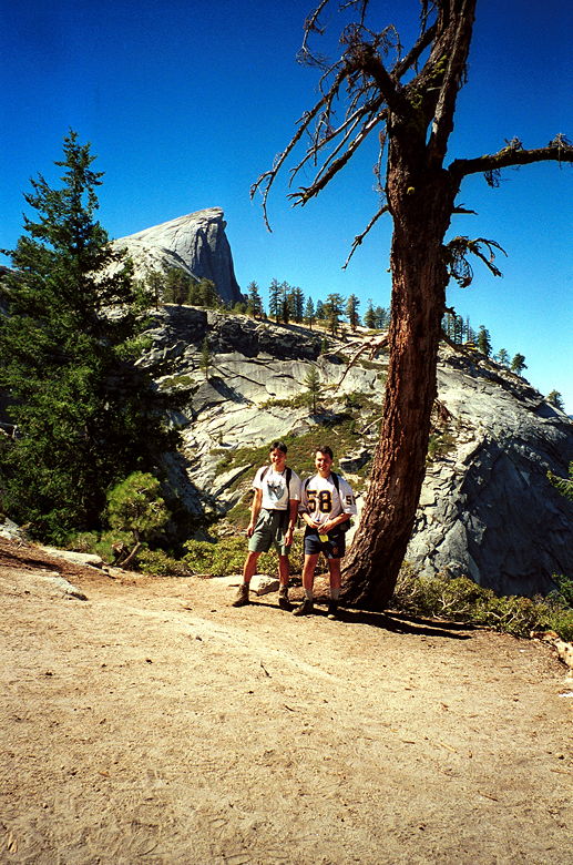
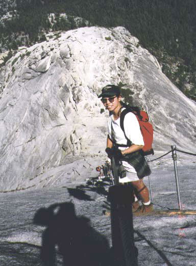
Almost there! Our first good look at our goal.
Two miles from the top there's a sign where the trail forks off
between the Half Dome Trail and John Muir Trail. We continued along
the Half Dome Trail. After a particularly long, straight ascent, we
were met with the first view of our goal -- Half Dome, still off in
the distance, but close enough that we could see hikers going up the
cables up the final ascent. From that point on, we'd have that image
in the back of our heads, waiting for us. It looked incredibly steep.
And I'm just a bit afraid of heights.
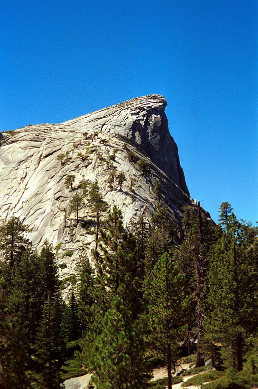
A little bit closer now...
The trees became sparser. We stopped at a plaque telling us not to
go on if there were storm clouds. But it was blue sky everywhere. And
so we began. Not the cables just yet, but some thing almost as bad --
in some ways worse. Another rock staircase -- worse than the one
going up Vernal Falls. Completely unshaded, steep, and nothing but
white rock beneath us. Here's where the lack of oxygen was sorely
felt. I stopped when I noticed my heart rate racing up towards 175.
As I took my camera out of my bag to get to my heart rate monitor, I
accidently dropped the display portion of the monitor. Oops. A hiker
a few feet below me picked it up for me. Which was good, because I
wasn't about to slide back down to get it.
Joe, on the steep rocks before the final ascent up the
cables.
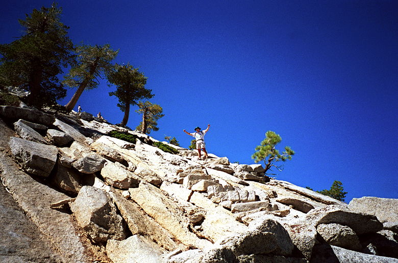
At the top of those stairs is a relatively flat place to rest,
take in the view of hikers going up the cables, and gather up the
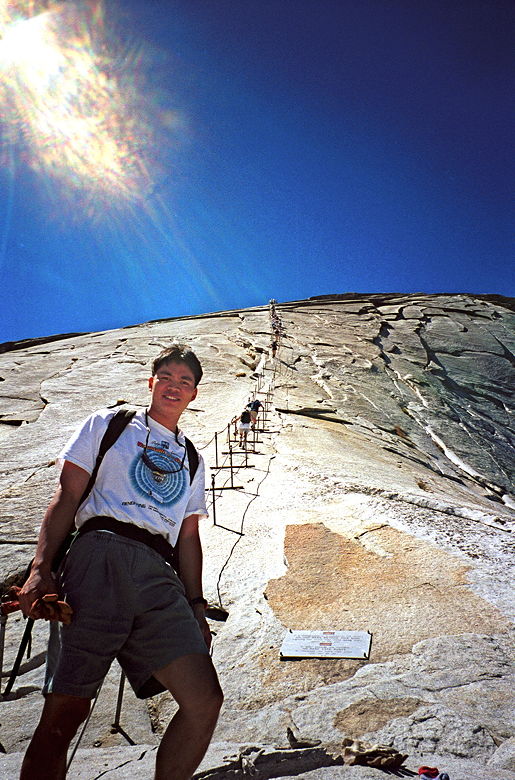
courage to do it yourself. Donning our gloves, we went up, one by
one, single file. The cables are two sets of thick steel threading
metal poles stuck in the rock about every 10-15 feet, 3-4 feet apart.
Two-by-fours resting on the most of the poles provided good places to
stop and rest our feet. Slowly but surely we made our way up the 900
feet (400 vertical feet) to the top -- a 44% average grade! Even
though this was a Friday, there were still a fair number of hikers
going up and down, causing some amount of traffic. One of the poles
popped out of its hole just as Angie got to it. It popped out again
after Dave passed it. We warned each other as we passed to be careful
of the wayward pole. Clanking metal is not an encouraging sound.
The view from the top of the rocks, looking back down.
Looking in the opposite direction, up at the cables.
Here we go!
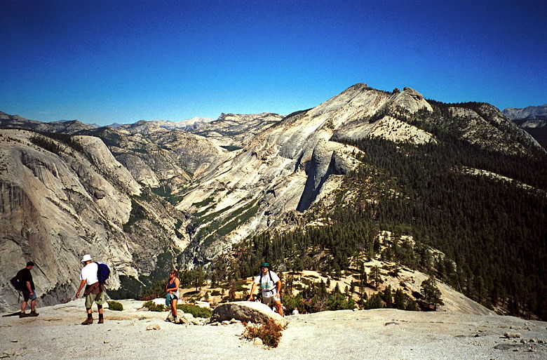
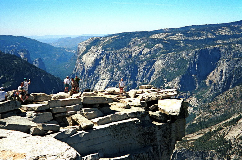
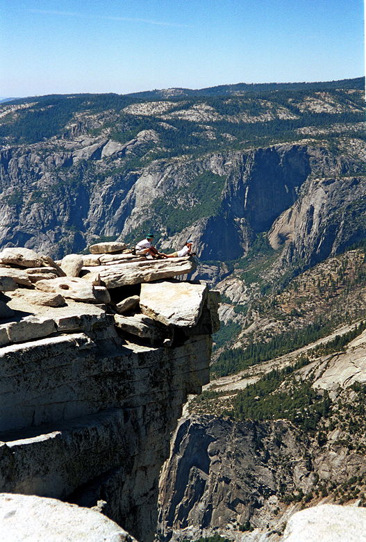
Finally, we were there. On top of Half Dome. Six hours after we'd
started. Probably 30-40 other hikers were also on top at the same
time. We watched as a couple of rock climbers made it up the sheer
side of Half Dome and topped out while we had lunch. The views are,
of course, great. Words can't really describe so I'll wait for my
pictures. The following day we'd be at Glacier Point looking at Half
Dome -- looking at the people who were standing where we were
standing now. We'd overhear people saying "There can't be people up
there -- how did they get there?!" But we would know, and feel a
great sense of pride and accomplishment. And even amazement.
Angie, standing at the top
Joe holding Angie by the ankles
Panorama from the top (Click image to view full size)
A climber make his way up to the top.
Jennie, getting ready to head down the cables. Picture
courtesy of Weihaw.
After a little over an hour at the top, we headed back down. I
expected the trip down the cables to be more frightening than going
up, but it wasn't. For me, anyway, I found it very easy coming down.
Then it was carefully down the rock stairs. Soon we were speeding
down the mountain, trying to get back before sunset. Back to the 2
mile sign. Back to the flat part going through Little Yosemite. A
small snake slithered near me as we approached Nevada Falls. I jumped
instinctively. Before I had a chance to take out my camera it was
gone. We inched down Nevada Falls, and then down Vernal Falls. I
think it's harder going up Vernal Falls, but harder going down Nevada
Falls because of loose rocks. A couple days later, one hiker would be
injured on the Mist Trail coming down Nevada Falls -- the same place
we went down! A rock slide caused a tree to hit him (or maybe the
tree caused the rock slide). Be careful!
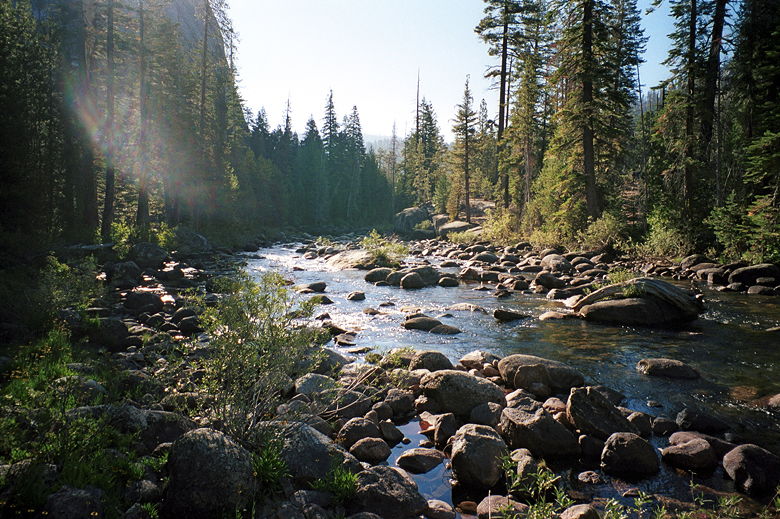
Merced River, next to Little Yosemite, on the way back.
Rez, standing next to Nevada Falls, on the way back.
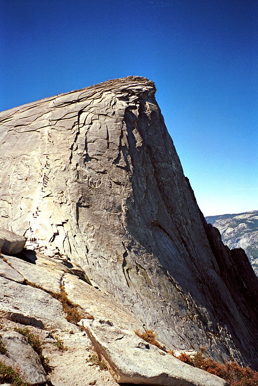
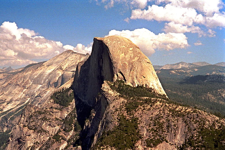
Half Dome, as viewed from Glacier Point, the next day. The
cables are on the opposite side of the dome.
We crossed the Vernal Falls bridge a few minutes before sunset,
and finished the hike in diminishing light, 4 hours, 45 minutes after
we'd started the descent. Then we raced to get on the shuttle bus to
take us back to our cars and, eventually, a nice hot jacuzzi. =)
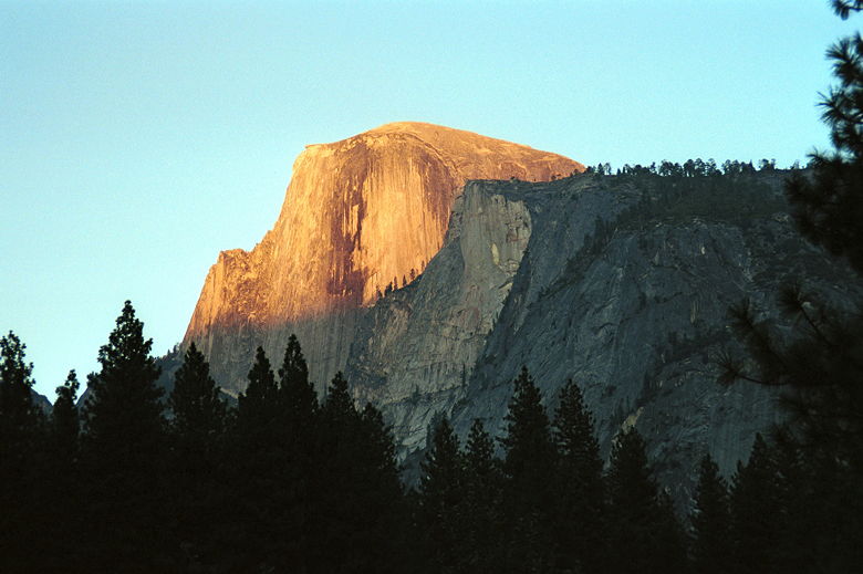
Half Dome at sunset, as seen from the valley floor near
Curry Village.
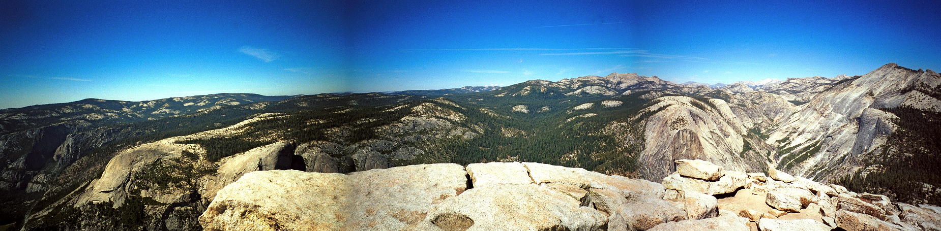
Panoramic view from Glacier Point. That's North Dome and
Basket Dome on the left. From left to right there's Tenaya Canyon,
Half Dome, Liberty Cap, Vernal and Nevada Falls. (Click image to view full size)
Important Note: As of 2010, the National Park Service has instituted a
permit and quota system for
hiking to the top of Half Dome. Visit the
park service web site for details.