|
Jean, Jennie, Lan and I hiked in the Ventana Wilderness.
Friday night we drove down from San Jose in two cars. I'd estimated
a little over 2 hours for the drive. However, there was traffic
(at nearly 10pm!) in Gilroy, and we ended up getting separated
and a bit lost. Jean and I went past China Camp before we realized
we must have gone too far. We turned around and saw Lan and Jennie's
headlights coming in the opposite direction. They must have been
within 2 miles, since I was able to reach them over the radio.
We finally met at the campground. The reason we missed the sign
is that it faces the opposite direction, and you'd have to look
behind you has a round a sharp right turn to see it.
Thankfully, we were able to find a vacant campsite (which are
all first-come, first-served), even though it was past midnight.
After not getting much sleep during the night, the early morning
sky began to fill with sounds you'd expect to hear in a jungle.
Birds of all sorts began their morning song.
At 6:30am, we got up and started packing and preparing for our
hike. The campsite was pretty, with lots of space between the
trees, with a 400-foot hill (which we would soon climb) behind
us for a backdrop. The drive in had heightened our sense of isolation,
as we'd traveled many miles of lonely county roads to get here.
We parked our cars above the campground and started off across
the road at 8am. I'd wanted to start at 7am, but it's hard to
get up that early. The hike I'd planned was 24.1 miles. I'd hoped
to finish in 13 or 14 hours to avoid hiking in the dark much.
But, of course, we were all equipped with headlamps just in case.
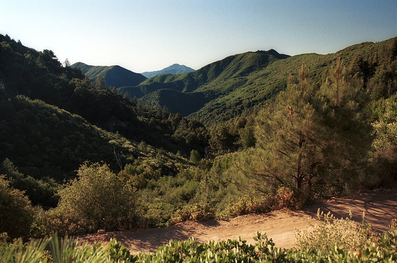
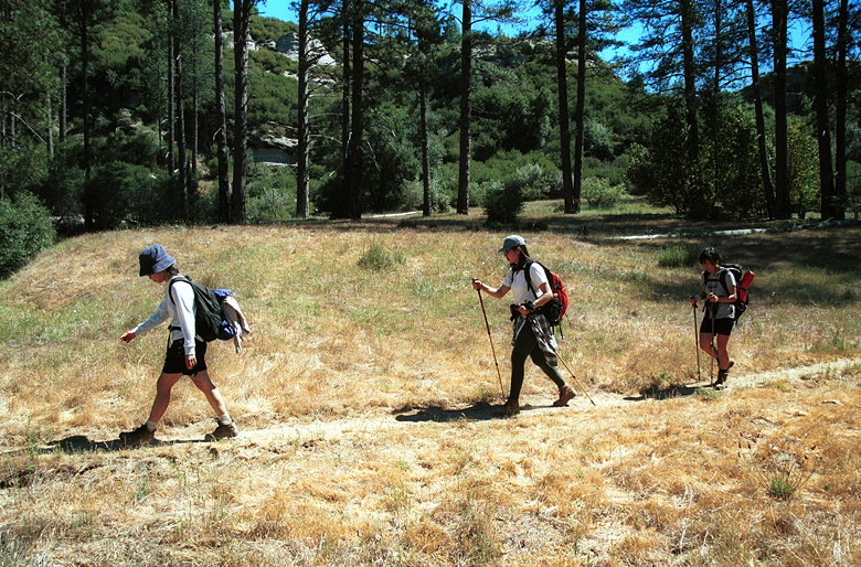
View shortly into the hike (that's Tassajara Road, not the trail)
As soon as we started the hike, we had nice views to the south.
Rolling green hills stretched on as far as the eye could see.
A few more steps, though, and we were soon engulfed in the trees,
no views on either side, starting the short climb up on the Pine
Ridge Trail.
It tops out 400 feet higher and 0.6 miles later, at 4750 the highest
elevation we'd reach on the hike. We descended 400 feet in the
next 0.6 miles, then climbed another 400 in 0.9 miles before starting
our main descent. Along the way, the views started to open up
again. We could see south and west. Again, rolling green hills
and canyons reaching far off to the south. The only variance was
a large section of exposed rock below us to the west.
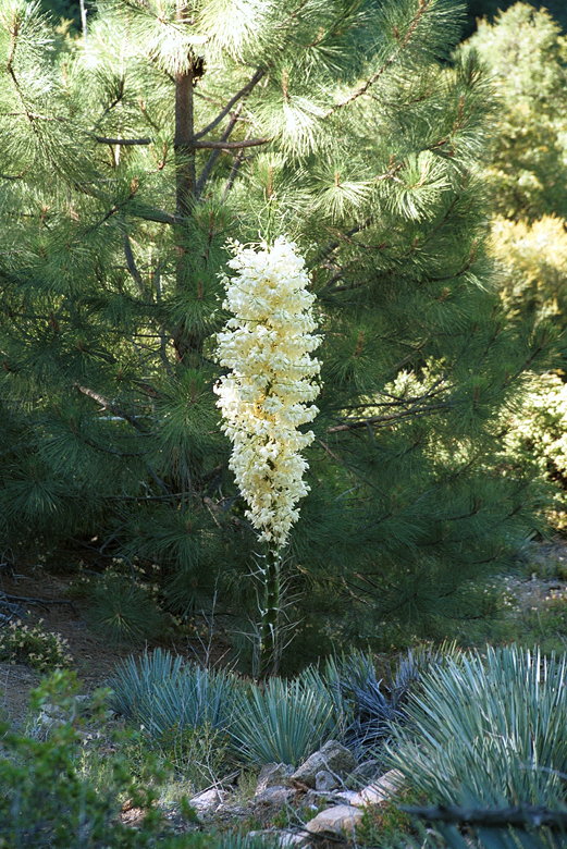
Big flowering plant
The temperature was pleasant at this time of day. We could hike
comfortably in shorts and t-shirts. Unfortunately, this meant
it would become uncomfortably hot later in the day. But, in the
meantime, we enjoyed the many wildflowers and other vegetation.
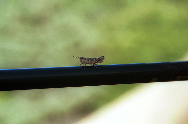
Grasshopper posing on Jennie's trekking pole
After a thousand foot descent, we reached Church Creek Divide
(3.6 miles into the hike), 2 miles after starting out. This is
a main trail intersection. We could go straight on the Pine Ridge
Trail, left on the Church Creek Trail, or right onto the Carmel
River Trail. We turned right and descended 1.7 miles and 500 feet
to Pine Valley. After going through mostly bushes, we emerged
into meadows, pine trees, and large rock faces which beckoned
to be climbed. Some would say it's reminiscent of the Sierras.
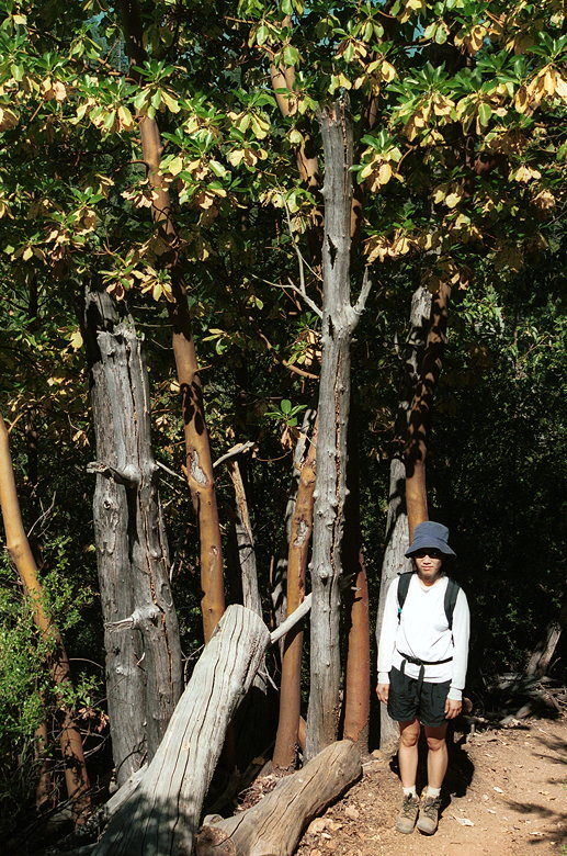
Jean next to some colorful trees
Hiking through Pine Valley
We passed a couple of campers -- the first people we'd seen that
day, before reaching Pine Valley Camp (elevation 3141). Here, on
the Carmel River water's edge, dozens of butterflies fluttered
around. Unfortunately, it also looked like a butterfly grave --
dozens or even a hundred or more butterfly wings littered the
ground. I snapped some pictures before we backtracked a few feet
to the fence and crossed through a gate. There was no sign here,
but I was sure this was the correct way to continue on the Carmel
River Trail. It was 11am when we started this segment of the hike.
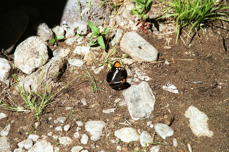
One of many butterflies; note the wing on the ground to the right.
As we hiked along a flat meadow, we passed an area with several
small wood buildings which is apparently an area for horses and
their riders. Ah yes, horses. While we saw lots of evidence of
horses along the trails the entire day, we never actually saw
any horses on the trail (though we would see some off the trail
later).
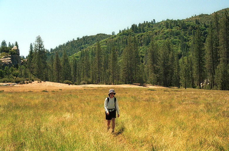
Jean hiking through the field after we crossed the gate
After a brief respite from climbing and descending, we started
a short, 300 foot climb up, crossed another gate, and started
another long descent. The trail was slightly overgrown, but I
commented that it wasn't as bad as the Bald Ridge Trail on Mt.
Diablo. I'd have to retract that comment later.
As we descended further and further, the jungle vegetation closed
in around us. As we were crossing the river in one place, I spotted
a largish gray snake slithering into the bushes in front of me.
I noticed the end of its tail was noticeably lighter than the
rest of its body. It appeared to stay right there, just inside
the bushes, and started making a loud hissing sound. I'm not expert,
and I don't know exactly what a rattlesnake looks or sounds like,
but I didn't want to take any chances. We were a long way from
help, and we hadn't seen anyone since Pine Valley Camp. We changed
our path, crossing the river over some logs, reaching the other
side about 10 feet away from the snake. (Note: there are 6 types
of poisonous rattlesnakes in California, and are found in the
Ventana Wilderness. If bitten, try not to overexert yourself,
and get treated as soon as possible. It helps to kill the snake
and bring it back with you, but of course that's not always possible.
Snake bites are rarely fatal, but take extra precautions if traveling
with small children, as they are at greater risk if bitten.)
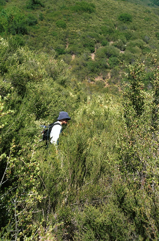
We continued our descent, perhaps a little more wary now. But
soon we had other things to worry about. The bushes closed in
on the trail even more. Soon, we were walking straight through
thick brush with branches so hard they sometimes drew blood on
our legs. The "trail" got worse and worse, and we thought about
turning back. I kept hoping it would get better, but it never
did. It was quite ridiculous. I know trail maintenance can be
difficult, but at some point it may be more prudent to throw in
the towel, let nature take its course, and close off what's left
of the trail. No one had warned us of this. Not the guidebooks,
not the ranger I'd talked to on Friday. Rangers don't know...I
suspect they rarely go far on the trails they're responsible for.
It's probably better to contact the trail maintenance volunteers
to get current trail conditions.
I'd hoped to get to the Round Rock Junction by 1pm, but 1pm came
and went and still no sign of it. I decided that if we didn't
get there by 1:30pm, we should probably turn around. As we neared
1:30pm, and we got closer to the water's edge, I figured we would
go to the river, rest, and head back. Luckily, the trail continued
all the way to the river, and we arrived there at 1:30pm. But
where was Round Rock Junction? In fact, we'd already passed it
without knowing, and were now at Hiding Camp (elevation 1800 feet),
9.6 miles into the hike.
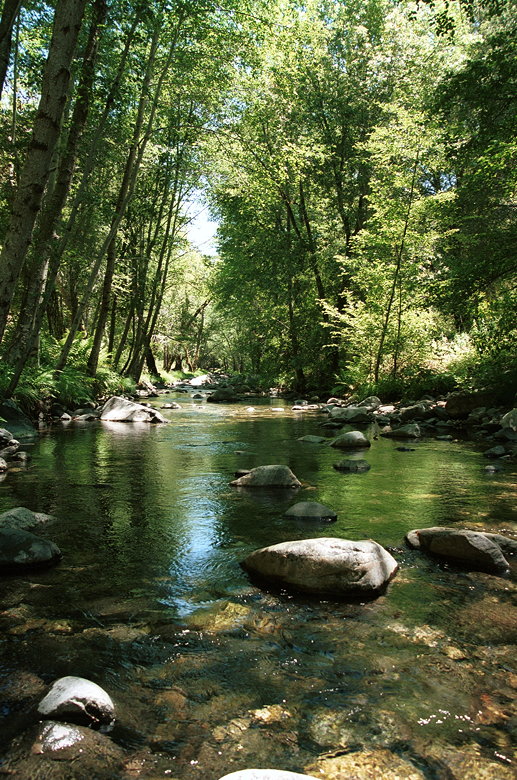
Hiding Camp
Hiding Camp is a beautiful area next to the Carmel River. Here,
the river is about 12-15 feet wide, but fairly shallow. Trees
line either side, providing ample shade, but there's sun to be
found if you want it. I skipped along some rocks to reach the
other side (though I inexplicably put my foot in the water on
the other side). There was a picnic table and a sign which pointed
toward Puerto Suelo Way. I crossed back to the other side and
joined the others. We put our bare feet into the clear, cool water.
I washed some of the dirt away and dried my socks out on the rocks.
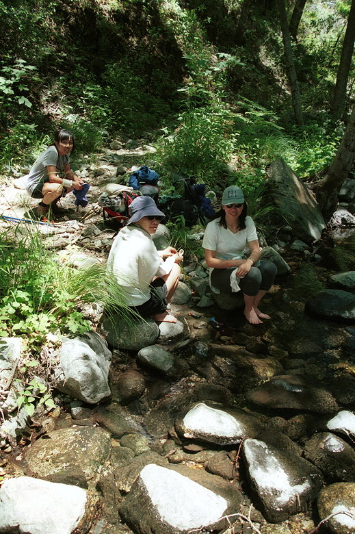
Lunch break at Hiding Camp
This was also a perfect spot to filter some water. By this time,
I had already finished my Platypus (over 80 ounces of water),
so I refilled it. We still had a long way to go. After eating,
drinking, resting, and refilling, we started to pack up to go.
After some discussion we decided to cut our trip short and head
back the way we came. While we didn't like the thought of heading
back through the brush, the alternative wasn't that great either.
Returning along the Miller Canyon Trail would require another
14.5 miles of hiking along unknown trail. Who knows if it was
any better than what we had just gone through? Plus, our progress
had already been slowed and we were looking at spending a fair
amount of time hiking in the dark. So instead we chose the 9.6
miles back the way we came.
We thought we were the only ones there, but a man came over to
the opposite shore and started talking with us. He'd backpacked
there and was spending the night before heading down to Los Padres
Dam. He sounded a bit skeptical when we told him our plans. Probably
thought we were nuts to be doing all this in one day. I'd tend
to agree with him; if it weren't for the fact that we were training
for the 21.4-mile Mt. Whitney day hike, I'd much rather prefer
to do this hike as a backpacking trip.
It was nearly 3pm by the time we started back up the trail. I
put my shell pants on to protect my legs. It was a hot day, but
I didn't care any more -- the skin on my legs had taken enough
of a beating already. We retraced our steps through the brush.
Somehow we ended up by the river again. This wasn't familiar at
all. We retraced our steps back up and found ourselves at the
Round Rock Junction. There's no sign here -- only a log across
the trail. I remembered passing it earlier. So now we headed back
up the correct trail - the Carmel River Trail.
Hiking through the bushes along the "trail"
Later along the trail, we encountered a pair of backpackers coming
the opposite direction. They told us the Miller Canyon Trail was
completely overgrown; they'd tried it in March and had to turn
around when they couldn't find the trail anymore. Plus, the rangers
had told them that the trails were fine and open. So we felt a
little vindicated, and happy with our decision not to go that
route.
We reached the snake's lair and did our little detour again, just
in case. All of us except for Lan, that is -- daredevil that she
is, she decided to walk the trail. The snake, of course, was longer
there.
I continued to suck down water in the oppressive heat. We topped
out and crossed through the gate and headed down into the meadows.
Two people, two dogs, and 3 horses were enjoying themselves at
the horse camp before the second gate. A dozen or more backpackers
swarmed the Pine Valley camp as we passed the butterfly graveyard
and found a place to rest along the river.
My watch read 6pm. It'd taken us 2 1/2 hours to traverse the 4.3
miles to Hiding Camp from here, and 3 hours to get back. Not bad
considering the climbing and bushwhacking involved, but it meant
we'd probably be hiking in the dark later. In the meantime, though,
we enjoyed another rest. Food, drink, more water filtering (I'd
almost finished another 80 ounces of water). Bugs flew all around
us as we rested, unfortunately, as they had been doing most of
the day. As I write this two days later, I still have dozens of
bites on my legs. I'm not going to bother to count. I'll have
to be more liberal with the DEET next time.
It was 6:30pm when we started out from Pine Valley Camp. We still
had 5.3 miles and 2000 feet of climbing to go. As we crossed another
meadow and started our climb, it struck me that the trail was
overgrown here, too. It definitely wasn't as bad as the jungle
we'd passed through, but I hadn't remembered it being overgrown
here. It'd been so long, I must have forgotten.
The climb starts gradually. 1.7 miles and 500 feet later, we found
ourselves at Church Creek Divide at 7:30pm. I felt better knowing
that we only had 3.6 miles to go, and we wouldn't have to do too
much night hiking. After a short break we started our main ascent.
We slowly trudged our way up the switchbacks, 1100 feet in 1.5
miles.
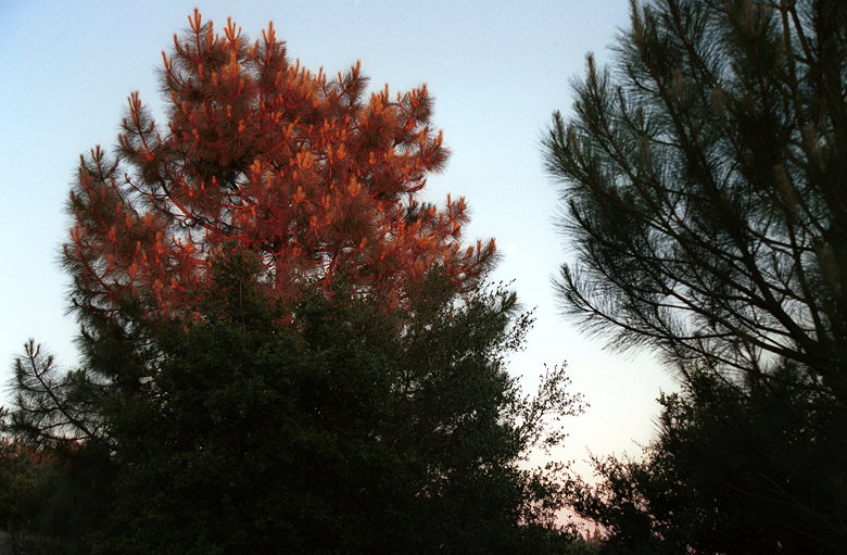
Final rays of light illuminating the top of a tree
After that, it was rolling hills back to the finish. The hills
to the west glowed with the light from the setting sun. A full
moon rose over the ridge to the east. And we had the trail mostly
to ourselves. It was nearly 9pm by the time it started getting
dark. By then we'd taken out our headlamps in preparation. Soon
we re-entered the brush and were glad we had them.
Jean led us through the bushes, head bobbing up and down to check
out the trail ahead. As we started climbing, I knew we had 1.2
miles to go. And when we started our descent, that meant a scant
0.6 miles to go! There was no stopping us now. The sky darkened
but our lights guided us. We broke out into a clearing and I knew
we were there. We heard voices, saw headlights, and then we were
done! A group hug at 9:30pm, after 19.4 miles, 4800 feet of climbing,
and 13 hours, 38 minutes of hiking. We still had a long drive
ahead of us, but there was a great sense of relief, satisfaction,
and accomplishment in finishing, even if we hadn't done the original
intended 24.1 mile route. Mt. Whitney, here we come!
| 

