|
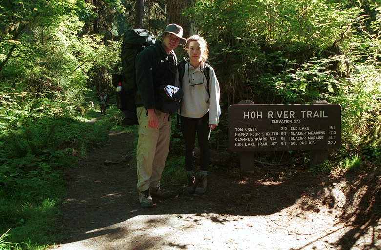
We parked the car, made final preparations, and started off our
hike at about 10:20am.
Because of the plane trip and repacking, I wasn't able to do the
thorough analysis of my pack that I usually do before a backpacking
trip. Significant changes from previous trips included my 1-pound
heavier (but warmer) sleeping bag, and a bear-resistant food container
weighing in at almost 3 pounds. Because of the bear canister,
I couldn't fit everything inside of my pack like I usually do.
The tent had to go outside, underneath my pack. I would guess
my packed weighed in at about 50 pounds. Jean's probably weighed
in between 30 and 35 pounds.
And we're off!
The first few yards of the trail are part of a paved nature trail.
Then we stopped at the wilderness information board to take a
picture, and we were off. Two things become immediately clear.
First of all, the trail is beautiful. It immediately plunges into
the rain forest. It's damp. Trees are covered with beautiful moss.
The only open ground is the trail itself. Various types of mushrooms
are visible at nearly every turn.
The second thing that's immediately clear is that the trail is
relatively crowded. It's a very popular day hike and backpacking
trail. I would guess that the backpackers actually outnumbered
the day hikers we saw. And there were probably at least 200 people
on the entire Hoh River Trail (the 17.5 mile trail we were on),
if not more. Still, the people are friendly, and the further out
you go the fewer people there are.
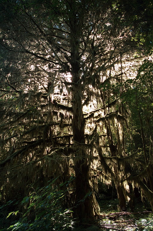
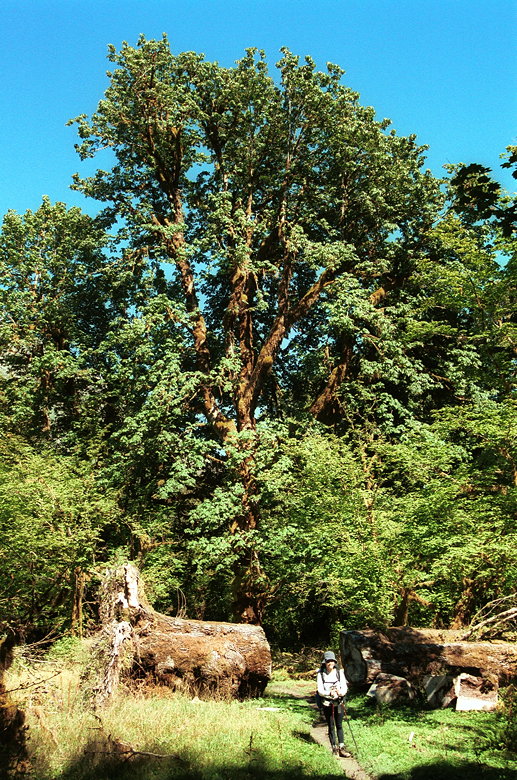
One of the innumerable moss-covered trees
The trail follows the Hoh River for the first 13 miles. The river
stays on our right side the whole time, the constant sound of
the rushing water becoming background noise. The river itself
is usually out of sight, but not far behind a wall of trees. Where
it is visible, the river bed is covered with gravel bars and the
swift, murky gray waters of the Hoh River. (we later learned the
murkiness is most likely caused by something called glacial flour)
Camp sites are frequent, occurring about every mile or two. We
passed three campgrounds by the time we came to a waterfall about
3 miles into the trail. I was beginning to get a bit concerned
about our pace, since we still had 12 miles to go and I was worried
about having to set up in the dark. So Jean went on ahead while
I stopped to take some pictures of the waterfall.
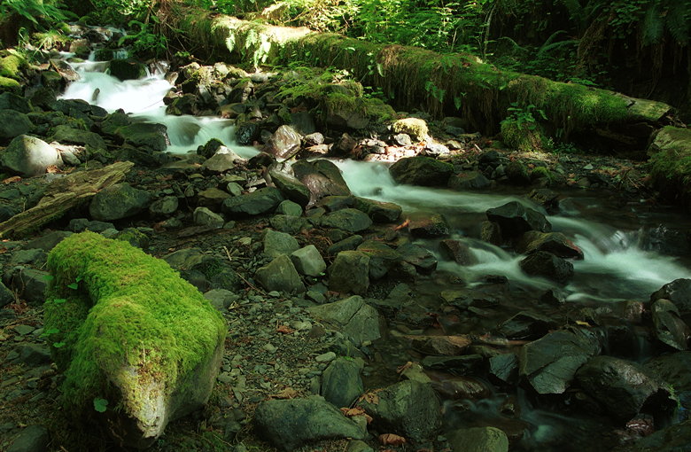
The first of several cascading waterfalls
After about 10-15 minutes I started out on the trail after her.
I kept a fairly good pace but couldn't tell if I was making any
progress. I passed a couple coming in the opposite direction.
I asked them if they'd seen a short Asian woman. They told me
they had. "She was moving VERY fast." I shook my head and started
going about as fast as my 50-pound pack would allow.
Along the way I blew past (and didn't even notice) a very nice
creek (Tom Creek, described in Tuesday's leg), crossed over a
lot of plank sections, on which I got one of my trekking poles
stuck (I learned my lesson and didn't use them on the planks after
that), and crossed over something called a puncheon bridge. I
have no idea what puncheon means, but it was bigger than the more
common foot bridges, which are logs placed over a stream, with
the top leveled off and notched for easy walking.
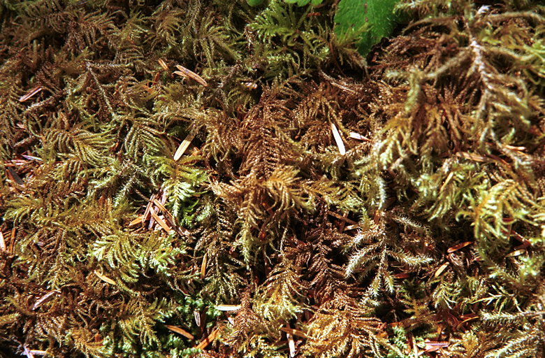
Close-up of some of the ever-prevalent moss
About a half hour after I started, I finally caught up to Jean.
We continued on for a while until we stopped in a dry creek bed
to eat something. Unfortunately, I hadn't brought a lot of food
for lunch. I brought the stuffing leftovers, which tasted great
cold, but hadn't remembered to pack something for Jean. All the
other food was in the bear canister. So I took out my poncho,
put it on the ground, and then proceeded to empty out my entire
pack onto the poncho (the bear canister was at the bottom). I
made sure to take some food out for later use.
Despite (or perhaps because of) the lushness of the forest, we
didn't see much in the way of wildlife. Birds were the most common
sighting. And of course there were bugs. They left us alone as
long as we were moving, but as soon as we stopped, they started
to converge. This helped keep our breaks short. There were also
warnings in several places where wasp and hornet nests were identified.
We gingerly walked past these signs.
Nine miles into the hike we reached a ranger station. Since it
was past labor day, there didn't appear to be any actual ranger
staying there now. We stopped here for a rest and read the information
panels. Apparently, they had a fire near here 20 or 30 years ago.
It was started by lightning and wouldn't go out despite incessant
rain. I can't imagine fire going on for long in the dampness of
the rain forest, but I suppose it's all part of the nature of
renewal. Something must die before something else can grow, usually
on top of the remains of the dead.
Jean standing in one of the few clearings
By this time, we figured out we weren't going to make it to Elk
Lake and the 15 mile campground. So we set our sites on the 13.5
mile campground just past the High Hoh Bridge. The ranger had
said it probably wouldn't be a problem if we decided to camp somewhere
earlier. Hopefully there would still be campsites there.
There are several horse camps along the trail, in addition to
the backpacking camps. Of course that means horse shit along the
trail. I find it odd that backpackers are required to bury their
waste and pack out all trash (even used toilet paper), but horses
can shit all over the trail. And they do. It's like an obstacle
course in places. Jean nearly sprained an ankle one time when
she spotted it mid-stride and adjusted her course to avoid it.
10.5 miles into the hike is Lewis Meadow, the largest meadow visible
along the trail. Other than that, there are a few scattered small
meadows. We slogged on, soon reaching a huge cedar tree which
seemed to be made out of about half a dozen smaller trees.
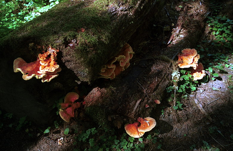
A few of the large variety of mushrooms growing everywhere
It was getting darker now. It wasn't even 6pm yet, but the thick
forest made it seem later. We passed a man camped alone by the
river, then saw a few more sites past him. It was the last site
beside the Hoh River, about 12.6 miles in. The last of the sites
was particularly nice, set down and away from the trail, nestled
in a small grove of trees. I liked the site very much and tried
to convince Jean that we should just take it. She wanted to continue
on to the 13.5 mile campground. We discussed it for a bit and
were just about to head up the trail when two women came down
the trail. They said they'd camped at Elk Lake the previous night
and that it wasn't that great. They also mentioned that there
were a lot of people between here and there. That settled it for
us. We decided there was no guarantee there would be vacant camp
sites for us further on, so we settled down here.
We quickly set up our tent and spread out my poncho on the ground
for our kitchen area. I went off in search of a place to filter
water. Despite the fact that we were only a few feet from a river,
I couldn't find an easy way down to the water. I ended up walking
4 minutes back down the trail before I found a place to sit on
some rocks and filter water. Despite the fact that it was September,
the water was rushing by quickly. I knew a fall into the water
would be very dangerous, so I made sure I didn't. I like the sturdiness
of my water filter and the taste of the water it produces. The
things I don't like about it are the weight (over a pound) and
the fact that it takes 14 minutes to fill my 96 ounce Nalgene
bottle with it.
Dinner consisted of rice, tuna, and a red bell pepper pesto sauce
packet. Yum. After some hot chocolate we washed up and were sleeping
by the river at 9:30pm. I usually can't sleep with loud noises
around me at night, but the river is very soothing, and I feel
asleep quickly.
| 

