|
If you want to go: take Highway 85 south. Take Saratoga Ave.
exit. Turn right; continue through downtown Saratoga (Highway 9,
straight ahead). Continue up Highway 9. At the top, turn right on
Skyline. 3.3 miles down the road, park at the signed parking area for
Upper Stevens Creek County Park/Grizzly Flat. Park on either side of
the road; the trailhead is on the left side of the road.
Anjani, Ashok, Dhananjay, Jacqui, Jean, Joe, and I hiked in Long
Ridge Open Space Preserve to the San Mateo County highpoint.
We started our hike around 11am under 90 degree heat. At the
trailhead, there's a display case with a map and information and a
stack of free maps you can take. The maps describe not only Long
Ridge Open Space Preserve, but also Saratoga Gap, Russian Ridge, Los
Trancos, and several other preserves in the area.
After winding our way along a relatively flat trail for about a
half mile through occasional shade, we stopped at the start of the
Long Ridge Trail to apply bug repellent. Mountain bikers flew down
the hill past us -- we'd encounter mountain bikers throughout the
trail. This is one of the main detractions from this hike -- too many
bikes kicking up dirt in our faces!
The hike may climb only 580 feet, but it does almost all of it at
the beginning of the Long Ridge Trail, climbing steeply (about 15%
average grade I'm guessing) through a forest providing ample shade. A
few minutes into this climb, out of nowhere, Joe came running up the
trail to meet us. I didn't think he was joining us on the hike, so
when he hadn't shown up at the trailhead by 11am (we were supposed to
meet at 10:30), we left. But he'd gotten there just a few minutes
after we'd left and started running after us. He was running up the
steepest part of the trail when he caught up to us.
Now numbering 7, we continued along the trail as it paralleled
Portola Heights Road; Jacqui and Anjani led the way. We emerged from
the forest into the blazing sun, to be met with wide-open views to
the west. A bench commemorating the late Pulitzer Prize-winning
author and noted environmentalist Wallace Stegner sits here,
overlooking the view. We took some pictures and then headed past the
private property sign toward the county highpoint.
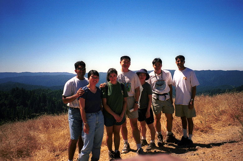
Group shot looking west from near the top
The book "California County Summits," published in 1994, gives
directions on reaching the San Mateo county highpoint, a couple
hundred yards from the bench. It explains the highpoint sits on
private property, but there's a downed fence and a use trail to the
top. Unfortunately, a brand new private fence (most likely built
since 1994) blocked our path. We hiked to the top of a nearby hill,
about 10 or 20 feet lower in elevation than the highpoint, which we
could see past the fence. The views weren't any better than those
from the bench.
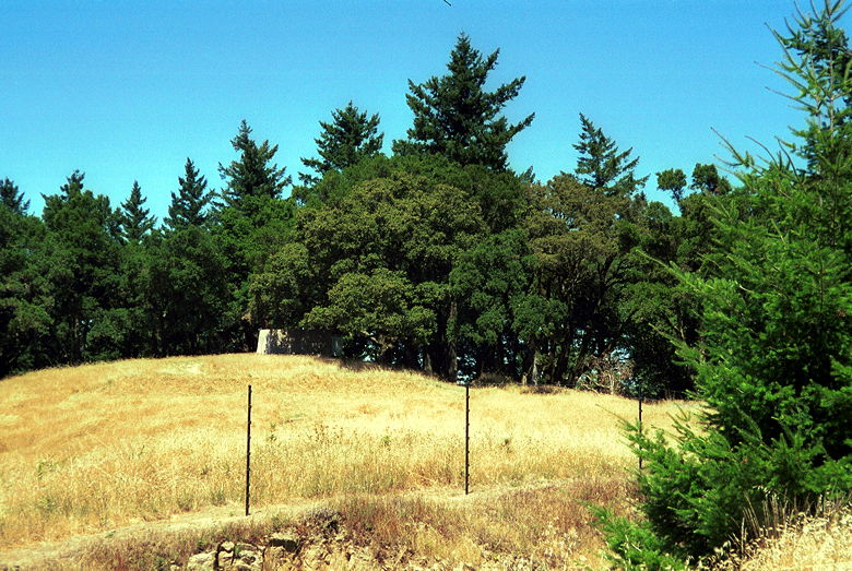
This is a lame picture, but I had to have a picture of the
actual county highpoint, on the other side of the fence.
After returning to the bench and picking the burrs out of our socks
and boots, we continued along Long Ridge Road. We stopped to have
lunch near the gate. Then we re-entered the forest and started hiking
back. Along the way we stopped by a small pool to observe some
salamanders. And then we were back at the parking lot. Anjani, Ashok,
Dhananjay, and Jacqui said goodbye, and Jean, Joe, and I drove over
to Windy Hill to do the
Anniversary Trail.
|


