(Note: the trail route above was created post-hike using electronic maps and was not created
using GPS, so it might not be completely accurate. It's probably pretty close, though.)
For the hiker and backpacker who have never climbed a mountain,
an experience which will greatly enhance and expand the joy and
renewal they have already found in the wilderness awaits them
on Mt. Dana. And for the well conditioned tourist who has never
climbed a mountain there awaits on Mt. Dana an experience which
will provide the opportunity, if seized, to enrich his/her life
beyond measure.
- Phil Arnot, "High Sierra"
Introduction
Usually my hike descriptions are somewhat dry, factual descriptions
of the hike route and events that occurred on the hike. I write
them for at least three reasons: as a context for the pictures I
put up on my hiking web site; as a description for other people to
read -- people who did the
hike with me, people who are interested in doing the same hike,
or people who are just interested in hearing about it; and
as a written snapshot of the event for myself, so that I can remember
it years from now -- a sort of hiking journal.
This hike description will be all of the above. But it will be
something more, as well. I've never been on a hike that affected
me and the people with me so deeply. One could argue that hiking
to the top of Half Dome was something special. But there is no
argument that hiking to the top of Mt. Dana was a Significant
Hike. And when I say Significant Hike, I don't just mean a hike
that was really hard -- although obviously Mt. Dana was. I mean
a hike that actually affects your life in some way. Perhaps it
makes you look at the world -- or more likely yourself -- differently.
I am left with at least two very strong impressions from the hike.
First, I am disappointed with myself for endangering the lives
of everyone on the hike. This sounds like a very strong statement,
and one I can't say without some misgiving. I'm not a paid guide,
and perhaps I shouldn't feel complete responsibility for everyone's
safety, but I am the "hike leader" so to speak, and I do feel
a great amount of responsibility. Perhaps, too, I've exaggerated
the extent of the danger to ourselves. But it is important to
keep the proper perspective. As Reza would say, we must show Mt.
Dana the proper respect.
Second, it is impossible to go through what we did and not be
affected by it on a personal level in multiple ways. The feelings
of accomplishment, of doing something really worthwhile, of staring
down your demons and conquering them, of camaraderie with the
other hikers sharing the experience.
So as you read this description, keep in mind the great challenge
and accomplishment of this experience, tinged with the realities
of safety.
Preparation
First, a little background.
Jean, Jennie, Reza, and I arrived at Tuolumne Meadows Campground
around lunchtime on Thursday (August 13th). As we started our
first hike, to Elizabeth Lake, a little before 3pm, it started
to rain. And then we started hearing thunder and lightning in
the distance. The rain never got very bad, the lightning never
got very close (hardly ever saw it, it was so far away), and it
stopped after an hour or two. We were a little frightened but
undeterred.
Friday morning, the four of us hiked Lembert Dome. As we finished
at noon, it started to rain. By the time we got to our camp site,
it started to pour. Angie, Cammy, Kane, Lan, and Susan all arrived
at this time. They set up camp and did their own hikes while Jean,
Jennie, Reza and I hiked to Cathedral Lakes. It was still raining
when we started, but it was off and on, very light, for most of
the first part of the hike. But as we got closer to Cathedral
Lakes itself, it got worse, and it was pouring again when we reached
the upper lake. In retrospect (actually, we were all thinking
this at the time), we shouldn't have been out in the meadow surrounding
the lake while we were getting dumped on by buckets of water while
hearing thunder and lightning in the distance. We were obviously
pretty good lightning targets in the middle of a meadow.
Weihaw and his friend C.J. arrived that afternoon. C.J. suffered
from altitude sickness and rested most of the day. So there were
now eleven of us. Originally, I thought there would only be five
of us doing the Mt. Dana hike -- Jean, Jennie, Reza, Weihaw, and
I. But plans changed and it turned out all eleven of us would
start the hike. As we feasted on the vast amounts of food everyone
brought, I told everyone we would try to wake up at 6am and leave
the campsite around 7:30 - 7:40am. Since the rain had started
at noon on Friday, it was my goal to start the hike at 8am, and
start descending the mountain by 11am. Mt. Dana, at 13,053 feet
is the second highest peak in Yosemite (Mt. Lyell is 13,1114).
It is no place to be in a lightning storm. I thought I was being
a little conservative by allowing 1 mph (the hike to the top is
2.9 miles, 3108 feet of elevation gain), and trying to descend
by 11am, since the storm had started at 12 noon on Friday. But
my estimations would be horribly wrong.
Saturday Morning
Shortly before 6am on Saturday morning, I woke up. As I looked
around my tent, I could pretend that I was about to launch an
attack on Mt. Everest. I'd read Into Thin Air a couple months
earlier, and I could almost imagine my tent was perched at Camp
Four, 3000 feet below the summit. That may be a stretch, but I
did have that feeling, that excitement. After doing three beautiful
hikes in the previous two days, I had almost convinced myself
that Mt. Dana would just be icing on the cake -- that even if
it was a disappointment the trip would be a success. But Saturday
morning, I was almost giddy; I was itching to get up that mountain.
I got out of my tent shortly after 6am and started to get ready
and rouse everyone else up. I could tell that we wouldn't leave
on time, but I had been conservative, so I wasn't too worried
by the extra time we were taking. While we were getting ready,
Kane's friend Daryl came by. He, too, would be joining us on our
adventure, so we now numbered twelve. Daryl had actually been
to the plateau before, hiking partway up the mountain. I was glad
to have his experience with us, since there was no maintained
trail (just a use trail) and I wasn't sure if we'd easily be able
to find our way to the top.
Tioga Pass
9,945 Feet
We didn't leave camp until after 8am. We drove to the Tioga Pass
ranger station (elevation 9945) and made our final preparations.
Daryl went over to the ranger at the entrance and discussed the
path to the top with him.
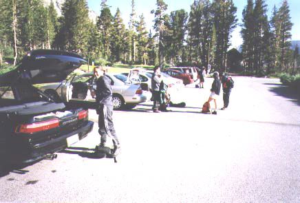
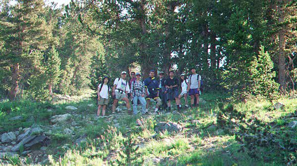
Tioga Pass parking lot. Preparing for the hike.
At 8:50am, we started the hike. I was a bit more concerned now,
but this still gave us 3 hours, 10 minutes to get to the top by
noon, which is when the rain started the day before, so I still
thought we could make it.
We started under clear blue skies. I noticed a tiny white cloud
off in the distance, and said, not at all jokingly, that the little
cloud would grow into the daily afternoon thunderstorm.
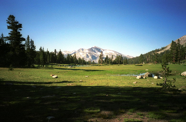
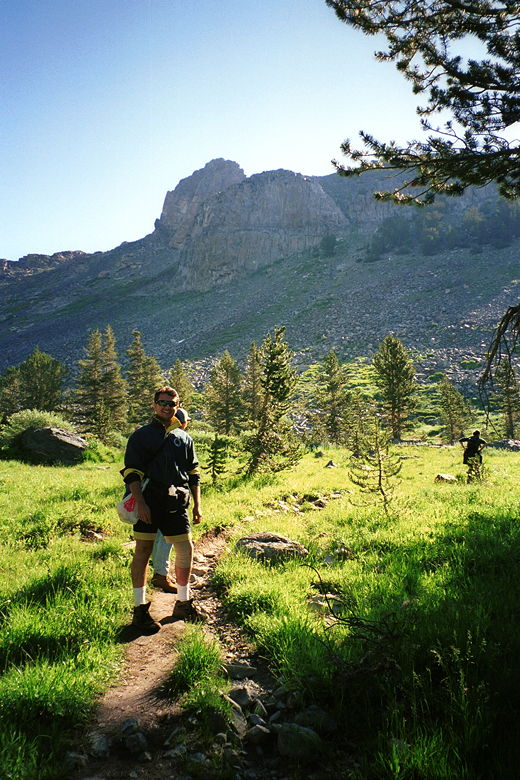
The meadow to the right of the trail near the start.
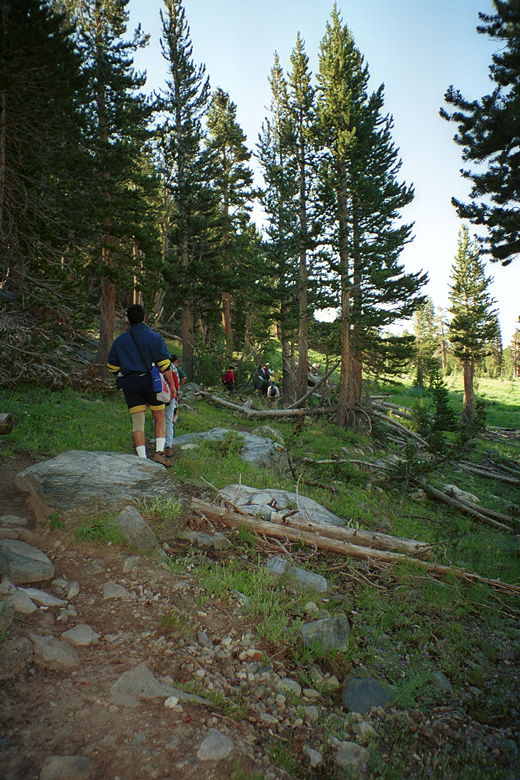
Early along the trail, there are lots of trees.
Daryl led the way through the trees, with small lakes and meadows
on either side. Kane, Lan, Susan, C.J., and Weihaw followed; then
came Reza, Jean, Jennie, Cammy, and Angie. I drifted off to the
back of the pack to make sure everyone was okay.
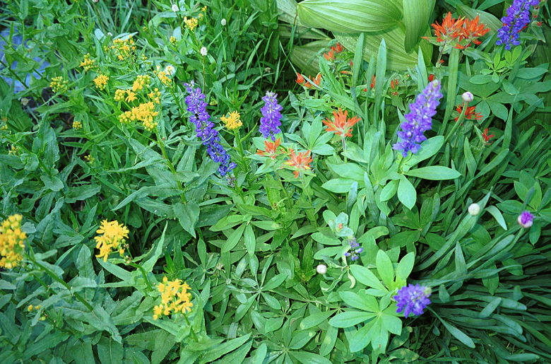
Some beautiful wildflowers near the beginning of the trail.
After a short flat section, the trail starts climbing steeply.
We stopped frequently to let everyone catch their collective breaths.
Kane and I compared heart rates (we both had heart rate monitors
strapped to our chests). Mine would stay at about 150 bpm for
most of the hike up to the plateau, dropping down to 105 during
our rest stops.
The trees are getting scarcer...
After another short flat section, the trail climbs again. We were
surrounded by trees and brush, but we knew that we would soon
be above all vegetation. About 40 minutes into the hike, Angie
and Cammy decided to turn around. They walked back to their car
while the remaining ten of us continued on the climb.
Cammy took this picture just before she and Angie descended.
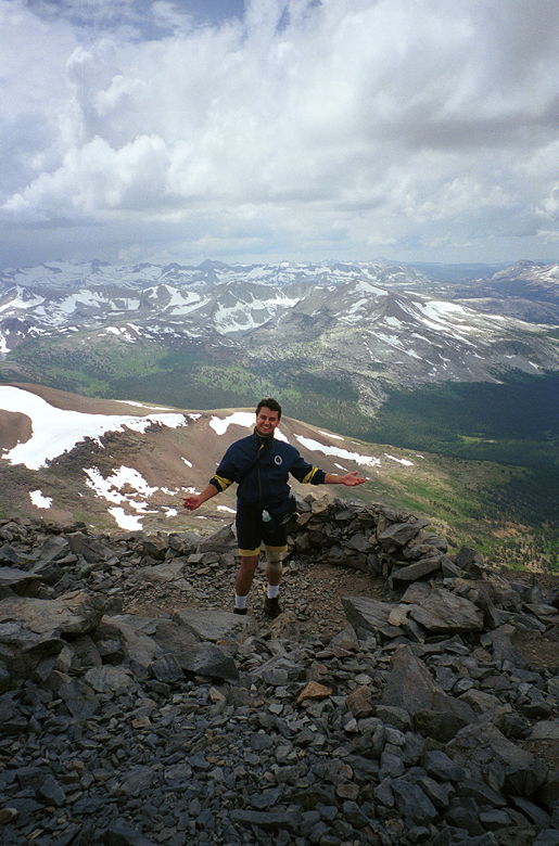
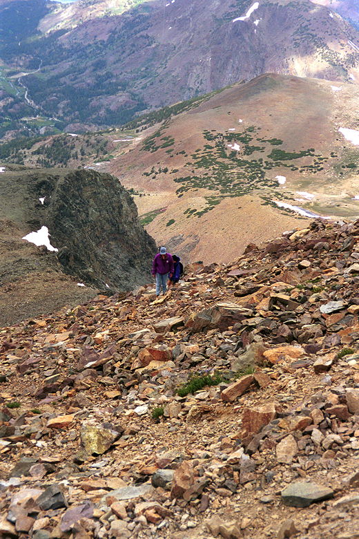
Kane and I, taking a break near the first big crest.
Mt. Dana rises 3108 feet in 2.9 miles from the Tioga Pass ranger
station. That's a 20.3% average grade. But because some sections
are flat, and even downhill, much of the trail is steeper than
that. Along the way, I kept everyone updated with our vertical
progress by reciting numbers from my altimeter watch. It was a
good motivator for me, telling me how much progress we had made,
and how much we still had to go.
At some point we found ourselves above the treeline, with just
bushes at our sides. The views started to open up and we marveled
at them and took pictures. As we stopped, Reza began to voice
his concerns about making it to the top before the storms, and
I agreed that we need to make our stops shorter.
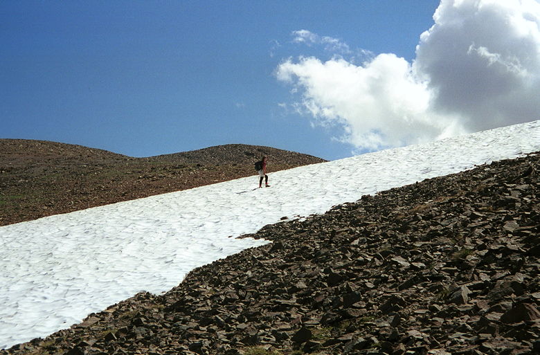
Daryl hikes straight up the snow patch. Notice the clouds starting
to come in.
We started to see patches of snow, and Daryl decided to hike up
through a snow patch while the rest of us hiked along the trail.
I'd never really done any hiking in deep snow patches before,
and the thought rather scared me. I had visions of myself sinking
or sliding down the snow patch, so I stuck to the trail as much
as I could. This would turn out to be a mistake.
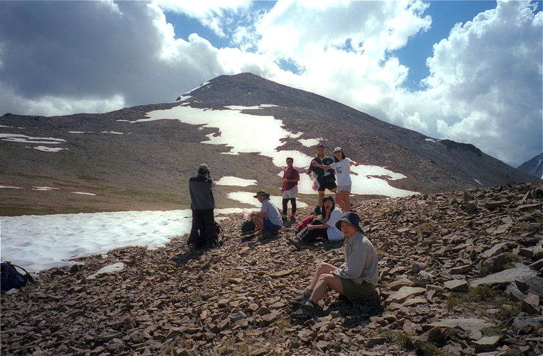
Plateau
11,400 feet
We crested the plateau and had a clear view of what lay ahead
of us -- Mt. Dana, still rising over 1600 feet above us. It was
a huge pile of rocks, void of vegetation, large snow drifts down
the middle slope. The ridgeline lay northeast of us. We saw a
few people hiking up above us. We'd already passed one hiker who
turned out to be an amputee, and there were a few other hikers
behind us as well. Above us, we could see the clouds starting
to form. Jennie mentioned that they looked like friendly clouds.
Indeed, they were still very white. But I was pretty sure that
later they would be decidedly unfriendly.
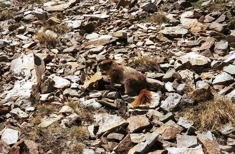
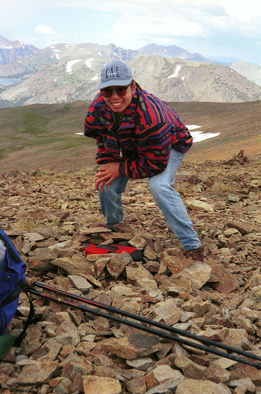
Marmot!
It was almost 11am by the time we made it to the plateau. We rested
here, played with the marmots, and readied ourselves for the upcoming
climb. While we were there, I talked with Kane, Reza, Jean and
Jennie, trying to see how everyone felt. Jean and Jennie had been
lagging behind; while part of me wanted to stay with them, part
of me also wanted to make sure I got to the top -- and that meant
turning on the afterburners. It was becoming just like your typical
Everest expedition. The closer you get to the top, the more it's
"every man (or woman) for himself (herself)." But Jean and Jennie
assured me it was okay for me to go on. So we split up. Daryl,
Kane, Weihaw, C.J., Reza, and I would be the lead group. Jean
and Jennie would follow. Lan and Susan decided that was enough
and would head back down. We gave a TalkAbout radio to each group
(both Kane and I had one in the lead group). If it were not for
the radios, I don't think I would have felt at all comfortable
splitting up like that.
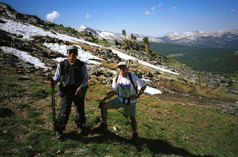
Resting on the plateau. We'd cross the snow patch on the left
and head up to the ridge in the upper left before going for the
summit. The clouds keep coming in...
At precisely 11am, we started off across the plateau, heading
north across a snow field toward the ridgeline. We picked up a
trail on the other side of the snow and started our ascent up
the barren dirt. I say "a trail" and not "the trail" because at
this point, people take whatever route they deem the best. So
there's not just one trail, but many very faint trails snaking
their way up the mountainside.
Soon after crossing the snow field, I twisted my left ankle with
an awkward step. I'd sprained my left ankle 4 times before (always
playing basketball, of course). So I was immediately worried.
But I moved it around and tested it and it felt okay. My big hiking
boots saved me yet again. Of course I didn't mention my ankle
to anyone until much later.
Daryl decided to take the more direct route -- up a steep snow
patch. So it turned out that Reza and I were the ones leading
up the "trail." Weihaw and C.J. followed further back, and Kane
fell further and further behind, which surprised me since he seemed
to be in good shape. But he was carrying a 7 or 8 pound tripod
with him. Soon after the snow field, he decided it wasn't worth
it, and left the tripod on the trail, hoping to lighten his load
and recover the tripod on the way back down.
Later, I would hear that C.J. had started to get altitude sickness
again and had headed down. Alone. Had I known, I would have insisted
that someone go down with him -- most probably with Lan and Susan,
since they stayed at the plateau for some time. But they apparently
didn't have their radio turned on, and so C.J. was left to fend
for himself.
At one some point, I gave Weihaw the "100 test" to see how he
was feeling. The test (used for sleep deprivation subjects, but
a decent test for altitude-induced intoxication) is that the subject
must count backwards from 100 by 7. Weihaw counted 100, 93, 86,
79, 70, 63. When I stopped him and pointed out his mistake, he
seemed a bit confused at first. But when I suggested I give him
a re-test by having him count down from 200 by 13, he gave the
proper response: "f*** you!"
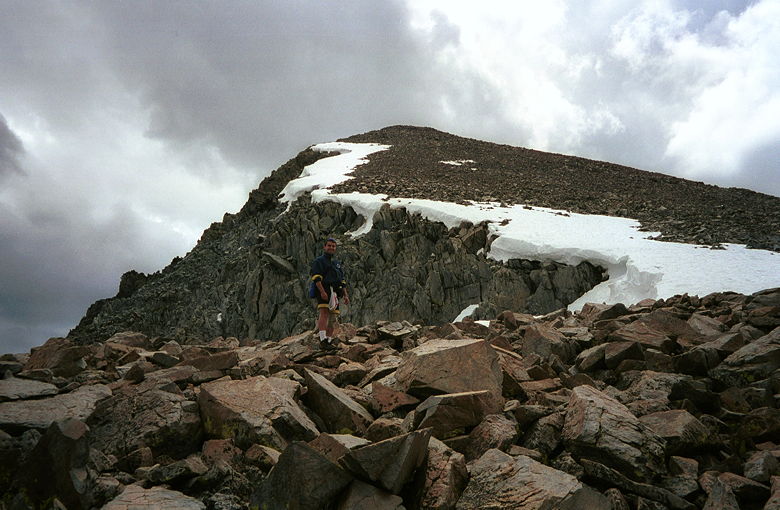
Northwest Ridge
12,160 feet
The rest of us turned our radios on and communicated our progress.
Reza and I were having problems finding the trail, but we eventually
made it to the northwest ridge (northwest of the peak, that is).
Reza reached it a few seconds before me, and immediately said
"OH MY GOD." I reached it and repeated the phrase into the radio.
We'd been climbing rock and dirt for hundreds of feet, thinking
of nothing but the climb. Then, suddenly, we're standing on a
ridge with a big drop-off, an amazingly deep aqua blue lake below
us, and our first impressive view of Mono Lake lying 7.5 miles
northeast. I'd later learn the other lake is Dana Lake. It was
an absolutely amazing sight, but I was too winded and worried
about the time to take my camera out and take a picture. The clouds
were getting worse -- they were no longer friendly white. I was
a little heartened by a hiker coming down -- he said we shouldn't
worry about the clouds just yet, and that we'd be safe once we
got about 15 minutes down the mountain once we'd summited.
We still had about 900 vertical feet to go from the ridge. But
we could see no trace of any trail anymore. Reza and I started
using our hands for balance and started carefully hiking up the
boulder field. This surprised me just a little. My hiking book
hadn't mentioned anything about this. Perhaps that's why the hike
isn't listed in the latest version of the book. I'd done almost
exclusively Class 1 hikes -- walking on a trail. Mt. Tallac involved
a short section of easy Class 2 hiking -- hiking rough cross-country
terrain, such as boulders or talus, sometimes using the hands
for balance. But this section in front of us was definitely hard
Class 2 hiking.
As the clouds moved in, Reza and I started to think seriously
of turning back. Not only were we worried about getting hit by
lightning, but also by the prospect of the perilous descent of
these rocks. Going up is almost always safer than going down.
We began to wonder if it was really worth it. What was the point?
Why were we doing this? Of course we both wanted to make it to
the top, but at the risk of life and limb?
I think we agreed that if weather conditions got worse, we would
just sprint down the mountain. We kept going. We were above 12,000
feet now, and I was definitely feeling the altitude. My head began
to throb. My heart rate monitor told me I was really exerting
myself -- 165 bpm now. I used it to gauge my pace and rest. I
would take a dozen or so steps and stop to catch my breath and
let Reza and Weihaw catch up. Daryl was walking easily a few minutes
above us. He looked like it was a walk in the park for him. I
looked down below us; Kane was still far below us, and Jean and
Jennie were far below him.
Reza, past the tough section of rocks just past the ridge.
The ascent became less hairy 10 or 15 minutes past the ridge.
Daryl encouraged us a little by telling us we were getting really
close. Soon we crested a false summit and had the prize in hand
-- the summit of Dana right above us, just 100 or 200 feet of
climbing to go. There would be no stopping us now. I turned on
the radio and relayed our progress. Jean and Jennie were close
to the Oh-my-God ridge. Kane was halfway in between them and Reza,
Weihaw, and I. At this point, I told Jean and Jennie that we were
all having a hard time making it, and suggested that perhaps they
should just stop at the ridge and turn back. I figured there was
no point in them going further than that if they weren't going
to make it to the top. No point in them facing the perilous rock
descent. They acknowledged me, but didn't actually say there were
going to head back down.
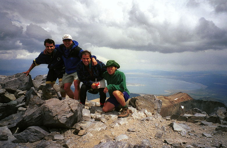
Summit
13,053 feet
The sky was turning dark as Daryl summited at about 12:20pm.
He was sitting there, reading (appropriately enough) "The Tibetan
Book of Living and Dying" as Reza, Weihaw, and I summited at
12:28pm. I turned on the radio and gave everyone the good news
-- we'd made it to the top! I was in a state of exhaustion and
elation while we took our group pictures, played with the marmots,
and ate our lunch. There were two other hikers at the top when
we summited. I believe a total of about 20 people (including
our group) summited that day.
My altimeter read 12,890 feet, which didn't surprise me, since
it usually reads somewhat low -- but it was only off by 160 feet.
As I sat down to change my film and refill my water bottles from
my large water bag, my head throbbed in pain. At 13,053 feet,
there's 39% less oxygen than at sea level. One of the most common
reactions is headaches, although symptoms of altitude sickness
can get much worse.
I took two ibuprofen pills and gave two to Reza, as well. For
some strange reason, when I stood up I felt better. But the pain
returned every time I sat down. It was as if someone had put a
vise around my head was slowly keeping pressure on it. From my
hikes up Mt. Tallac and Half Dome, I knew from experience that
I usually started to feel lightheaded at above 7000 feet. That
was the reason I'd arrived two nights before -- to acclimatize.
It definitely helped. We were camped at Tuolumne Meadows, elevation
8600, for two nights before attempting Mt. Dana. And I didn't
feel the elevation at all until 12,000 feet. But now I was definitely
feeling the altitude at 13,053 feet -- nearly 4500 feet above
our camp.
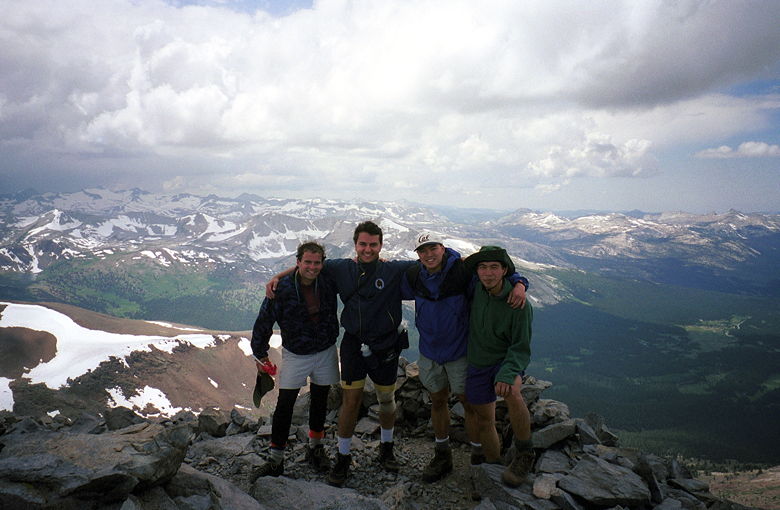
Reza, me, Daryl, and Weihaw at the top, Mono Lake in the background.
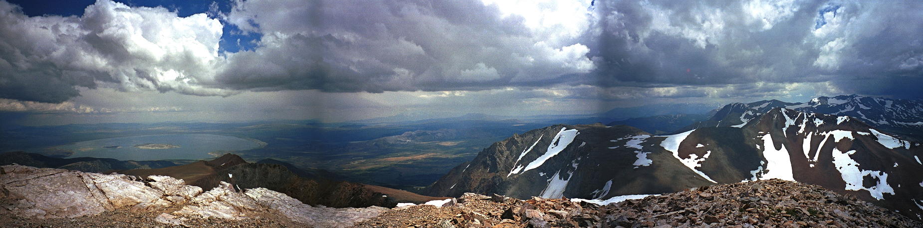
Oh, did I mention the views? Despite the clouds, the views were
amazing. Snowcapped mountains surrounded us on all sides, except
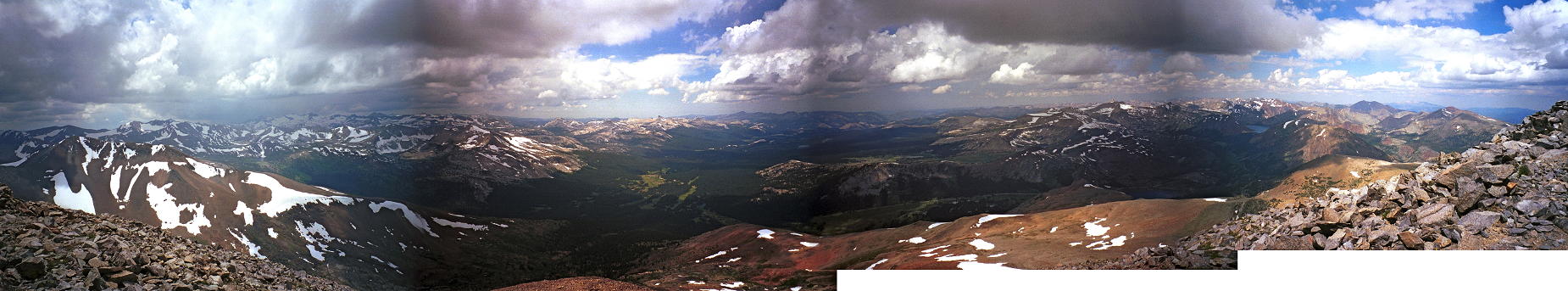
to the northeast, where Mono Lake dominated the landscape. I snapped
several pictures to capture a 360-degree view. There were two
or three large stacks of rocks shaped in semicircles, like little
fortress lookouts. Possibly made by people who needed shelter
from the wind. Unfortunately there was no summit register to sign.
Daryl, Reza, me, and Weihaw at the top
Notice the semicircle of rocks to Reza's left.
View from the top looking west. (Click image to view full size)
View from the top looking northeast toward Mono Lake (Click image to view full size)
While we were there, Kane asked us over the radio if a woman had
just summited. He'd been behind her and wanted to gauge his progress.
We told him she just had. A few minutes later, Kane was at the
top, at 12:48pm, 20 minutes after we'd summited. We relayed the
news down to Jean and Jennie, who were still climbing. The skies
were getting darker, and Reza and I were itching to get down.
We asked if anyone else wanted to join us. Kane said he was just
going to stay a few minutes and take some pictures and head down.
Descent
Just a minute or two after Kane summited, Reza and I started
racing down the mountain. As we headed down, we followed a clear
path going down the southern side of the west face. We hadn't
seen it at all coming up. We warned Jean and Jennie to start heading
down themselves. Reza tried to convince them that, for all practical
purposes, they had made it to the top. But there could be no denying
them the summit.
Jean and Jennie come up as Reza and I descend. That's the Oh-My-God
ridge on the left.
Somewhere around this time Lan radioed up. I asked where she was.
She and Susan were already back at their cars while the rest of
us were high up on the mountain. The radios were purported to
have a range of 2 miles, and she was nearly 3 miles down the trail!
But I later thought about it and realized the straight line between
us was probably closer to 2 miles. And there was nothing between
us except empty sky. Still, it was very impressive.
I was surprised when I saw Jean and Jennie approaching the last
false summit. I hadn't realized they were that close. But they
were still about 10 minutes away from the summit, and as the skies
continued to darken, every minute would count. They dropped Jean's
pack (I'd later learn they'd already dropped Jennie's pack) and
started to race up the mountain unhindered by anything except
Jennie's camera. I asked to make sure Jennie had her camera. After
they passed us, I radioed up to tell Jennie that I'd already taken
a panoramic view, and that she didn't need to waste precious time
doing so herself.
Reza and I started to feel drops of rain and quickened our pace
down the mountainside. Kane, Daryl, and Weihaw had already started
down behind us. At first, I was glad we were avoiding the perilous
rock descent by the northwest ridge. But then the trail disappeared
into another sea of rocks.
I got the word that Jean and Jennie had crested, at about 1:18pm,
about 30 minutes after Kane. I would later learn that they got
a nervous couple (who were itching to get off the mountaintop)
to take their picture. And Jennie did get her panoramic shots.
When I heard they'd made it to the top, I congratulated them,
and told them to run for their lives!
Wrath of God stuff
The rain started. Then, just minutes after Jean and Jennie had
started their descent, the sky crackled and we all heard a thundering
boom which shook us all to the core. I looked up and saw Jennie
immediately shrink down, curling up in a ball as if to protect
herself, make herself lower. She was the highest on the mountain,
only 20 or 30 feet below the top. Everyone else was scattered
between her and Reza and I.
I don't know where the lightning hit, but I think Weihaw said
later that it was less than a mile away. We should all consider
ourselves lucky. Going up when we did was irresponsible. Now I
can truly begin to understand how seasoned climbers could ignore
the warning signs and continue to the top of Everest to their
doom. The lure of the mountain is so strong. To come so close,
and to turn around at the last minute and give up -- it's almost
unthinkable. But the alternative -- being on top of the second-highest
peak in Yosemite in the middle of a lightning storm -- is that
really any better?
It wasn't over yet. The rain started. Hard rain. I said over the
radio "that's not rain -- it's hail!" I cursed at Weihaw (well,
he couldn't hear me) as my bare legs got pelted. Just before I'd
started the descent, I'd considered putting on my shell pants.
But Weihaw had said I wouldn't need it, and I didn't feel like
taking the extra time to take them out of my pack and put them
on. But as the hail continued, I decided to put them on. I stopped
at one of the last patches of exposed dirt, sat down and took
off my pack as hail continued to fall. After putting them on,
I continued my descent through yet another perilous rock field.
I fell at least twice, and have a blood blister on my left hand
to prove it.
As Reza would say later, safely back home, it would have been
a perfect time to say, in your best Klingon accent: "Perhaps today
IS a good day to die!"
The Pack
The hail subsided in a few minutes, but we were still trying to
get down as fast as possible. Unfortunately, Reza and I appeared
to have painted ourselves in a corner. We decided the best way
for us to proceed was to continue almost horizontally across the
mountain, toward the snow patches. We radioed up and warned the
others. Meanwhile, Jennie radioed out that she'd left her pack
on the Oh-my-God ridge. She'd thought we'd be descending the same
way we came up. In fact, all of us did. I hadn't taken any pictures
from the ridge, despite the awesome view. Neither had Kane. Neither
had Jennie. It's unfortunate, but we have no photographic record
of that view.
Since Reza and I were already far down the mountain, past the
ridge, we couldn't retrieve her pack. I told Jennie it wasn't
worth it for her to get it herself. I asked if someone from Kane's
group could go in that direction to retrieve it. Kane asked that
someone try to retrieve his tripod on the way down.
While Reza and I were making our way toward the snow, I saw Jean
glissading down the mountain, passing us with ease, sliding down
the snow on her jacket. Reza soon joined her. They were way down
the snow when I finally reached it. I put one foot in the snow
and it sank about 20 inches. I decided that wasn't a good place,
so I walked a little further down before finding some firmer snow.
As soon as I started walking in it, I realized we'd made a mistake
by avoiding the snow. It was so much easier descending in the
snow. I suspect it would have been easier ascending it, as well.
Soon I was taking big, quick steps down the mountain, following
the path of footsteps others had made before me.
I looked up above me, and Jennie was glissading down as well.
Soon, Kane joined her. The hail and rain had stopped. Soon enough
we were all so happy to be playing in the snow and safely down
the mountain. Weihaw radioed in that they'd retrieved Kane's tripod.
But they hadn't retrieved Jennie's pack. Jean, Reza, and I walked
across the flat snow field to the same place on the Dana plateau
we'd rested before, over 3 hours earlier. Daryl and Weihaw were
already there. Kane was just coming in as Jennie reached the other
side of the snow field. She saw some hikers coming up the mountain,
and was going to ask them to retrieve her pack. We told her it
wasn't worth it, that we'd get her a new pack for her birthday
(she'd already taken everything except food and water out of her
pack). She finally agreed and turned around and headed toward
us across the snow field.
We were all laughing and talking. Daryl was building a mound of
rocks. I was still suffering from my altitude-induced headache,
but I was still happy. Reza said there was a marmot in the rocks.
I didn't see anything. I was too impaired by the headache to realize
what was going on. Jean took her car keys out and stuck them on
the rocks. Weihaw took a water bottle and put it on top of the
keys. They told Jennie to retrieve the bottle that Weihaw had
"dropped." She did. I thought there really was a marmot in there
and that they were trying to get a reaction out of her. Then Jean's
keys. As she retrieved the keys, Jennie looked in and saw something
red. Suddenly, she realized what it was. Daryl had, in fact, retrieved
her pack and buried it underneath a pile of rocks. She let out
a squeal of delight as she dug her pack out from underneath the
rocks.
Jennie retrieves her pack from underneath a pile of rocks.
We ate, rested, got a fellow hiker from Orange County who was
resting to take our pictures. It was a joyous time. =) None of
us had ever met Kane or Daryl before (they knew each other, of
course). But after going through what we did, I think everyone
felt a great sense of camaraderie.
You're Kidding Me
I noticed my hear rate monitor had stopped. Perhaps when I fell
earlier, I'd accidentally hit the stop button. I restarted the
monitor; I lost about 44 minutes worth of data, from 1:34pm to
2:18pm. We started our final descent a little after 2:30pm. We'd
learned our lesson and most of us went down through the final
patch of snow. Then it was back on the steep trail down.
The last big crest.
We suddenly remembered C.J. We radioed down to Lan, but she said
she hadn't seen him. That got us a little worried. Weihaw started
racing down the mountain after him.
The rest of us were still above the treeline when Reza told us
that he couldn't continue. He had a suspect left knee in a brace,
and it'd finally cried uncle. He asked if he could use Kane's
trekking poles. Daryl, Reza, and Jennie were a little above me
up the trail. Jean and Kane were below. Jean, Daryl, and I walked
up and down to relay Kane's trekking poles to Reza. He started
using them. Assured that he could continue, slowly, Jean, Kane
and I continued on down the mountain while Daryl and Jennie stayed
with Reza.
We started relaying landmarks so that we could gauge how far behind
us they were. At some point when we were sufficiently far enough
ahead, Kane radioed up that we'd taken a wrong turn. He told Reza,
Jennie, and Daryl that they would have to turn around and head
back up to find the trail. Jennie said "You're kidding me!" Kane
kept on going on and on, for what seemed like an eternity (it
was probably 2 or 3 minutes). Eventually he relented and let on
that he was kidding.
Almost there! This lake is on the right coming down, in the final
flat section.
Later, as we were at the flat section before the final descent,
Jennie radioed in again. She said that Reza had broken Kane's
trekking poles and couldn't continue. Someone would have to go
back up and help them. I couldn't tell if she was lying or not.
I suspected that she was, but if she were serious, well, that
wouldn't be good. Kane didn't seem to be sure or not, either,
but he played along, telling them that I had already started back
up the trail to assist (even though, in fact, I was already 50
feet down the trail from Kane). They went on like that for a while
before Jennie admitted she was kidding. Jean and I couldn't stand
this trickery and started running away from Kane so we wouldn't
have to hear it.
Home Sweet Home
At 4:04pm, 7 minutes and 14 minutes after we'd started, we were
back at the car, where Lan and Susan (who'd actually seen us in
the snow, high up on the mountain, with binoculars) greeted us.
Weihaw was there. He'd caught up with C.J., who was now in the
car, resting. Apparently, C.J. had gotten really sick on the descent.
He'd gotten caught in the hail and had in fact lost the trail.
At one point in the hail, he slipped himself under a tarp and
rested. Fortunately, he saw some hikers on the trail and rejoined
it before Weihaw caught up to him.
Daryl, Jennie, and Reza arrived 20-25 minutes later. Hugs all
around from a giddy Jean. Reza slapped me with a high-five so
hard, I swore it was the worst pain I felt all day. He proclaimed
that was it, that was the best, and he was now retiring from hiking.
Kane took out his tripod and used it for the first time on the
trip, taking a group picture of us with Mt. Dana in the background.
While she'd been waiting, Lan had made reservations for us for
dinner at 8pm at Tuolumne Meadows Lodge. We were looking forward
to rest and a good meal.
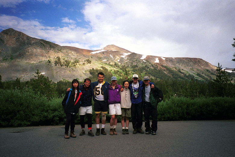
All's well that ends well. Back at the parking lot. From left
to right: Susan, Daryl, Reza, Jennie, Jean, Kevin, Kane. Mount
Dana far in the background.
My head still hurt. I felt much better, though, after a couple
ibuprofen and a nap. At dinner, we feasted on rolls, soup, salad,
baked potatoes, mixed vegetables (they ran out of corn on the
cob), steak, chicken. Reza surprised me and gave a toast to me,
thanking me for organizing and getting us all off the mountain
safely.
The next morning I woke up and it was hard to believe what we'd
done the previous day. Yes, we'd gone past the point of safety.
Yes, we should have started earlier and set a strict turnaround
time. But we'd all made it safely back. We'd shared the pain of
the climb and descent, the thunder and lightning, rain, and hail.
The beauty of the views from the northwest ridge and the summit.
My immediate reaction was that I would never do the Mt. Dana hike
again. It's dangerous and there are lots of other mountains I'd
like to climb. But, who knows. Perhaps one of these days I will
return. But of course it will never be the same.
Appendix 1: Hiking Time
You may be asking how it could possibly take 7 hours and 14 minutes
to hike 5.8 miles. You may be thinking you could be up to the
top and back in 3 hours. But you'd be horribly wrong. There are
several factors:
Steepness. This one goes almost without saying. The steeper the
hike, the longer it takes. But we're not just talking steep, we're
talking STEEP. Mount Tallac has an average grade of 12.1%. Half Dome has an
average grade of 13.8%. These are tough, steep hikes. Mount Dana
has an average grade of 20.3%!!! This is by far the steepest hike
over distance I've ever done. The steepness not only makes the
ascent difficult, it also makes the descent difficult and dangerous.
Rocks. Even given the steepness, if the trail had been nicely
paved over, it wouldn't have taken us as long as it did to do
the hike. Unfortunately, the trail near the top -- which was also
probably the steepest section of the hike -- is really not so
much a trail as a collection of rocks. Hiking over loose rock
takes a lot of time and patience to prevent sprained ankles or
even tumbling down the side of the mountain. This slowed us down
going up and down.
Altitude. I don't mean the fact that we climbed 3108 feet. I mean
the fact that the hike was done at up to 13,053 feet above sea
level, where the air is thin (39% less oxygen than at sea level).
This not only makes you feel winded, it also slows you down. I
made the big mistake of not taking this into account when I did
my hiking time estimations.
Views. When you're hiking through all these amazing sights, you'll
want to enjoy them. So whenever you're not gasping for breath
or cursing your group leader for taking you up here, you'll probably
stop to take pictures.
Appendix 2: Electronic Toys
My average heart rate from 8:50am to 1:34pm (partway into the
descent) was 140 bpm, with a maximum of 167 bpm. My average from
2:18pm to 4:04pm was 131 bpm, with a maximum of 158 bpm. Perhaps
later I will put up the graph of my heart rate, with pointers
to significant points in time.
My altimeter would end up reading 3850 feet of vertical climbing.
I think that's inaccurate due to the changing weather conditions.
I'll accept the 3108 feet according to topographic maps.