|
On this first hike of the new year, Jean and I parked at Alpine
Skills International (parking is $5) You can park at nearby Donner
Ski Ranch, instead, if you want to save some money.
The trail starts at the southern end of the parking lot. A group
of half a dozen snowshoers was gathered near there, apparently
engrossed in an avalanche safety course. They were talking about
avalanche transceivers. Something I hope never to have to use,
but I should probably learn about. If lightning is the single
most-feared summer hiking hazard, avalanches would have to be
the equivalent for winter hiking.
The previous day it had snowed for the fist time in weeks -- about
six inches of fresh powder, I'd heard. Enough that I'd had to
spend several minutes in the morning scraping ice off my car windows.
But now the day was beautiful -- a crisp clear blue sky, and a
bit chilly as well.
I'd made the mistake of leaving my Platypus water bottle in my
car the previous night. Obviously, it partially froze, rendering
the drinking tube useless. Not having easy access to hot water,
I salvaged some of the water and put it in another water bottle
I had with me -- one I hadn't left in the car. We brought that
and some half-frozen All-Sport, which is actually quite good in
that condition (think Slurpee).
The hike starts down a forest service road before quickly turning
into a real hiking trail through a beautiful forest. Then the
climbing begins. We started our hike at 10 in the morning, but
we were not the first. At least two sets of snowshoe footprints
led us up the switchbacks. These clearly had to have been made
this morning. We hoped that whoever had made them knew where they
were going.
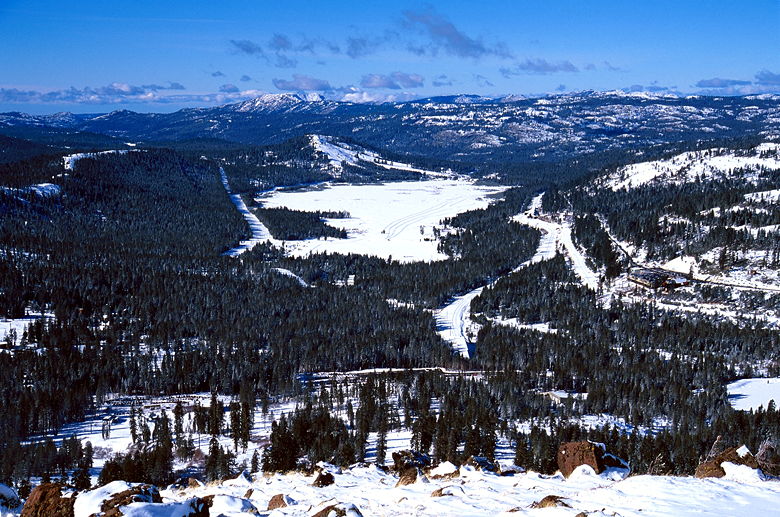
The switchbacks led us up a snow bowl to a forested plateau. From
here, the trail (or rather, the snowshoe footprints in front of
us) winds around a hill, gently rising. We soon had views of Lake
Van Norden in Royal Gorge, where we'd been the previous day cross-country
skiing. Also visible was Donner Ski Ranch's snow-making machines,
spewing out powder.
The trail then heads steeply up a hill to the left, through the
forest to a large clearing at the top. A ski lift reaches the
southwest portion of the summit plateau. But this wasn't our goal.
Donner Peak, our original goal, was clearly visible to the east.
Unfortunately, the path we took hadn't taken us to the saddle,
as we'd hoped. Instead, we were to the right of the saddle. Going
to Donner Peak now would involve descending to the saddle and
then heading up to the peak. Instead, we decided to ascend the
nearby Mount Judah.
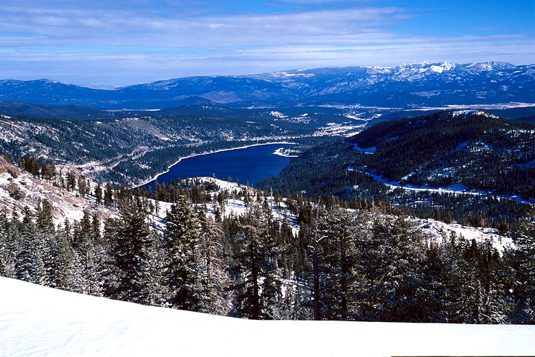
Frozen Lake Van Norden
We crossed the summit plateau. Wind had obscured the tracks of
the previous snowshoers, who had also gone on to Mount Judah.
But we soon picked up the trail in the forest. We winded our way
up. Through the trees we had a great view of Castle Peak to the
north. After yesterday's snow, however, it looked much different.
Lake to the east of Mount Judah
A couple of snowshoers passed us on their way down. They could
have been the ones who made the original prints we were following,
but I'm not completely sure. In any case we continued up the ever-steepening
trail as it traversed a snow slope on the eastern side of the
Mount Judah summit ridge.
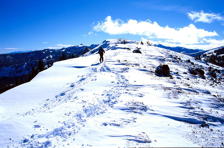
Hiker heading south on the ridge toward the actual summit
We kept slipping and sliding near the very steep section at the
top. I discovered that I made much better progress if I kicked
in steps into the snow before continuing up. On top, we had great
views of the surrounding area -- the downhill ski resorts and
Royal Gorge to the west, Donner Peak to the east, Castle Peak
to the north. A bone-chilling wind kept our stay at the to to
a minimum.
The true Mount Judah summit still lay south of us, along a corniced
ridge. However, we wanted to get started back to the Bay Area,
and I don't imagine the view from there is much better, so we
started back.
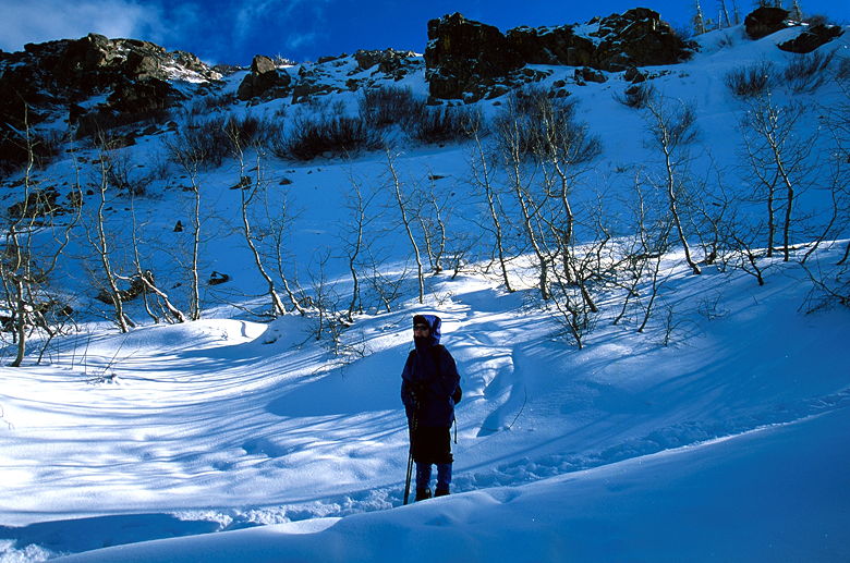
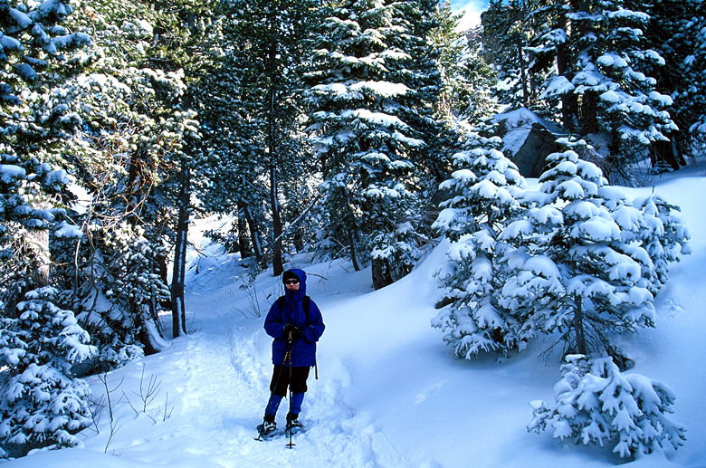
Jean standing at the bottom of the snow bowl near the start of the trail
The way back was fairly uneventful. We encountered a lot more
people coming up, and a cross-country skier taking a route slightly
east of ours. We passed some sledders coming up near the bottom.
And then we were back at ASI, ready to head back home.
Trail through the forest
| 

