|
Jean, Jennie, and I woke up early and got to the roadside trailhead around 8am. The
forecast called for a slight chance of afternoon thunderstorms, so we wanted to get an
early start. We were the fourth car to reach the lot, and started out at about 8:15am
under clear blue skies.
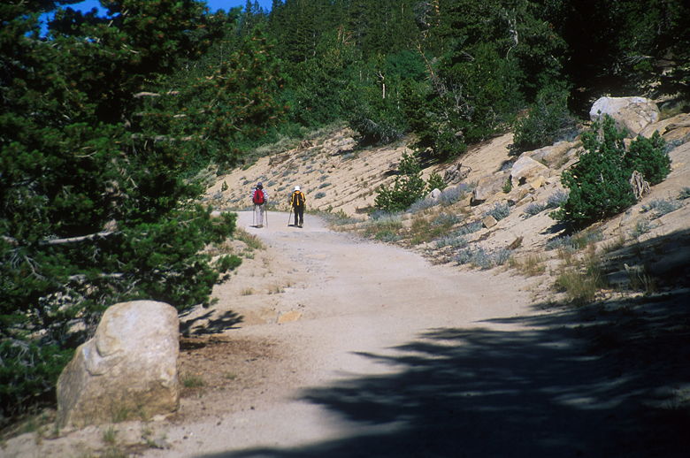
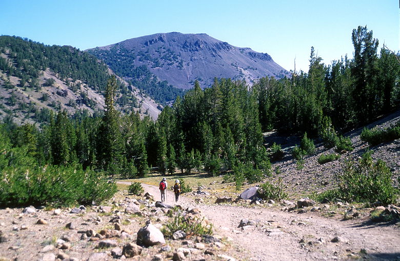
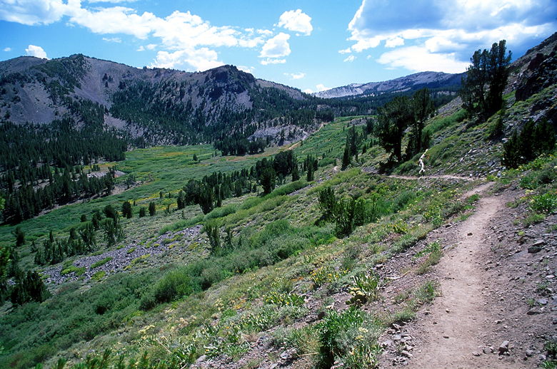
Walking up the trail
The trail begins along Highway 431, next to a concrete building. We hiked along a wide
dirt fire road which climbs very gradually, roughly parallel to the highway. We could
hear the traffic for some time as we took in better and better views of Lake Tahoe and
Incline Lake to the southwest. Across the road we could see Tahoe Meadows.
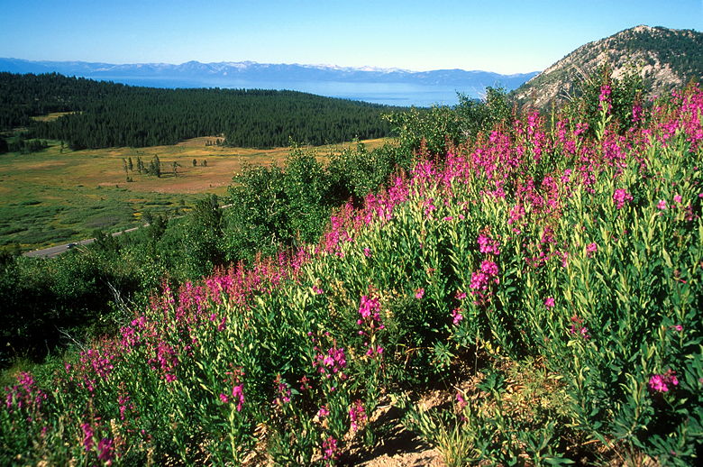
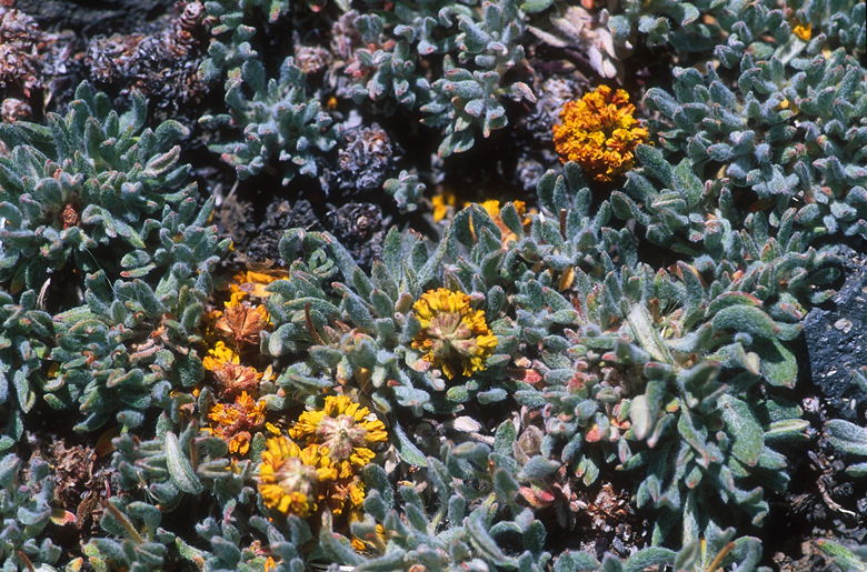
Flowers along the trail
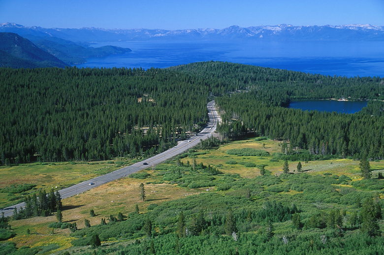
Lake Tahoe and the Mount Rose Highway
After a very easy pace during which I stopped several times to take pictures, the trail
turns right (northwest) and the views are left behind. We soon entered a forest and
continued the barely imperceptible climb. A couple of kids passed us on mountain bikes.
I asked them how far they were going, and they said they were going to the pond. We'd
reach the pond less than a half hour later.
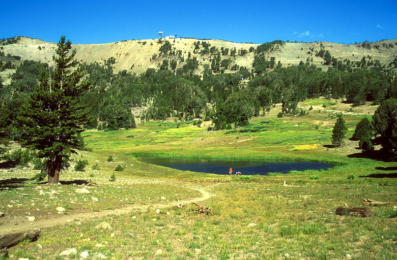
Kids by the pond
The kids were still at the pond when we arrived. Behind the pond loomed a mountain topped
by the Mount Rose Relay Station. The dirt road we were on curved up to the left to reach
the station. We, on the other hand, turned right and passed a sign telling us we were
entering the Mount Rose Wilderness.
The trail now turned to single track and double track. It also descended over 300 feet.
I hadn't expected this, and it would add an extra 600 feet of climbing to our hike. Next
time I should pay more attention to the topographic map which I was carrying. But an
extra 600 feet tacked on to 2000 wouldn't make much difference.
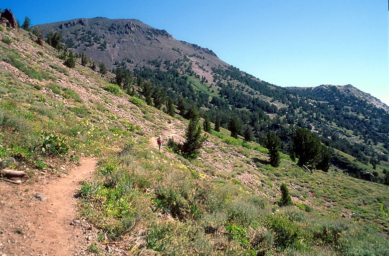
Mount Rose (we'll hike up the gully on the left)
The trail descends steeply in places. It passes several little streams which give rise
to colorful wildflowers, lupine and Indian paintbrush among them. While the flowers were
nice, they weren't as nice as they probably were earlier in the year, due to the lack of
snowfall in the previous winter. Usually they would have been more spectacular at this
time of year. Still, it was nice. And we could also finally see our final goal -- Mount Rose
was clearly visible right in front of us. I could see that the trail would head up a gully
between Mount Rose and the mountain range closer to us on our left. It looked quite steep.

Jean resting under a tree
At one point the trail crosses and then parallels a series of telephone poles leading
straight up the mountain up to the relay station. I was a bit surprised, as I didn't
realized that was allowed in designated wilderness areas. The relay station itself is
outside the wilderness area, but I don't believe the telephone poles and wires are.
Heading toward the gully
We continued the second half our our descent before heading steeply up the hot gully.
We would ascend about 700 feet up the switchbacks. As the canyon was very steep, the views
were mostly blocked on both sides.
My goal had been to reach the top in 4 hours, stay 1 hour, and then descend in 3 hours. I
figured that if we reached the next trail intersection at the top of the 700 foot climb
by 11am, we'd be on schedule. We did just that -- before we knew it, we were at the top of
the climb. The trail leveled off for a few dozen yards before reaching the trail
intersection. If we continued straight, we'd hit Forest Service road 462. Instead,
we turned right up the Mount Rose trail and promptly found a spot amongst the trees to
rest. It's a pretty popular spot to rest, as a group of hikers descending stopped here,
and then another group of hikers ascending stopped here just as we were about to leave.
We reapplied our sunscreen, had something to eat, and then started up the final ascent.
The group who had descended told us that they'd made the 1000 foot ascent in about 50
minutes. I didn't think we could do it that fast, but we ended up being pretty close
to that time. We would have been closer if it hadn't been for the fact that we had to
stop for a nature call.
After four nights and three days of acclimatizing, the altitude above 10,000 feet didn't
affect us at all. No headaches, no light-headedness. We climbed steadily up the
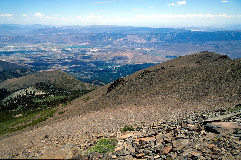
switchbacks as the views began to open up. First we had views to the south. Then the
trail turned northward and we had views of Boca Reservoir and Stampede Reservoir to the
west. We could see clouds forming above the mountains to the west, but they looked
safe enough for now.
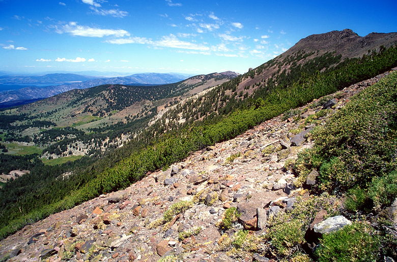
View from the trail near the top
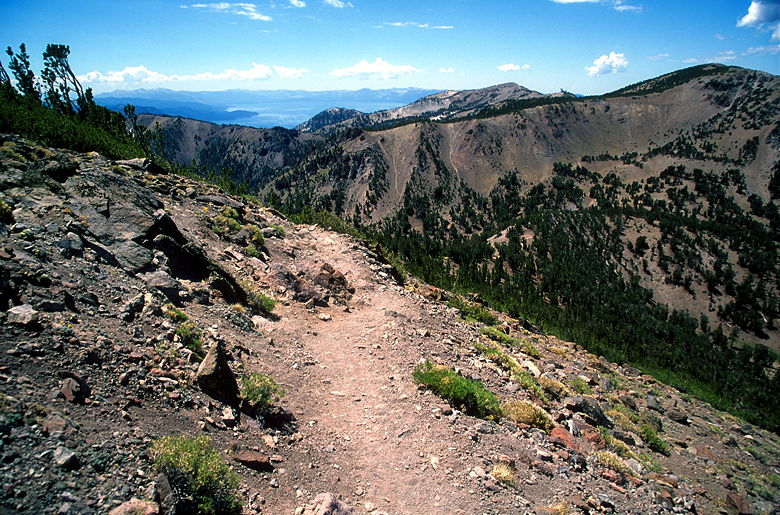
Looking back toward Lake Tahoe
The trail heads toward the saddle between Mount Rose and Church Peak. We soon found
ourselves above timberline. The top consists of rocks, dirt, lichen, and some very small
bushes. As we neared the top, we found some other inhabitants -- butterflies! Not just
a few butterflies. Thousands of them. I've never seen so many butterflies in one place
in my life. There were so many fluttering about in the summit winds that I felt that if
I wasn't careful, I'd accidentally breathe one into my mouth.
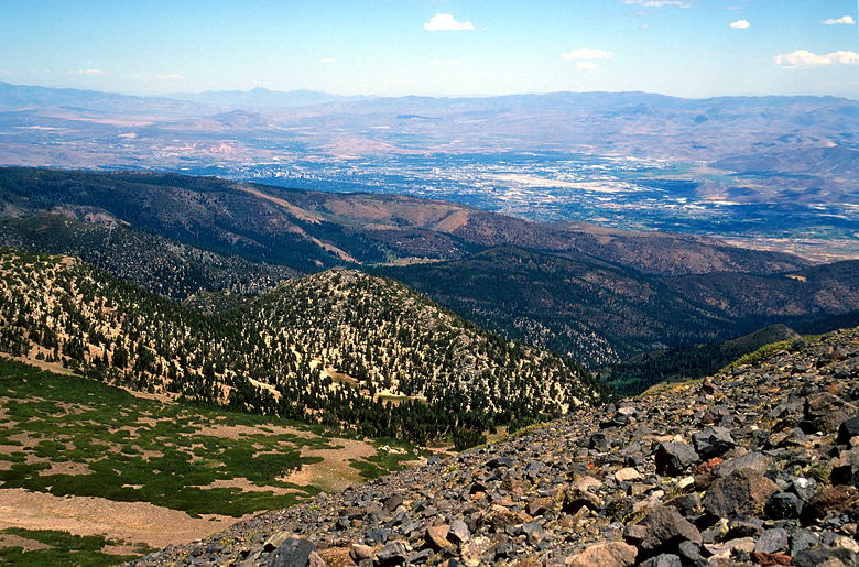
Reno
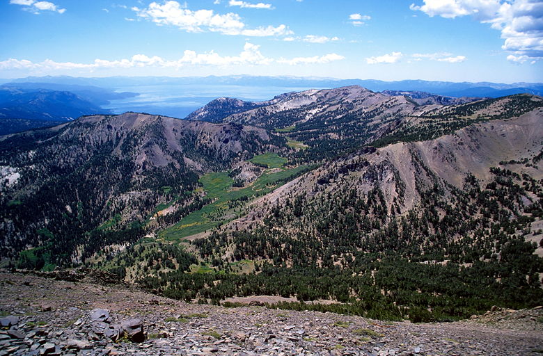
The green meadow is the downhill section we descended earlier
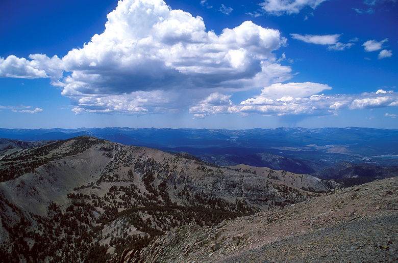
Storm clouds moving in from the west
The butterflies continued to dance in the air as we reached the top of Mount Rose, the
highpoint of the Carson Range, 10,776 feet above sea level. It's also the third highest
peak in the Tahoe basin. As you would expect, the views are tremendous. Reno and its
surroundings are clearly visible to the northeast. The Washoe Valley to the east. Lake
Tahoe in all its glory to the southwest. And butterflies all around. [Note: I've since
been informed that these are probably California Tortoiseshell butterflies.]
View looking northeast
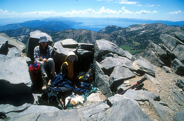
Jean and Jennie in the shelter
There are several rock storm shelters on the summit which provide shelter from the
summit winds. While it was windy, it wasn't as fierce as I'd expected or feared.
We settled into the first shelter and spread out some food to eat. I took some pictures
of the view, keeping an eye on the clouds to the west, which were now spilling rain onto
the mountains below. They were still too light in color to look threatening, however, so
we weren't too worried. Still, we set a time to start our descent.
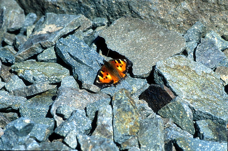
One of the thousands of butterflies on the summit
I chased around butterflies, trying to take their pictures. I also tried to find a way
to capture the sheer magnitude of their numbers. I don't think I succeeded, but judge
for yourself. I'd read that there was a summit register, and another hiker on the summit
asked if we'd seen it. I don't think anyone could find it.
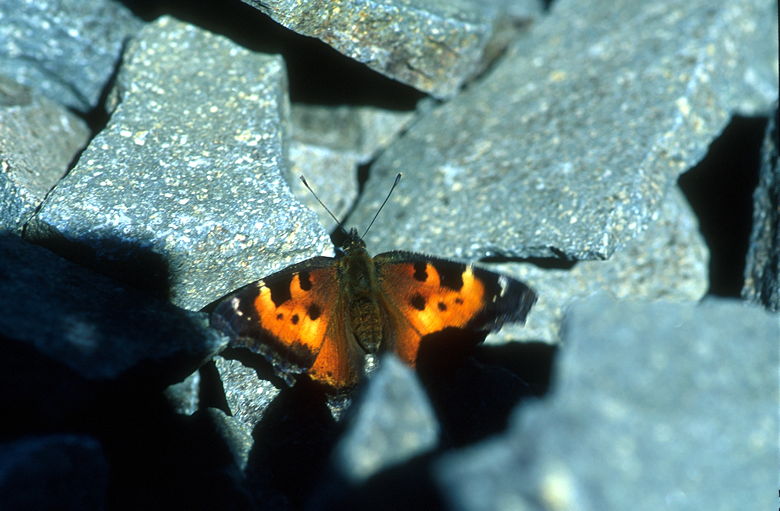
Another butterfly
While we ate and rested, several people joined us on the summit. Three women and their
three dogs walked by us. A man and his two young daughters (perhaps about 10 years old)
came up just as we were leaving. He said he'd been to Mount Rose about 20 years earlier.
We told them they could have our shelter as we were just packing up.
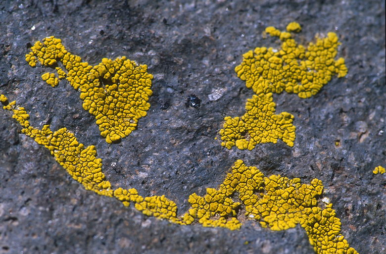
Lichen growing on the summit
Another small form of life on the summit
The descent was quick. Our trekking poles helped us speed down the mountain. On the
way down we passed a hiker with a full backpack. He said that he used it to train for
doing Mount Whitney every year. I can't imagine doing Mount Whitney every year -- to be
frank, I don't think it's the prettiest place in the world. There are many other hikes I
would rather do. But perhaps he just looks at it as a challenge to repeat year after year.
We descended 1000 feet back to the trail intersection in less than 35 minutes. We then
stopped in the same place we'd stopped on the way up. While we rested, the women with
the dogs stopped to rest, as well. We again reapplied sunscreen and began descending the
gully. Meanwhile, the rain clouds to the west never quite reached us.
Heading back towards the meadow
We encountered quite a few people coming up the trail while we descended. They were
coming up quite late in the day. While there was plenty of sunlight left for them to
make it back before dark, the light was not nearly as good as earlier in the day. There's
something pleasing about starting a hike early in the morning.
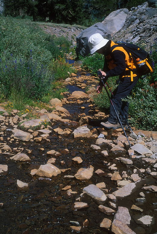
Jean reaching toward the stream
That 300 foot descent on the way to the summit now turned into a tough 300 foot ascent.
But it's only 300 feet, and we made our way back up to the pond. Then it was all downhill,
save for a short 10 foot climb further along the dirt road. We made the left hand turn
and started descending a bit faster, but not as fast as we remembered. The road is actually
quite long as it parallels the highway back to the parking lot. But eventually we made it,
finishing the descent in just about 3 hours, as planned.
Return to 2001 Lake Tahoe trip report.
| 

