|
If you want to go: Hike starts at the Environmental Education
Center, near the pony rides, in Tilden Regional Park in Berkeley, CA.
Ben, Jean, Kane, and I hiked in Tilden and Wildcat Canyon Regional
Parks.
Jean, Kane, and I started from the Environmental Education Center
in Tilden, next to the Little Farm where kids get to pet and feed the
animals. We started up around 10:30am. Meanwhile, Ben started up at
Inspiration Point so that he wouldn't have to do the hike up to
Wildcat Peak. The plan was to meet at the intersection of the Wildcat
Peak and Nimitz Way trails.
We started tentatively up the trail, as there weren't any obvious
signs. Another small group of hikers came up near us, looking at
their maps. They wanted to do the same route up to Wildcat Peak as we
were, using the Sylvan Trail. Unfortunately, most of the signs didn't
have trail names on them. They had pictures which didn't make any
sense to me. If I had picked up the Nature Trails map, I would have
known that a picture of a rat meant the Pack Rat trail, a picture of
3 trees means the Sylvan Trail, and a picture of a hill meant the
Wildcat Peak Trail. At the time, I just thought it was pretty stupid
to have iconic trail signs without any writing.
Somehow, though, we managed to find our way along the right trails
and proceeded to climb up the Wildcat Peak Trail. It climbs from
about 400 feet to 1211 feet. It is reasonable steep. The first half
of the trail is mostly shaded, but the second half is not. The
temperature throughout the day was just fine -- about 80 degrees, so
it wasn't much of a problem.
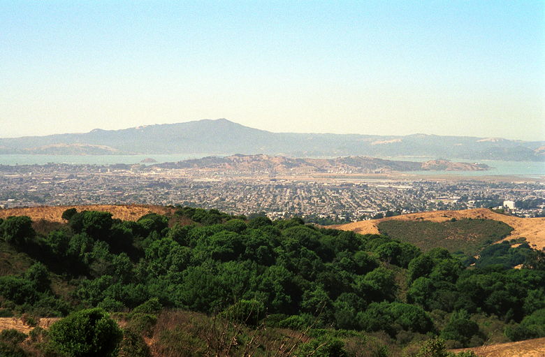
The closer we got to the top, the better the views were.
Unfortunately, at noon on a summer Saturday in the Bay Area, the
skyline is covered by a sickening envelope of pollution. At the peak
there is a large circular monument which you can sit on and have
lunch and enjoy the views of the bay, San Francisco, Mt. Tamalpais,
the Golden Gate, and on the other side, the southern portion of San
Pablo Dam, and also Mt. Diablo. On a clear day, it would have been
great. But the haze would lift later in the day, so we had some nicer
views later from other spots on the trail.
We were running a bit late, so I went on ahead while Kane and Jean
stayed at the top to rest and enjoy the view. I shortly came to the
trail intersection, but found no sign of Ben. I wasn't sure if this
meant he'd abandoned, if he hadn't gotten this far yet, if he was
confused about the meeting place and was waiting somewhere else, of
if he'd gotten tired of waiting and thought we'd gone ahead and was
further up the trail in search of us.
Thinking that we could find him later if he were further up the
trail, I went back the other way along Nimitz Way, toward his
Inspiration Point starting point. I knew there was another trail
intersection 0.45 miles away, and that perhaps he was waiting there.
Meanwhile, I updated Kane with my progress using my Motorola
TalkAbout. I was definitely less than 2 miles away, but a grove of
eucalyptus trees hampered reception so we had to repeat things once
in a while.
I reached the intersection with the Laurel Canyon trail, but there
was no sign of Ben there. I turned around and told Kane and Jean that
they should start down from the peak and meet me at Nimitz Way. A few
minutes later we were back together and hiking toward San Pablo
Ridge. Nimitz Way is paved for the first 4 miles from Inspiration
Point, and is a great trail for bikes and even baby strollers. It's
not too congested, however. We would go minutes without seeing
anyone, before a biker whizzed by.
A few minutes later, we found Ben, waiting at the intersection
with the Conlon Trail. He'd been waiting there for about 20 minutes,
so I must have just missed him when I first reached Nimitz Way. No
harm done, though. The four of us then continued along the trail.
Nimitz Way goes through rolling hills with views of San Pablo
Reservoir on the right. We saw little in the way of wildlife. I saw a
cow off on the left, wagging its tail underneath a shady tree. A
lizard here and there. The most striking vegetation was a plant which
Jean insisted was an artichoke, and which Kane said was a sunflower.
I could see the resemblance to a sunflower, but not ever having seen
an artichoke (well, maybe I'd seen one, but didn't know it), I wasn't
sure about it. Some of the plants were very green, but others looked
like they'd burnt up in the summer sun. At times the ridges were
littered with them. We spent the entire hike not knowing whether to
refer to them as sunflowers or artichokes. We would find out later
(from the helpful people at the Environmental Education Center) that
what we saw was most likely cardoon thistle, which is in fact a wild
artichoke related to the sunflower family!
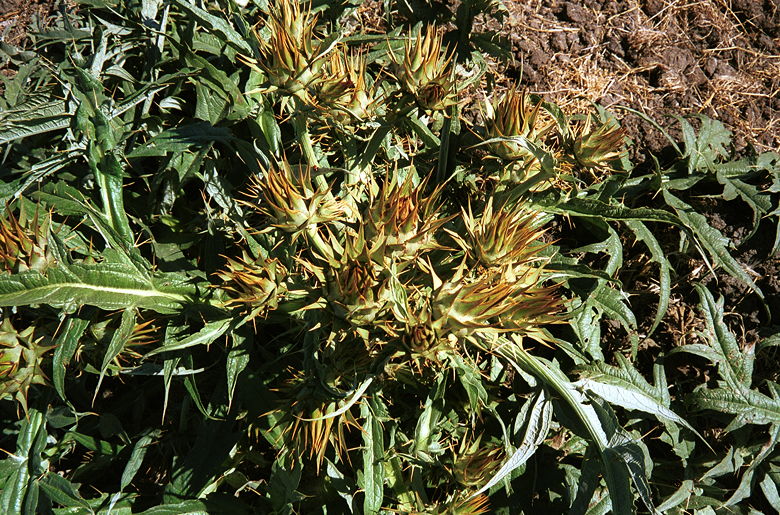
Wild artichoke...er, sunflower
At the end of the paved section of the Nimitz Way trail, there is
a bench looking east. There's a view of Mt. Diablo here, and not much
else. We stopped for lunch, carefully avoiding eating expired fruit
leather.
View of Mt. Tam's distinctive outline from Nimitz Way
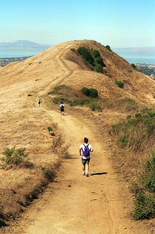
Jean (way off in the distance) has absolutely no idea that
a few minutes from now I will be sneaking up on her and beating her
to the top of that hill.
After lunch we continued along the dirt trail. After a dip, we
climbed up and up to the top of San Pablo Ridge. From here, the views
are a bit nicer. There are nice views in three directions -- east,
north, and west. We snapped our pictures and then started down. Near
the end of the San Pablo Ridge trail, the trail descends extremely
steeply -- probably a 30 percent grade! After carefully working our
way down, we saw mountain bikers head up, only to stop a third of the
way up and walk the rest of the way. Too steep! Looks like the trail
crew was too lazy to put in switchbacks (there was plenty of room to
do so).
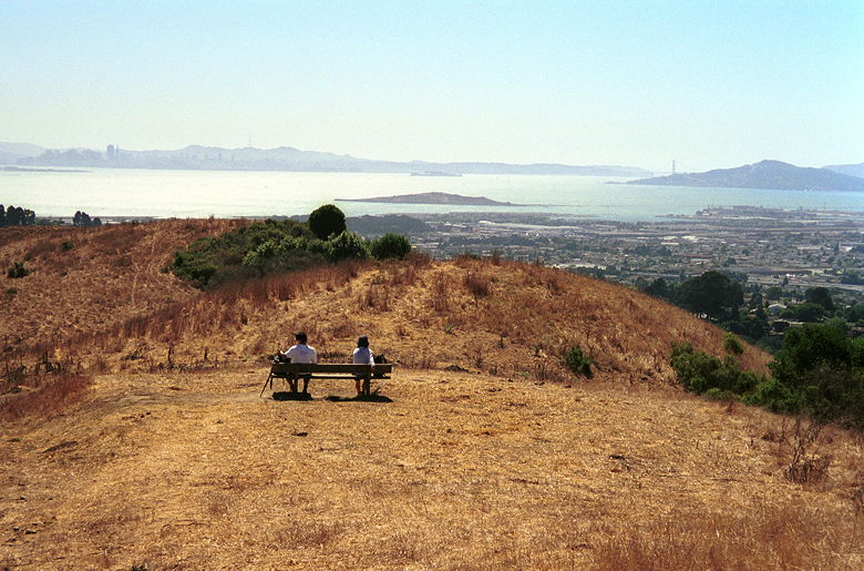
Then it was down the Belgum Trail. Near the bottom, there's a nice
bench which overlooks the bay. By this time, it had cleared up
considerably and we were able to enjoy views of an armada of
sailboats enjoying the weekend waves, while beautifully-winged birds
(I need a field guide) soared overhead. After our respite, we
continued on down the trail, past palm trees (!) and a farm of cows,
down to the partially paved Wildcat Creek Trail.
View of the Bay Area from above Richmond on the Belgum
Trail
As we hiked south along the Wildcat Creek Trail, we encountered
more and more bikers and people in general. The trail goes up and
down, up and down, and never actually gives a view of Wildcat Creek
itself. I was a bit disappointed in that regard. The trail also
doesn't provide much shade - though, more so than the Nimitz Way
trail (which isn't hard, considering Nimitz Way doesn't provide any
shade at all!).
At the intersection with the Mezue Trail there is a water
fountain. I didn't check, since I was carrying plenty of water, but
it looked like it was in good working order. A couple miles later we
reached Jewel Lake. We followed the Pack Rat trail around the lake.
This trail is completely different than the other trails. It took us
through a veritable jungle by comparison. It was a refreshing change,
but it didn't last too long. Less than half a mile later, we were
back at the Environmental Education Center, and our cars (well,
except for Ben).
The Environmental Education Center has maps from all of the East
Bay Regional Parks. It also has a walk-through exhibit with
information on the natural area. A great place to take the kids.
As we cooled down at our cars and drank and ate, dozens of people
were enjoying the afternoon, while others were wrapping up picnics.
Tons of people visit Tilden each weekend, but few venture out onto
the trails we did. In fact, I've lived in the area most of my life,
and visited Tilden many times, but never ventured onto those trails.
But it's definitely a nice trip and would be even better on a cool,
clear autumn day to enhance the views.
|


