Ohlone Wilderness Trail |
Day 3 of 3
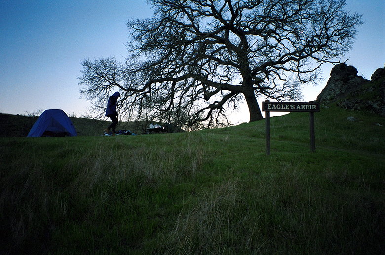
Before 7am I got up and went outside. When I first started looking
for my tripod foot in the grass, I thought it would be like looking
for a needle in a haystack. But less than a minute later, I found
my tripod foot. I used the pliers to pull out the leg and reattach
the foot (don't use that sentence out of context). The sun was
still behind the hills, but our camp was getting brighter.
As the sun rose, it started to illuminate Mission Peak and the
other peaks in that range, off to the west. Kane and I snapped
some pictures. It shed its light on a hill to the northwest, with
a house/ranch perched on top. It was a picture-perfect spring
morning. It was cold, but the wind had died down.
I started my stove up to boil water for breakfast. Unfortunately,
I was low on fuel. I'd cooked dinner and breakfast before, and
the half-pound fuel canister was being pushed to the limit. It
took nearly half an hour to boil one pot of water, and Kane had
to help out with his stove. Early morning at Eagle's Aerie camp
Birds circled overhead as we ate our oatmeal and hot chocolate.
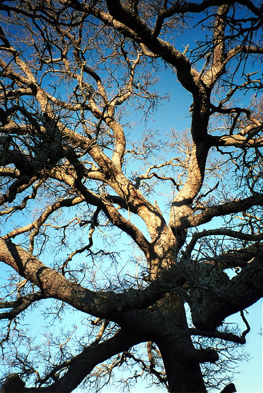
We broke camp and packed everything away as quickly as we could. Tree protecting our campsite
It was 9 in the morning by the time we finally left. The people
at Hawk's Nest were still in their tents. We had the whole beautiful
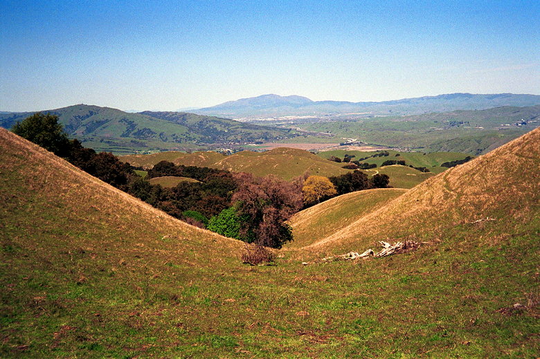
valley to ourselves. We crossed creeks and babbling brooks, beautiful
green hills with large trees here and there. It was a beautiful
peaceful hike.
There were some patches of mud, and cows greeted us along the
trail again. Poison oak threatened us from both sides of the trail.
The trail went gently up and down. Nothing like the climbing of
the previous two days. But we still had the climb up Mission Peak
ahead of us.
After turning left onto Cerro Este Road, we caught our final glimpse
of our campsite, perched high above, silhouetted by the morning
sun. We then turned right, down into the brush.
Soon we could see the Sunol headquarters parking lot below us.
After navigating by some cows, we were soon serenaded by loud
car radios and we walked along a stream to the headquarters.
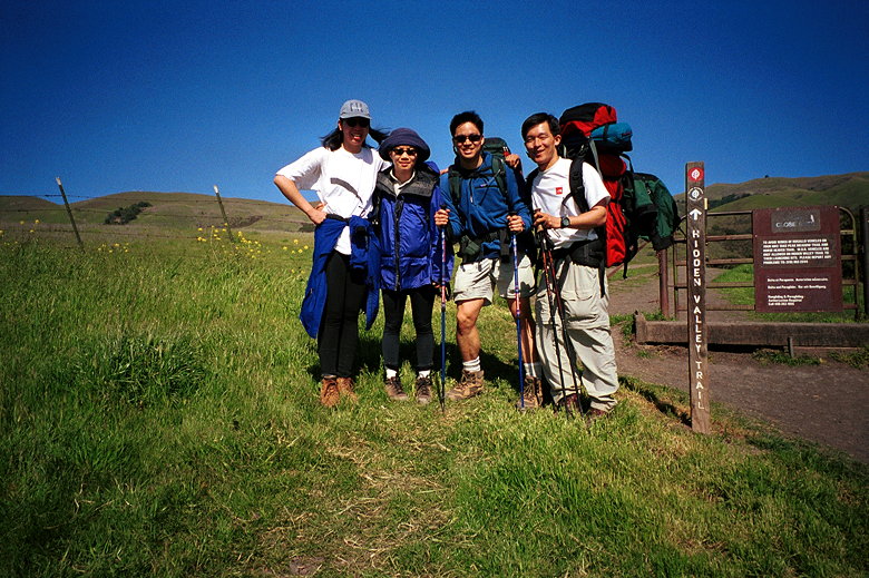
Lan greeted us at the headquarters. She would be joining us for
the hike up to Mission Peak. We arrived at the headquarters at
about 10:45am, and would leave at 11:20. During that time we ate
some, threw away some trash, and changed into clothes more appropriate
for a sunny Easter Sunday than a cold mountain climb.
We registered at the sign-in panel near the headquarters. Then
we entered a gate and started back onto the trail. After less
than a mile, we crossed the only road of the trip -- Calaveras
Road. There weren't any cars. In fact, there were hardly any people
to speak of. We passed perhaps one or two sets of hikers the entire
hike up to Mission Peak.
Lan and Kane went ahead of us. They would end up getting to the
top about a half hour before the rest of us did. The scenery along
this section of the trail was beautiful. But every time I took
off my sunglasses I realized the harsh noontime sun would wash
out all the colors in a photograph. So I don't have any pictures
of the beautiful trees and colorful leaves in this section of
the trail.
When we approached the base of Mission Peak, the scenery changed
dramatically. Instead of a shaded trail we saw before us an endless
wave of rolling green pastures. Shortly we passed a bunch of cows
and even a bison. We looked up to the Mission Peak ridge and saw
the forms of Kane and Lan high above us. Later, we reached another
sign-in panel and saw that they were a half hour ahead of us.
After a brief respite back into the shade, we emerged and started
the relentless climb. Mt. Diablo (far center) as seen from the trail east of Mission
Peak
We took the Eagle Trail and went up via the south ridge. We crossed
the largest mud field yet, and I ended up half-submersing my left
boot into it. But soon we were over the top, standing on the south
ridge. Wow. This was our first good look at the Bay Area since
Friday. We could see the salt ponds and the rest of the bay. Paragliders
soared through the air. It was a beautiful sight. But there were
still a few more feet to climb.
And then we were there. Kane and Lan greeted us as we climbed
to the top of Mission Peak, elevation 2517 feet. We congratulated
one another and took our victory pictures. All that lay between
us and the finish were 3 miles of steep downhill. But before we
descended, we soaked up the beautiful view. The one time I'd been
to the top before, it'd been overcast. But not this time. We could
see everything. The Santa Cruz Mountains. Diablo. Mt. Hamilton.
Rose Peak, where we'd been just yesterday, stood proudly above
the rest of the range to the east.
Sunday, April 4th
Eagle's Aerie to Mission Peak
12.0 miles
2770 vertical feet (ascent)
6:47
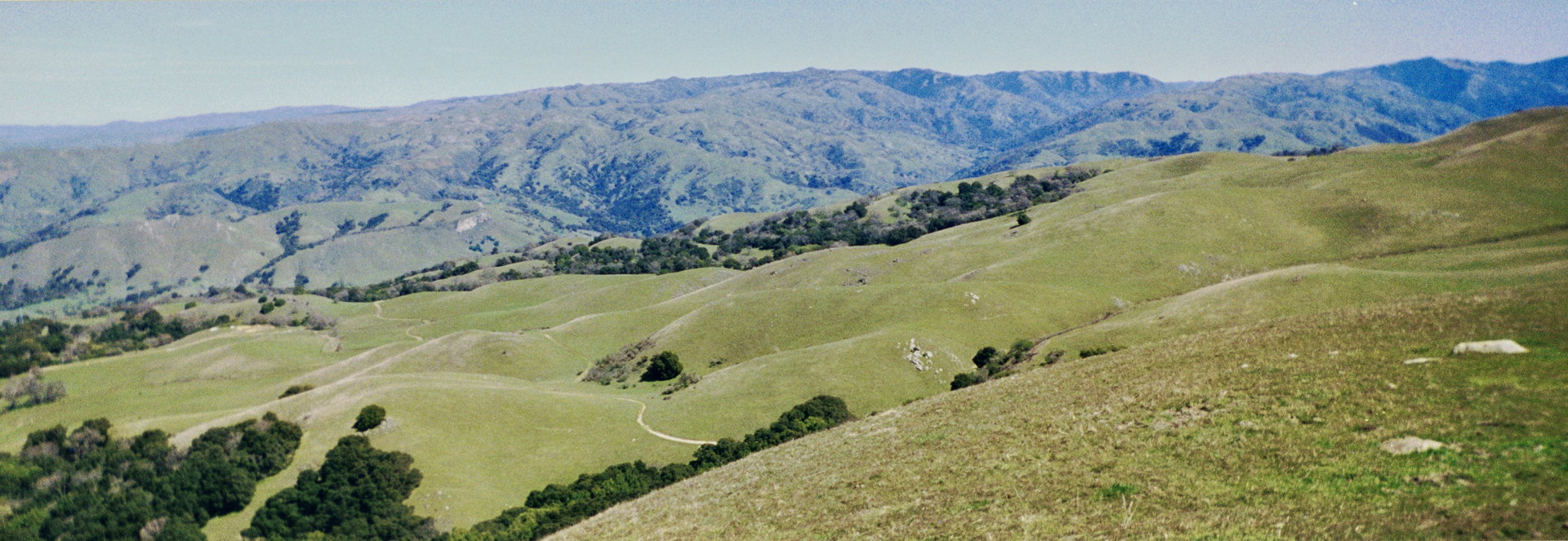
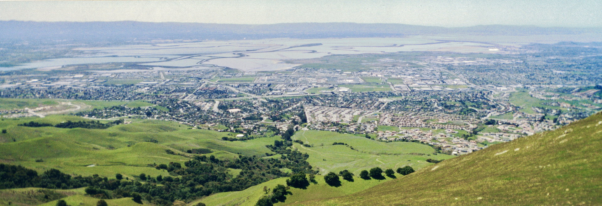
Panoramic view from Mission Peak looking east
(Click image to view full size)
Panoramic view from Mission Peak looking west
Lan decided to head back to her car the same way she came. The
rest of us finished up our lunch and, encouraged by the growing
chill from the wind, started our descent.
On top of Mission Peak
The first part of the descent is especially tricky, littered as
it is with rocks upon rocks. But even after that, the trail just
keeps descending. There's no let-up. Along the way, we saw tons
of people. The west side of Mission Peak is in stark contrast
to the east side -- while the east side is completely devoid of
people, the west side is a veritable zoo. Mountain bikers, road
bikers, paragliders, trucks, couples, friends, kids, dogs. Many
of them saw our packs and asked us about our travels. A few commented
on our trekking poles. One asked me if I'd been skiing. Wise guy.
At about 4pm, we were done. We took our final pictures. We started
to load Jennie's car only to find that it had been vandalized.
As I was saying, some people are just so disrespectful. I think
next time we'll have to be dropped off and picked up. We're done!
We drove back to Del Valle to retrieve Kane's and Jean's car.
The ranger recognized us and waved us through without having to
pay.
When I got back, I weighed my pack. 35.0 pounds. This was minus
most food, water, and fuel.
I slept for 11 hours that night. The next morning (and the day
after that as well) my calves were still tight. But other than
that I felt fine. The skies opened up and it poured on Monday.
I was glad that we weren't out there in that weather. Light snow
and hail is much more preferable to rain -- at least we didn't
get wet. As I drove home from work, east on Highway 237, I saw
Rose Peak covered with snow. It was a beautiful sight. But it
also means a lot more to me now. I'd seen that range of mountains
covered with snow before. But having been there, I know what's
behind all those mountains now. I know what it's like to be up
there. And every time I drive on that highway, I'll remember this
trip.
Notes: For those of you who'd like a less challenging trip with
much of the scenery, try this: start at Sunol headquarters and
hike to the Sunol backpacker's area (Eagle's Aerie camp recommended).
It's just 4 miles. You can do a day hike to Rose Peak the next
day (12 miles round trip) or simply return to headquarters.
(Click image to view full size)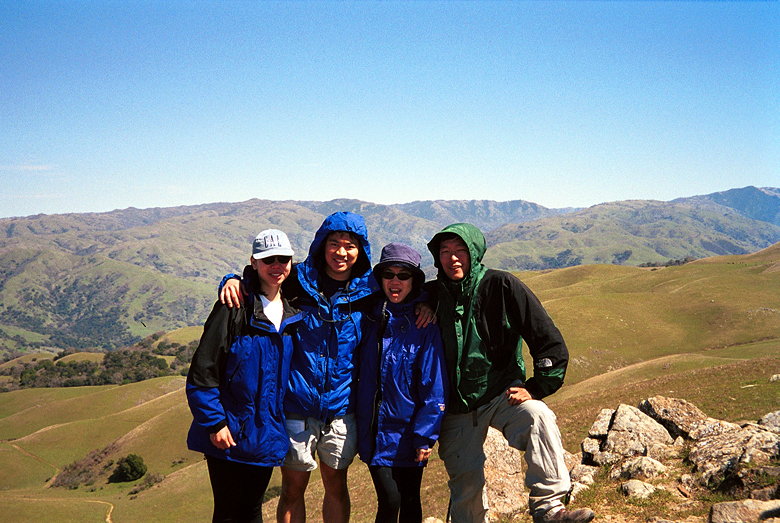
Related Pages:


|

|