|
Cammy, Jason, Jennie, and I met at Huddart County Park for a hike into Phleger Estate,
part of the Golden Gate National Recreation Area. It was a hot day for a hike, but most
of the hike would be under shade of redwoods and other trees, so it wouldn't be too bad.
We started at the lot just inside the entrance. If you're trying to meet someone here,
be specific -- there are myriad parking lots and picnic areas. After crossing the road
we followed the trail signs toward Phleger Estate. Our stay in Huddart Park would be
fairly brief. We passed another parking lot and then started descending a set of
switchbacks lined with a wooden fence. Redwoods, madrone, and manzanita lined the trail.
At the bottom of the switchbacks we began to see redwood groves along McGarvey Gulch Creek.
Jason somehow spotted a single fish, about the size of a hand, swimming in the creek.
We continued following the well-marked signs toward Phleger Estate, soon making a right turn
at an intersection and entering the Estate. The Estate is a relatively new park, becoming
public in 1995 (see the National Park Service page for its history).
Phleger Estate is known for its intricate trail signs, and we soon found one -- a large
metal sign with trail names high above, and a rooster on top. There are basically only
4 sections of trail in the park -- the Miramontes Trail, which we were now on, the Raymundo
Trail and
Mt. Redondo Trail, which form a loop, and the Lonely Trail, which heads up to Skyline
Boulevard.
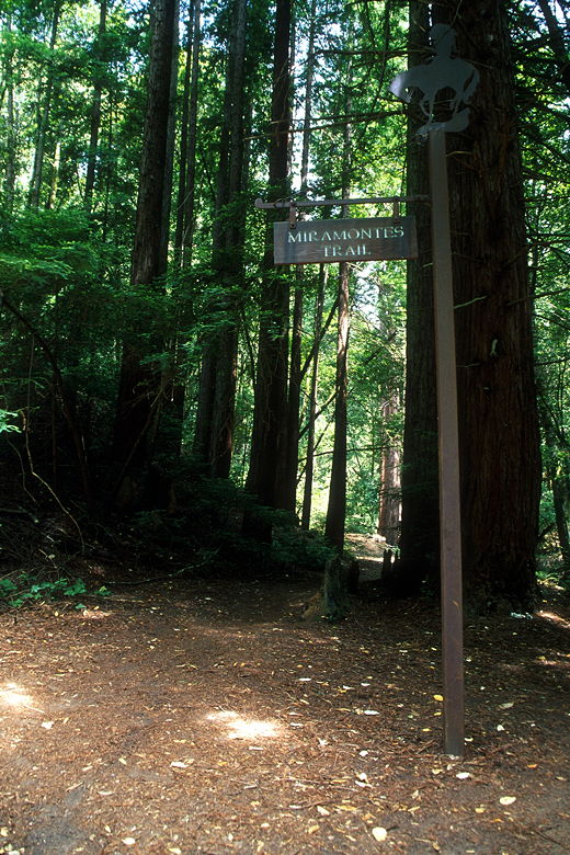
One of the trail signs
While hiking on the Miramontes Trail we were passed in the opposite direction by an
equestrian. We spent a fair amount of the hike stepping around the horse shit on the
trail. And an equal amount of time dodging the trail runners. It seems Phleger Estate is
fairly popular with runners, perhaps due to the fact that loop hikes are pretty short.
We turned left onto the Mt. Redondo Trail and began a stiff climb next to a dry gulch
lined with redwoods.
Eventually we crossed the gulch and came to the Lonely Trail intersection. That would take
us up another 800 feet to Skyline Boulevard. Perhaps another day. The map says
there are two benches along the Lonely Trail, so there must be good views. Instead we continued
on the Raymundo Trail to complete a loop.
Finding a nice spot with logs, we stopped for lunch. A cloud of bugs swirled around near us,
inching closer as we ate, but never quite got to us. After lunch we continued along the
trail, marveling at how some trees adapt to adverse situations. One tree growing out of the
side of the trail grew at an angle before turning sharply and going straight up to find the
sun. Others grew at crazy angles, curving, swirling, or bending to find their place in the
sun.
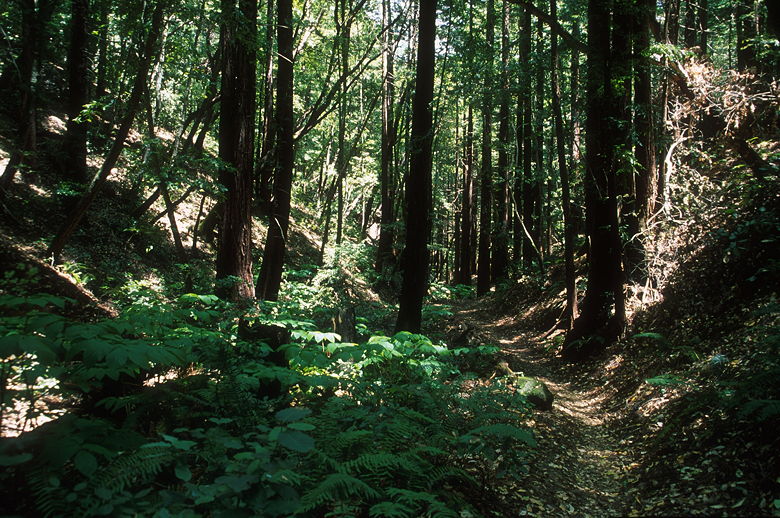
Redwoods along the trail
I spotted a squirrel doing acrobatics high above us. We watched as it flipped between the
broken branches of a redwood tree, higher and higher, like a trapeze artist. While hiking
on the Raymundo Trail, we saw the second-largest garden hose I've ever seen, a propane
tank inside the ruins of an old log cabin, and other structures in a private residence nestled
between the Phleger Estate and the Peninsula Watershed protecting Crystal Springs Reservoir.
Soon enough we completed our loop, finding ourselves back on the Miramontes Trail. We
retraced our steps, stopping briefly when some hikers pointed out a fawn on the other side of
the creek. The tiny creature ate as we took out cameras. We were surprised it would be
alone without its mother. After several minutes we walked up the trail to get a better
view. Eventually we scared the fawn off, however, just as we saw its mother, which had been
close all along.
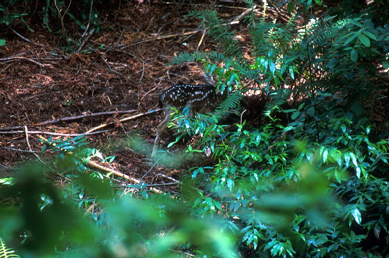
Fawn peering behind a fern
We passed another equestrian just before we re-entered Huddart County Park. We climbed the
switchbacks we'd descended earlier (although we didn't remember descending them on the
way in). Then it was back to our cars. A decent hike, but if you're looking for redwoods,
I'd recommend Purisima Creek much more.
| 

