|
It was again 32 degrees outside when we woke up at 6:30am. It seemed like we had done so much
descending that we'd be lower than we were, but we were still at about 9500 feet.
During the night the bear had sniffed around Scott's bag again, but left it this time, not
finding anything. Other than that, he left us alone.
I hadn't
brought along my balaclava and gloves, and I regretted it this morning. I basically moved in
slow motion, waiting for it to get warmer. Eventually the sun lit up our tent and I was able
to change and pack up. We left at 8:50am, perhaps 20-30 minutes after everyone else (except
Travis, who was still eating his breakfast).
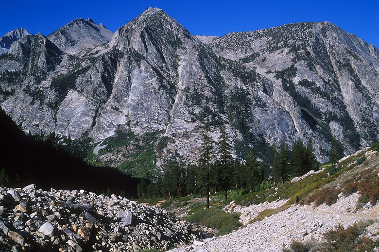
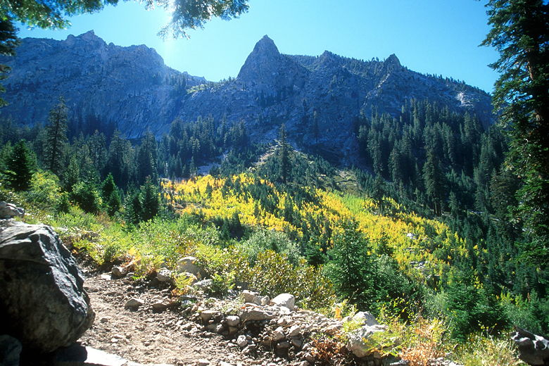
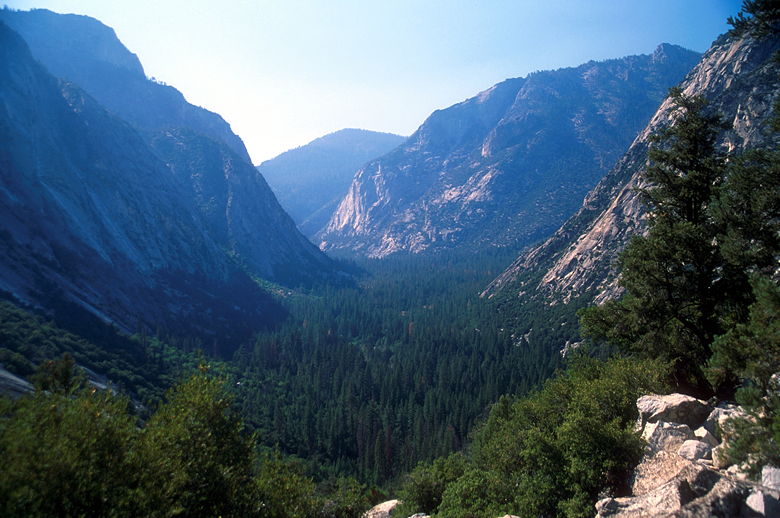
Mountains rising over the Bubbs Creek valley
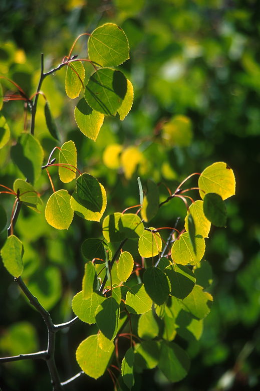
Aspen leaves glistening in the late morning sun
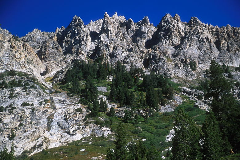
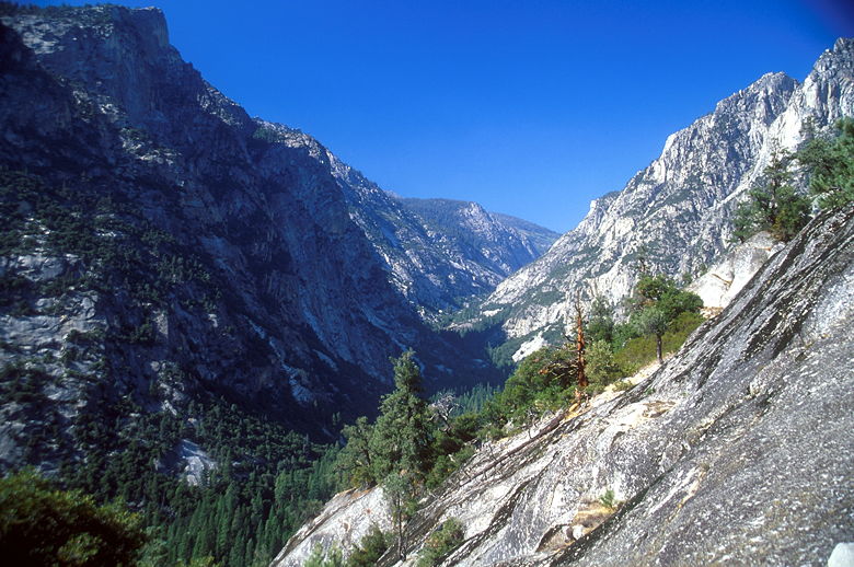
Crags above the trail near Junction Meadow
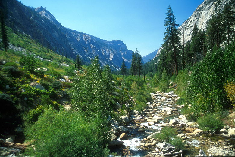
The trail starts descending immediately and doesn't let up. The trail descends, steeply most
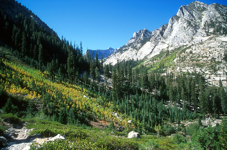
of the time, past several waterfalls of Bubbs Creek. Along the way we had views of aspens
beginning to turn colors, especially on the western slopes of West Vidette, to our left
on the other side of Bubbs Creek as we descended.
Aspens turning color
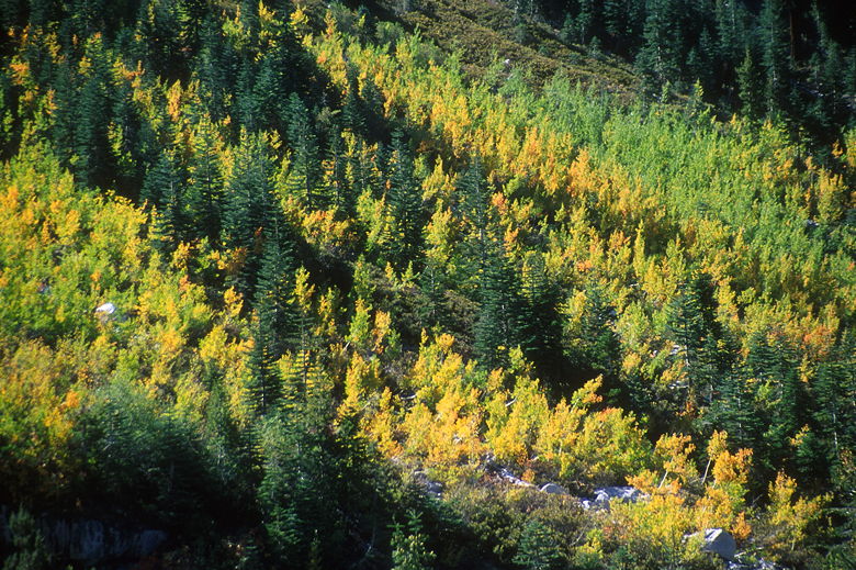
A closer look at the aspens
Looking back at the aspens
After descending for over 1100 feet, we reached Junction Meadow. There's a trail that leads
toward the camp sites, but from the trail it doesn't look as nice as Vidette Meadow.
I'd stopped several times along the trail to take pictures, and Jean must have been getting
antsy. I agreed not to take pictures for a while, and we raced through the next hour on the
trail. Along the way we passed through lots of ferns and some nice sections of forest next to the
creek.

Aspens at Junction Meadow
We moved so fast and uninterrupted, we caught up to the rest of the group. We passed Scott,
Steve, and Kenny, and soon afterwards came upon Monica and Hugh, resting near a small cascading
waterfall of Bubbs Creek. There's a very small beach here, as well. I filtered some water
and had something to eat. While we were there, Travis came down the trail on his way to Sphinx
Creek. That was our planned destination as well, but I'll get to that...
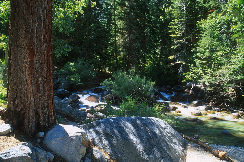
Bubbs Creek
Everyone else hit the trail while we were still resting. We later caught up with Monica
and Hugh at Charlotte Creek. The creek flows through a beautiful conifer forest, with tiny cascading
waterfalls descending from right to left across the trail. Monica suggested dunking our heads
in the creek on this hot day (she'd already done the same). After crossing the creek (me on the logs,
Jean on the rocks), that's exactly what we did.
Monica and Hugh left while we rested, and that's the last we'd see of them for quite some time.
Immediately after Charlotte Creek, the trail descends into an open sequoia forest with ferns on
either side. The hot sun beat down on us as we continued our descent. I could see the Sphinx
ahead of us, and knew the camp came before it. As we approached the 6500 foot elevation, the
bugs began to bother us again. It didn't get nearly as bad as the hike up to Mist Falls, however.
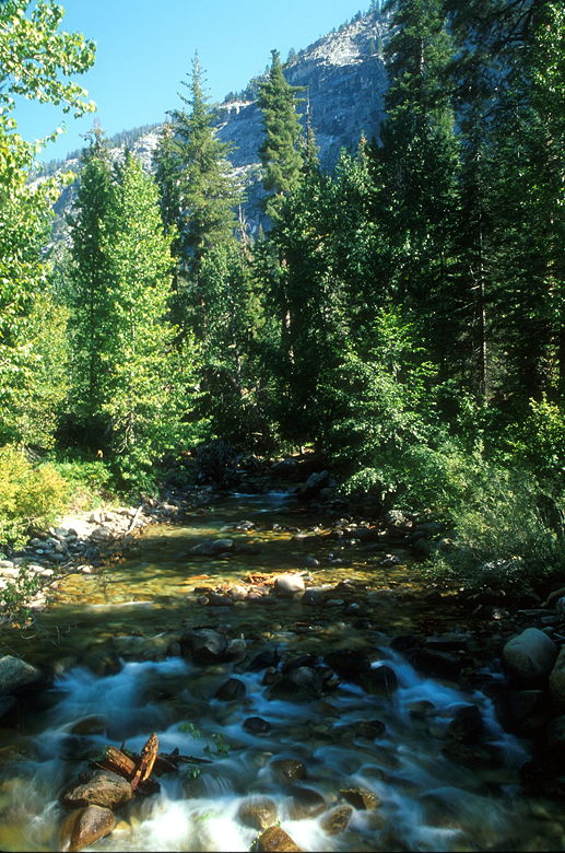
If you think that because the trail parallels Bubbs Creek that you don't have to worry about
water, well, think again. The trail runs high above the creek. When you cross water, make
sure you check your water levels.
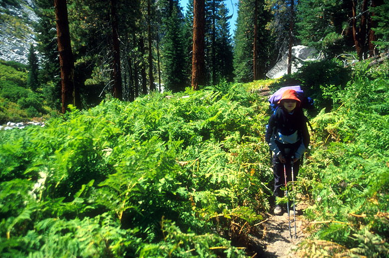
Jean amidst the ferns
Bubbs Creek
The long trail in the hot sun took its toll, and I needed to stop for a break. We stopped to
refuel, and then continued on through the bugs. We finally rounded a corner and saw a trail
sign ahead. Tents were set up in the camp on the hill before the sign. Travis came walking
toward us, telling us that Monica had left a note for us. We went to the sign and found the
note. Apparently they'd all decided to keep going all the way to Road's End. We'd planned
to all camp at Sphinx Creek, but the camp is just over 4 miles from Road's End. Still, it would
make for a long day.
Bubbs Creek from the bridge at Sphinx Creek
They left the note at about 2:45pm, and we arrived at about 3:05. We stopped to rest, and I took
some pictures from the bridge over Bubbs Creek. To be honest, the camp isn't in the prettiest
spot on the trail. Jean and I decided to continue on and join the others. It was 3:26pm when
we started down the trail.
We blitzed down that trail. We extended our trekking poles and started the 1200 foot descent
down to the bridge across the South Fork of the Kings River. The trail is quite impressive,
switchbacking back and forth with beautiful views of the Kings Canyon to the west and of the South Fork
Fork canyon to the north. The trail walls have intricate stonework to help avoid erosion. Of
course we didn't have time to appreciate all this as we descended, only stopping twice for me
to take pictures (one of each canyon). We practically ran down parts of the trail, reaching the
next trail intersection 2.2 miles and just 45 minutes later.
View from the switchbacks. Our car's down there somewhere!
Canyon carved by the South Fork of the Kings River heading down from Paradise Valley, where we were 5 days ago.
The map doesn't quite show it, but there are several bridges here. I counted about 5 bridges in
all, one of which crosses Bubbs Creek, and the last of which crosses the South Fork of the Kings
River. The view from here was much different than what we'd seen 2 years earlier in May. The
water level was, of course, much lower.
We crossed the bridge and then continued on the nearly level trail back toward Road's End. This
is the part of the trail we'd already done before at the beginning of the hike.
I hadn't noticed it before, but the trail is very sandy. Now that I was trying to go fast, however,
I noticed it with every step. It was as if a 50 pound force was holding me back. Oh wait, that
was a 50 pound force. In any case, every step was excruciating work, made even worse by the fact
that the long day was starting to cause blisters on both my feet. I'd never had problems with
blisters before, but if I were ever to have problems, this would be it -- 50 miles in 6 days, topped
off by nearly 13 miles of downhill on the last day.
We slogged through the sand as fast as we could, and then we were there. I saw a sign by
a creek crossing, and I knew we were close. Shortly after, I saw the cars in the parking lot.
And then we saw that everyone was still there -- Monica, Hugh, Steve, Scott, and Kenny.
We finished the last 4.1 miles of the hike (starting from Sphinx Creek) in an amazing 1 hour,
25 minutes. In fact, we'd nearly caught up to them, as Monica had just arrived a minute earlier.
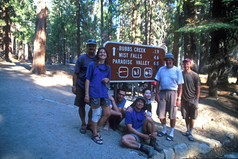
Back at the trail head
We're done!
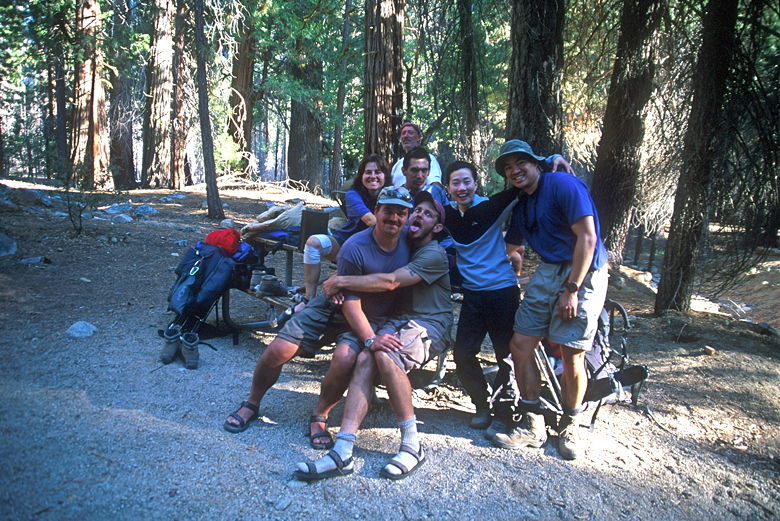
We took some group pictures and then headed toward the showers. We arrived just in time. Steve
had heard the showers closed at 7pm, but they actually closed at 6pm. We all got to take our showers.
Jean and I were first, and afterwards got ice cream and drinks. When we returned to our car, we
saw these unfamiliar men coming towards us. It was Steve and Scott, sans facial hair. They looked
completely unrecognizable now.
We went to the Cedar Grove restaurant and had burgers, fries, onion rings, and potato salad.
Afterwards we drove over to Sentinel campground and found site 30 and 32 available. We set up
and then Monica, Hugh, Jean, and I headed off to find firewood. Monica knew where we could drive
a short distance away to find wood, and that we did. I also finally used the hand saw I'd been
keeping in my car, slicing the wood into manageable chunks.
Back at camp, we started a nice camp fire and talked about our trip and future trips. It was
nice not having to worry about bears as much, and not having to hike the next day. Later in
the night, while we were still around our camp fire, a guy holding a Corona came waltzing into
camp. "Knock knock!" Now, if you were to tell someone to act out the part of the drunken
American car camper, and then you saw Steve, you'd say he was over acting. He inquired about
our long-burning wood. He claimed he was in the wood business and had brought $200 worth of
fire wood up. He was with his friend, also named Steve, and if we wanted to join them, they
had a MAJOR RAGER going back at their camp. That is to say, a big fire fueled with $200 worth
of fire wood. We made fun of Steve the rest of the night.

Back at Sentinel Campground and ready to head home!
The next day, we said our goodbyes. Then we drove back into civilization. The Rae Lakes Loop
is a beautiful trip, one I think we'd all do again sometime. The thing about the trip is that
there's something new and wonderful each day. The first day there was Mist Falls and Paradise
Valley. The next day, there were the aspens of Castle Domes Meadow. The third day, there was
the beautiful marshes and waters between Dollar Lake and Rae Lakes -- not to mention the beauty
of Rae Lakes itself. We enjoyed Rae Lakes some more on the fourth day, along with a peaceful
lake in Sixty Lakes Basin. On the fifth day, I'd say the highlights were the amazing views of
East Vidette and West Vidette from the switchbacks heading down. And of course where was the
bear at Vidette Meadow. And the sixth day we had the aspens turning color on West Vidette.
Oh, and for you east coast hikers, the guys from Virginia says there's no comparison. They'll
take the Sierra Nevada over the Appalachian Trail any day. :)
| 

