|
Jean, Judy, and I drove to Skyline Wilderness Park in Napa for a late autumn hike. There
were a few remnants of fall color here and there in the valley, but there was little to be
found in the way of fall colors in the park, particularly because it was relatively late.
The parking lot (which costs $4 per vehicle) was full of mountain bikers either returning
from a ride, or getting ready for one. Some of the trails are off-limits to bikers, but
that doesn't seem to stop them from using those trails, anyway. They were generally
courteous, however, and weren't much of a problem.
The fenced garden we'd seen earlier in the year was now torn up. Someone was there,
working on the grounds; I'm not sure what was happening there. We continued along
the trail, past horses coming in the opposite direction, and past the state hospital
property. We soon found ourselves at a trail intersection. We were on Lake Marie Road,
and headed up to the right, where we passed the Buckeye Trail and the Lower Skyline Trail
before turning left onto the Skyline Trail -- part of the Bay Area Ridge Trail.
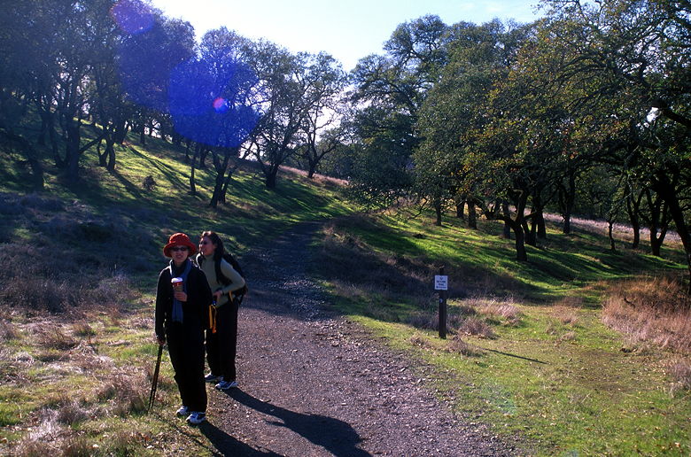
Jean and Judy at the start of the main trail (no apologies for the lens flare)
The area is filled with rolling hills and patches of oak trees. We spent the next
hour zig-zagging our way up the Skyline Trail, following the edge of a private property
fence. The trail is relentless in a way -- I kept thinking it would level out for a
bit, but it kept climbing, pretty steeply in places.
Trees and hills obscure some of the views, but we got occasional glimpses of San Pablo
Bay. After topping out at close to 1000 feet, we headed down. This was a bit
disturbing to me, since I knew this meant we'd have more uphill ahead of us. After a
steep downhill, we hit the bottom of a gully and then resumed our ascent.
To our right were grazing cows behind a fence. We could clearly see a quarry to the
west, as well. We snaked our way up the hillside, this time without much in the way of
views. We did enter some nice sections of forest with mosses and ferns. The trail
leveled off as we approached Lake Marie. We never actually reached the lake, but hiked
along the trail parallel to it, about 20 feet above the water. The lake is not very
wide, but it is wide, and the trees cast a beautiful reflection in the water. Our side
of the lake was very dark, while the other side was bathed in sunlight.
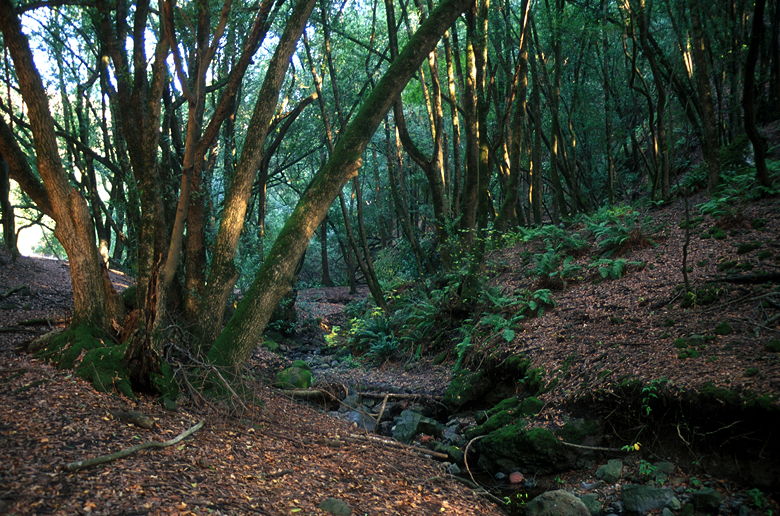
The creek
Shortly after passing the lake, we passed the ruins of an old brick house. We started
looking for a place to stop for lunch. We came to the Rim Rock trail intersection,
which is where we wanted to turn left. But we passed the intersection to find a nice
lunch spot by the creek a short way down the trail. We crossed a log covered with
mushrooms and stopped at a rock to sit and eat. The small creek tumbled gently by.
We saw a salamander and a slug, but that was it. After listening to all the chirping
birds in Australia, Jean and I found the park to be practically dead quiet. That
can be good or bad, depending on your perspective or mood.
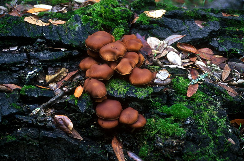
Mushrooms growing all over a log
After lunch we started up the Rim Rock Trail. While we'd started to get quite cold
by the creek, it was quite warm when we emerged from the trees into the sun. We started
another series of switchbacks which would take us to the top of Sugarloaf Mountain.
We got better and better views of the hills around us as we climbed. The only feature
marring our view was a series of microwave towers on a nearby hilltop.
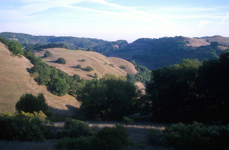
Glowing hillside
The very top is very steep -- our trekking poles at this point helped us from sliding
back down the hill. It's a short stretch, though, and we soon found ourselves at
the top of Sugarloaf Mountain, elevation 1630 feet. Unfortunately, the top is covered
with oak trees which prevent any views whatsoever. If I'd opened up the book I was
carrying, I'd have known that we could have wandered west down the hillside to find some
views. As it is, I didn't, and we didn't, and perhaps it's just as well, as we didn't
have all that much time to finish the hike before sunset.
We started our descent down the other side of the mountain and were soon met with
another treat -- birds with huge wingspans soaring above us. We stood there in awe
as the birds circled higher and higher. As one of them passed us, I could see his
head cock backwards to look at us, like a bicyclist does before making a turn or
lane change. Soon we noticed that there were a half dozen in the sky behind the trees,
and more still in the valley below. The amazing thing is that I did not see any of
them flap their wings even once. They were riding the late afternoon thermals.
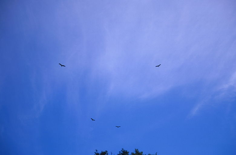
Birds circling overhead
We eventually tore ourselves away so that we could resume our descent. The descent
was fairly steep and rapid. Along the way we passed metamorphic rock like that
on top of Monument Peak near Fremont. We passed more trees with a kind of nut that
we'd seen earlier. As we got lower, we started seeing manzanita trees. They seem
to be darker than those found in Henry Coe State Park. More of a dark red color.
They were quite a treat for Judy, who'd never seen such a spectacle -- completely
smooth trees that looked as if they'd been spray-painted dark red.
We decided to pass up the trail that would take us to Lake Marie Road and instead
take the road less traveled -- the Manzanita Trail -- back to our car. We filed
past more manzanitas and winded our way through a pleasant forest. As the sky
darkened, the sun turned the western horizon into a beautiful sunset red.
Below us, to the east, we saw the golden yellow of a vineyard turning color.
Soon enough we were heading across a creek and along a flat wide path back to our car,
one of only two remaining in the lot, just about 20 minutes after sunset. Perhaps
next time a good hike would be to take the Buckeye Trail to Lake Marie, and then take
Lake Marie Road back. As we had racked up 2200 feet of climbing today, that path would
definitely be easier.
| 

