|
We picked a weekend with perfect weather. Last time we'd suffered through snow
flurries. Today it was clear skies. We paid for our $2 permits at the gate and
claimed our camping reservation. The ranger asked "Have you stayed with us before?"
as if it were a Holiday Inn. We assured her we had and went on our way.
We parked near the visitor's center and prepared to go. By this time we were already
getting hungry so we ate our lunch before even getting started. Around 3pm we crossed
the bridge and started off on the Indian Joe nature trail. The camp site is only
about 4 miles from the headquarters, so I wasn't too concerned by our late start. The
sun wouldn't set until after 7:30pm. But we did want to get into camp with enough time
to enjoy it and not have to cook and clean up in the dark.
The start of the hike was gentle, strolling along the creek with all the families in
the park. We soon made a left turn onto the Canyon View trail, which as you might guess
led us upwards. In fact, it was much steeper than I remember -- but that's probably
because we were heading in the opposite direction last time. There were some short
steep pitches, but since we knew the distance wasn't great, we could take our time.
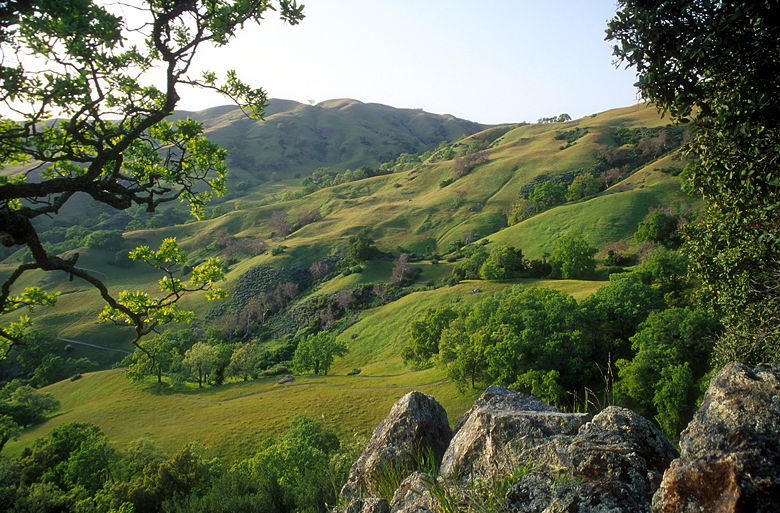
We gained elevation rapidly, and with it came increasingly better views of the glowing,
rolling green hills dotted by oak trees.
My pack weighed in at about 45 pounds. This was quite a lot for just a one night trip.
Since I didn't have to take as much food, water, fuel, etc., I'd taken the liberty to include
all my camera equipment -- an SLR body, 3 lenses, flash, and tripod. I ended up not using the
flash and one of the lenses, so I could have saved myself about 3 pounds. But I'm not
complaining much. The load wasn't much to bear for that short a distance. Meanwhile,
Jean was carrying just 27 pounds!
We still encountered lots of day hikers as we turned left onto the McCorkle Trail. As
I stood near the trail intersection, Jean continued up the trail. A dog bounded up
toward her and started growling at her before heeding its master. According
to the park brochure, dogs may be unleashed in open space and undeveloped areas of the parklands,
so I guess we can't complain too much.
The McCorkle Trail climbs some more through the open hillside before diving into the bushes.
We zig-zagged our way down into the brush for a few minutes before starting the climb back
out. A group of hikers trailed us as we made up our way to the ridge and our first distant view of
our camp site. We searched hard and found a small patch of grass uncluttered by cow pies.
While we sat there and enjoyed the view, the group of hikers behind us came up and stopped.
Much to our dismay, they just stood there and talked for no apparent reason. They were
discussing the stock market or something, I don't know. Eventually they headed down the Cerro
Este trail and left us to enjoy the view.
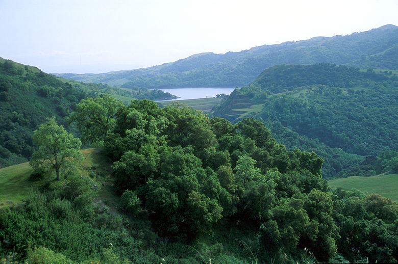
Calaveras Reservoir
I climbed up the small hill behind us to take in the view of Calaveras Reservoir to the south
and the rolling green hills we'd hiked now to the west of us. After a few minutes we started
up the Cerro Este trail, where a half dozen cows waited for us at the trail intersection.
We had a stare-down with the cows before heading through them along the continuation of the
McCorkle trail.
We descended and crossed the creek which is oddly named the "W" tree rock scramble.
It's marked on the map but
I don't think it's an official trail. We were now in very familiar territory. Fortunately,
it wasn't muddy like it had been two years ago. We soon found ourselves at the large gate
denoting the Sunol backpack area. The sign said our camp, Eagle's Aerie, was 7 kilometers away.
There are only 4 camp sites -- Star's Rest (the first), Hawk's Nest, which is just above the
outhouse, and then our camp just above the water spout. From our camp site it's a decent
walk up and around a ridge and down to Sky Camp.
We said hello to the couple who were staying at Hawk's Nest and then started setting up our
camp site. As we put up the tent I noticed a few things different about the site. First,
the picnic table which had been there was no longer. Instead there was a small bench. Also,
the large tree which dominated the site was now full of leaves and full of life. If I recall,
it hardly had any leaves when we'd seen it last, and hadn't been nearly as big. One spot
where we'd taken a picture before was now covered by a large branch.
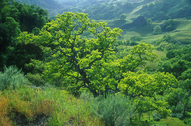
Trees as seen from camp
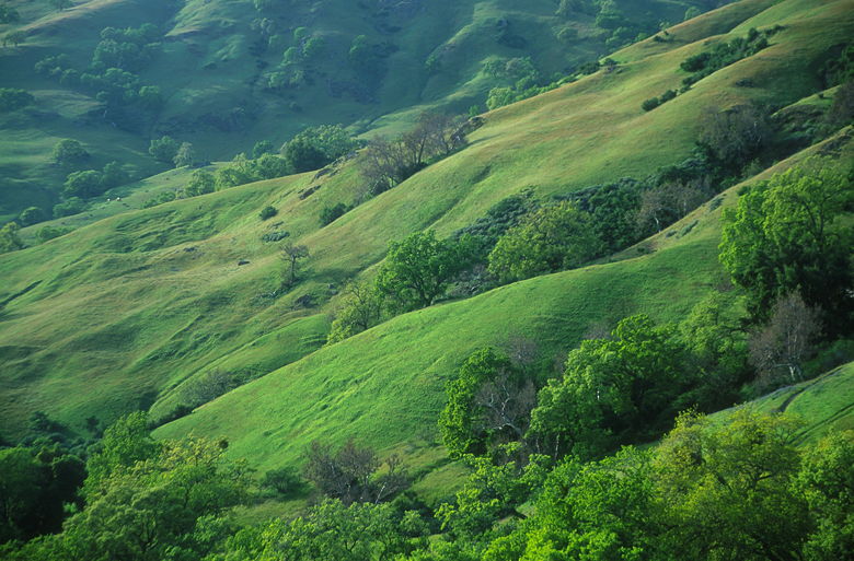
Green hills as seen from camp
Despite these small changes, the site was a lovely as we'd remembered. Our site commanded a
large hillside and we enjoyed the solitude, far from the masses of the park. After filtering
water, I took a short excursion toward Sky Camp while Jean started dinner.
I'd been too tired to make the short trip last time,
having backpacked about 12 miles that day. The curving ridge toward Sky Camp contained patches
of wildflowers -- splashes of color in the form of poppies, lupine, and mustard. There were
definitely more wildflowers on the hike this time than two years earlier.
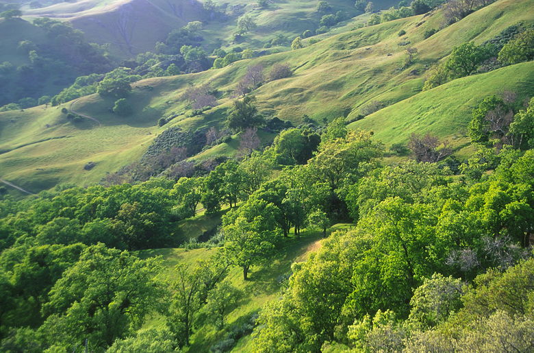
Green hills as seen from camp
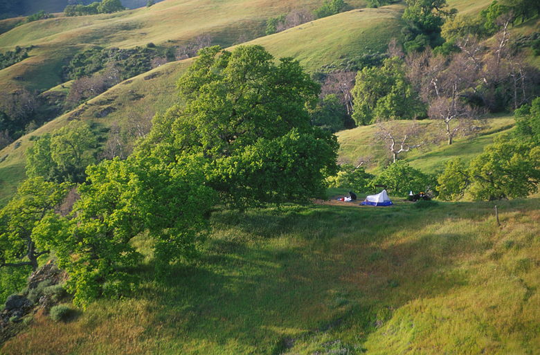
Our campsite as seen from ridge
From the top of the ridge I could look down the other side and see the valley containing
Alameda Creek. The view from Sky Camp itself isn't much better than Eagle's Aerie, and requires
a much longer walk to get water. i returned to the ridge where I soaked in the beautiful view
of our camp site, sitting out in the middle of nowhere, perched on the edge. I returned to camp
just in time for a wonderful dinner of risotto with scallops and asparagus.
View from Sky Camp
After dinner we still had time to see the sunset, wash up, and organize the camp site before
dark. We then settled into the tent and played a few card games before settling off to sleep
around 9:30 or 10pm. Winds rattled our tent a bit, but past experience suggested they would die
down quickly, and they did. Planes overhead sounded as if they started their descent into SFO
here, but the sound went away as quickly as the wind. Soon it was still and quiet and we were
fast asleep.
| 

