(Note: the trail route above was created post-hike using electronic maps and was not created
using GPS, so it might not be completely accurate. It's probably pretty close, though.)
Angie, Dave, Jennie, Reza, Weihaw, and I went to South Lake Tahoe
and hiked up Mount Tallac (pronounced tuh-LAK) in the Desolation
Wilderness.
Unbelievable. That's the only way to describe this hike.
We arrived in South Lake Tahoe the day before -- partly to get
acclimated, and partly to have fun jet-skiing. The acclimation
part didn't work so well. The hike starts at the Mt. Tallac trailhead
a few miles from South Lake Tahoe, elevation 6500 feet. I'd never
really noticed the adverse effects of the thin air at altitude,
but almost all of us noticed it to some degree on this hike. To
me, it was a lightheadedness as we climbed higher and higher.
By the end I was fine; I think an extra day of acclimation would
have helped.
The trail starts climbing immediately -- it almost has to, since
the hike averages about a 12% grade for the 5 mile climb to the peak. The climbing
pays off quickly, however, with great views of Fallen Leaf Lake
to the left.
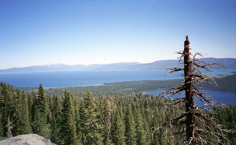
From far down on the trail. Top left is part of the peak of Mt.
Tallac. Off to the right you can see a bit of Lake Tahoe.
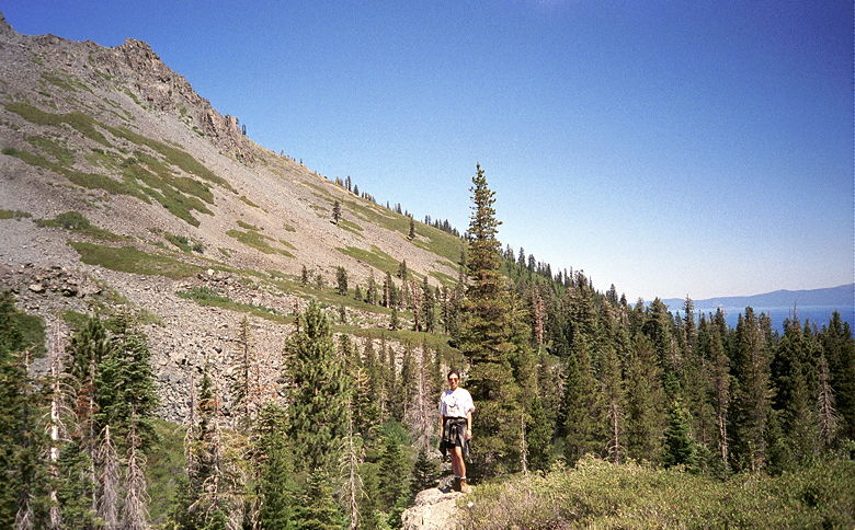
Lake Tahoe on the left. Fallen Leaf Lake on the right, behind
one of many dead or trees in the forest.
The trail follows a ridge viewing the lake for a bit until it
veers off to the right and a wonderfully clear, peaceful pond.
We started noticing the bugs more at this point, and started applying
more bug repellent -- a must for this hike in the summer.
The trail continues into the forest, still climbing steadily.
After another pond the trail heads up onto some distinctly rocky
ground where we begin to get better views of Fallen Leaf Lake
below. Then it's back into the forest before it emerges out into
the open. That's when the fun starts.
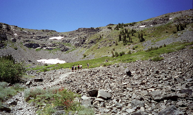
Here's the start of the big climb. We've just emerged from the
forest to see snow on the left and a steep climb in front of us.
Switchbacks here we come!
In front of us now was the peak itself, high above us. The trail
looked so steep we almost needed to arch our necks back to see
it all. A lone tree and small shrubbery dotted an otherwise barren
slope. Halfway up there was...snow. In August. Patches of snow
which we would later find was hard-packed, cold as you would expect,
and 2-3 feet deep. All this in 75 degree weather under a cloudless
sky.
We slowly made our way up the slope, stopping occasionally now
and then. Parts of a make-shift band passed us. A guy with a drum
walked by, followed later by a guy with a flute. The woman with
the guitar as further back down the mountain.
Finally, we crested the steep slope to be greeted by awesome views
of the mountains south of Lake Tahoe. After taking pictures we
followed the trail through a sort of meadow. and a strange sort
of meadow it was. Patches of trees were separated by patches of
grass which were interrupted by patches of small rocks. It looked
like a huge rock avalanche, with patches of trees and grass caught
up in the middle of it.
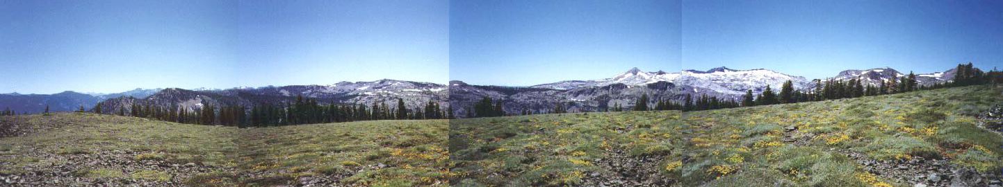
Once at the top, there are sweeping views to the south across
a windy meadow. I'll try to improve the stitching later. (Click image to view full size)
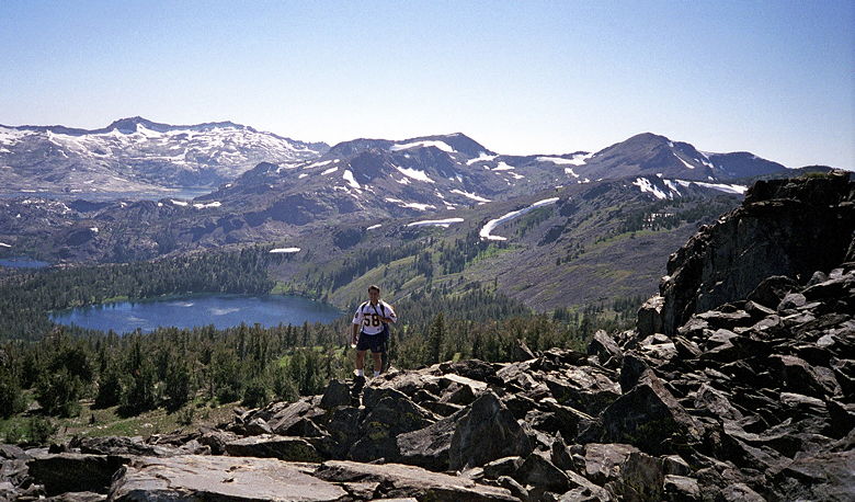
The climbing here was steady, not as steep as the big slope, but
still steadily climbing up toward the rocky peak. As we turned
a corner and came to the base of the final climb, we were met
with yet another awesome view -- that of Lake Tahoe itself, and
Emerald Bay and Fallen Leaf Lake. A hiker coming down told us
the view from the top was even better -- hard to believe, but
it was true.
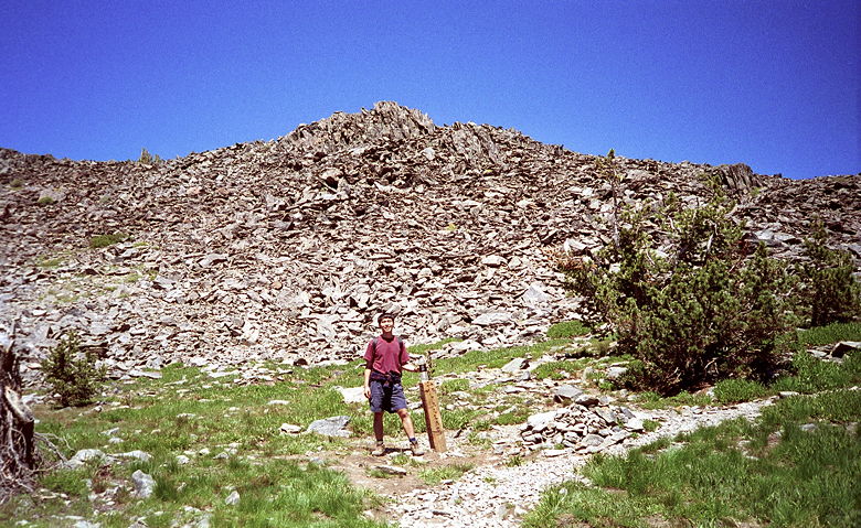
We're almost to the top. Weihaw's standing next to the final trail
sign. The trail is off to the right. We go up and around this
huge pile of rocks.
The final climb is a couple hundred feet over nothing but rocks.
No dirt, no grass, no vegetation, just rocks -- big rocks, small
rocks, sharp rocks. Not particularly hard, but you have to measure
each step.
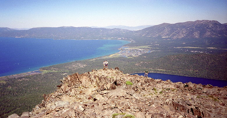
And then you're there. Standing on top of the world. Taking in
one of the most breathtaking views you can imagine. To the north,
you see 90% of Lake Tahoe itself, including Emerald Bay. To the
east, it's Fallen Leaf Lake, looking so incredibly small compared
to earlier in the hike. To to east, south, and west, it's the
mountains of the Sierra Nevada, with patches of snow here and
there. Other small lakes can be seen to the west and south. You
look around and it seems there is nothing higher than you in the
world. Mt. Tallac is the highest peak rising from the Lake shoreline,
at 9735 feet, and not much shorter than Freel Peak (10,881), the
highest in the basin.
Words can only begin to describe the sheer beauty of this place.
My only hope is that my many pictures can help that description.
On top of the world! Weihaw's taking this picture of me and Reza
from near the actual peak. Lake Tahoe and Fallen Leaf Lake in
the background, far below. You should be able to make out South Lake Tahoe just above us to the right.
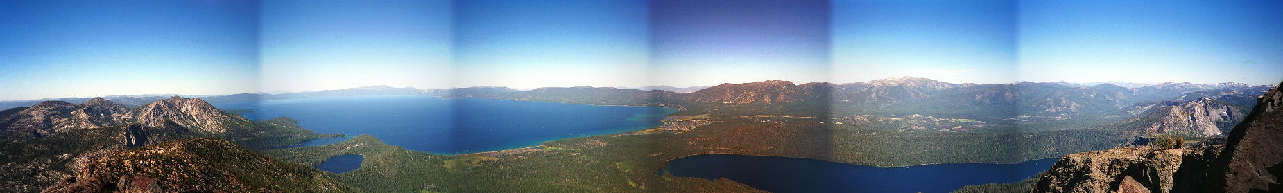
Even this picture doesn't do the views justice. But I tried. That's Emerald Bay in the second
frame. As usual, there's Lake Tahoe and Fallen Leaf Lake, with
the mountains of the Sierra (on the Nevada side) off in the distance.
I took these pictures from a great place near the top -- a flat
stone slab where you can sit and enjoy the view for hours. (Click image to view full size)
After a long stay at the top, we headed down, down, down. It was
only then that we realized how much we hated hiking on rocks.
And it was only then that we realized the trail is covered with
rocks for 80-90% of the hike. It's actually not as dangerous as
the descent of Giant Loop, because the rocks are large enough
to give decent footing. But you'll soon be thankful for every
single step you take on grass or dirt.
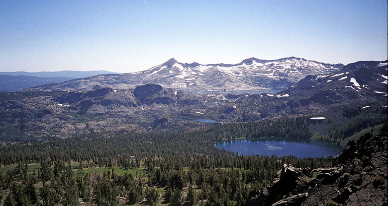
A view to the south. You might be able to see the effects of some
strong winds on the lake surface. Not sure what lake that is --
the area is filled with lots of smaller lakes.
We're descending the huge pile of rocks (we accidently missed
the trail from the peak). As we scrambled down to the main trail,
I took my last picture -- Reza standing in front of the Big C
of snow (above right)!
We finished the hike in 8 hours, 36 minutes, but probably hiked
for less than 6 hours. We stopped for about 90 minutes at the
top. It didn't even seem that long. You almost have to pry yourself
from the views at the top to make sure you have enough time to
make it to the bottom by sundown.
In summary, the best hike I've been on. I'd wanted to save a 10
rating for something that was really really good. Well, this was
it. Yes, it's steep. Yes, the rocks are incredibly annoying. Yes,
the altitude and thin air will affect you. Yes, there's hardly
any wildlife to be seen. But it's all worth it. The views you
take in make it all worthwhile.