|
I hiked in Granite Chief Wilderness.
I parked my car in the main lot of Squaw Valley, then walked over
to the fire station, which is where the Granite Chief Trail starts.
It was about 9:15am when I started the hike. I had the trail all
to myself. There are a lot of side trails which are hard to distinguish
from the real one. There were a few signs which said "Trail" with
an arrow, and I followed those where available. The USGS map I
had showed that the trail headed north, following a creek until
heading west across the creek at about the 6750 foot elevation.
I walked in and out of forest, whistling occasionally to make
sure any bears in the area would hear me. Of course, I make so
much noise with my trekking poles that whistling is probably unnecessary.
It also occurred to me that I have no idea what bear scat looks
like. I saw some stuff on the trail, but wasn't sure. It would
probably be a good idea for me to find out.
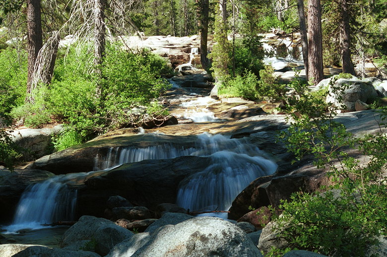
Small cascading waterfalls
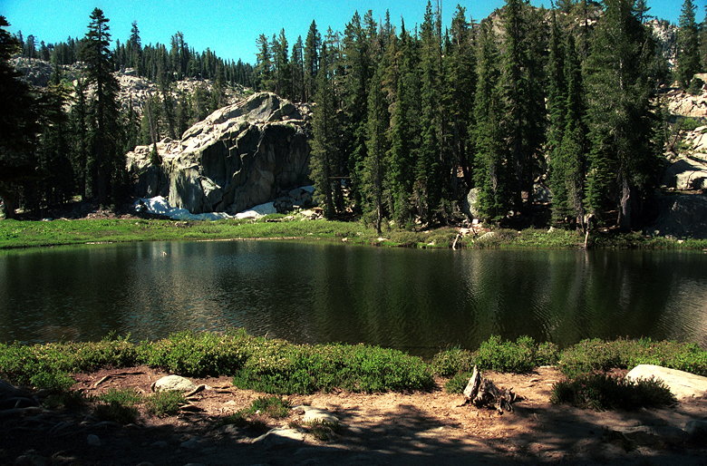
I reached a beautiful cascade of small waterfalls about an hour
into the hike. After taking some pictures, I crossed the creek
at about the appropriate elevation, then went through more forest
before starting to climb granite boulders. Stacks of rocks showed
most of the way, though they were few and far between. I was at
the bottom of a half-bowl, and had to work my way up to the ridge.
A stack of rocks (top, middle) leads the way
Shirley Lake
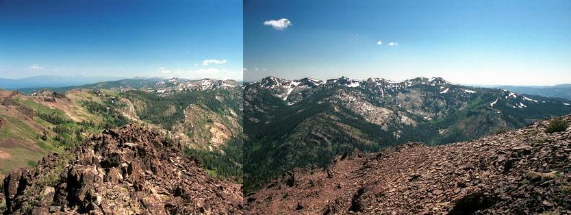
After reaching the top I continued west along the trail and soon
had a great view of Granite Chief looming above and in front of
me, a little to the left. The trail flattens out here and at 11:15am
I found myself standing on the shore of an beautiful lake. Unfortunately,
it was also an unexpected lake. I checked out the topo map, noticed
the unmistakeable ski lift on the other side of the lake, and
decided I was at Shirley Lake. This was bad. This meant I was
nearly three-quarters of a mile away from the trail, the closest
point of which lie to the northeast of where I was.
According to the map, I gathered that I'd been following Squaw
Creek the whole time, though I was supposed to follow a side creek
for a while, then cross it. Going further west was not an option.
There was no more trail past the lake, and the terrain gets much
steeper. Retracing my steps along the trail wasn't an option,
either, as I had no real idea how far back I'd made a wrong turn,
and most likely it would have added a tremendous amount of distance
to my already long hike.
So I decided to cross the creek and head cross-country northeast
to get to the right trail. My progress was hindered by large swampy
meadow areas and overgrown bushy areas, which I avoided. I kept
studying the terrain and looking and re-looking at the topo map
to make sense of it. I kept making progress further east, but
not as much progress going north due to the terrain. When I finally
reached a point where I thought the trail should be, it wasn't
there.
The trail crosses another side creek, which I thought I found
(it's hard to tell because there are so many side creeks, and
only a few show up on the map). According to the topo map, the
trail crossed the creek at about 7380 feet, so I started following
the creek up in hopes of finding the trail. But 7380 feet came
and went and still no sign of the trail. I began to grow frustrated
and headed east across the creek, hoping to find the trail further
back.
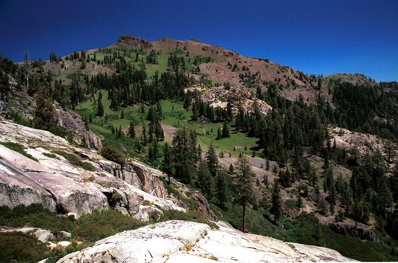
Silver Peak
It occurred to me that, even though I wasn't hungry, I should
eat something. I perched myself on a slab of granite overlooking
Squaw Valley and ate some of my bagel as I looked at the maps
again. The Squaw ski lifts brought trams full of people up the
mountain to my right. To the northeast I could see what I assumed
was Silver Peak.
I was starting to think about heading back down to the trail I'd
taken up and returning the way I came. Then I heard voices. No,
I hadn't gone crazy. Below Silver Peak were a large group of hikers
coming toward me. They were obviously on a trail, but not the
one I'd taken. Maybe that was the trail I should have taken? I
wasn't sure. Looking at the topo map now, in hindsight, that wasn't
Silver Peak I saw, but the peak next to Silver Peak.
As I was waiting for these hikers to approach me, I noticed a
man perched on a rock just a few hundred feet away from me. I
wondered to myself how he'd gotten up there. I scramble up to
him and asked him. He'd come up the Granite Chief Trail that I'd
somehow lost track of. He was part of the group coming up the
trail toward us. After chatting with him a bit to get my bearings
and confirm the trail ahead, I headed up the trail. It was now
12:51pm. I'd lost over an hour and half and probably added at
least a mile to my journey. I'd originally hoped to reach the
Pacific Crest Trail at 12pm. Now, of course, that was impossible.
I'd pretty much lost hope of reaching Tinker Knob today. I resigned
myself to at least reaching the Pacific Crest Trail before turning
around.
Nevertheless, I saw no point in completely giving up yet, since
it was still relatively early, so I started hiking as fast as
my lungs would allow. It's all uphill, about 700 vertical feet
up to the PCT junction. The trail crosses the creek just a bit
further up from where I had looked for it earlier. And now, after
spending the first 3 hours of my hike in complete isolation, I
started seeing other hikers. Most of them coming down.
I gained the PCT at 1:25pm. My altimeter read 8090 (the topo map
says about 8100). I started to think I had a slight chance now.
I was still over 3 miles away, but I figured I could try to make
it to the top by 3pm before turning around. I didn't want to turn
around too late because of the threat of darkness and bears. I
had a headlamp, but I'd clambered up granite rocks on the way
up and didn't want to go down that at night. (of course, that
wasn't part of the real trail, but I had no idea what the real
trail was like) Also, I figured the later it was the more likely
I'd run into a bear. So I had some definite motivation for turning
around before it got too late.
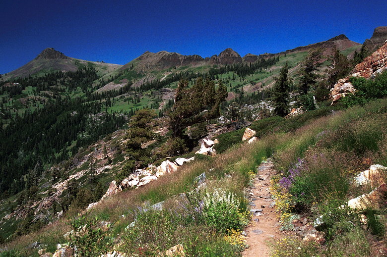
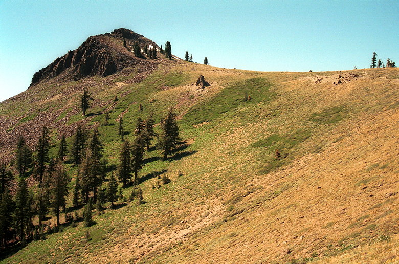
Tinker Knob (far left), still a long ways away
I continued my break-neck pace, almost sprinting downhill. Yes,
downhill. I passed through a few scattered snow patches and muddy
trails. I passed a sign which told me I had 2 miles to go before
Tinker Knob. Shortly after that I encountered two women who were
returning from Tinker Knob. I asked them how long it would take
and they said about an hour. It was now 2:08pm. I'd reached the
end of the descent and would now start the climb from about 7500
feet elevation -- leaving me about 1500 feet still to ascend.
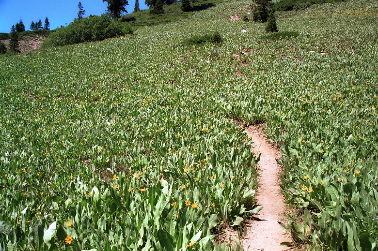
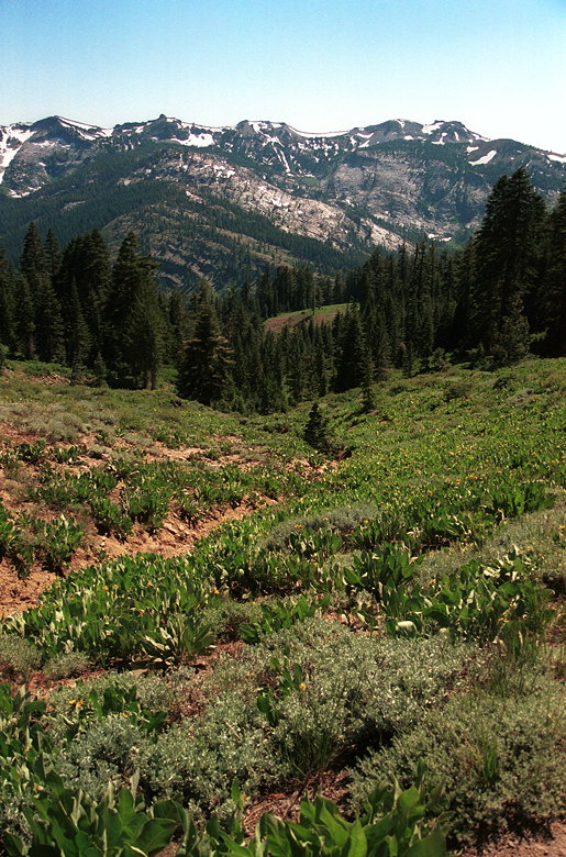
The mountain slopes are covered with Mule's Ears
I headed up through a field of plants. They have big green leaves
with small bright yellow flowers. The
entire mountainside was covered with them. It was a strange and
beautiful sight. I've since learned that they're Mule's Ears.
Up to this point I hadn't really known which of the peaks was
the one I was headed toward. I started to have this sinking suspicion
that I was headed toward this massive peak towering above all
else, standing somewhat alone, seeming so far away. I thought
to myself that if that was the actual peak I was headed to, there
was no way I'd get there in any reasonable amount of time. It
seemed completely unreachable. Unfortunately, I encountered a
group of men who were returning from Tinker Knob who confirmed
my worst fear.
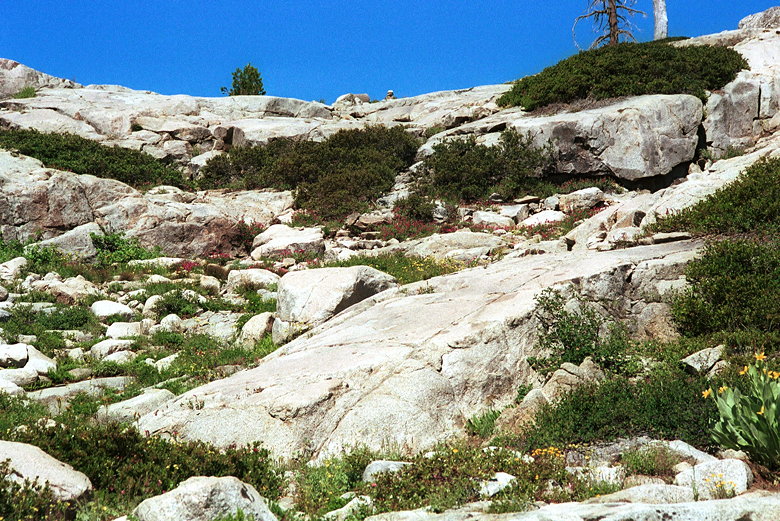
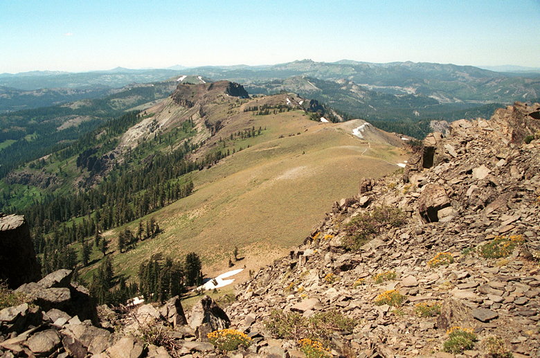
The summit plateau
I trudged on. Up and up, until I started up the switchbacks which
gave a clear view of the saddle above me. I climbed steadily, at a
rate of about 30-35 feet per minute. I soon found myself standing
on the saddle, glorious views to the other side, and just the
final climb up the peak remaining. I was happy I'd made it this
far, but I knew there were still some difficulty ahead. The Tinker
Knob massif is a jumble of rocks upon rocks, similar to Mt. Tallac,
only steeper. I started up the backside, walking on a trail which
soon disappeared into the rocks. At first I used my trekking poles
in both hands to help balance myself. It began to get more interesting,
however...At one point I had to put both my poles in my right
hand as I reached for a handhold with my left and physically pulled
myself up to the next foothold. I stepped carefully, testing each
foothold gingerly before placing my full weight on it. Suddenly,
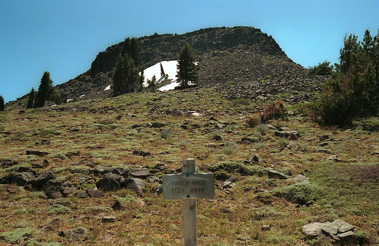
there was nowhere left to climb. I'd reached the top of Tinker
Knob, elevation 8949 feet! A wave of jubilation and triumph passed
over me. After all the frustration of earlier that day, I think
this was the happiest I've ever been to reach a summit.
Almost there!
I'd reached the summit at 3:10pm. A large circular stack of rocks
signified the actual peak. I took pictures, enjoyed the view.
Snapped a picture of myself holding the summit register. There
wasn't any paper inside, so I tore a piece from my notes and wrote
"Yippee! Awesome!" and signed my name along with the date and
time. This was the first time I'd actually signed a summit register,
per se. One creature curious by its absence was the marmot. I'd
seen marmots at the top of Alta Peak and Mt. Dana. But nothing
here. Perhaps there aren't enough people at Tinker Knob to attract
them.
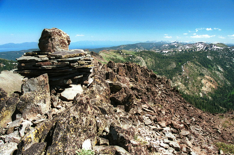
The summit marker
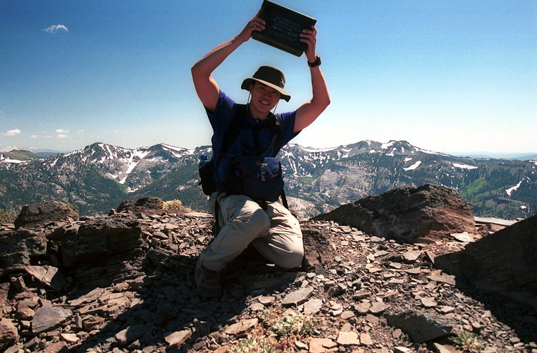
The summit register
Anderson Peak from Tinker Knob
|