|
It was a completely overcast sky as we started the hike at 11:30am. We crossed
the grass next to the tennis court and came to a large sign denoting Darwin's
Walk. It's named as such because Charles Darwin himself did this walk back in
1836.
He probably saw something very different from what we saw at the beginning of the
hike. The trail follows Jamison Creek. On either side were ferns, stumps, and
chopped down trees. Apparently they are trying to restore the area to its
natural state, and that involves cutting down foreign species of trees. It looks
ugly now, but I suppose it's good in the long run.
There are also the remnants of a road crossing the trail, concrete slabs with
graffiti still standing. There are also quite a few houses very close to the trail
on either side. Some have use trails leading right to the creek.
Thankfully, the trail soon becomes more wild. The houses start to disappear and
the vegetation looks normal. The trail turns from dirt to wooden planks, much
like those on our rainforest walk near Daintree. Jean spotted wild onion growing
near the banks of the creek. The birds started chirping, and the sun even
started to show signs of coming out from behind the clouds.
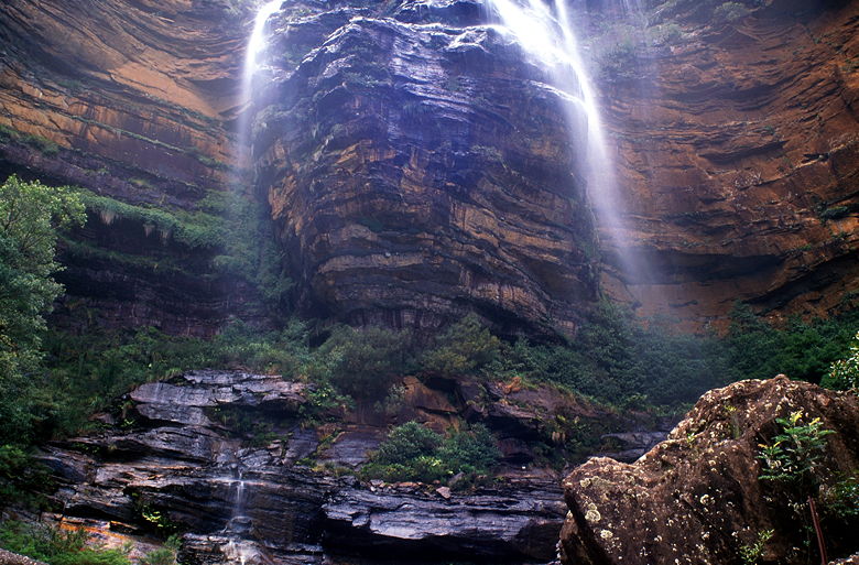
Weeping Rock
We crossed the creek, the water soothingly rushing over the rocks at a gentle angle.
Soon we came to what we think is Weeping Rock -- a rock formation where the
water drips over the sides, not in a torrent, but like gentle rainfall. Steps
and railings lead us over and past the formation.
Top of Wentworth Falls
On the other side, we came to a trail intersection. To the right is a picnic
area at the end of Falls Road. We took the left fork, down the stairs. Suddenly,
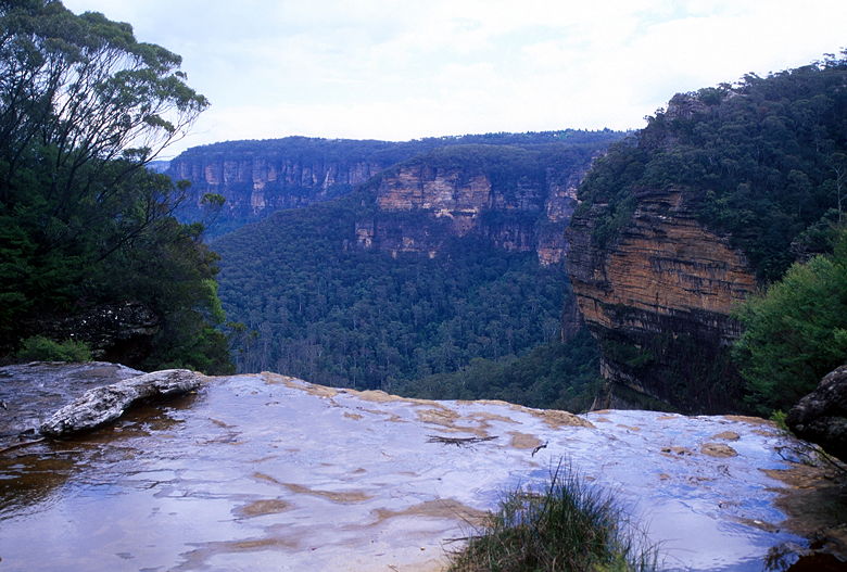
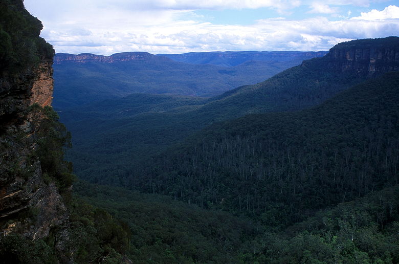
after a pleasant walk along the creek, we came out into the open and witnessed
a dramatic view. Before us lay the lush green Kedumba Valley, dropping down far
below, steep
rock walls on either side, and mountains far away on the opposite side. The
views would just get better.
Jean behind the railings at the top of the falls
The cascade above the main falls
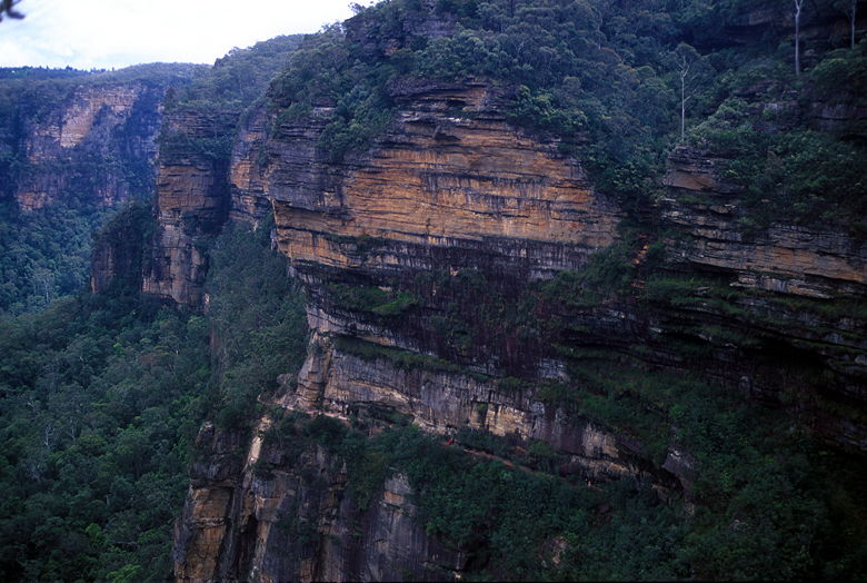
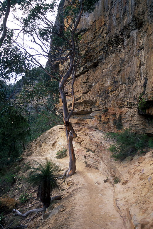
Steep canyon walls. You can't tell from this image, but there's a trail etched in the side of the wall.
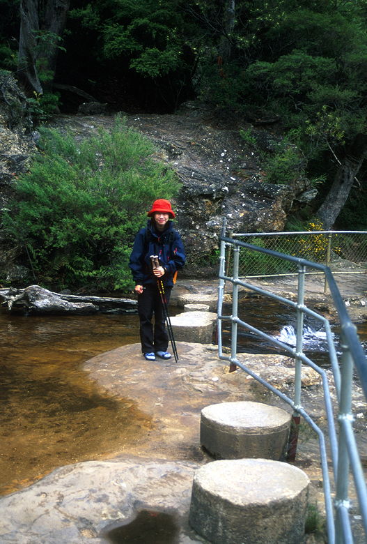
We crossed the creek over concrete stepping stones and hand rails. To our left
was a cascading waterfall. A dozen feet to our right, a sheer drop. We walked
slowly now, soaking in the views, but also being careful because of the nature of
the trail. The trail is blasted out of the side of the cliff, with very steep
and high steps and hand railings to keep us from falling.
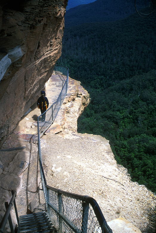
Precarious trail
One of the great views from the trail
On the left is a spur trail to Rocket Point, but we were getting all the views
we needed on the main trail. At times it's almost single file along the trail
as it descends toward the base of the falls. Soon enough we could see the falls
themselves. Jamison Creek actually falls in two steps; in the middle is a large
flat area which we were descending to. We'd reach the lower level much later
in the day.
Our first look at a waterfall
Mist from the main falls
There were a few other people on the trail, most coming from the opposite
direction. Perhaps they had a car shuttle arranged and were hiking the length
of the National Pass in one direction. In any case, after descending the steps
for about 400-500 feet, we reached the flat area where we would cross the creek.
We stopped for lunch here, enjoying the view of the falls splashing down 20 or 30
feet in front of us, and continuing its journey past our lunch spot only to
continue its descent.
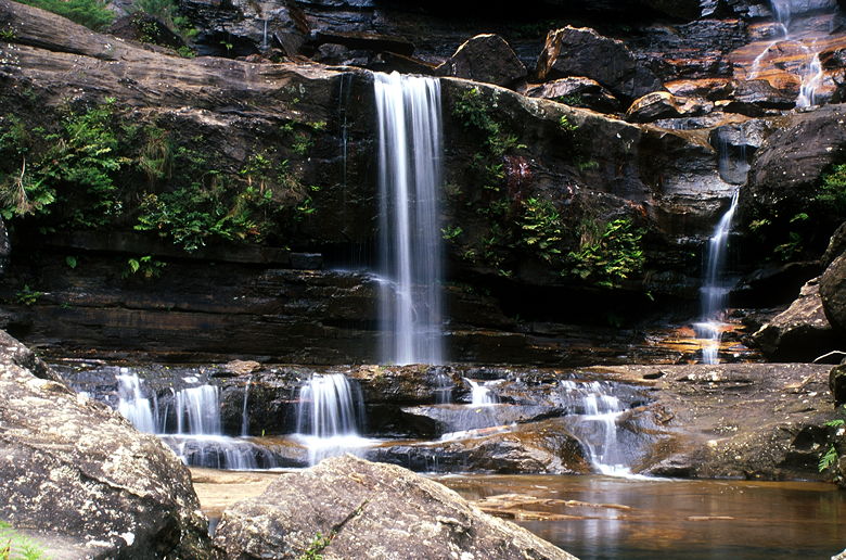
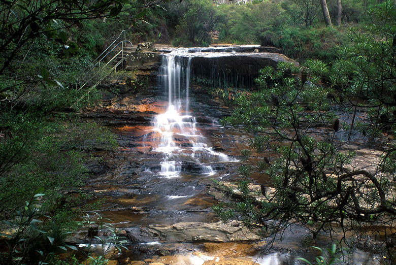
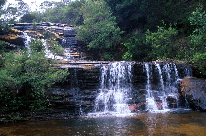
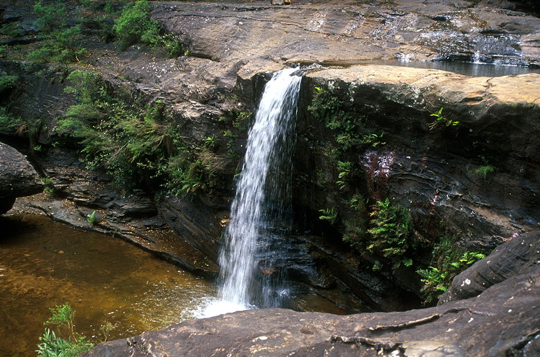
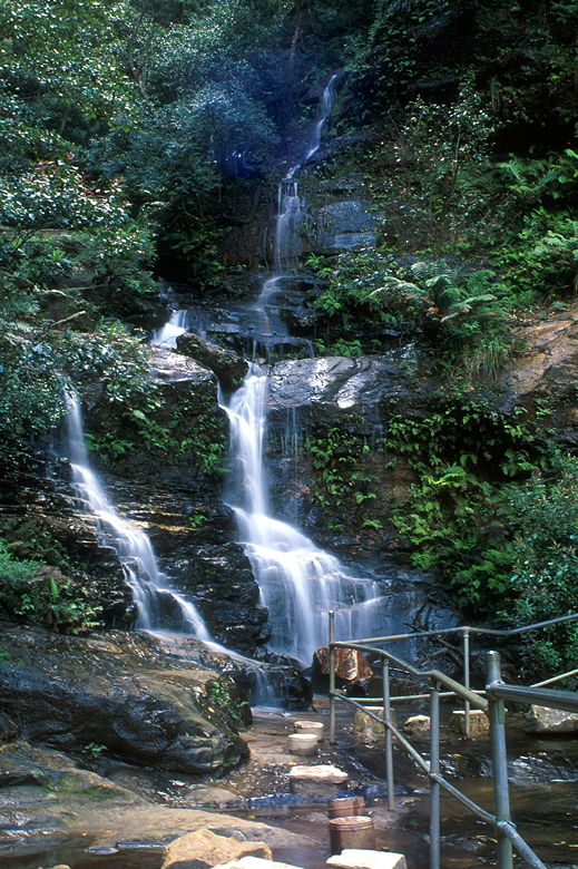
Lots of little falls near our lunch spot
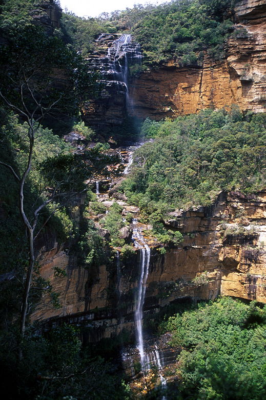
Two stages of Wentworth Falls
Even within the major falls there are sub-falls which added to its character. It's
not one big drop. The biggest drop was dominated by a giant cloud of mist
which formed as the individual drops separated on the long drop down. After
lunch we finished crossing the creek and continued along the Wentworth Pass
trail. At one point, we had to walk bent over for a hundred feet as the trail
was only carved 3 or 4 feet high into the rock, with a steep drop on the left
side. To top it off, it was muddy. And Jean was doing this hike in Tevas.
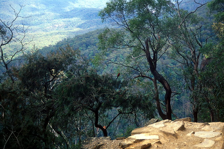
Bird in the trees below the trail above the valley
I spied two large white birds soaring over the valley near us. We watched
them climb higher and higher until they finally flew above the rim of the
valley. At times it felt like it was raining because water would drip over the cliffs
above us. Not in some majestic fall, but just a small mist, enough to get us
a little wet. We passed the intersection for Slacks Stairs on our left. We'd
eventually come back up that way. Instead, for now, we continued along the
National Pass.
Trail next to the steep walls
Eventually we rounded a corner and were out of sight of the falls. To our
left we found an unmarked intersection leading down into the valley. I knew
the path we wanted to take was on our left, but it was supposed to be signed
Wentworth Pass. I suspected that was the path anyway. My suspicion was
confirmed when a couple minutes later we came upon Empress Falls. These falls
are much smaller than Wentworth Falls. It's dark and cold and the water
snakes its way through the rocks, stopping briefly on a flat rocky section
before continuing its descent. We crossed this flat rocky section and took
a break here.
An older couple also stopped here to take a break. They would continue on up
the stairs to the top of the falls (and presumably on to their car). We,
on the other hand, would turn around at this point. But first, we ate a little,
chasing off the crows who eyed us. As soon as we packed up and left, they
descended and picked the ground for any crumbs they might find. They'd repeat
this behavior whenever we stopped after this.
Empress Falls
We doubled back and shortly took the unsigned fork (now on our right). The
trail here, if you can call it that, is steep and overgrown. We practically
slid down the hillside, crossing the creek and working our way down cautiously
until we
finally saw a reassuring trail sign. If we continued down, we'd reach Vera Falls;
instead we turned left, crossing the creek again and continuing on Wentworth
Pass.
Wentworth Pass is completely different from National Pass. The whole time we
were on National Pass, we had the cliff face on one side, gorgeous views on
the other. On the Wentworth Pass, we were deep in the middle of the rain
forest. No views, no cliffs. The other contrast is that we didn't see anyone
else on the trail after we saw that couple at Empress Falls. In fact, we wouldn't
see anyone on the trail the entire way back to the beginning of Darwin's Walk.
We passed tree ferns and listened to the birds. We didn't see mammals of any
kind, however. The vegetation was thick, though -- so thick that at one point
a vine snagged my tripod and ripped it right out of my backpack! First time
that's ever happened to me.
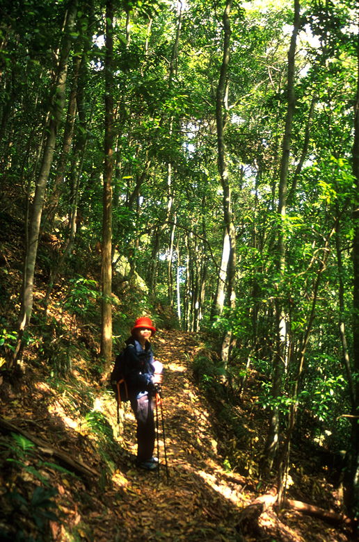
Jean in the rain forest
After our trip through the rain forest, we broke out into the open, reaching
a beautiful pool beneath the second leg of Wentworth Falls. High above us now,
straight up, was the spot where we'd had lunch. This spot was even better,
perhaps because it seemed more remote.
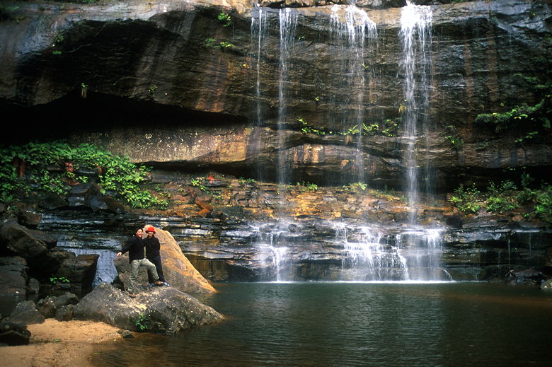
Bottom of the second plunge of Wentworth Falls
After enjoying the pool and falls, we had work to do. We began our ascent of
Slacks Stairs. The stairs are metal stairs with railings. It reminded me of
the ones at the top of Sierra Buttes. These stairs, however, are much steeper --
they should be renamed Slacks Ladders.
They're so steep that a couple of them actually have a cage around them
to prevent people from falling over backwards. It's like climbing up a Jeffries
tube on Star Trek. Only narrower. My backpack got snagged on the cage several
times.
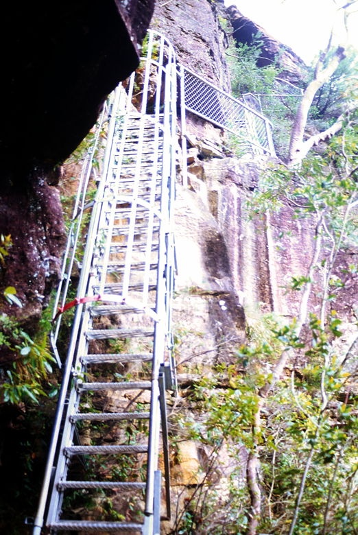
Slack's Stairs (a more appropriate name would be ladder)
After much huffing and puffing, we made it to the top of the stairs and rejoined
the National Pass, turning right to head back to our lunch spot. Somehow we got
off the main trail and came upon the river at a point higher than we'd crossed
before. We saw the blue railings we'd used, however, and walked along the bank
until we reached them and crossed safely. Then it was up, up, up those steep
steps blasted into the side of the cliff. Many of the steps were over a foot high,
some perhaps two feet high. Stairmaster is nothing compared to this. The steps
are probably higher than those at the top of Vernal Falls in Yosemite, if you can
believe that.
Eventually we made it to the top. Now all that lay ahead of us was the gentle
Darwin's Walk. It was actually quite nice to have that as a sort of cool-down
at the end of the hike. The creek seemed nicer, the birds happier now, than when
we'd done the trail in reverse in the morning. And we were on our way to the
nearest ice cream store for our just rewards.
| 

