|
Given the somewhat long drive from 101, there were quite a few more people
at the park than I expected. Most of them were parked at the large day use
lot. We parked at the Black Oak Picnic Area, where our hike started.
There was lots of foot traffic as we started off on the Waterfall Loop
trail. The trail starts off as a wide dirt road underneath cover of forest.
Almost immediately, we came to the first trail intersection. The left
fork is the Alec Canyon Trail, on which we would be returning on this loop
hike. We took the right fork, following it as it climbs gently above
Swanson Creek.
The next trail intersection comes a few minutes later. The left fork
descends a staircase down to Swanson Creek and then follows it upstream.
The right fork continues along the wide dirt road, overlooking the creek.
We chose the right fork; if I had to do it again, I definitely would have
chosen the left fork instead. There's not much to see on the right fork.
If you only had time to do the 1-mile Waterfall Loop and nothing else, then
I would recommend taking the left fork up and the right fork down, since it
will be faster coming downhill.
After crossing a short bridge, we came to a spur trail on the right which
leads to Black Rock Falls. The narrow trail only takes a couple minutes.
The falls are in a narrow canyon, falling about 30 feet. Nothing spectacular.
We turned around and continued on the main trail, which at this point merges
with the left fork of the loop.
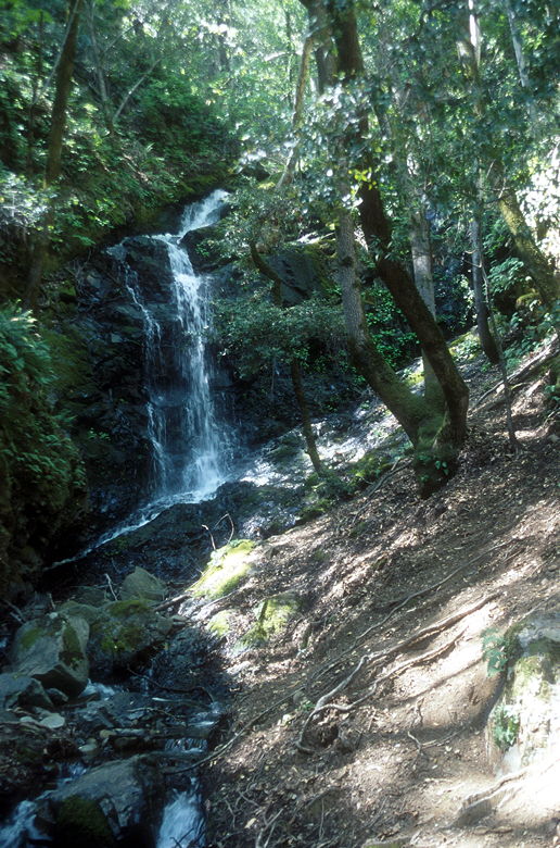
Black Rock Falls
Shortly, we came to a picnic bench at Myrtle Flats, situated a few feet from
the waters of Swanson Creek. Since we got a late start, we decided to
stop here for lunch. In retrospect, this is one of the few decent places
to have lunch on this hike. Another possibility is a bench I'll mention later
on in the hike, but this spot is nicer anyway.
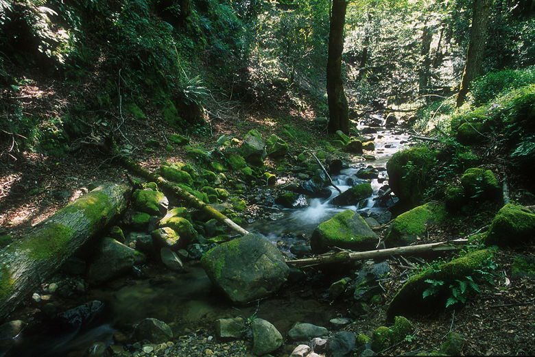
Swanson Creek
After lunch, we continued up the trail, crossing a footbridge, and stopping
to see Upper Falls, which is about 20 feet high. It is much wider and in a
much bigger canyon (the main Swanson Creek canyon) than the Black Rock
Falls.
After Upper Falls, we went on the short spur trail to Basin Falls. To be
honest, it's not worth the 2 minutes to get there. There's really not much
to see here. We quickly turned around and the continued on the Contour
Trail. The trail leaves behind the wide dirt roads and becomes narrow as it
winds its way steeply up the canyon next to the creek. Eventually, the trail
crosses the creek (trekking poles are helpful, but by no means necessary here).
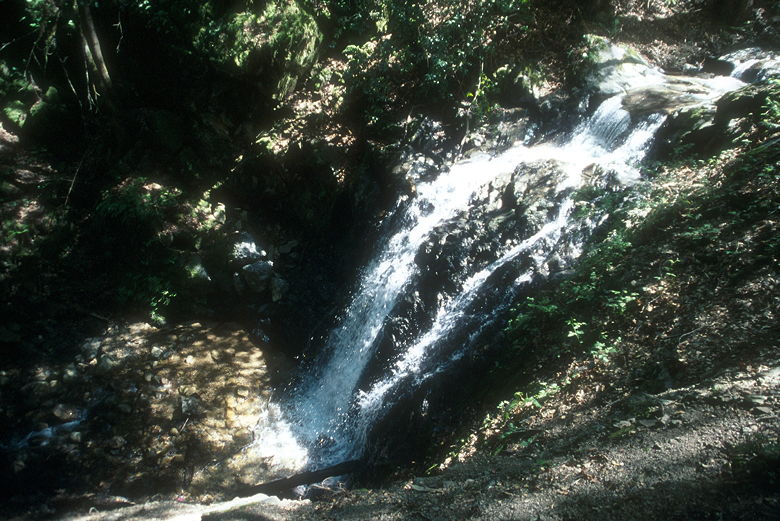
Upper Falls
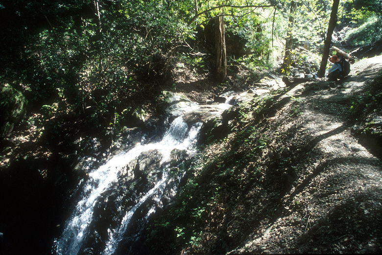
Jean above Upper Falls
After crossing the creek, the trail levels out as it heads away from the
creek. On this stretch of trail, we passed lots of manzanita and madrone
trees. Occasionally, views open up to the mountains to the northwest.
At the top of those mountains is the remnants of a forest fire. I believe
this may be the result of the Croy Fire in September 2002. What's left is
standing bare trees at the top, and brush down to the untouched forest a
little below the top.
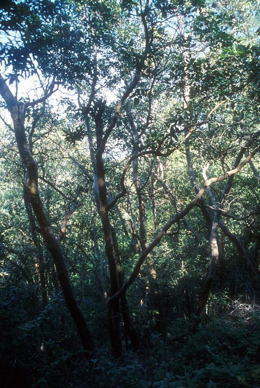
Manzanita forest
The trail winds and winds, each gully looking the same as the last.
Eventually it drops down to the Alec Canyon Trail, another wide dirt road
(a former logging road). We turned right and soon reached Manzanita Point.
A bench and shade make here make it look exactly like a bus stop by the
side of the trail. Sitting on the bench, you have a great view of the
valley below.
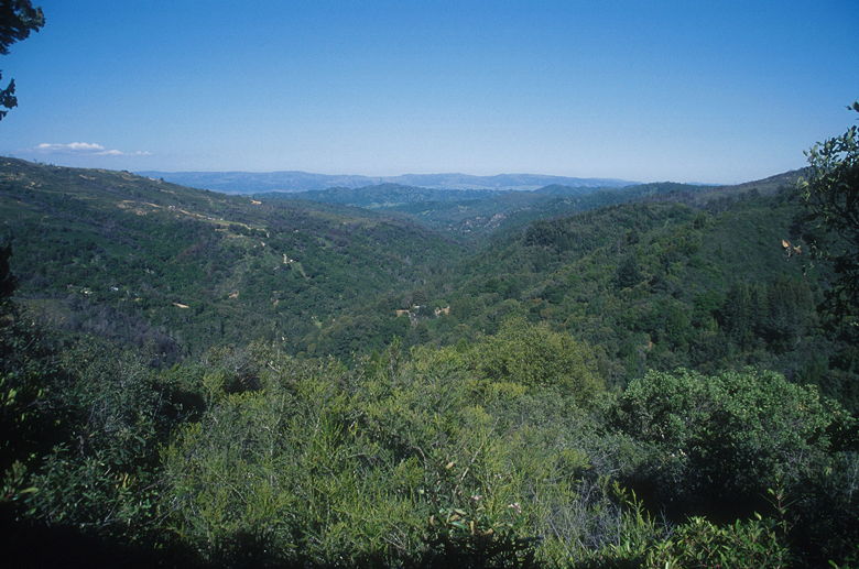
The view from the bench
At this point of the trail, you'll finally need sunglasses and a hat, as it's
one of the few unshaded parts of the trail. After heading downhill a bit,
we came to the spur trail for Triple Falls. The narrow trail climbs steeply
through a redwood forest. After about 0.2 miles, you'll get your first
glimpse of Triple Falls. Your first reaction will be -- "That's IT?!" But
if you go all the way to the top of the viewing area, your eyes will turn
the corner and realize that the falls are actually quite pretty. The falls
tumble in a 40 foot cascade in a narrow canyon. It was quite dark by the
time we got here in the late afternoon; if you want to see these falls, morning
is probably better.
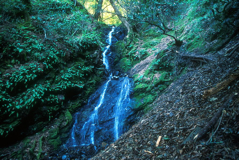
Triple Falls
After taking a break at the falls, we headed back onto the Alec Canyon Trail,
retracing our steps back to Manzanita Point. From there, the trail continues
fairly flat until just past the intersection with the Contour Trail.
Instead of going back on the Contour Trail, we continued straight on the
Alec Canyon Trail, which soon plunges steeply down the hillside. In no time
at all we were back at the parking lot.
| 

