|
After a suitably large pre-trip breakfast, we did some more last-minute packing, then left the
hotel and made the 30 minute drive back along Highway 50 to Echo Chalet. Unfortunately, by the
time we got there (around 11am), the parking area was basically full. We circled around before
finding one tight spot in the dirt lot next to a tree. So, be forewarned - if you can, arrive early.
Next we finalized our packs and did the final weigh-in. Much to my disappointment, my pack
weighed in at an astounding 65 pounds. Unfortunately I felt it was too late to make any last-minute
adjustments, and I figured since I carried 60 pounds last year that I would just live with it.
Well, let me tell you those 5 extra pounds makes a big difference.
Here's a list of everything in our packs. If I had to do it again I might
have ditched a few things. But we decided we were done packing and walked down
the short steep hill to the boat dock.
The boats don't run on any set schedule. Just arrive and they'll leave when there are enough
people (4 is enough). After paying our $40 one-way for the four of us (no discounts for kids), we set off
almost immediately in the boat taxi (which has room for about 14 passengers). The boat travels
west across Lower Echo Lake, then slows down to pass through a channel to Upper Echo Lake. From
there, it crosses the smaller of the two lakes before reaching a small pier at the northwest end.
Jean and I had actually snowshoed across the lakes 12 years ago on the way toward Echo Peak, so it was
neat to now take a boat across it instead.
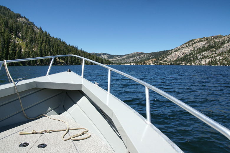
On the boat taxi on Lower Echo Lake
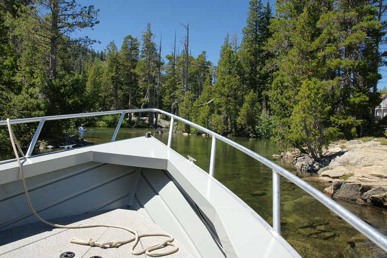
Entering the channel to Upper Echo Lake
When the boat reached the pier, there were at least 15-20 people waiting to take the return trip --
too many people to fit the boat, in fact, so some had to wait for the next one. While one of them
waited, he started up a conversation with me. I showed him the route we were planning to take and
he said he'd done the reverse trip 10 years ago, and had been to the Desolation Wilderness every
year since. He also mentioned a spring (with the best tasting water he'd ever had) near Dicks Pass,
if I recall correctly.
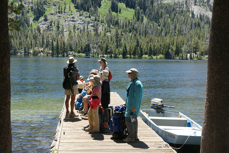
People waiting for the boat taxi to take them back
At 1:20pm, we left the pier behind and promptly set off in the wrong direction, past the public phone (there's
also a direct line to the Echo Chalet to tell the boat to come). We quickly turned around and headed
up to the main trail, directly up the hill from the pier. Shortly we turned left and were on our
way toward the wilderness. The trail climbs pretty much constantly, with some rocky stretches
alternating with packed dirt. After 0.6 miles, the trail passes a sign designating entry into the
Desolation Wilderness.
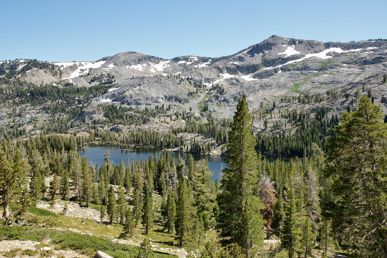
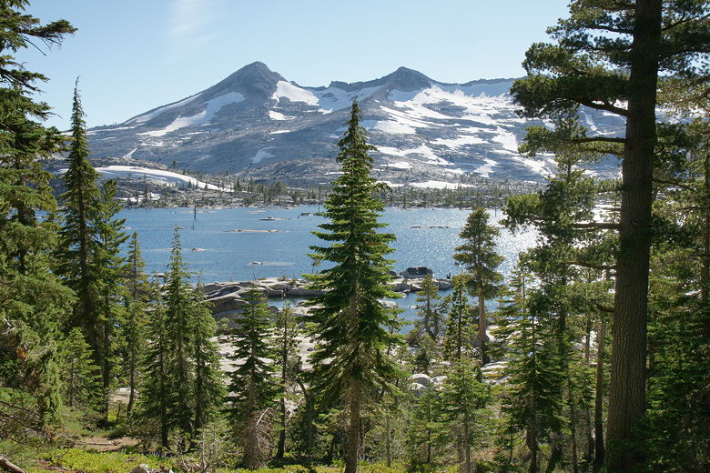
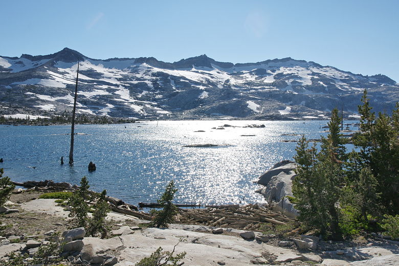
Echo Lakes from the trail
The trail now becomes extremely rocky, and climbs relentlessly with no shade. At least there are nice
views of Tamarack Lake to the left. There were also lots of people on the trail, many of them
backpackers. There are frequent well-signed trail intersections, so it's easy to gauge your
progress if you have a trail map with mileage (which we did). About a mile and a half in, we passed
a man wearing a Cal hat in the opposite direction. He saw our kids and said that his dad had brought
him to the Desolation Wilderness 48 years ago, and he'd been coming here ever since. In general
everyone was really encouraging of our kids and the fact that we were bringing them out into the
wilderness. I caught a different vibe than we do in National Parks, where I feel like we're more of
a spectacle with two young kids in hiking gear (and everyone else is in flip-flops).
Tamarack Lake backed by Ralston Peak
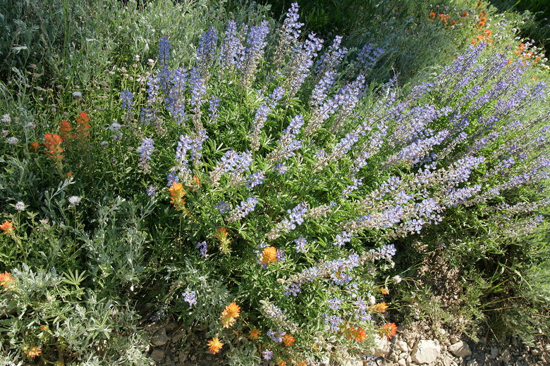
Wildflowers next to the trail
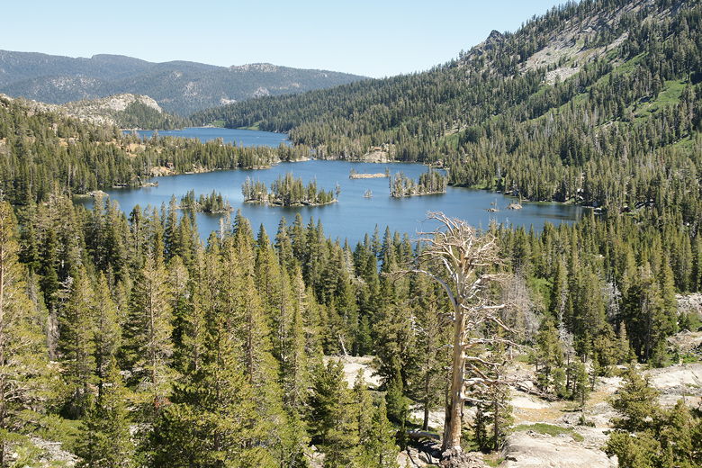
As we passed through Haypress Meadow (about 1.5 to 2 miles in), we encountered our first snow patches.
There wasn't much mud to worry about, and the snow patches were either easily avoidable or easily
walked on. There were also hardly any mosquitoes. I'm sure it varies from week to week.
Haypress Meadow basically represents the top of the trail on this hike. After a brief flat section,
the trail starts a descent toward Lake Aloha. We saw views of Lake Lucille to our right.
We saw the trail toward Lake of the Woods (to the left) but could never actually see the lake.
Soon we reached a sign with Lake Aloha to the left.
But wait, on further inspection, the fork to the right also leads to Lake Aloha. The right fork
is the more direct route, about 0.8 miles to the lake, while the left fork is 1.1 miles to the same
place, although it does provide earlier access to the lake shoreline. We chose the shorter right
fork.
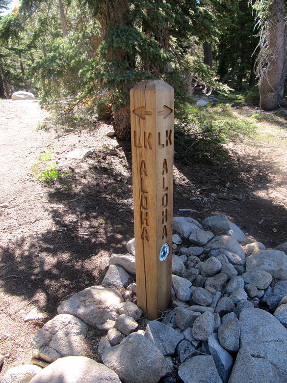
Two trails to Lake Aloha
Lake Margery
We passed near tiny Lake Margery on our right.
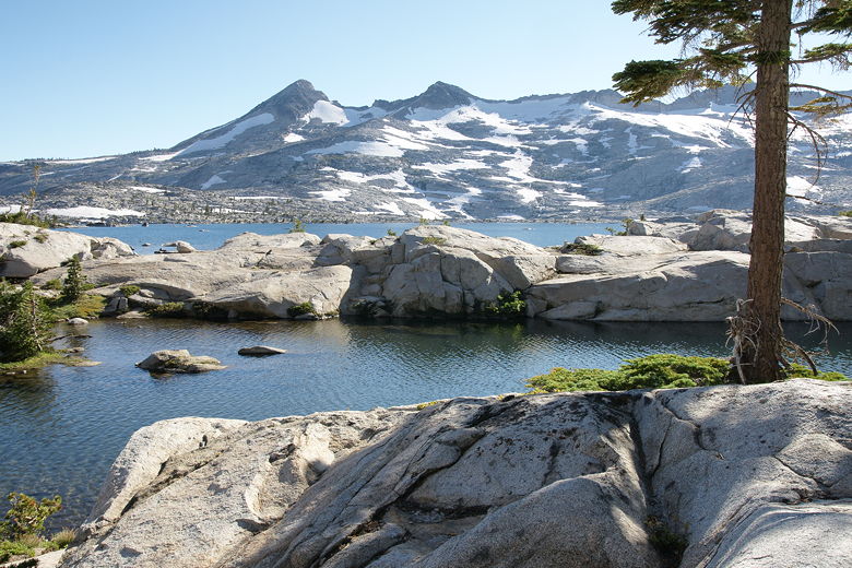
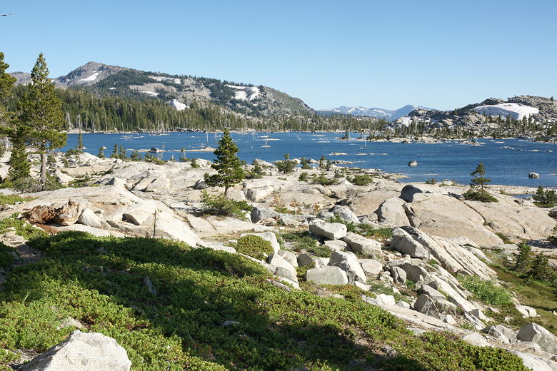
After descending we finally got our first look at beautiful Lake Aloha. We could see it through
the trees to the left, dotted with tiny little rock islands, with snow-patched Pyramid Peak
and Mt. Agassiz looming behind the lake. A few minutes later, we basically reached the bottom of
the trail and soon had great unencumbered views. The landscape is all open granite with trees
scattered around. In addition to the other two peaks, Mt. Price now came into view, the three
mountains forming a dramatic backdrop to the lake.
First glimpse of Lake Aloha
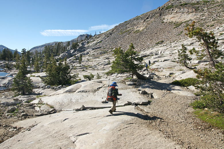
Rocky trail next to the lake
We continued on the trail, which roughly parallels the northeastern shore of Lake Aloha, several
hundred feet in from the shore. After about a half mile we started to look for suitable
campsites. After crossing a snow patch, we found a great site which was just the perfect size
for our tent. We even had a rare tree for some shade and wind protection, and easy access down
to the water's edge.
Mountains behind Lake Aloha
Pond and Lake Aloha backed by Pyramid Peak
After setting up camp, I walked down to the lake and I have to say the water was
not as cold as I would have expected. It was nice to enjoy on a warm day. I filtered water
and we had dinner, then tried to cram everything into the bear canisters. We managed to fit all
our food, but not our other scented items (sunscreen, bug repellent, toothpaste, etc.). We
wrapped those up as best we could and hoped for the best.
Looking southeast across the lake
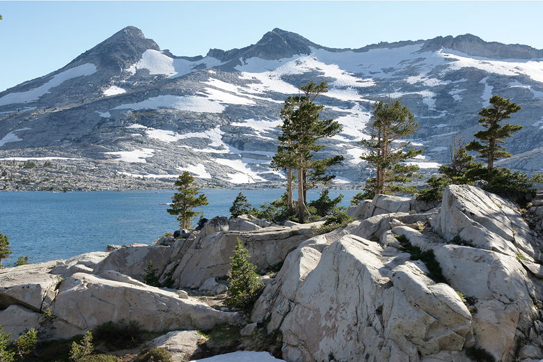
Pyramid Peak
Later afternoon sun at Lake Aloha
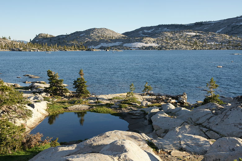
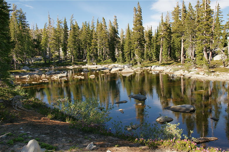
Pond near our campsite
As the sun set the mosquitoes came out, but they were never a big problem. Neither was the
wind, which was nice since I can see it might sometimes become windy with those big mountains
looming behind the lake.
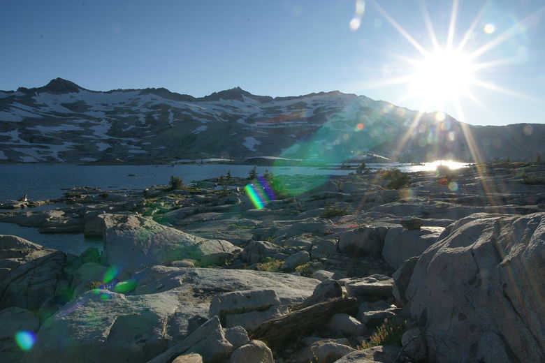
One downside of this trip is that the moon was not visible during the night. I would love to
take some moonlit pictures of Lake Aloha at night. Maybe I'll do that on a future trip.
| 

